| NAD83 COORDINATES (1986 adj.): |
|---|
| X= 577416.760 Y= 151702.778 Z= 000.00 UAJ 05/20/1997 FLT |
| 6/1/1997 | (Unknown date Jun __, 1997 ) CIM set to grade by Bill Soshnik |
| 5/16/1997 | Monument removed during construction |
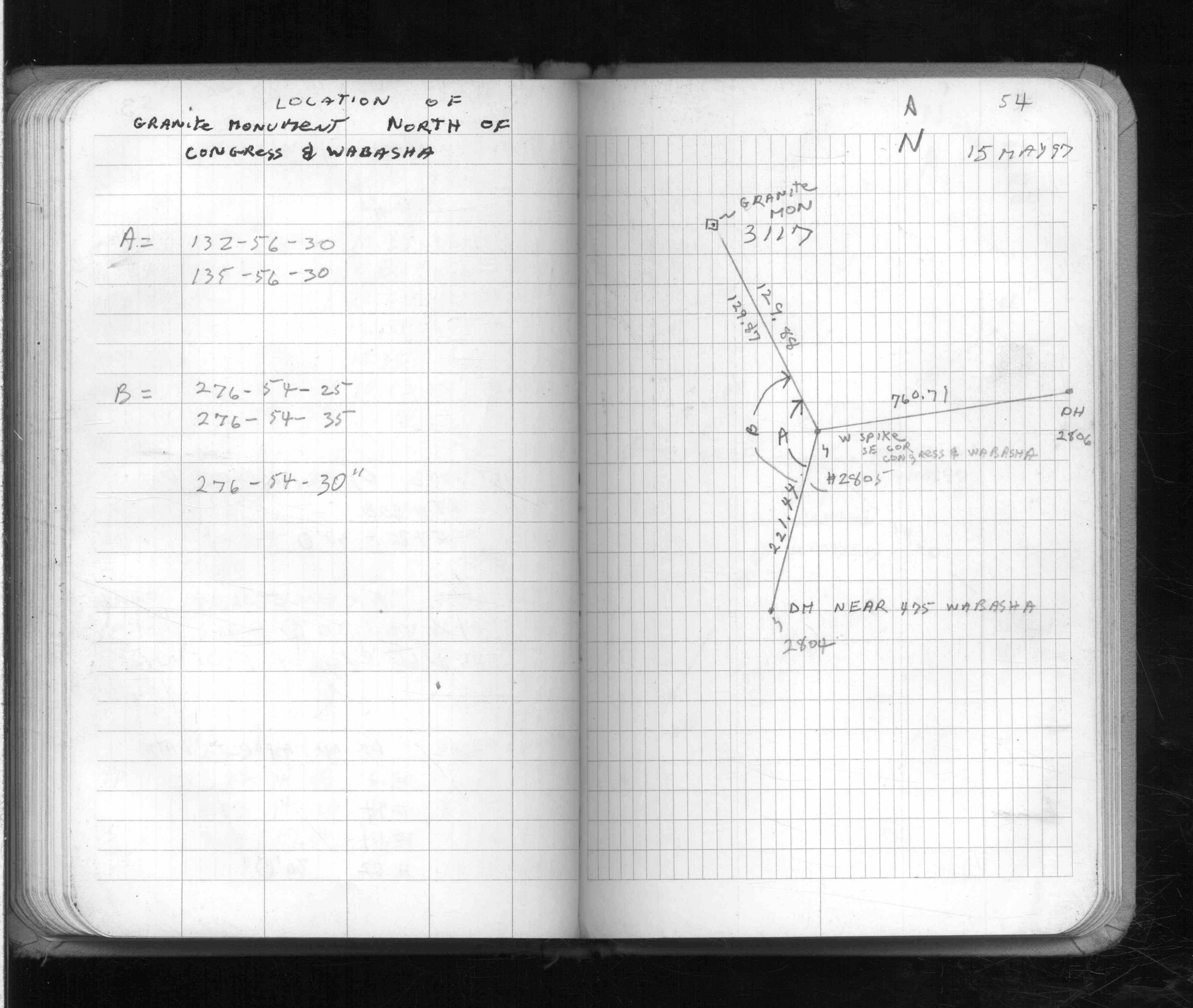
| 5/15/1997 | Located GM by traverse (single stub). See FB 1574 p.54 |
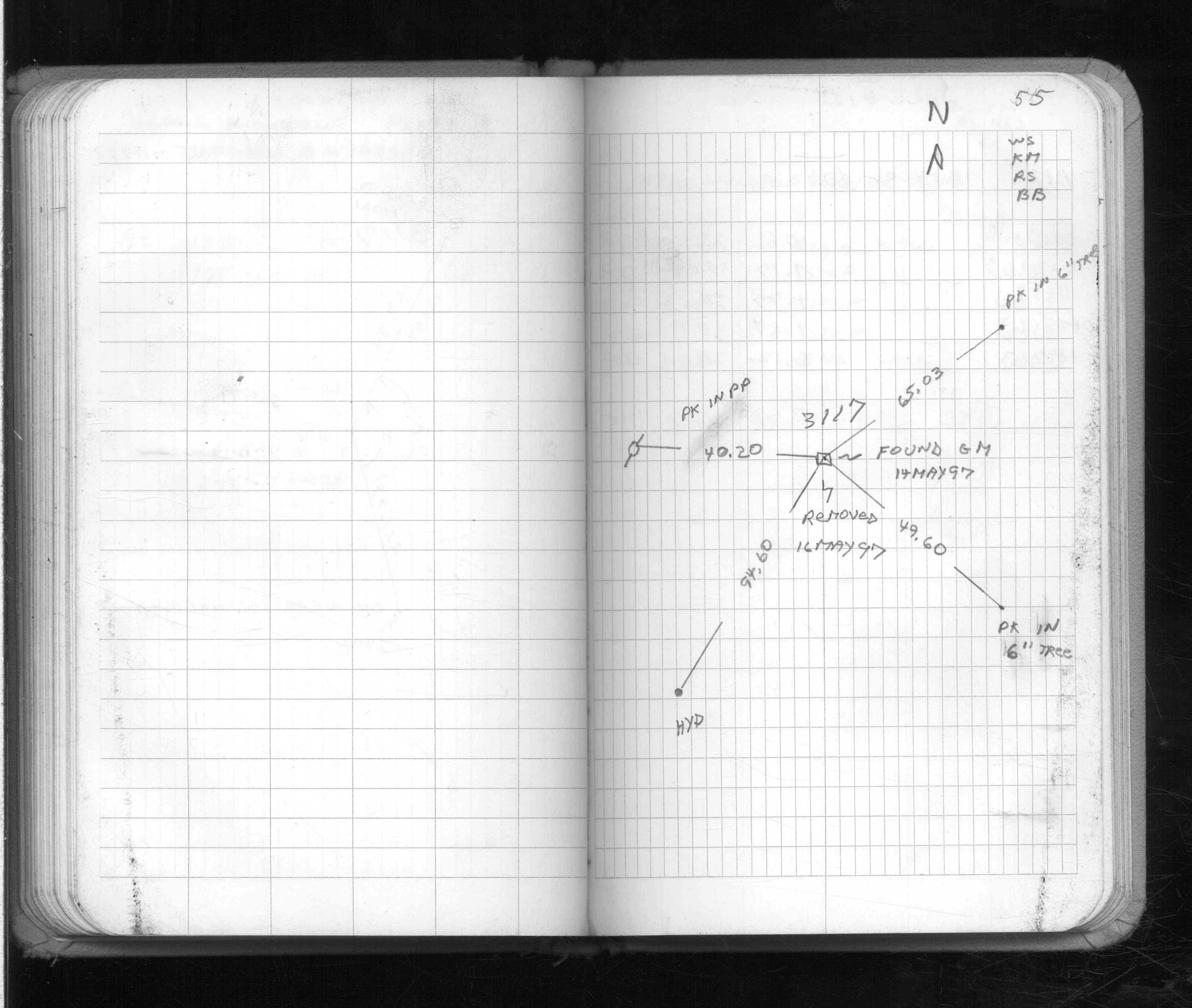
| 1/1/1997 | (Unknown date ___ __, 1997 ) Placed ties on GM. See FB 1574 p.55 |
| 10/1/1888 | (Unknown date Oct __, 1888 ) Monument reset by R J Johnson. see FB 200 & 211 |
| 1/1/1884 | (Unknown date ___ __, 1884 ) Monument set by A M Gibson under the direction of H H Fuller & Gates A Johnson who re-established the centerline as laid out by Mr Johnson for the Owatonna Road in 1861-1863 |
Above is NOT an all inclusive history of this point. Please review all the links below.
| PLS NOTES | Field | Cross Section | Sewer | J.B. Irvine | Monument | River Survey |
|---|---|---|---|---|---|---|
| FB 1574p.54 | ||||||
| FB 1574p.54 | ||||||
| FB 1574p.55 |