| NAD83 COORDINATES (1986 adj.): |
|---|
| X= 577790.241 Y= 162372.759 Z= 000.00 UAJ 06/03/1998 STB |
| X= 577790.246 Y= 162372.927 Z= 854.221 1/10/2013 RTK-VRS |
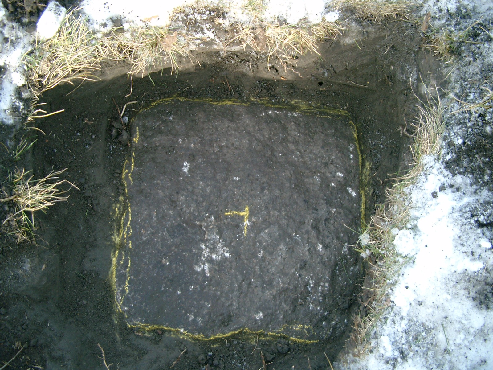
| 1/10/2013 | Located 15" x 15" GM appx 1 ft below surface level in front of 680 Rivoli St. Monument had no drill hole in center and appeared to be tipped slightly to the north. Photos taken and position established using RTK-VRS GPS. Elev 160.12 ft. |
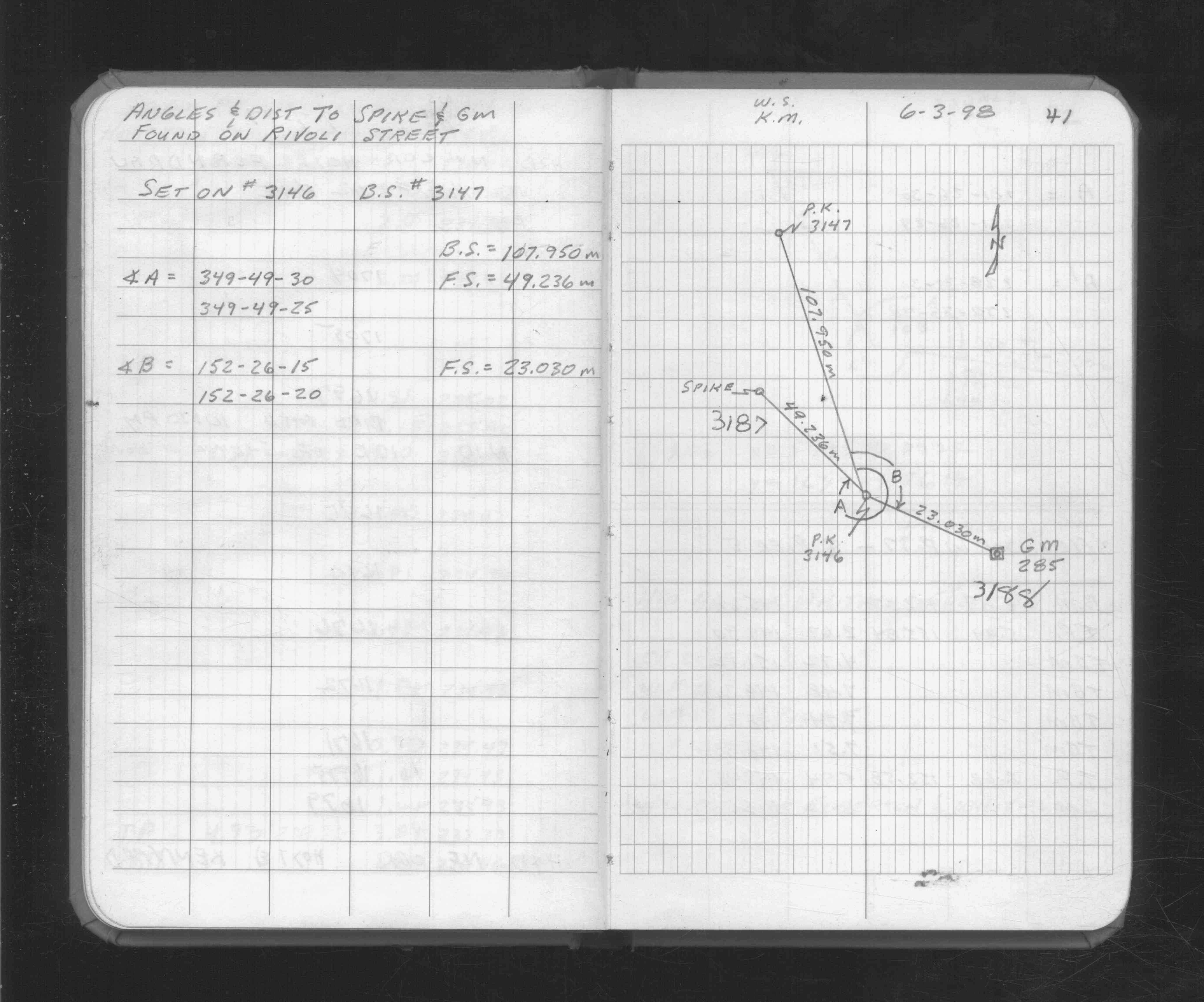
| 6/3/1998 | Located GM by traverse (single stub). See FB 1733 p.41 |
Above is NOT an all inclusive history of this point. Please review all the links below.
| PLS NOTES | Field | Cross Section | Sewer | J.B. Irvine | Monument | River Survey |
|---|---|---|---|---|---|---|
| FB 1733p.41 |
| FILE | PHOTO DATE | COMMENTS |
|---|---|---|
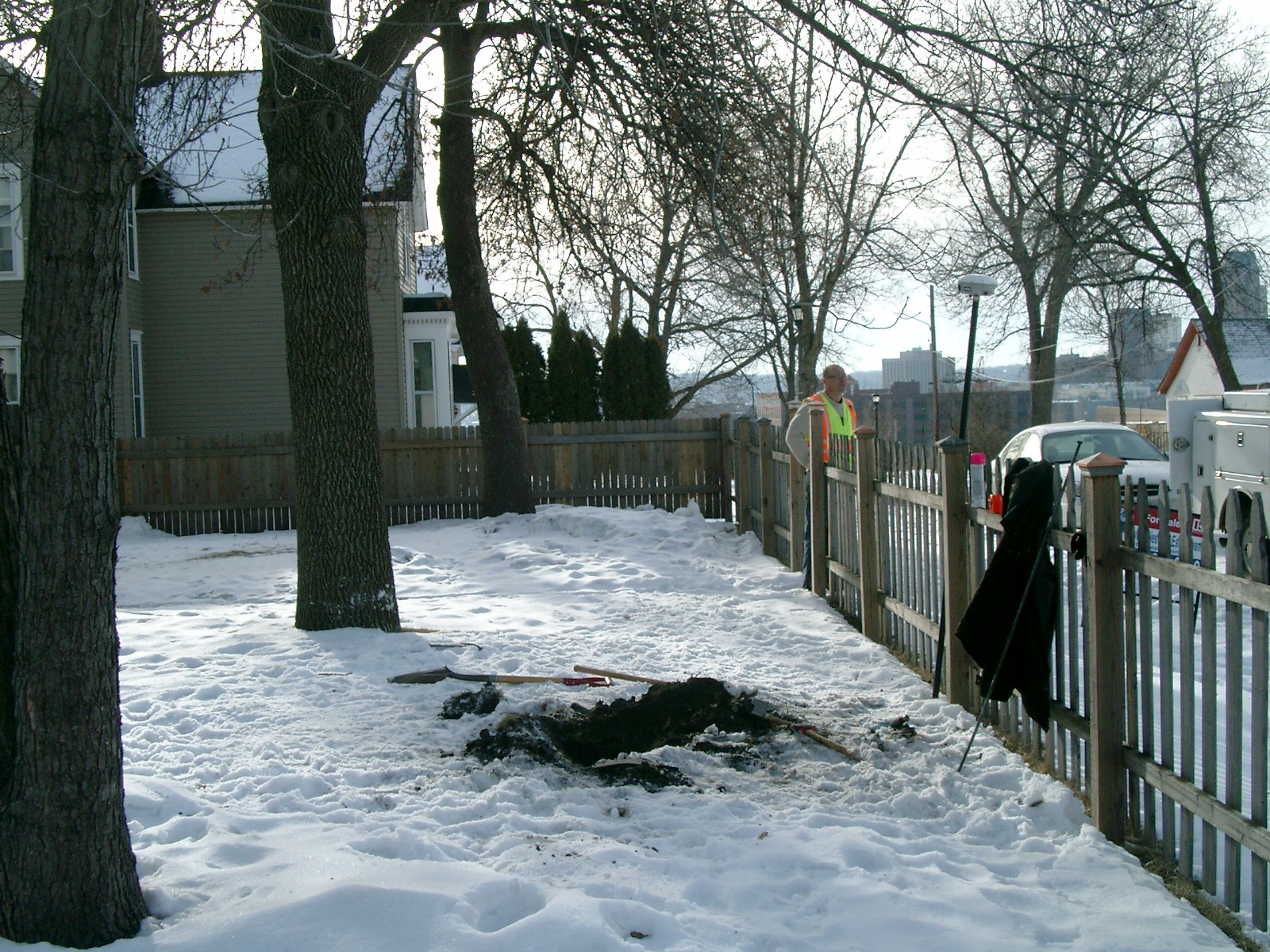
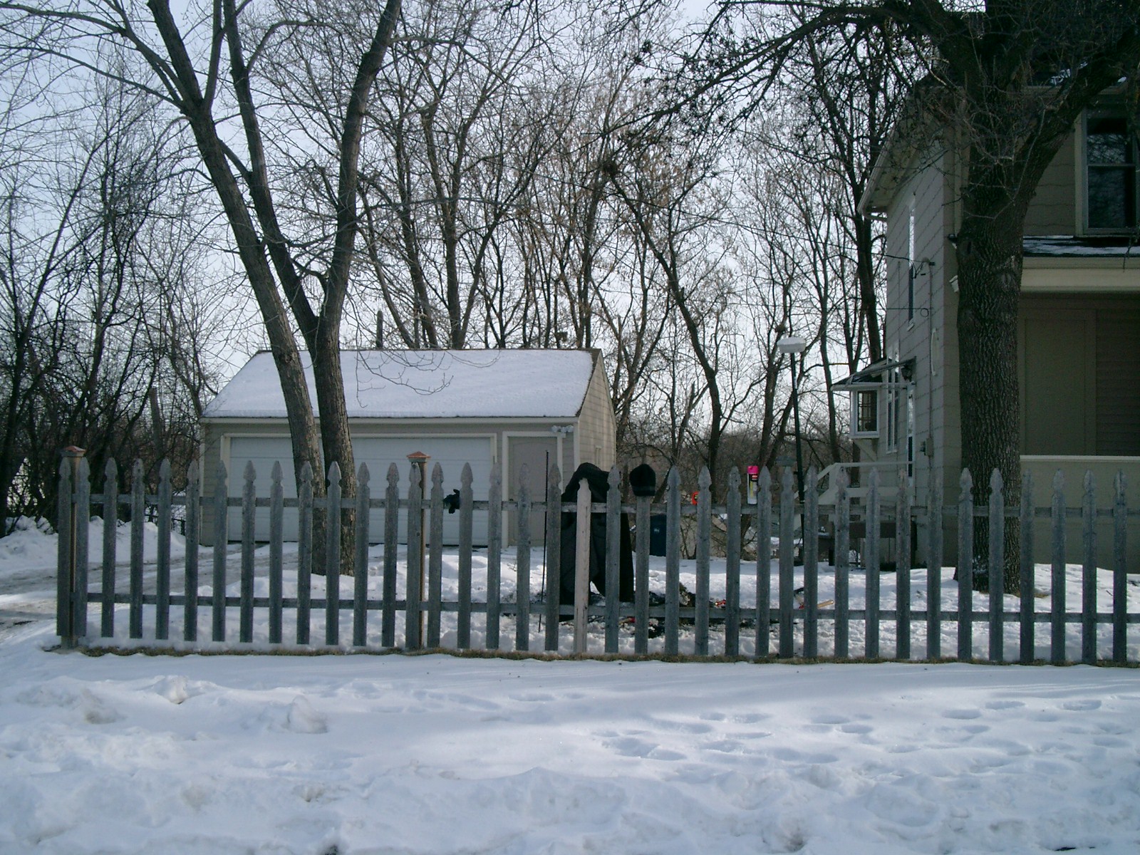
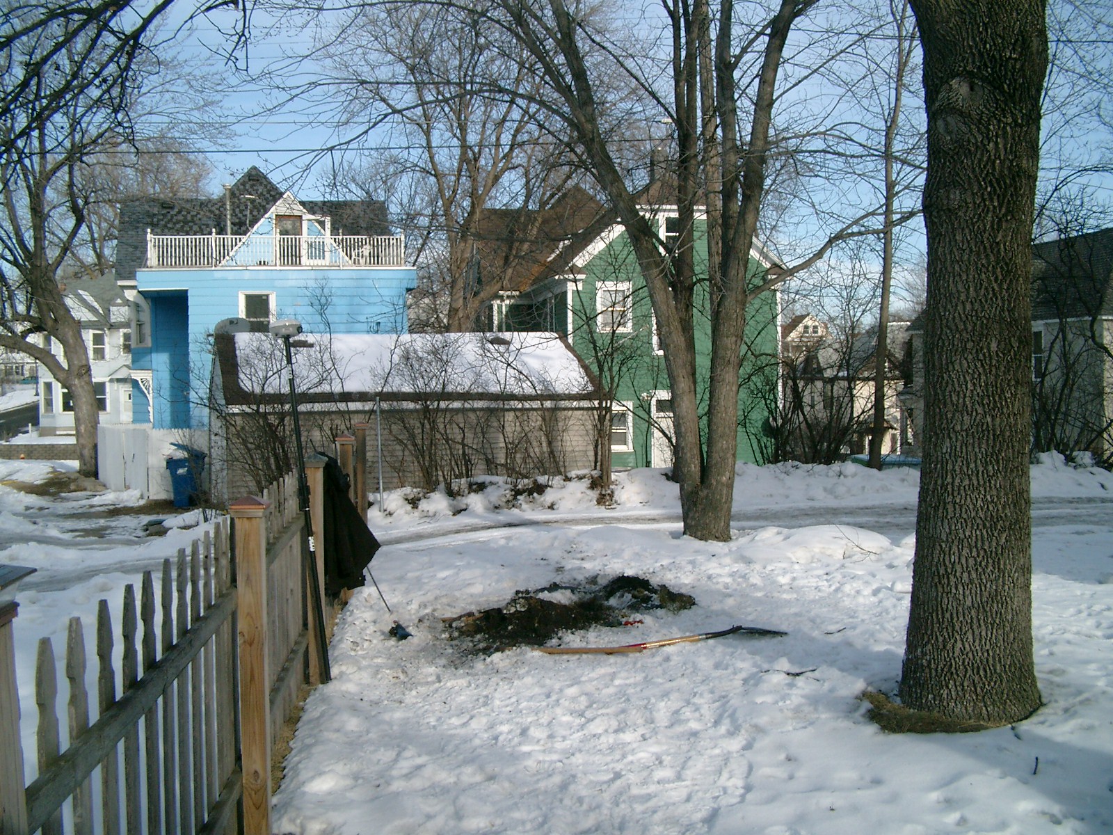
| 3188-0285-5.jpg | January 10, 2013 | Looking west. |
| 3188-0285-4.jpg | January 10, 2013 | Looking south along Rivoli St. |
| 3188-0285-3.jpg | January 10, 2013 | Looking east. |
| 3188-0285-2.jpg | January 10, 2013 | Looking north along Rivoli St. |
| 3188-0285-1.jpg | January 10, 2013 | Close up of monument. |