| NAD83 COORDINATES (1986 adj.): |
|---|
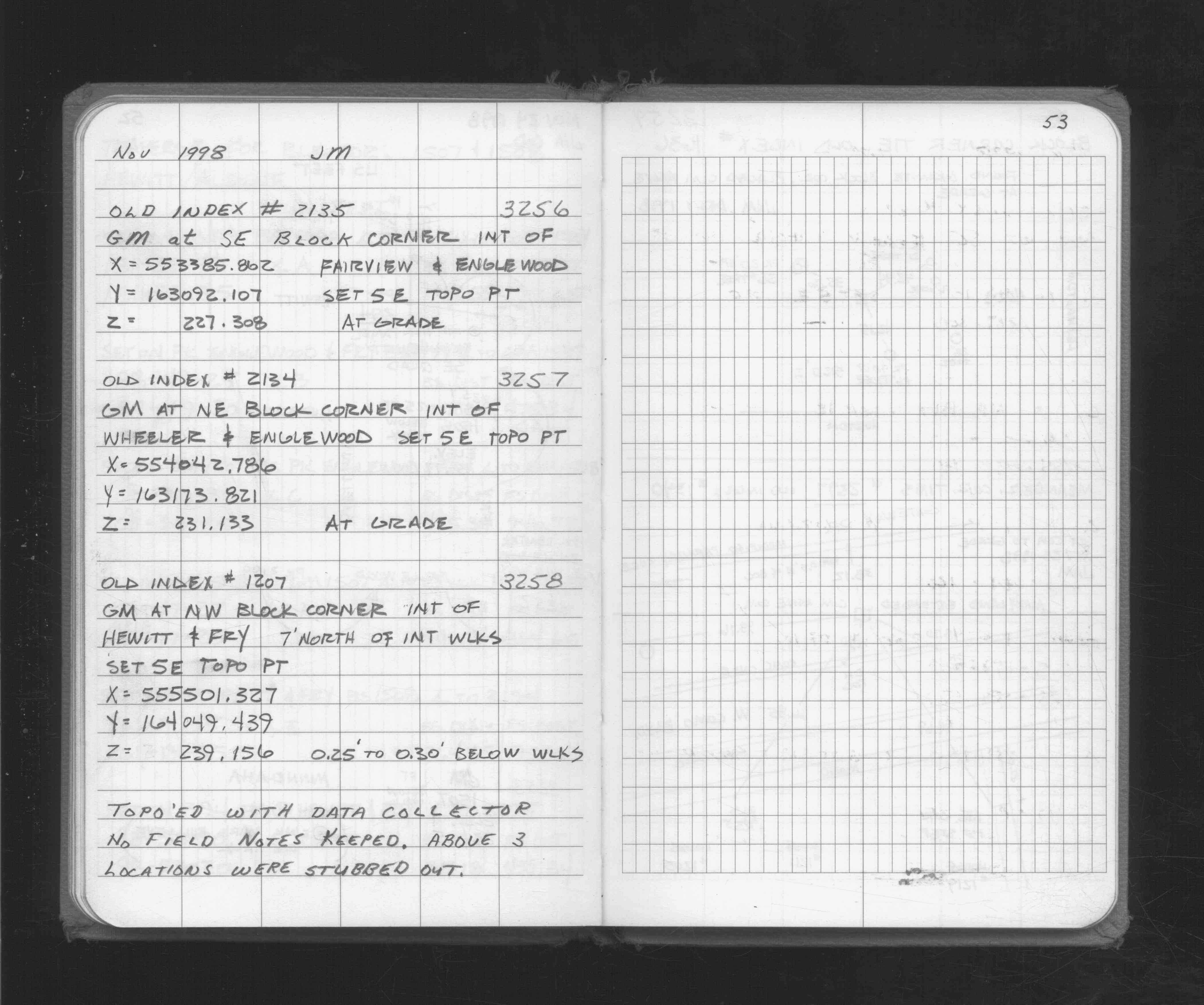
| X= 555501.327 Y= 164049.439 Z= 239.16 TOT 11/28/1998 UAJ |
| NAD83 COORDINATES (1996 adj.): |
|---|
| X= 555500.904 Y= 164050.092 Z= 933.4 11/9/2010 MnDot |
| 11/22/2011 | Probed 1.0' to monument. |
| 11/9/2010 | GM found by MnDOT. Coordinate established using total station w/ static GPS control (1996 adj). City Elev = 239.14 |
| 11/24/1998 | Located GM by topo. See FB 1716 p.53 |
| 11/1/1998 | (Unknown date Nov __, 1998 ) Recovered GM 0.25' to 0.30' below walk & 7' north of walk intersection. |
Above is NOT an all inclusive history of this point. Please review all the links below.
| PLS NOTES | Field | Cross Section | Sewer | J.B. Irvine | Monument | River Survey |
|---|---|---|---|---|---|---|
| FB 1716p.53 |