| NAD83 COORDINATES (1986 adj.): |
|---|
| X= 575351.670 Y= 155774.786 Z= 093.96 LSQ 02/08/1999 FLT |
| 7/4/2005 | Fd CIM Photos taken. |
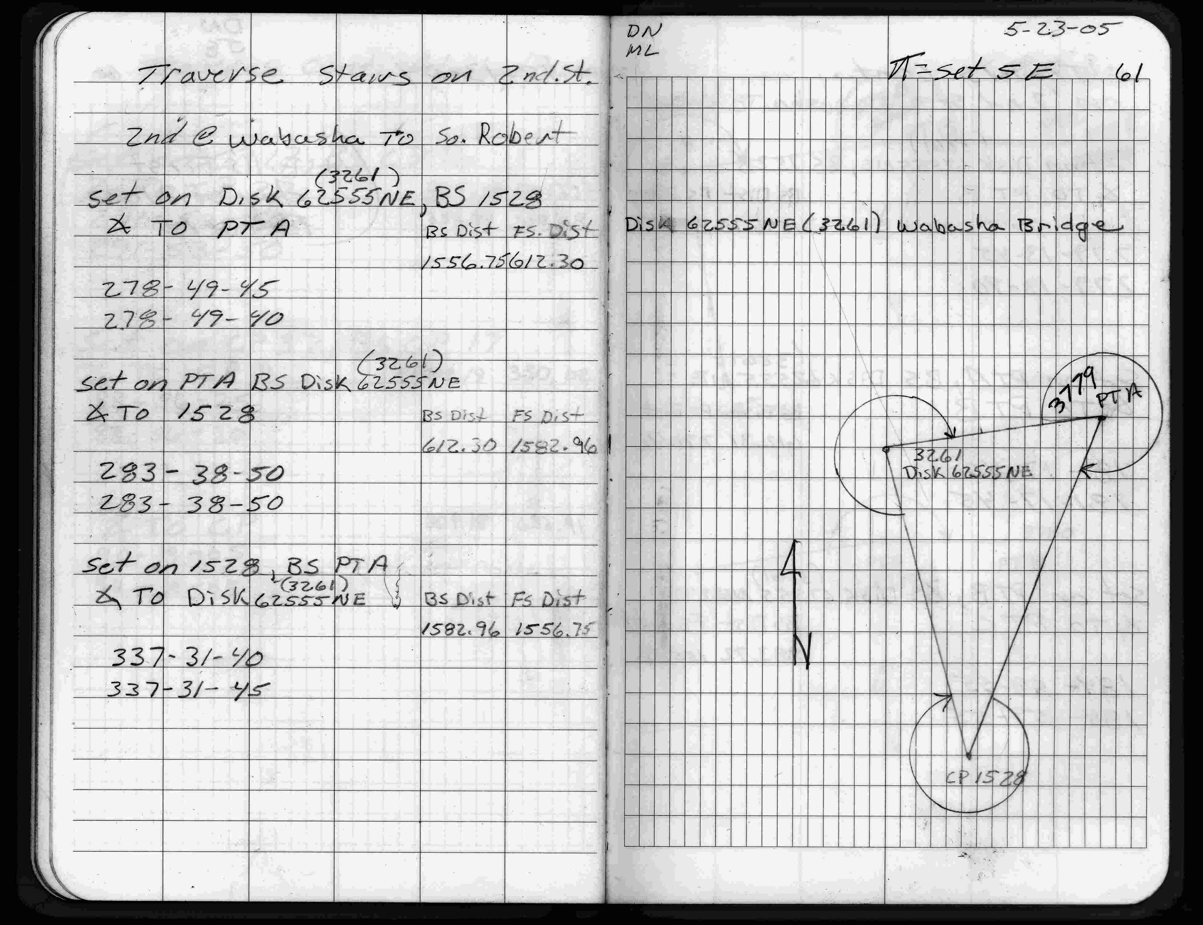
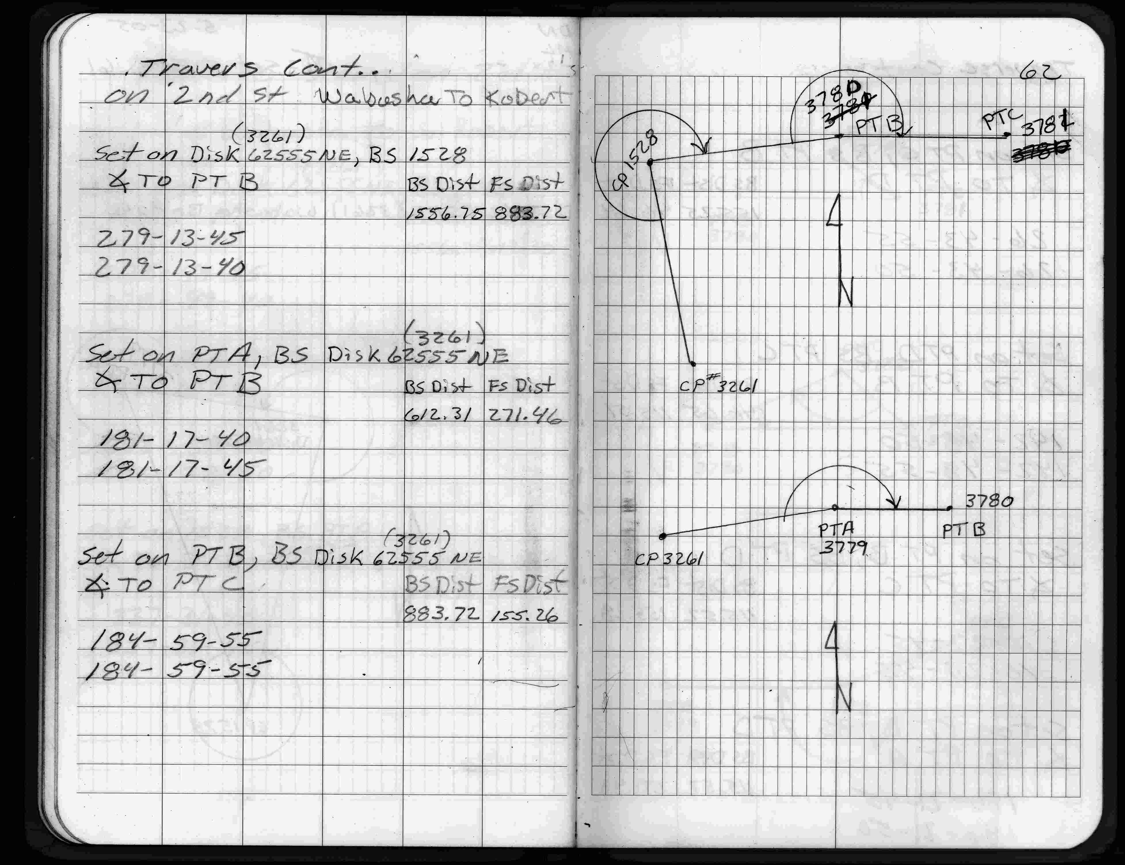
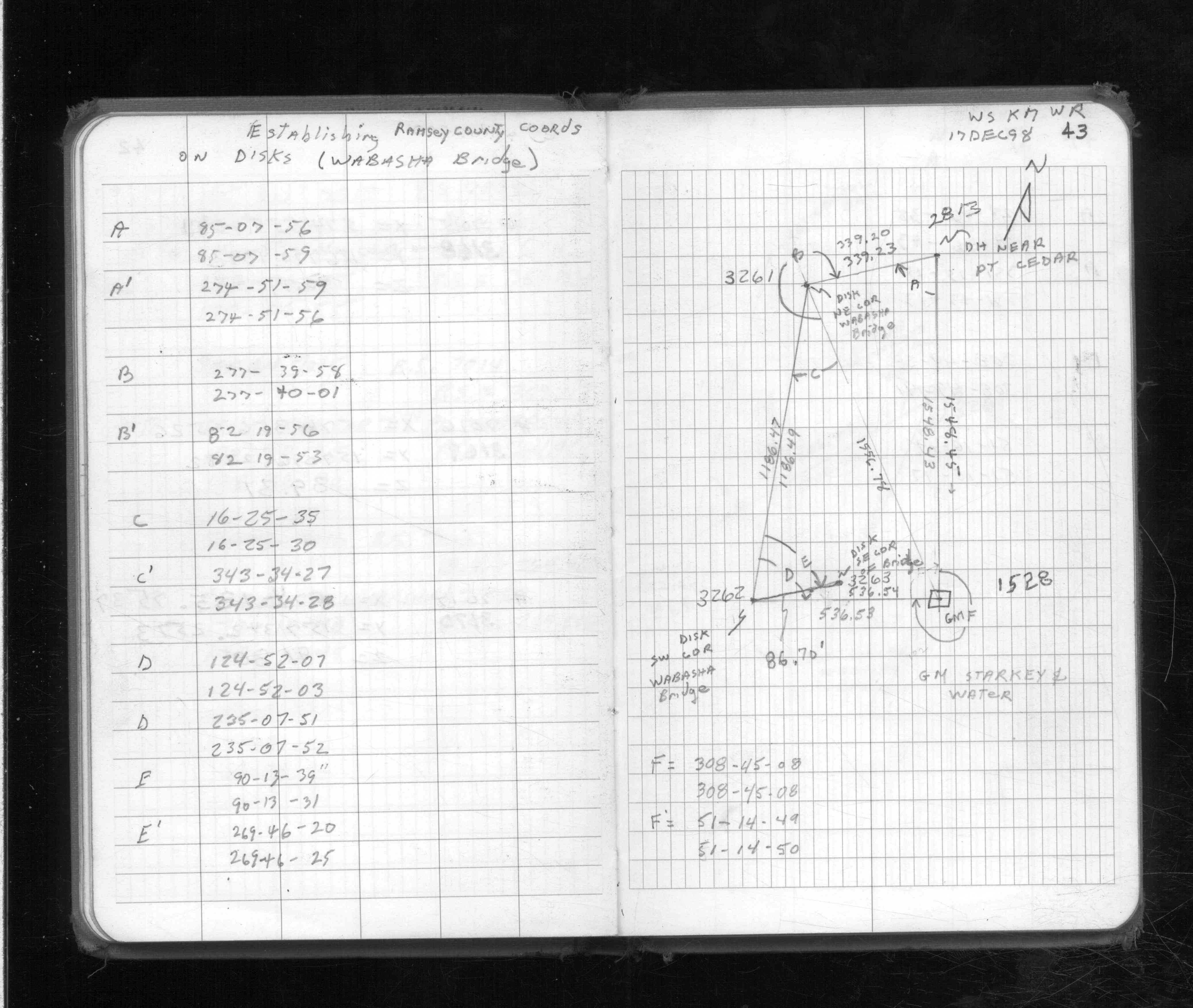
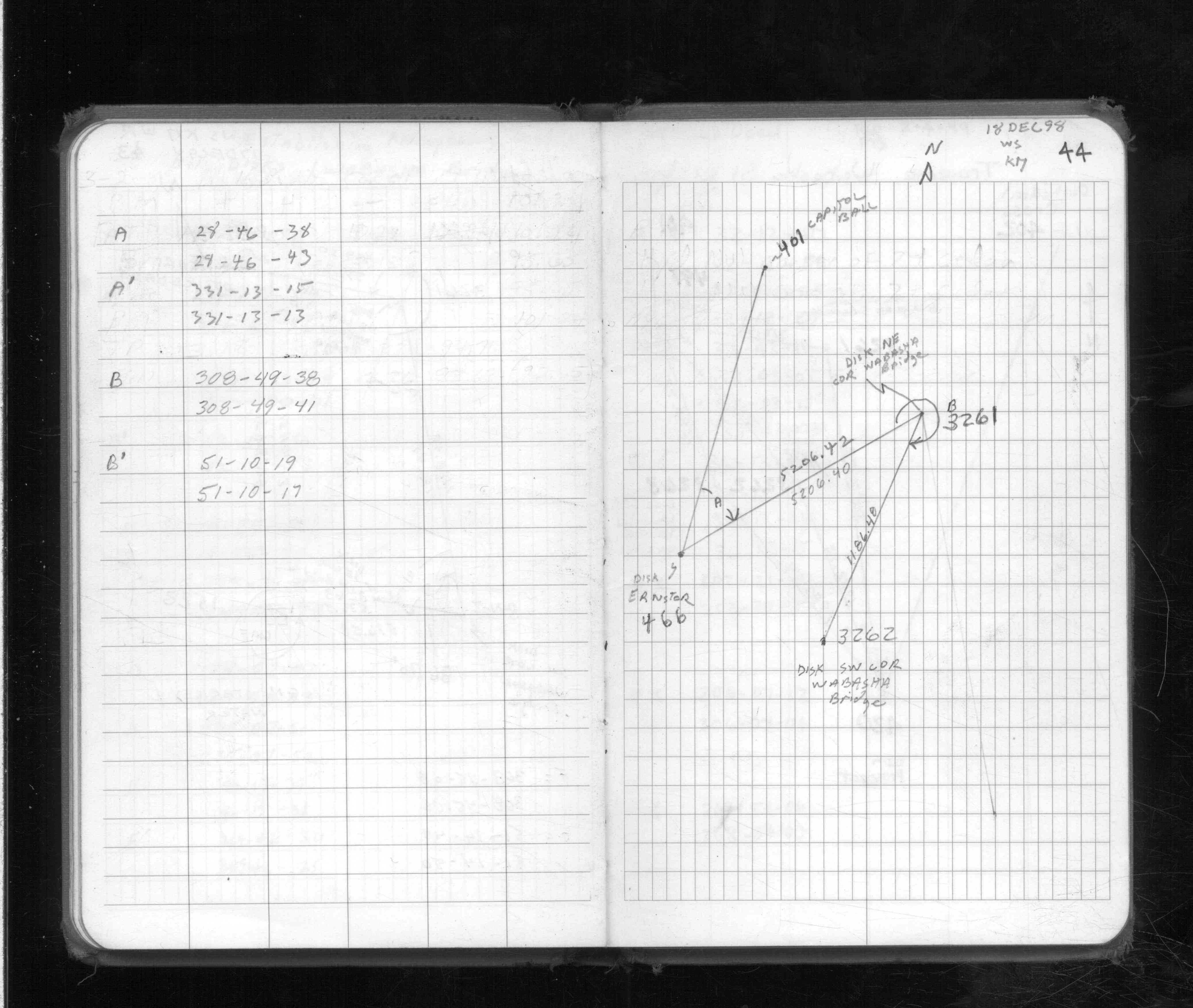
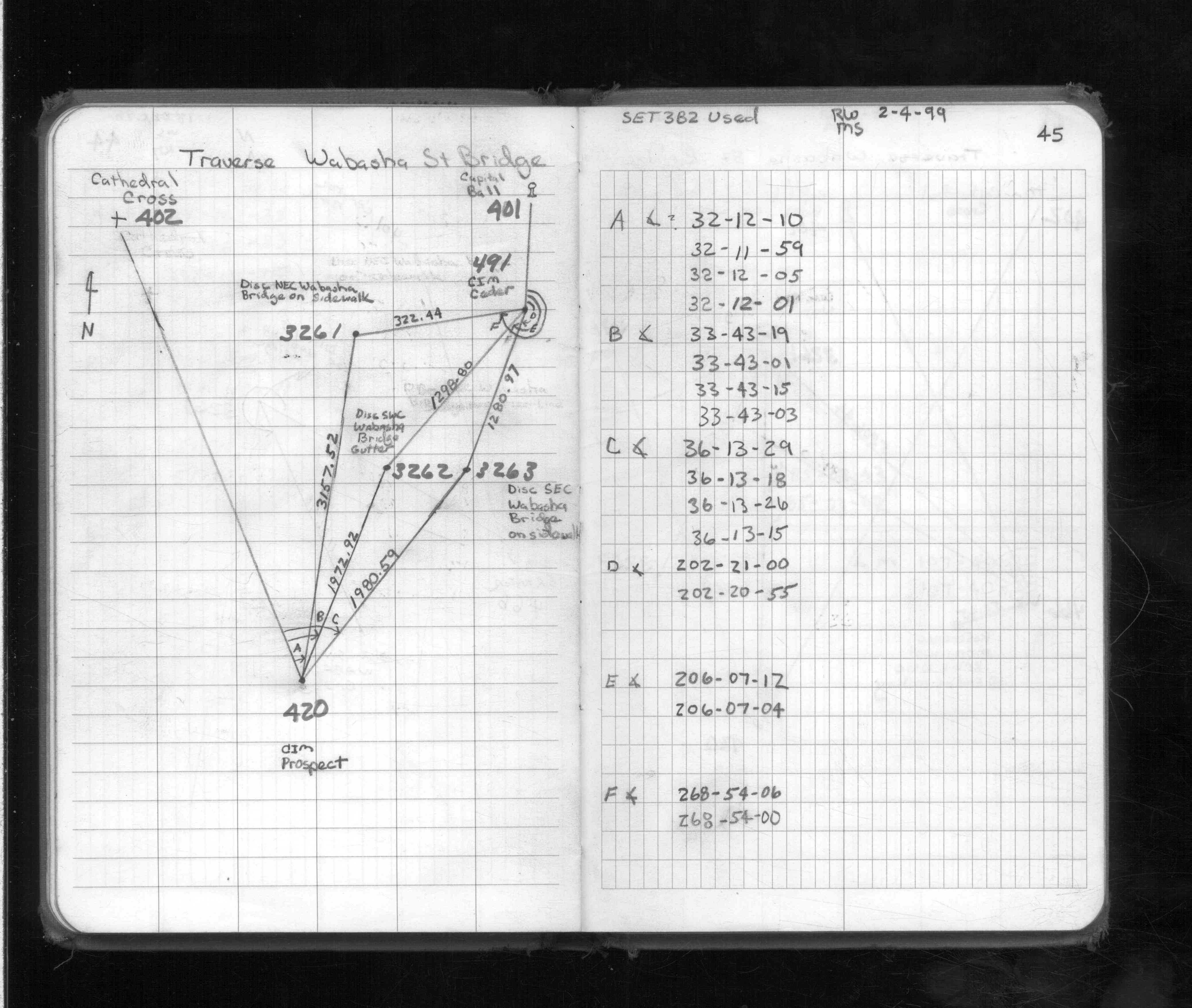
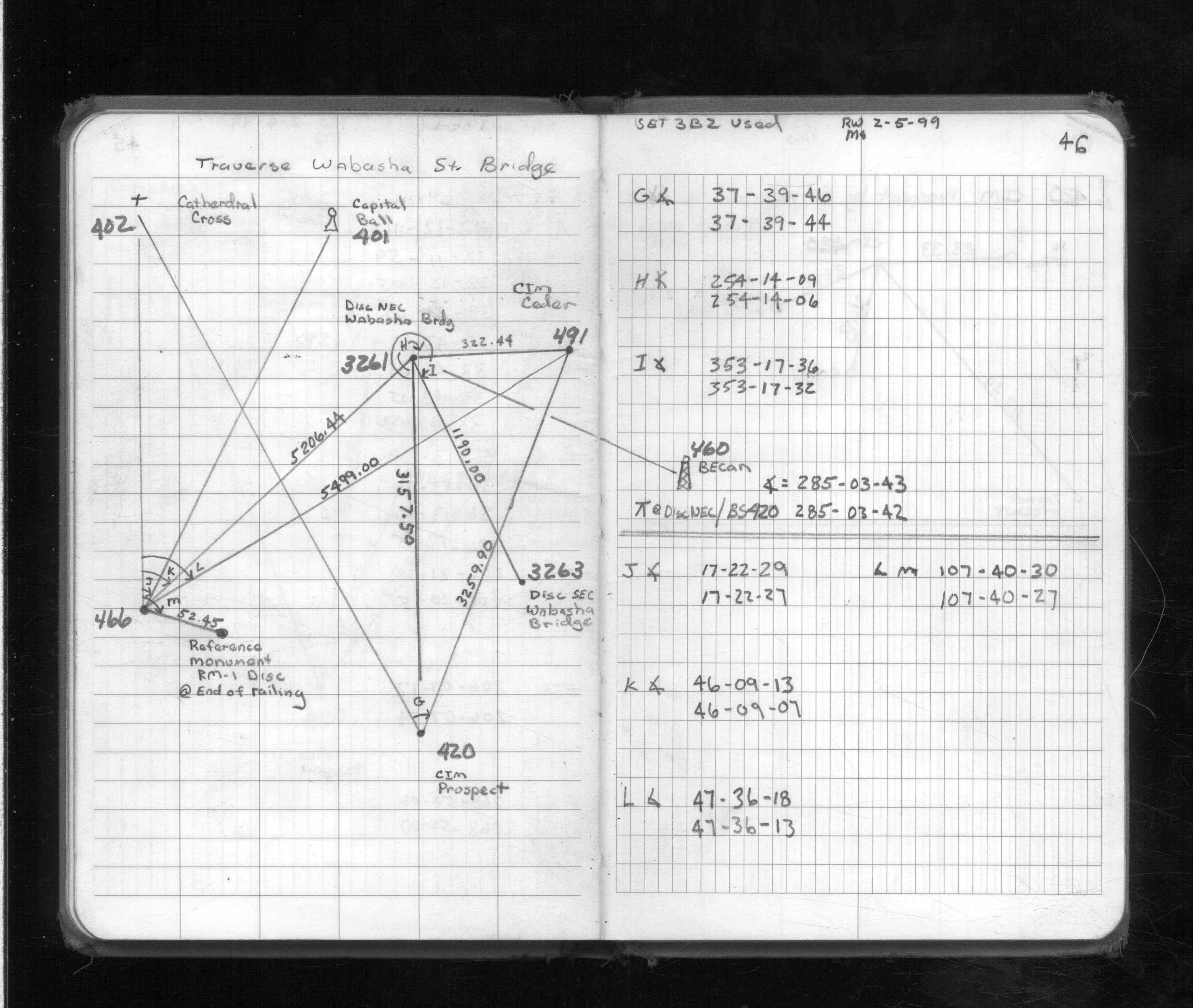
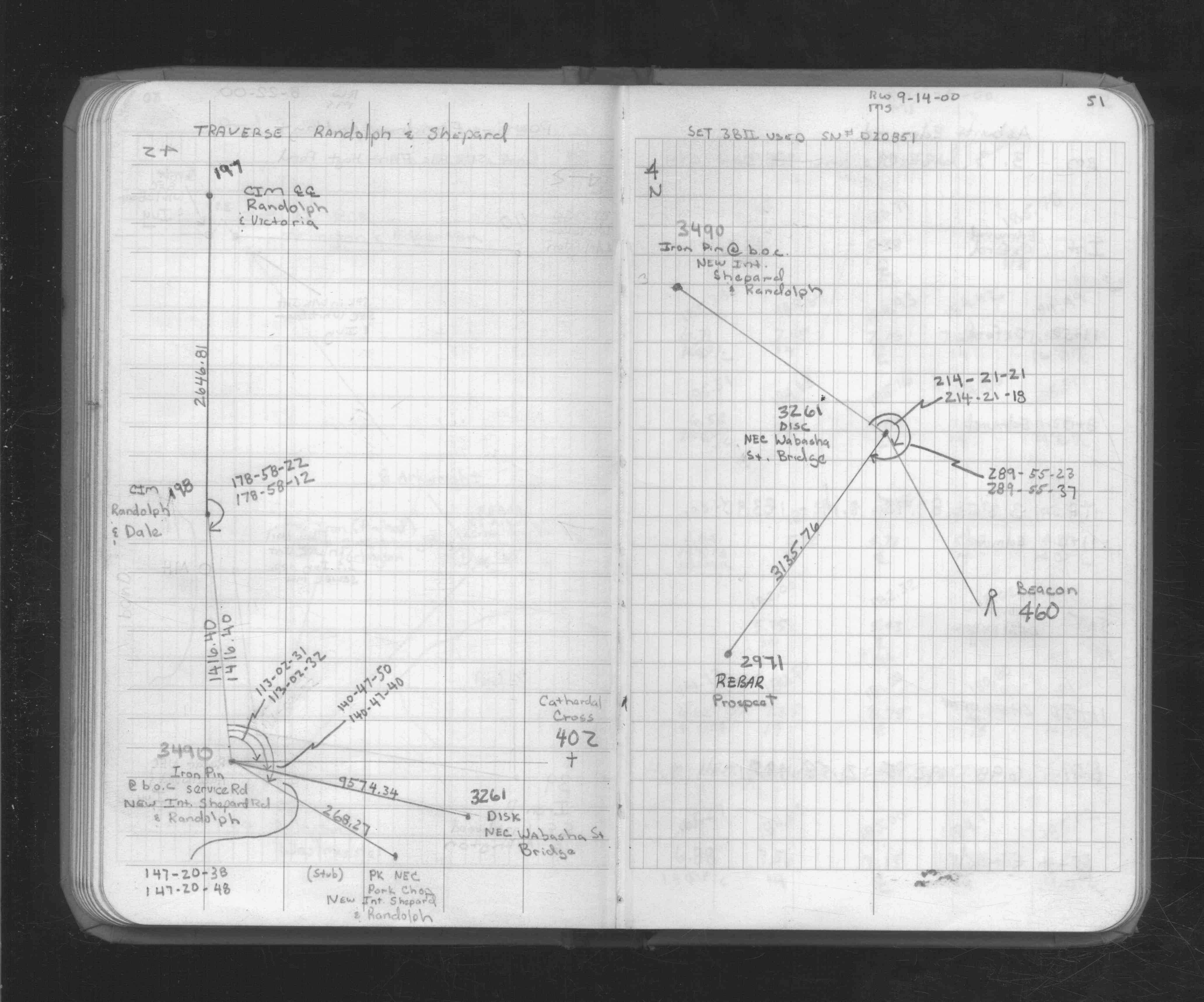
| 12/17/1998 | Traversed through disc. See FB 1713 p.43,44,45,46 |
Above is NOT an all inclusive history of this point. Please review all the links below.
| PLS NOTES | Field | Cross Section | Sewer | J.B. Irvine | Monument | River Survey |
|---|---|---|---|---|---|---|
| FB 1706Ap. 61 ,62 | ||||||
| FB 1713p. 43 ,44 ,45 ,46 | ||||||
| FB 1734p.62 | ||||||
| FB 1734Ap.51 |
| FILE | PHOTO DATE | COMMENTS |
|---|---|---|
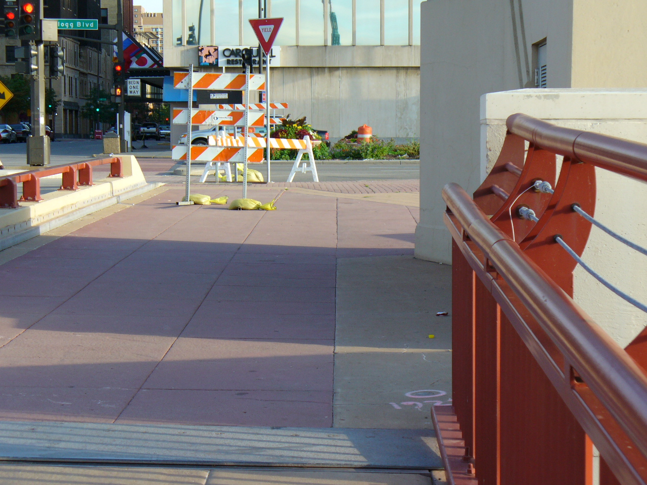
| 3261-__hp-4.jpg | July 4, 2005 | Looking Northerly towards Kellogg Blvd. |
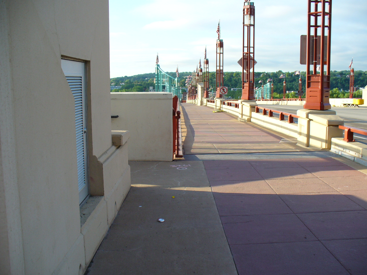
| 3261-__hp-3.jpg | July 4, 2005 | Looking Southerly along the Wabasha Bridge. |
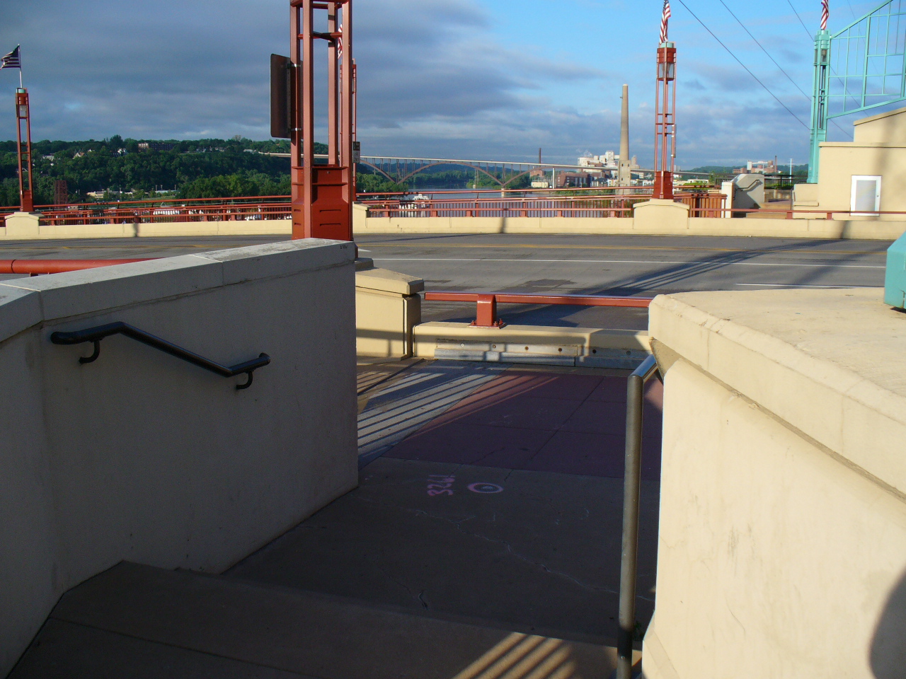
| 3261-__hp-2.jpg | July 4, 2005 | Looking Westerly towards the high (Smith Ave.) bridge. |
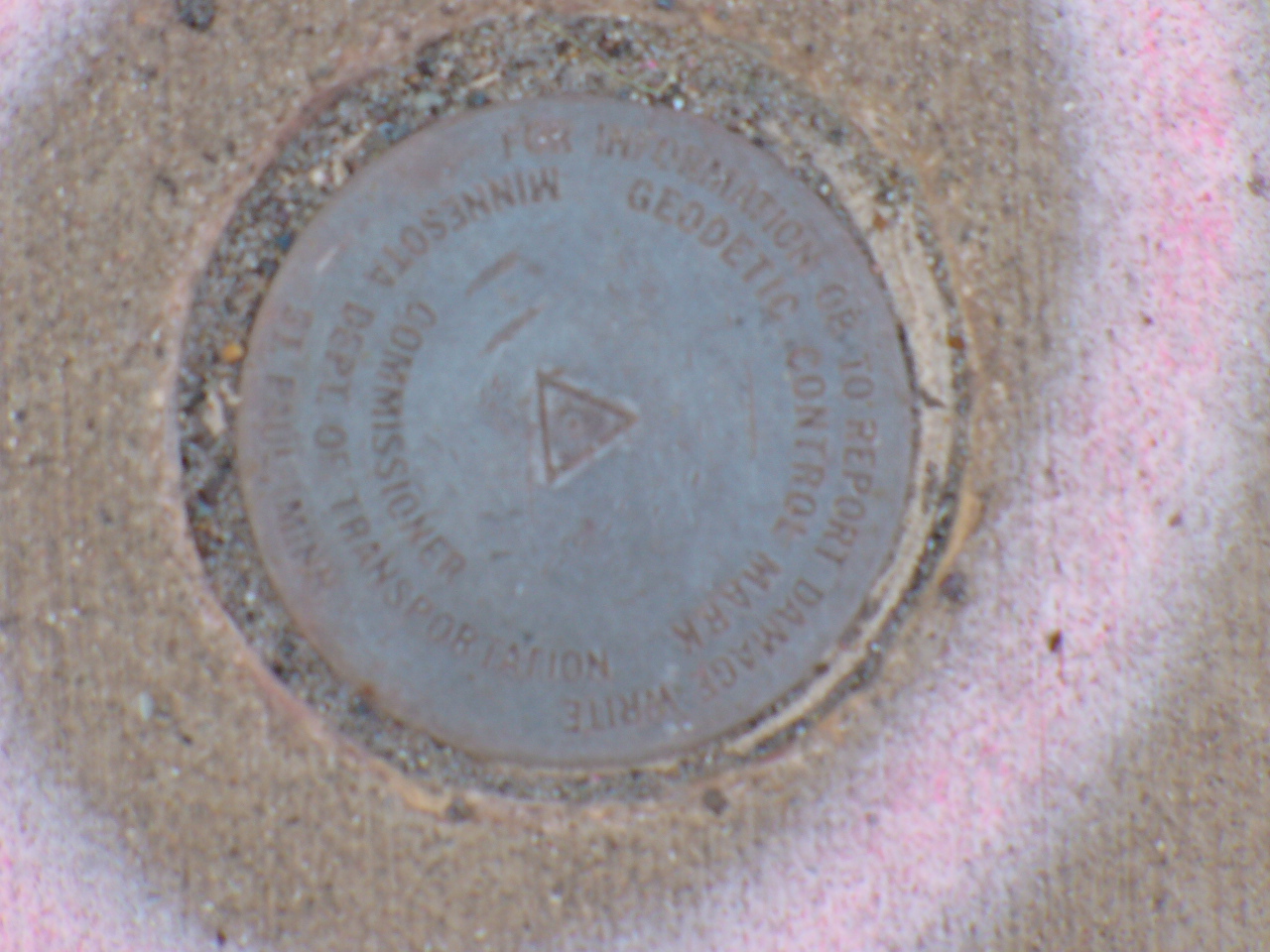
| 3261-__hp-1.jpg | July 4, 2005 | Close-up of bridge disk. |