| NAD83 COORDINATES (1986 adj.): |
|---|
| X= 578836.619 Y= 164093.573 Z= 177.64 TOT 02/18/1999 STB |
| 6/23/2004 | GM inplace at sidewalk grade. Photos taken. |
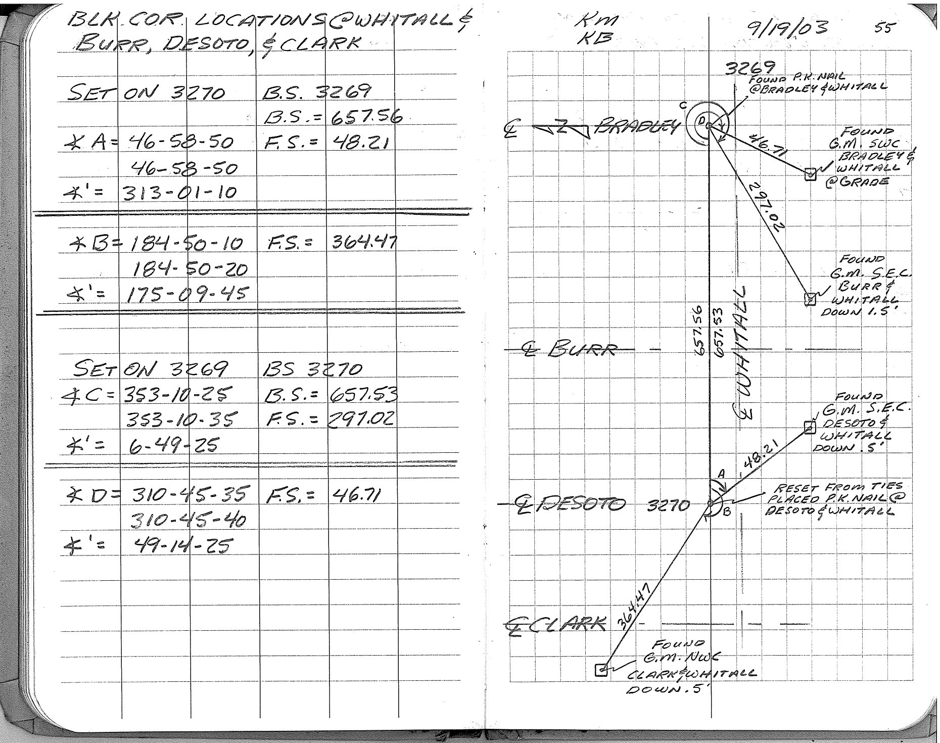
| 9/19/2003 | Located GM by traverse (single stub). See FB 1737 p.55 |
| 7/3/2003 | Placed ties on GM at sidewalk grade. See CofL 3272-0345-A |
| 2/18/1999 | Fd GM. See ~survey/acorddat/1999/p1189/blkcor.sdr |
| 2/1/1890 | Monument reset after grading by Chas Hunt |
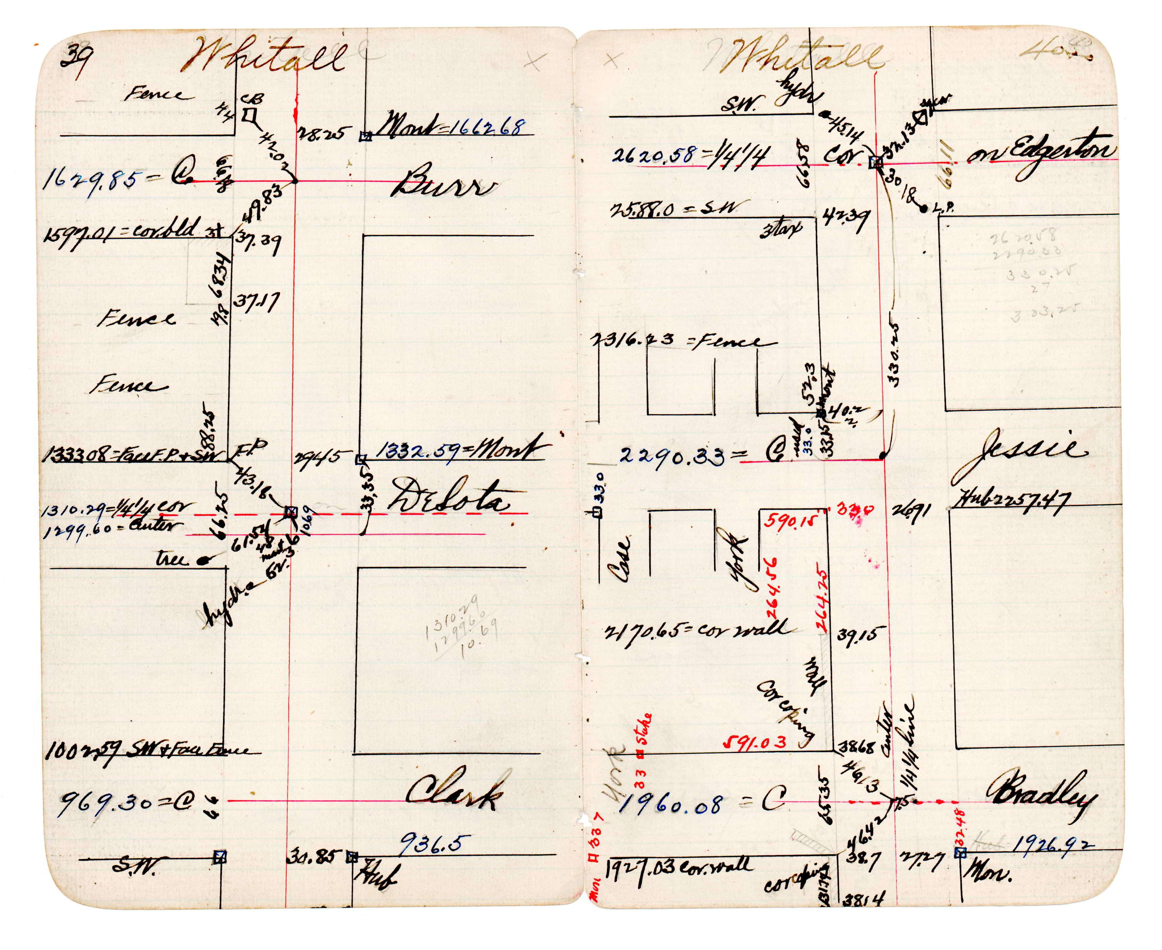
| 1/1/1890 | (Unknown date ___ __, 189? ) Monument location. See JBI 23 p.39-40 |
Above is NOT an all inclusive history of this point. Please review all the links below.
| PLS NOTES | Field | Cross Section | Sewer | J.B. Irvine | Monument | River Survey |
|---|---|---|---|---|---|---|
| FB 1737p.55 | JBI 23 p.39-40 |
| FILE | SURVEYOR | LIC. NO. | DATE SIGNED | DATE TIED |
|---|---|---|---|---|
| 3272-0345-A.tif | Michael P. Murphy | 41001 | September 17, 2003 | July 3, 2003 |
| FILE | PHOTO DATE | COMMENTS |
|---|---|---|
| 3272-0345-2.jpg | June 23, 2004 | Looking southwest toward monument. |
| 3272-0345-1.jpg | June 23, 2004 | Close up of monument. |