| NAD83 COORDINATES (1986 adj.): |
|---|
| X= 579573.256 Y= 162380.753 Z= 000.00 UAJ 06/21/1999 STB |
| 4/16/2002 | Fd GM 0.5 ft below walk. Photos taken. |
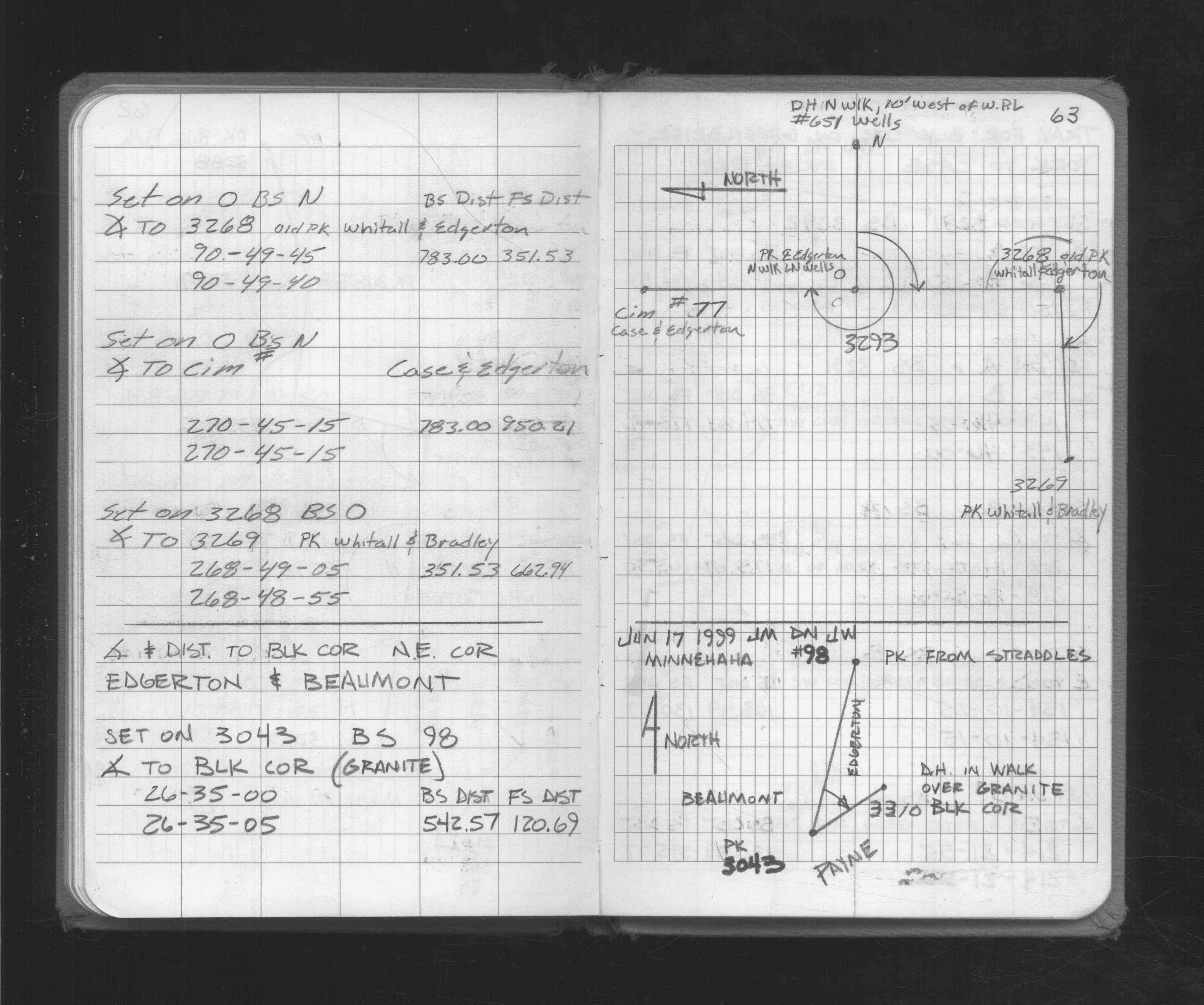
| 6/17/1999 | Fd GM 0.5 ft below walk & placed drill hole in walk over GM. See FB 1716 p.63 |
| 1/1/1887 | (Unknown date ___ __, 1887 ) Monument was in place before street graded, mon't not disturbed during grading - Chas Hunt |
Above is NOT an all inclusive history of this point. Please review all the links below.
| PLS NOTES | Field | Cross Section | Sewer | J.B. Irvine | Monument | River Survey |
|---|---|---|---|---|---|---|
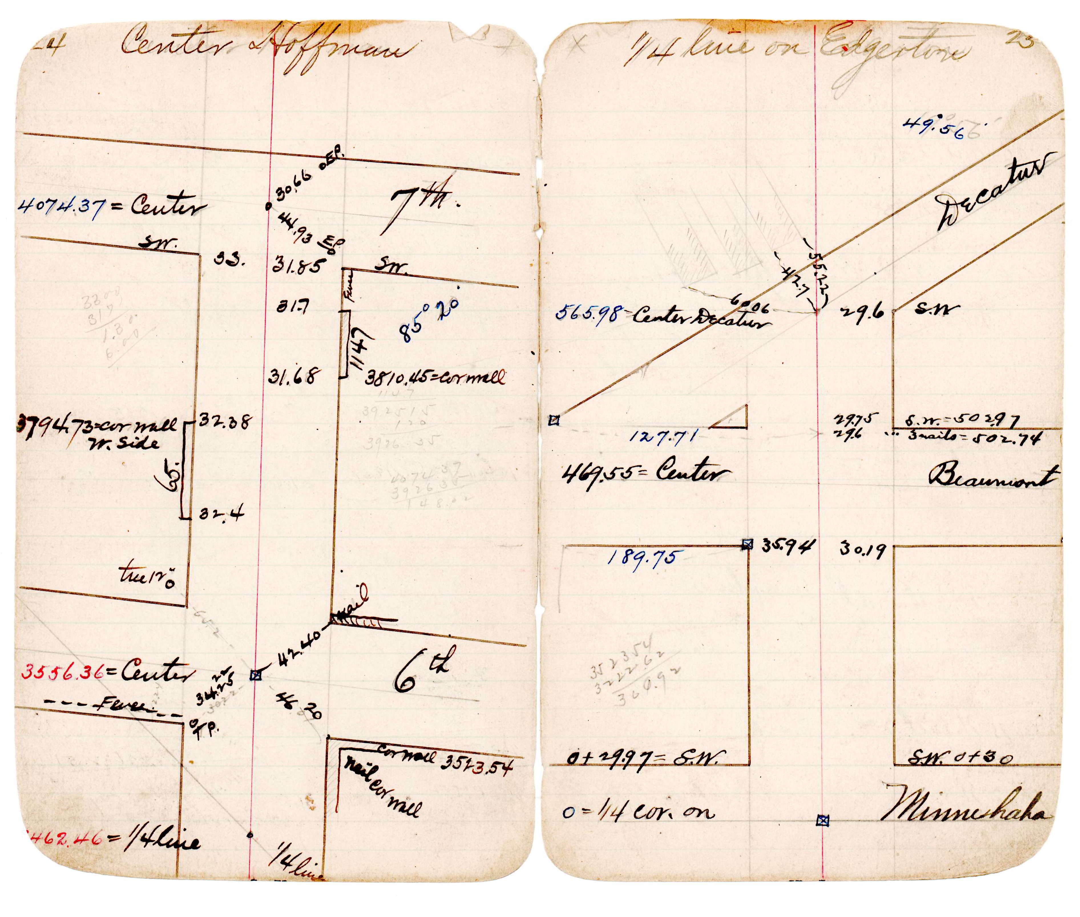
| FB 1716p.63 | JBI 21 p.24-25 |
| FILE | PHOTO DATE | COMMENTS |
|---|---|---|
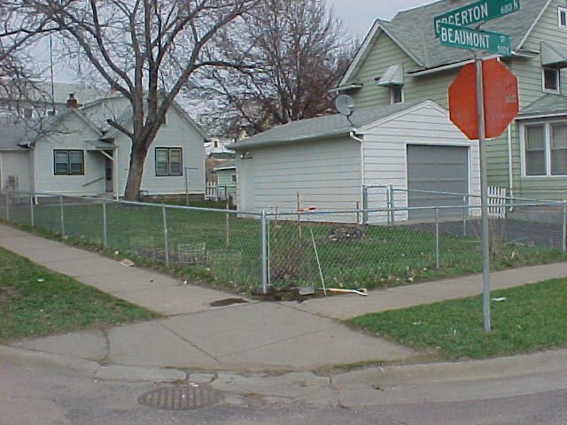
| 3310-1179-2.jpg | April 16, 2002 | Looking northeast. |
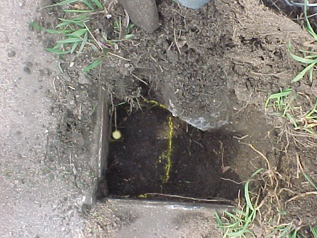
| 3310-1179-1.jpg | April 16, 2002 | Close up of GM |