| NAD83 COORDINATES (1986 adj.): |
|---|
| X= 581787.907 Y= 162218.917 Z= 000.00 UAJ 06/21/1999 STB |
| 6/25/2013 | Probed in several placed along walk, nothing found. Building has been erected at this location since traverse was run in 1999. |
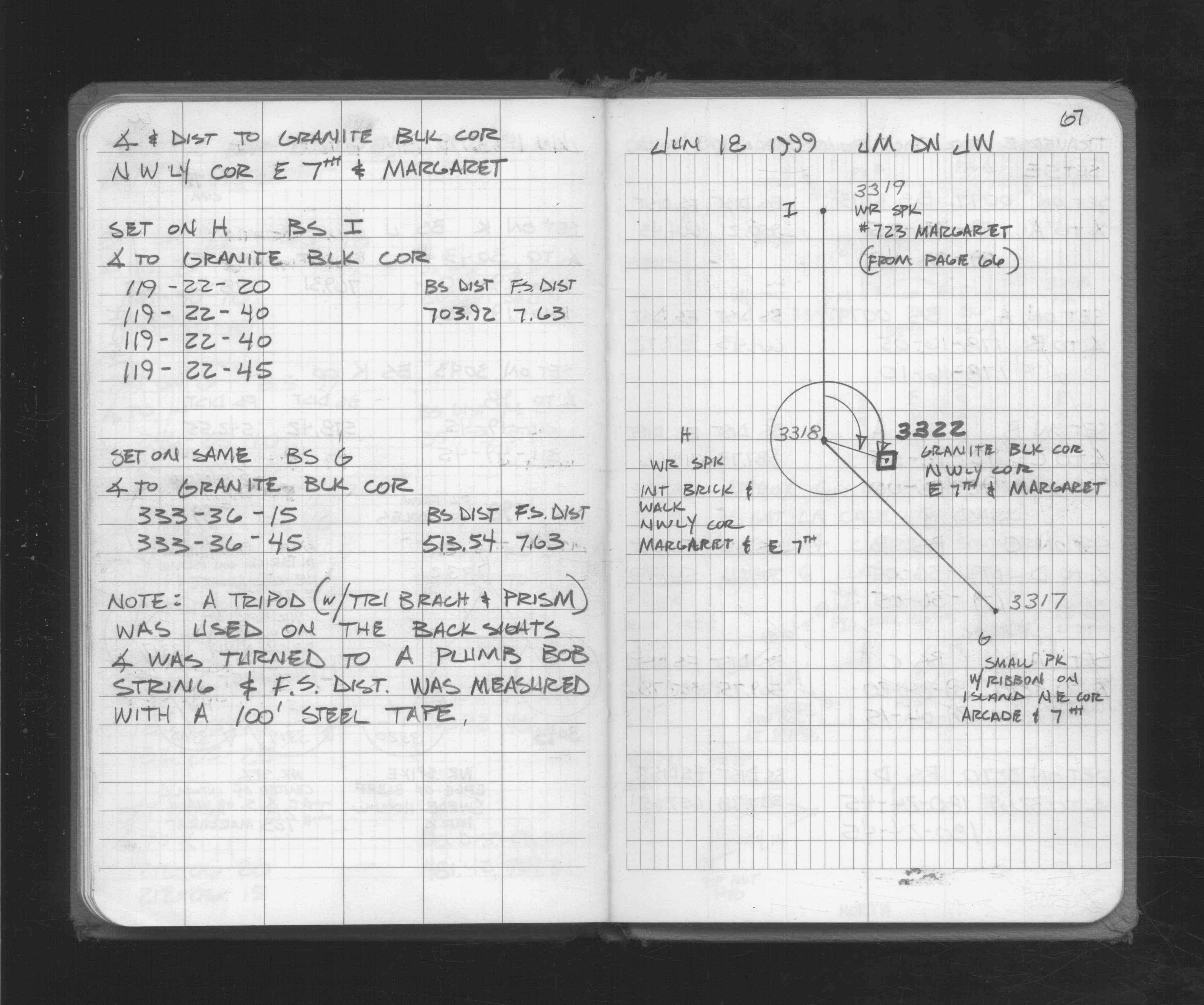
| 6/18/1999 | Located GM by traverse (single stub). See FB 1716 p.67 |
| 6/16/1999 | Fd GM 0.45 ft below walk & placed 4 - 1 ft straddles |
| 7/1/1887 | (Unknown date Jul __, 1887 ) Monument set by J H Armstrong from survey in book 206 |
Above is NOT an all inclusive history of this point. Please review all the links below.
| PLS NOTES | Field | Cross Section | Sewer | J.B. Irvine | Monument | River Survey |
|---|---|---|---|---|---|---|
| FB 1716p.67 |