| NAD83 COORDINATES (1986 adj.): |
|---|
| X= 553420.77 Y= 150978.81 Z= 930.50 02/20/2009 RTK-VRS |
| X= 553420.917 Y= 150978.820 Z= 000.00 LSQ 10/25/1999 FLT |
| 2/20/2009 | Position on GM established by RTK-VRS GPS. Elev 930.5 ft. Photos taken. |
| 3/11/2008 | Fd GM and read Elev. 236.504 Loop No. 260 |
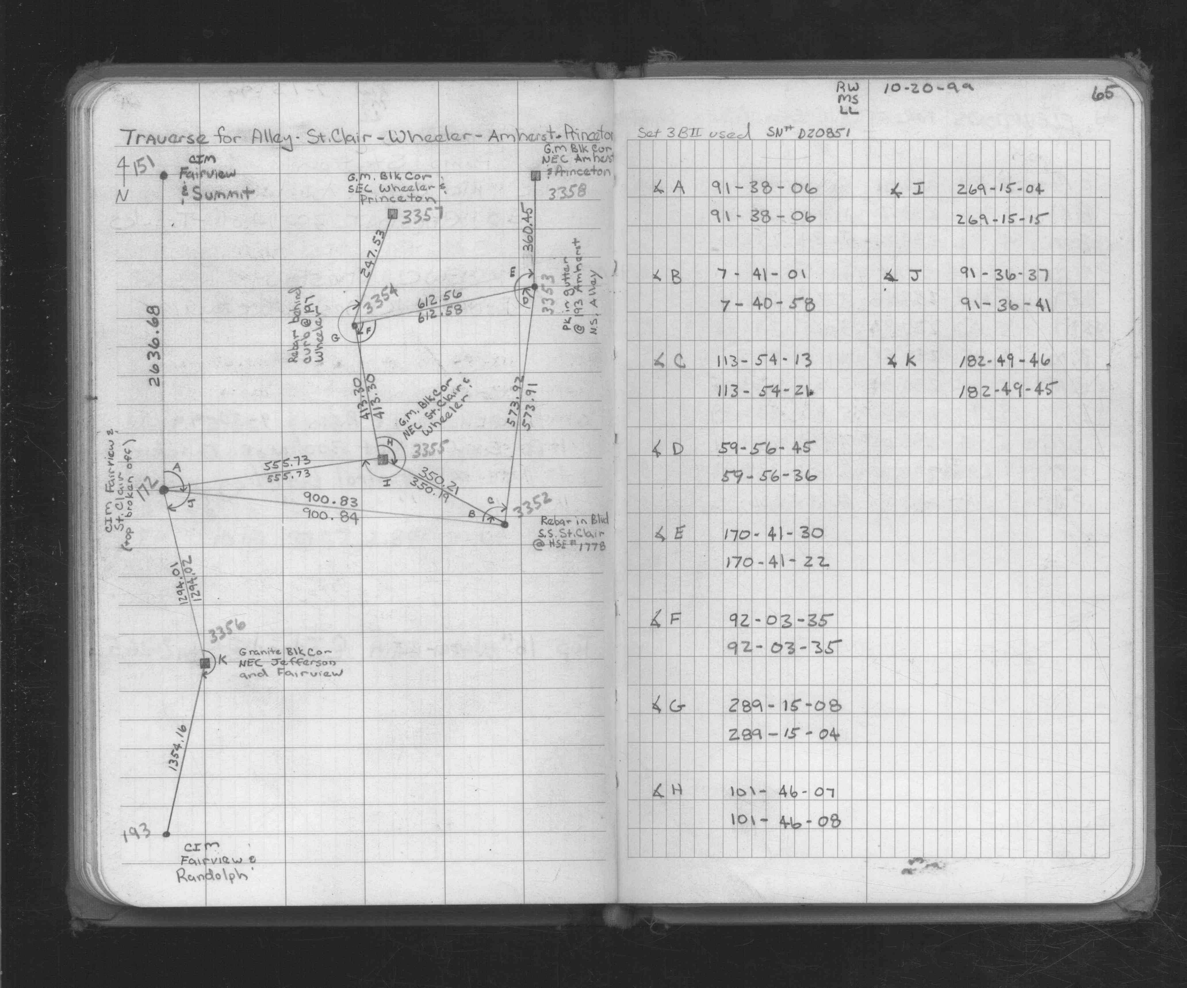
| 10/20/1999 | Placed ties on GM at sidewalk grade. See CofL 3356-2470-A |
| 10/20/1999 | GM recovered. Position established by traversing through. See 1734p65.lst for adj results |
| 12/17/1891 | Monument set by J B Irvine |
Above is NOT an all inclusive history of this point. Please review all the links below.
| PLS NOTES | Field | Cross Section | Sewer | J.B. Irvine | Monument | River Survey |
|---|---|---|---|---|---|---|
| FB 1734p.65 |
| FILE | SURVEYOR | LIC. NO. | DATE SIGNED | DATE TIED |
|---|---|---|---|---|
| 3356-2470-A.tif | Jeffery L. Grosso | 13144 | November 10, 1999 | October 20, 1999 |
| FILE | PHOTO DATE | COMMENTS |
|---|---|---|
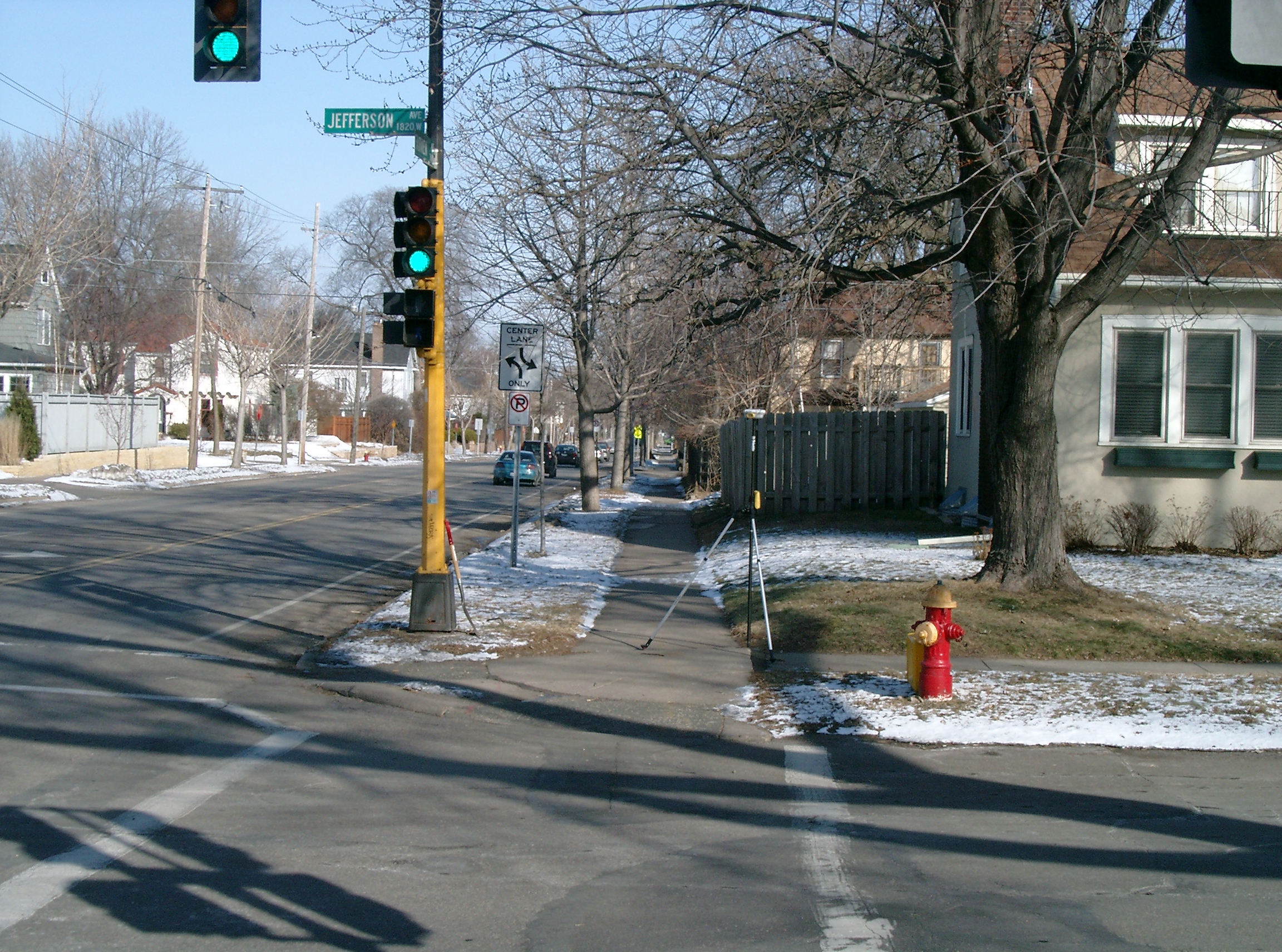
| 3356-2470-5.jpg | February 20, 2009 | Looking West along the North side of Jefferson Ave. |
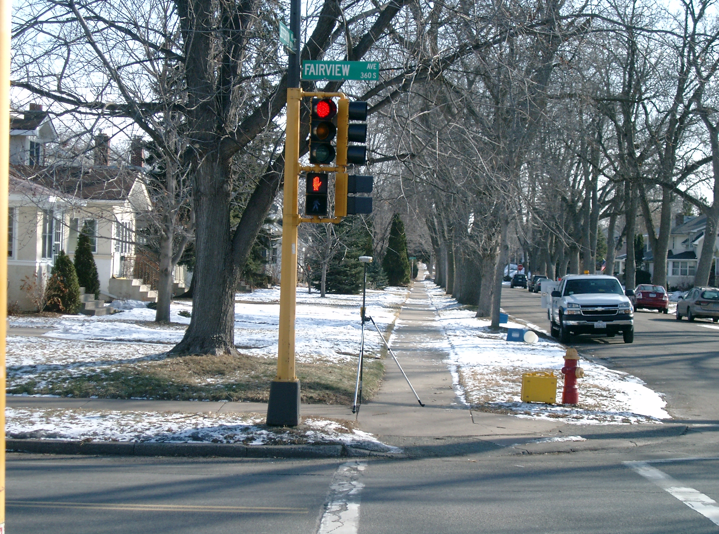
| 3356-2470-4.jpg | February 20, 2009 | Looking South along the East side of Fairview Ave. |
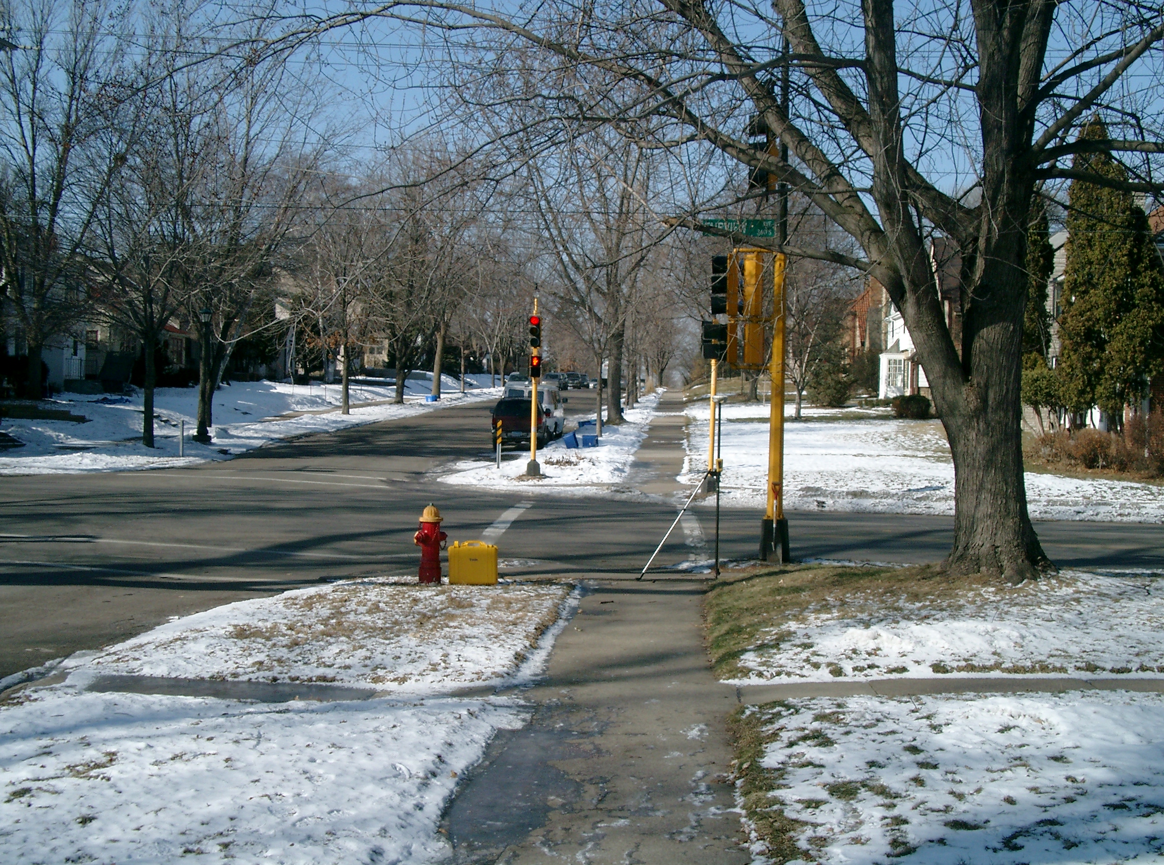
| 3356-2470-3.jpg | February 20, 2009 | Looking East along the North side of Jefferson Ave. |
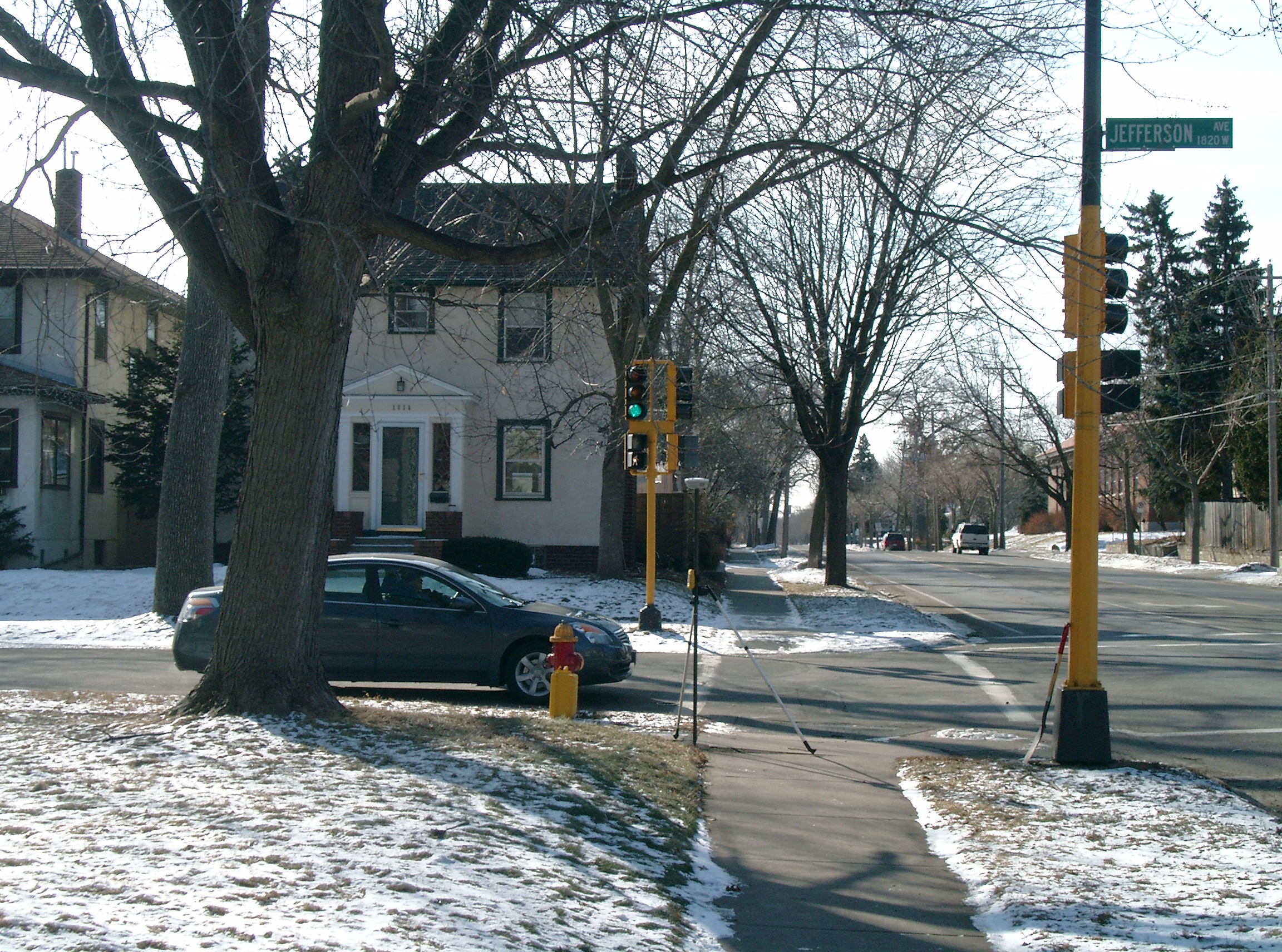
| 3356-2470-2.jpg | February 20, 2009 | Looking North along the East side of Fairview Ave. |
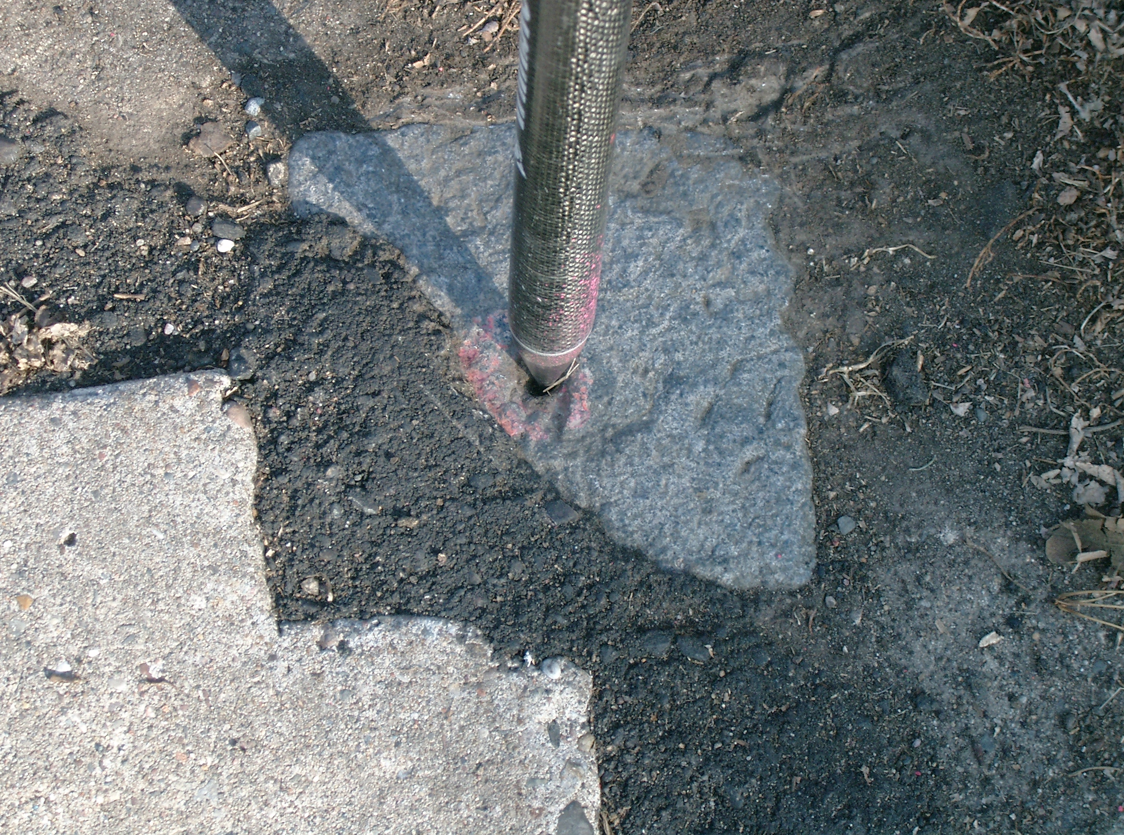
| 3356-2470-1.jpg | February 20, 2009 | Close-up of the GM. |