| NAD83 COORDINATES (1986 adj.): |
|---|
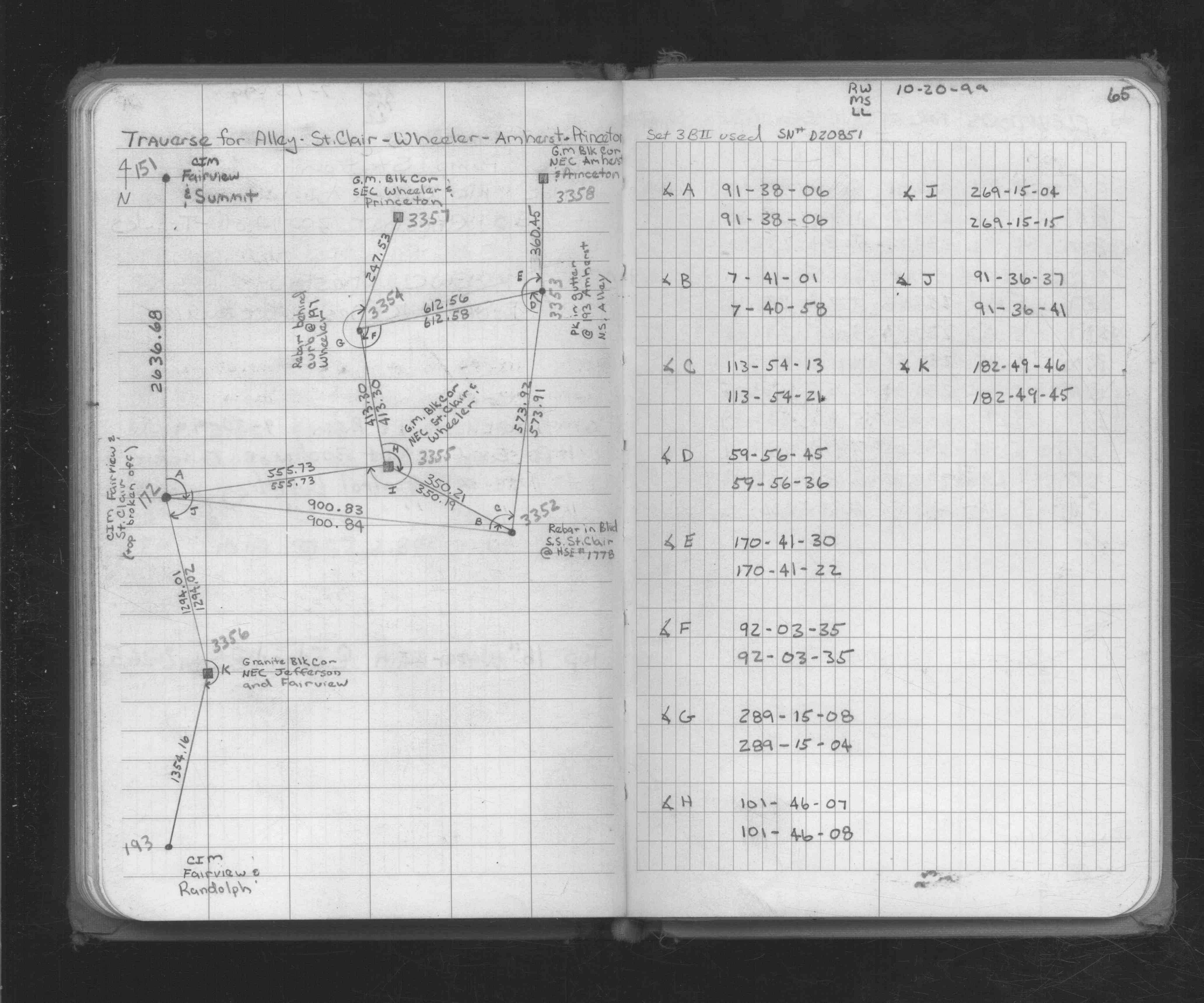
| X= 554632.366 Y= 153111.269 Z= 231.61 LSQ 10/25/1999 STB |
| 11/4/1999 | Elev 231.61 ft on GM. Topo survey. See acorddat/1999/amherst/amherst-.sdr |
| 10/20/1999 | Placed ties on GM. See CofL 3358-0787B-A |
| 10/10/1999 | Fd GM. Position established by traverse (single stub). See 1734p65.lst for adj results |
| 3/11/1889 | Monument reset by Chas Hunt |
| 1/1/1887 | (Unknown date Jan __, 1887 ) Monument set by T J Murray in place of original iron stake |
Above is NOT an all inclusive history of this point. Please review all the links below.
| PLS NOTES | Field | Cross Section | Sewer | J.B. Irvine | Monument | River Survey |
|---|---|---|---|---|---|---|
| FB 1734p.65 |
| FILE | SURVEYOR | LIC. NO. | DATE SIGNED | DATE TIED |
|---|---|---|---|---|
| 3358-0787B-A.tif | Jeffery L. Grosso | 13144 | November 10, 1999 | October 20, 1999 |