| NAD83 COORDINATES (1986 adj.): |
|---|
| X= 553374.389 Y= 158925.901 Z= 000.00 CMP 02/16/2000 STB |
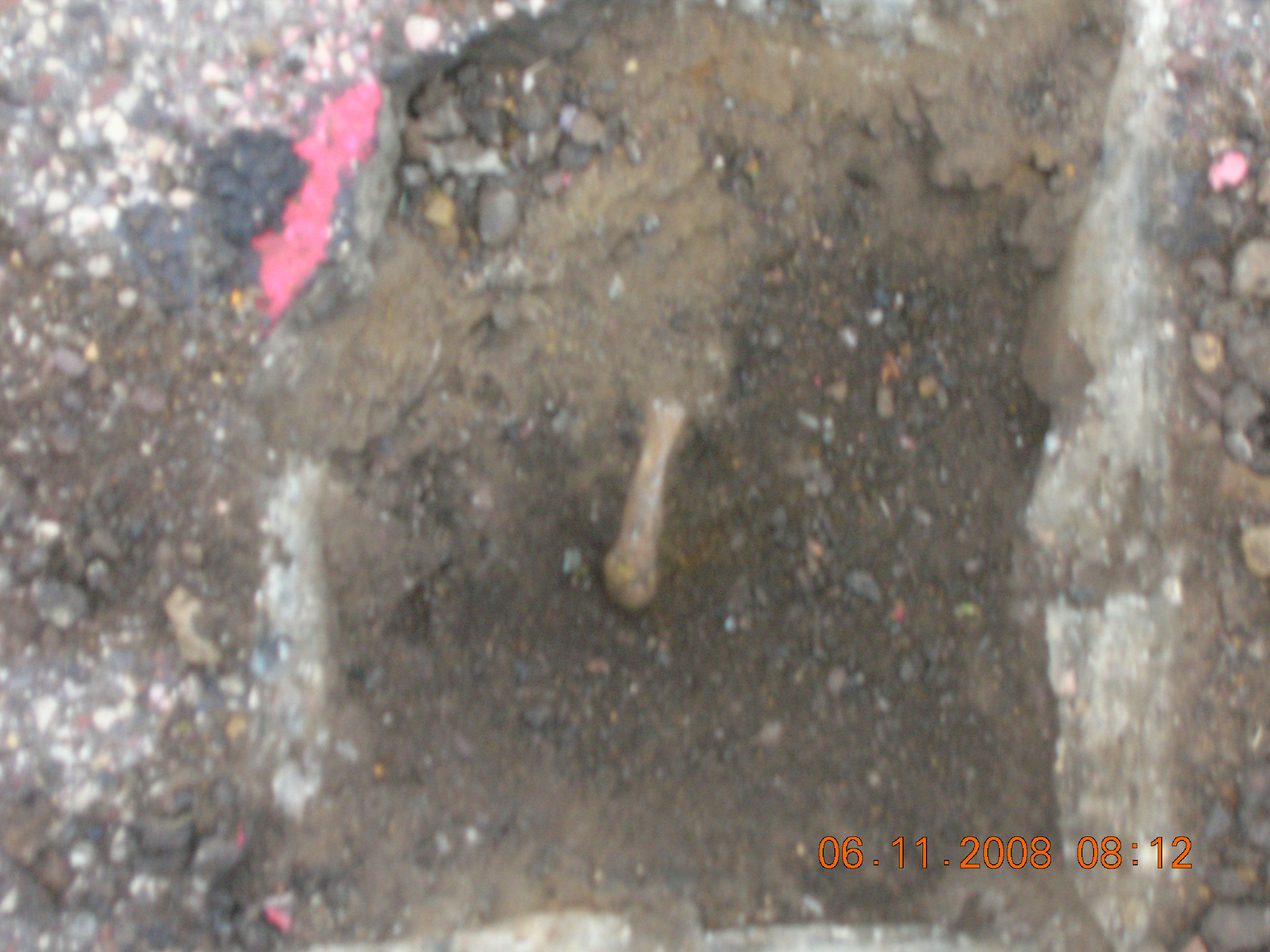
| 6/11/2008 | Photos taken. |
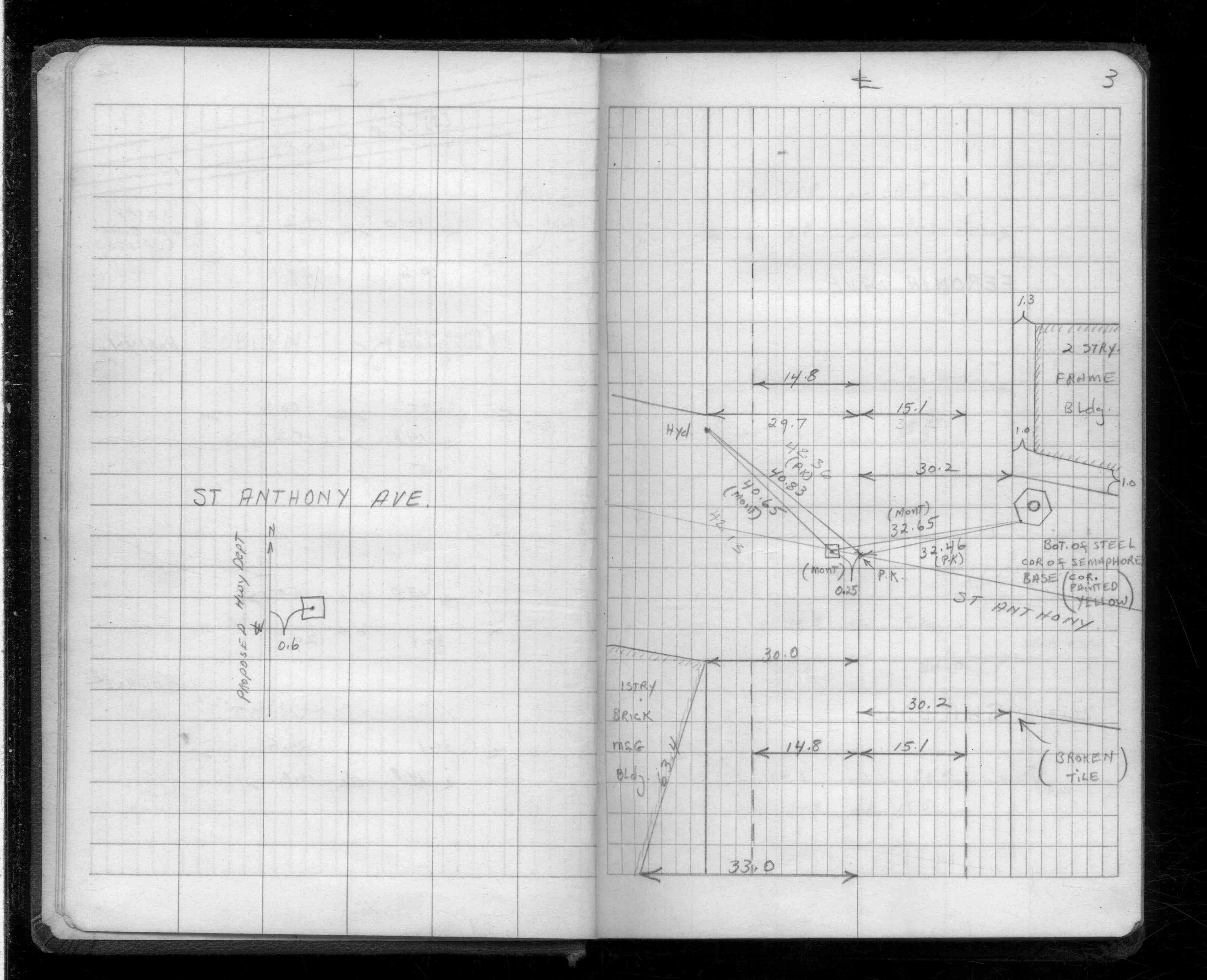
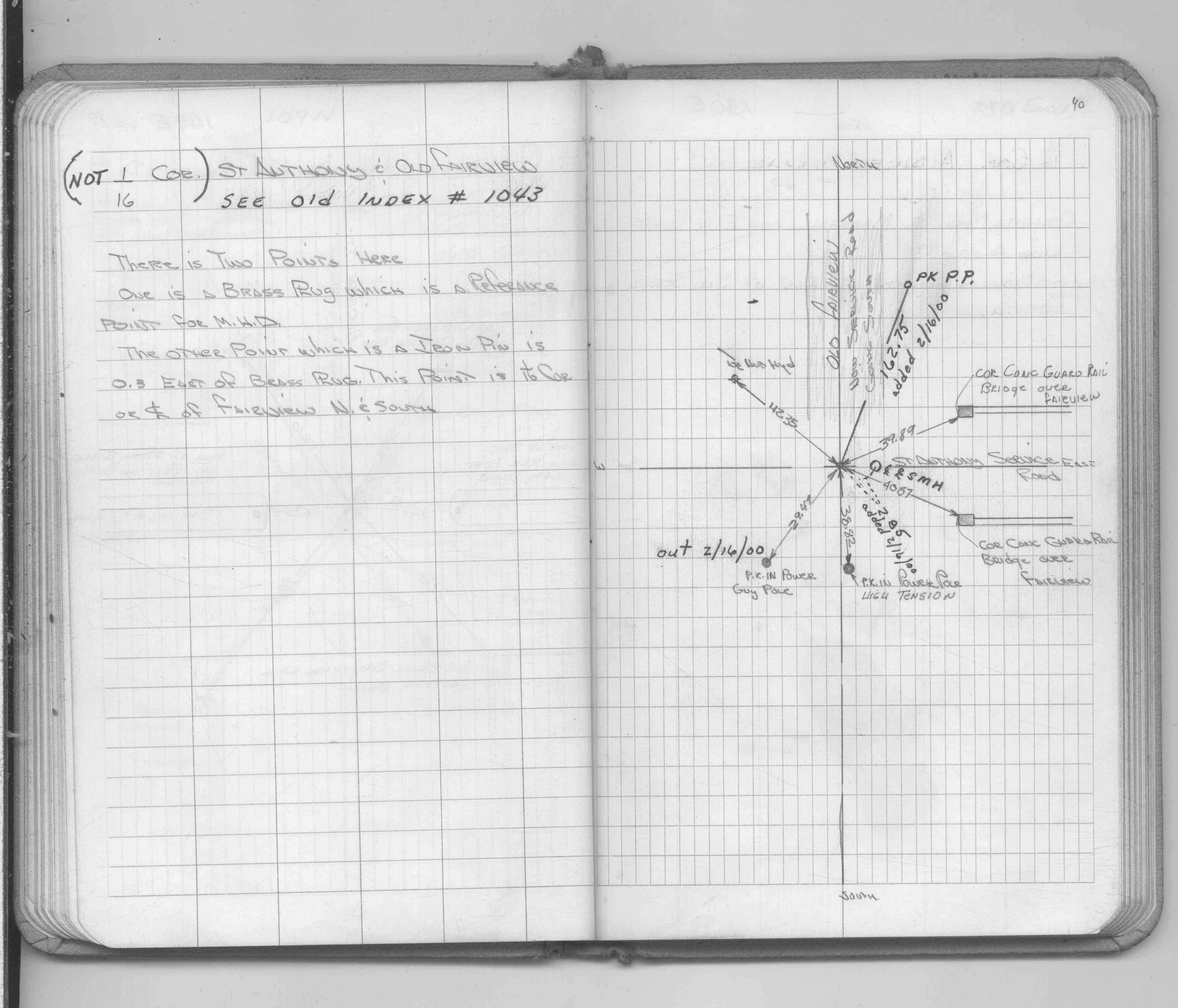
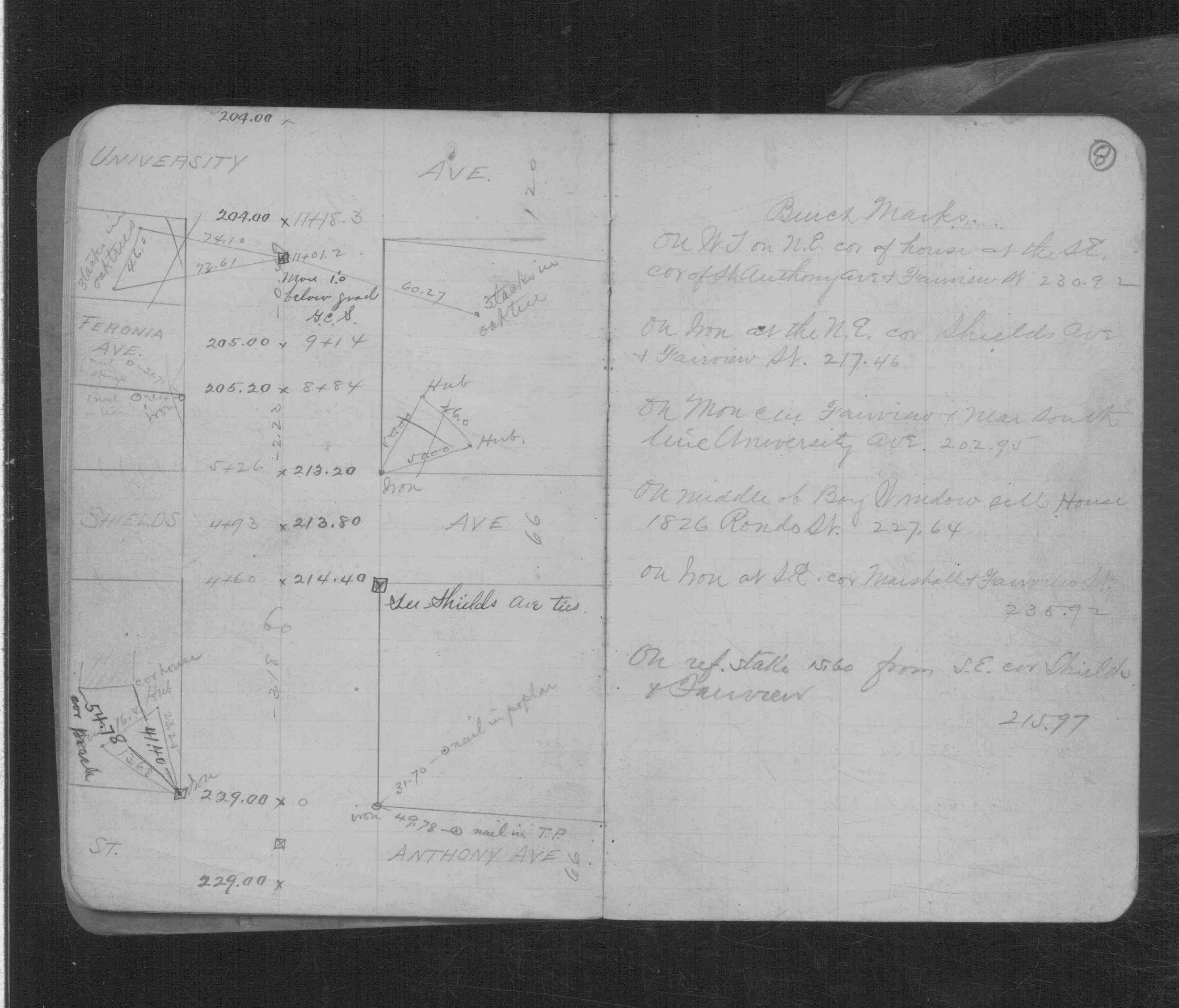
| 2/16/2000 | Placed ties on iron 0.4 ft below grade. See CofL 3430-1043-A |
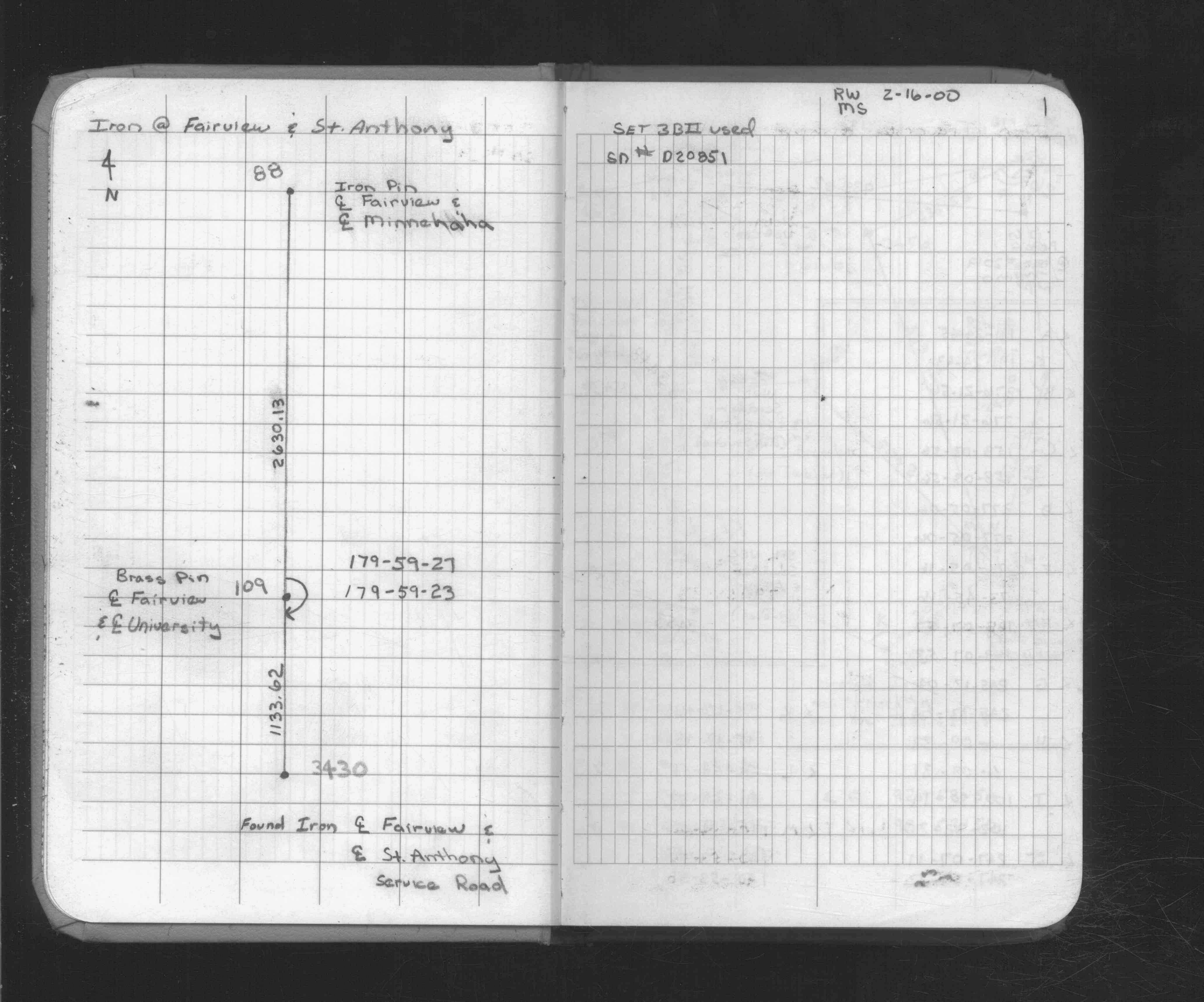
| 2/16/2000 | Made measurement to monument 109. See FB 1734A p.1 |
| 11/1/1972 | (Unknown date Nov __, 1972) Placed ties on iron pin. See FB 1689A p.40 |
| 10/1/1962 | (Unknown date Oct __, 1962) Placed ties. See FB 1535 p.03 |
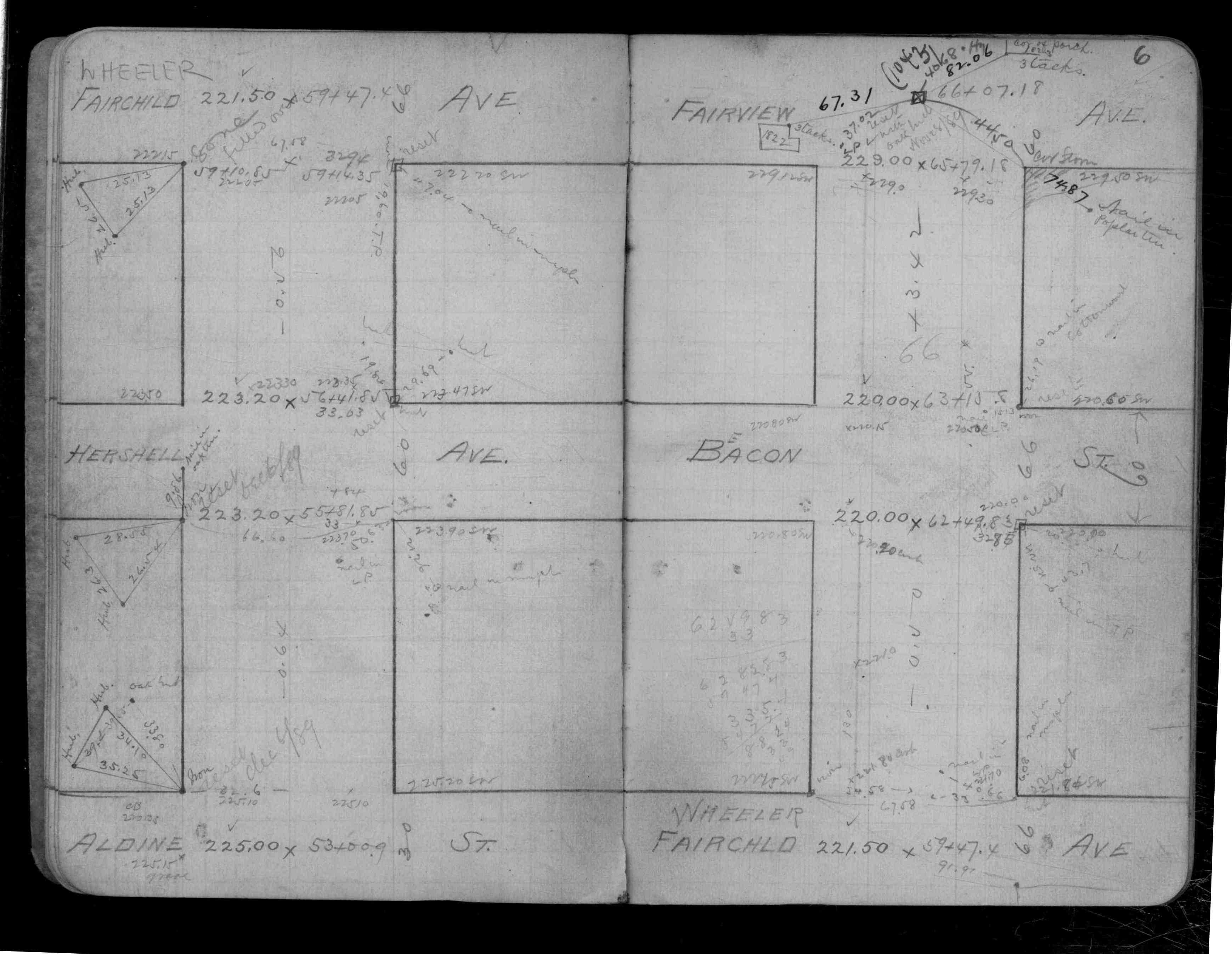
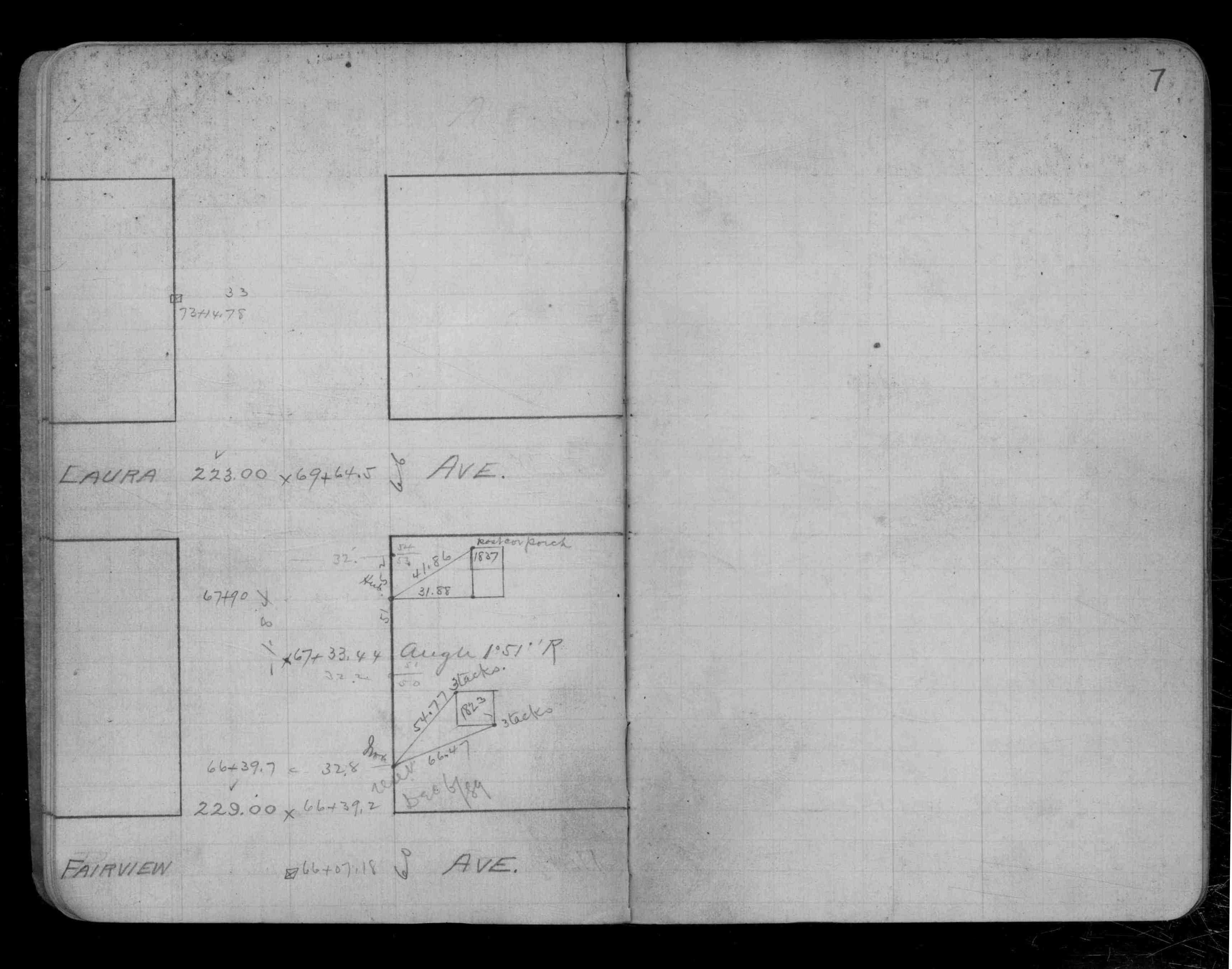
| 2/1/1890 | (Unknown date Feb __, 1890 ) Monument reset by Chas A Hunt after grading. See CS 122 p.6,7 |
| 8/1/1887 | (Unknown date Aug __, 1887 ) Monument set by J H Armstrong |
Above is NOT an all inclusive history of this point. Please review all the links below.
| PLS NOTES | Field | Cross Section | Sewer | J.B. Irvine | Monument | River Survey |
|---|---|---|---|---|---|---|
| FB 1535p.03 | CS 0122p. 06 ,07 | |||||
| FB 1689Ap.40 | CS 0601p.08 | |||||
| FB 1734Ap.01 |
| FILE | SURVEYOR | LIC. NO. | DATE SIGNED | DATE TIED |
|---|---|---|---|---|
| 3430-1043-A.tif | none | none | none | none |
| FILE | PHOTO DATE | COMMENTS |
|---|---|---|
| 3430-1043-1.jpg | June 11, 2008 | Close-up of bent iron pin aprx. 0.4 ft. below grade. |