| NAD83 COORDINATES (1986 adj.): |
|---|
| X= 567684.805 Y= 152250.795 Z= 000.00 CMP 03/10/2000 STB |
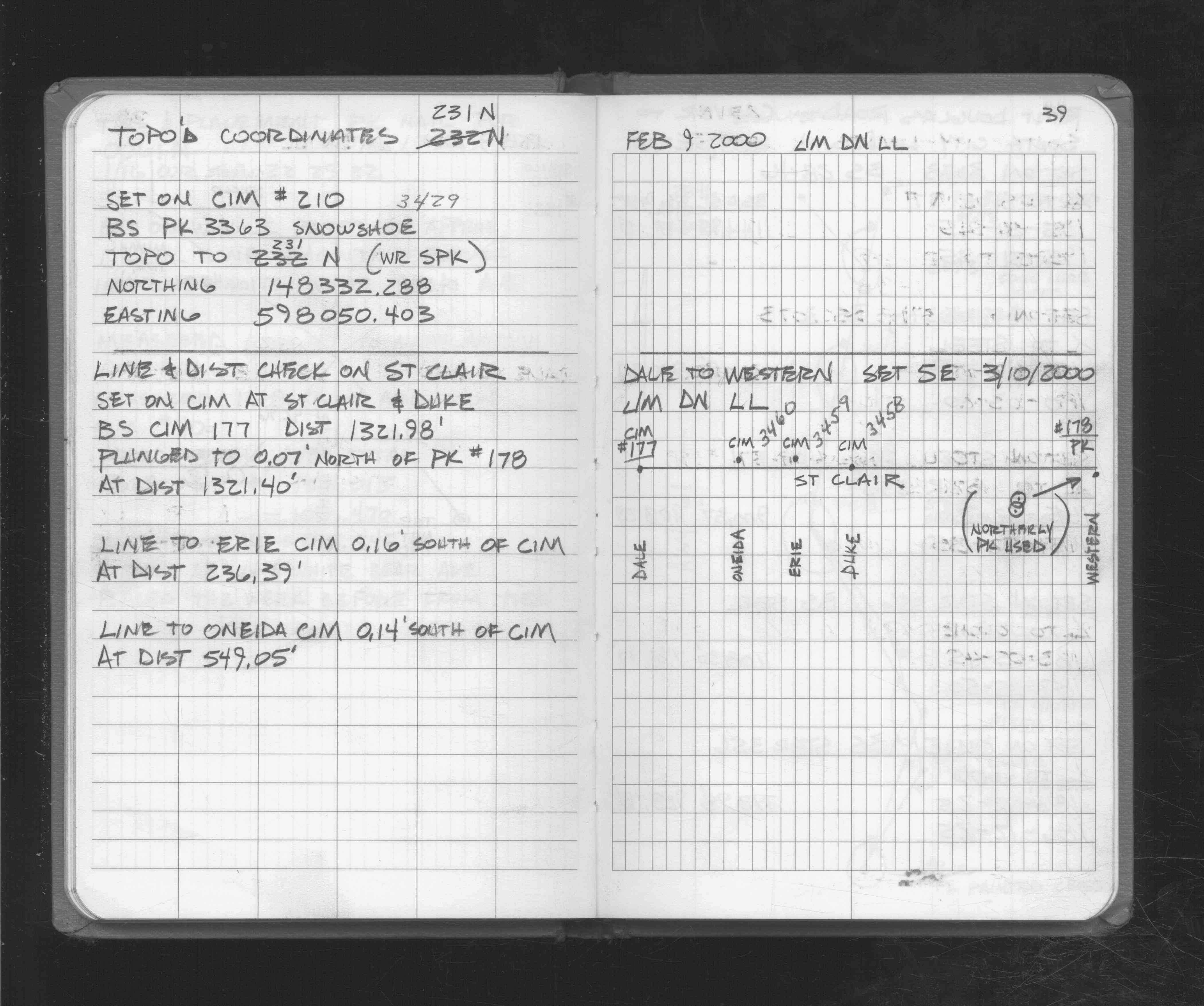
| 3/10/2000 | Recovered CIM. See FB 1721 p.39 |
| 6/2/1994 | No monument fd. Set CIM to grade based on FB 1716 p.16,17. See CofL 3459-0972-A |
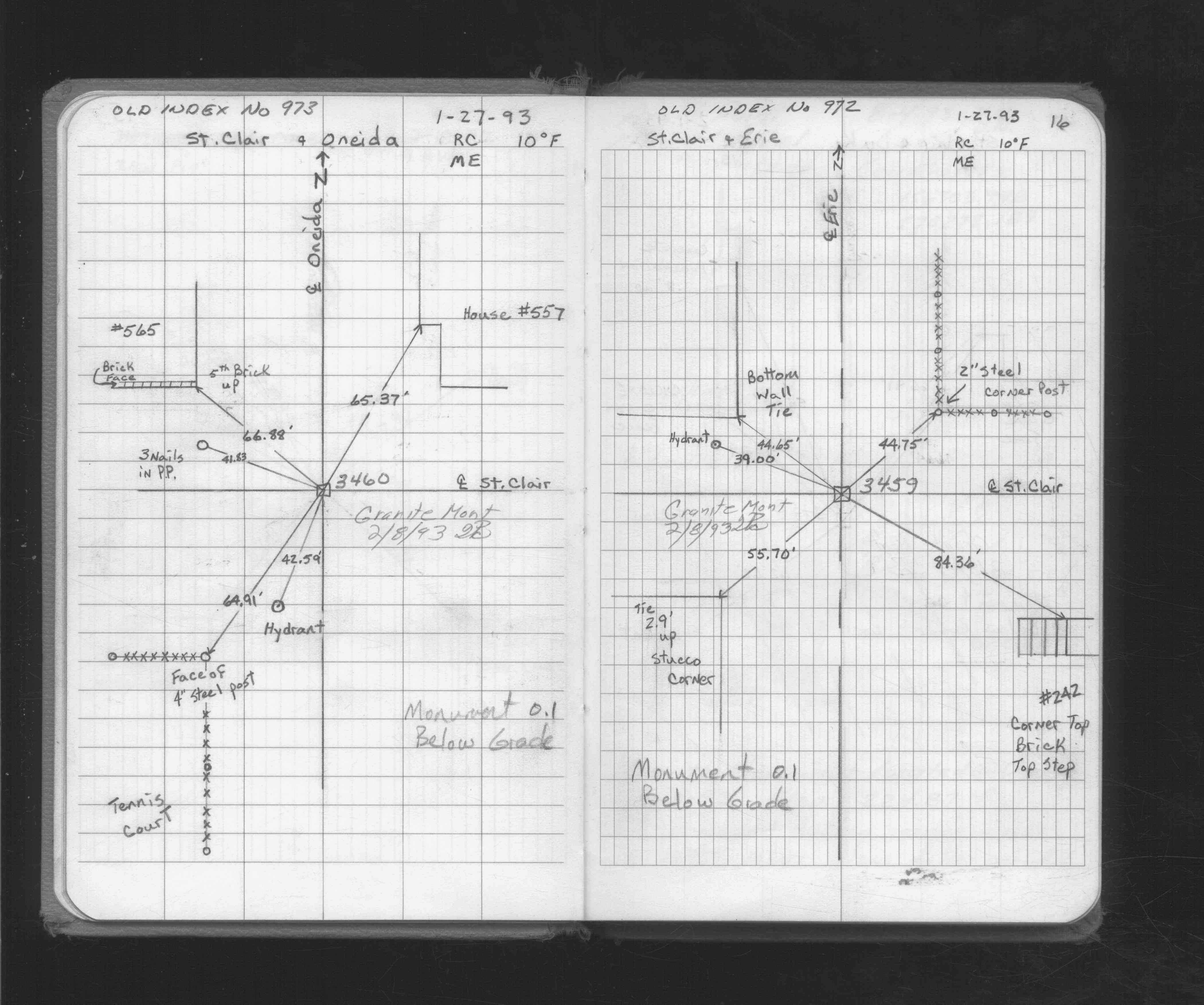
| 1/27/1993 | Fd GM 0.1 ft below grade, placed ties. See FB 1716 p.16 |
| 4/1/1887 | (Unknown date Apr __, 1887 ) Monument set from survey by J H Armstrong |
Above is NOT an all inclusive history of this point. Please review all the links below.
| PLS NOTES | Field | Cross Section | Sewer | J.B. Irvine | Monument | River Survey |
|---|---|---|---|---|---|---|
| FB 1716p.16 | ||||||
| FB 1721p.39 |
| FILE | SURVEYOR | LIC. NO. | DATE SIGNED | DATE TIED |
|---|---|---|---|---|
| 3459-0972-A.tif | Jack M. Walkky, P.E. | 20394 | July 1, 1994 | June 2, 1994 |