| NAD83 COORDINATES (1986 adj.): |
|---|
| X= 573245.159 Y= 147017.102 Z= 000.00 TOT 10/02/2000 STB |
| 6/1/2001 | (Unknown date Jun __, 2001 ) GM not disturbed during the reconstruction of Manomin. GM 0.2 ft below surface |
| 4/5/2001 | Fd GM 0.2 ft below street grade, placed ties, left GM as found. See CofL 3499-1973-A |
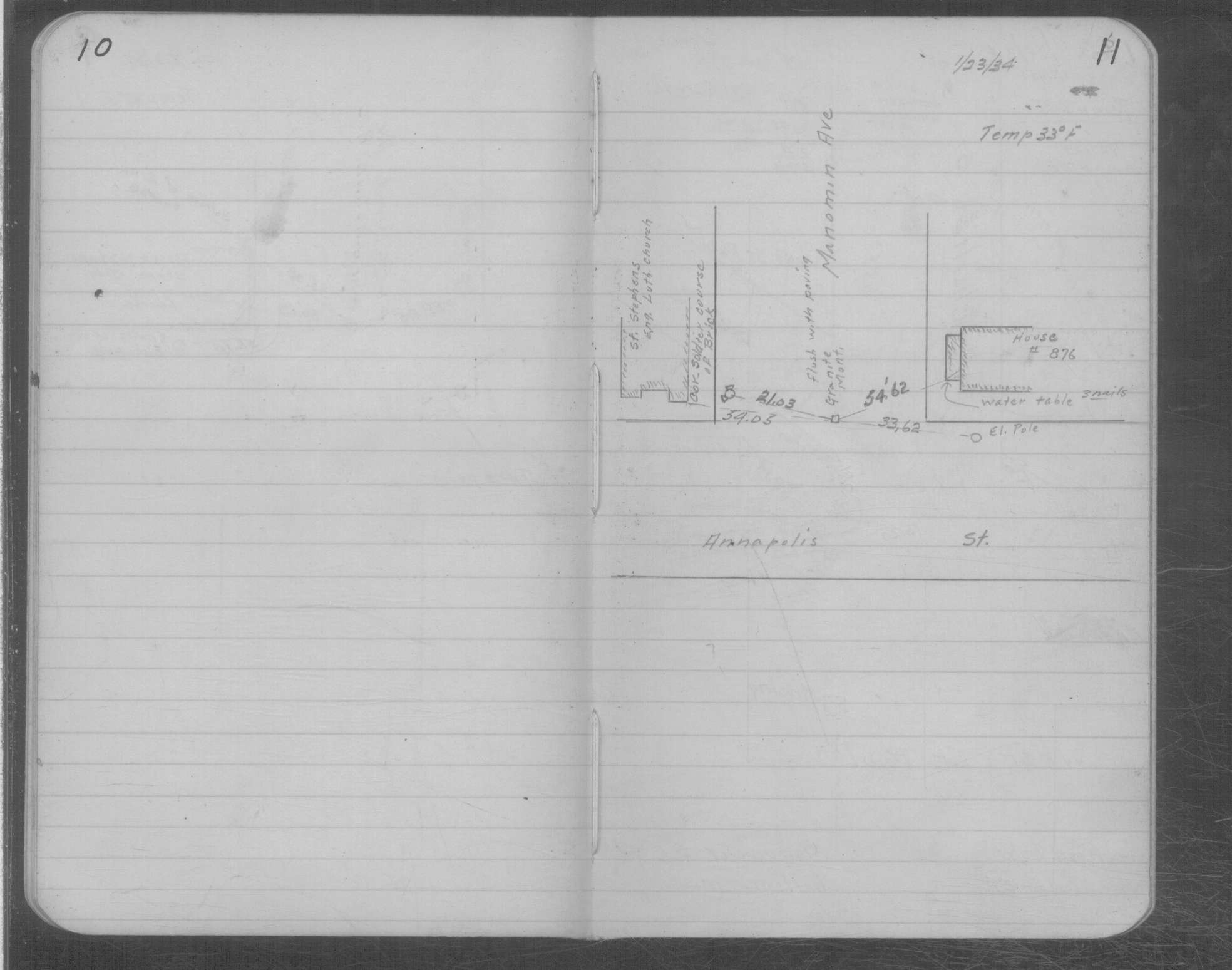
| 1/23/1934 | Placed ties on GM flush with pavement. See MSX 1 p.10-11 |
| 10/28/1890 | Monument set by J H Armstrong |
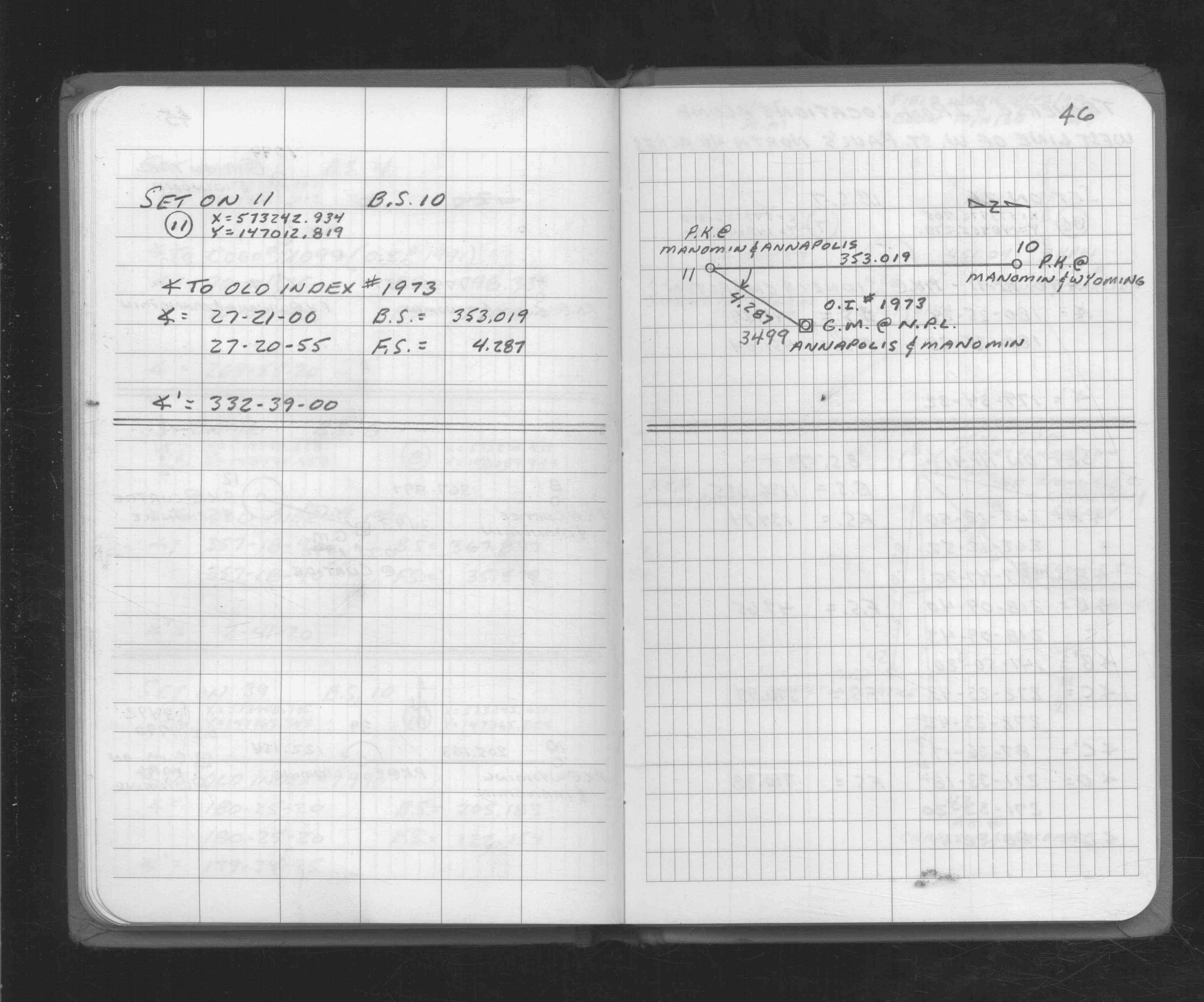
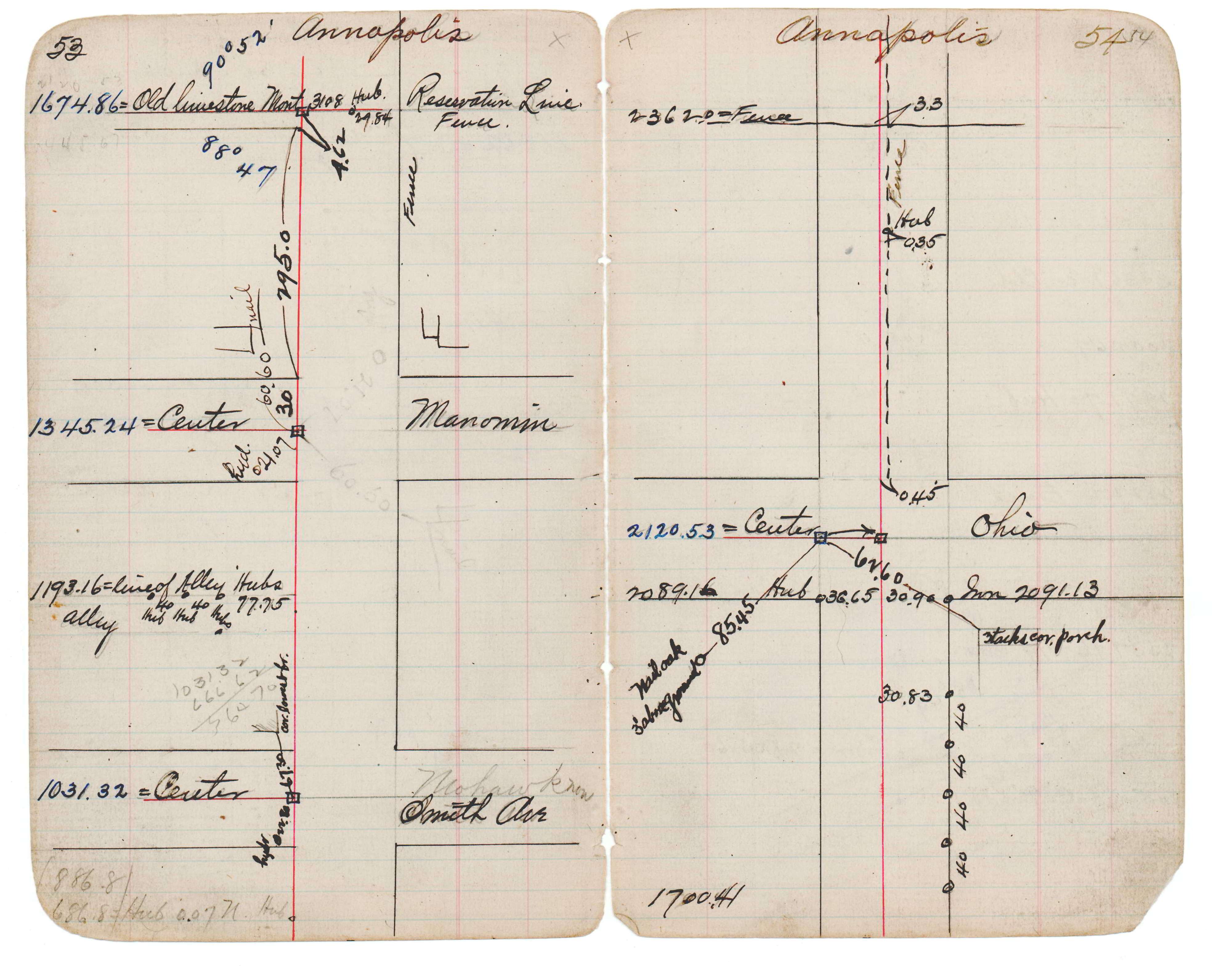
| 1/1/1890 | (Unknown date abt __, 189? ) Monument at Sta 13+45.24 on Annapolis at Manomin. See JBI 17 p.53-54 |
Above is NOT an all inclusive history of this point. Please review all the links below.
| PLS NOTES | Field | Cross Section | Sewer | J.B. Irvine | Monument | River Survey |
|---|---|---|---|---|---|---|
| FB 1730p.46 | JBI 17 p.53-54 | MSX 0001 p.010-011 |
| FILE | SURVEYOR | LIC. NO. | DATE SIGNED | DATE TIED |
|---|---|---|---|---|
| 3499-1973-A.tif | Jeffery L. Grosso | 13144 | April 11, 2001 | April 5, 2001 |