| NAD83 COORDINATES (1986 adj.): |
|---|
| X= 547816.399 Y= 168272.447 Z= 226.87 TOT 10/05/2000 STB |
| X= 547816.438 Y= 168272.349 Z= 920.301 3/14/2012 RTK-VRS |
| 3/14/2012 | Position on GM established using RTK-VRS GPS. Elev. 226.20 ft. EDM ties placed using Trimble S6. |
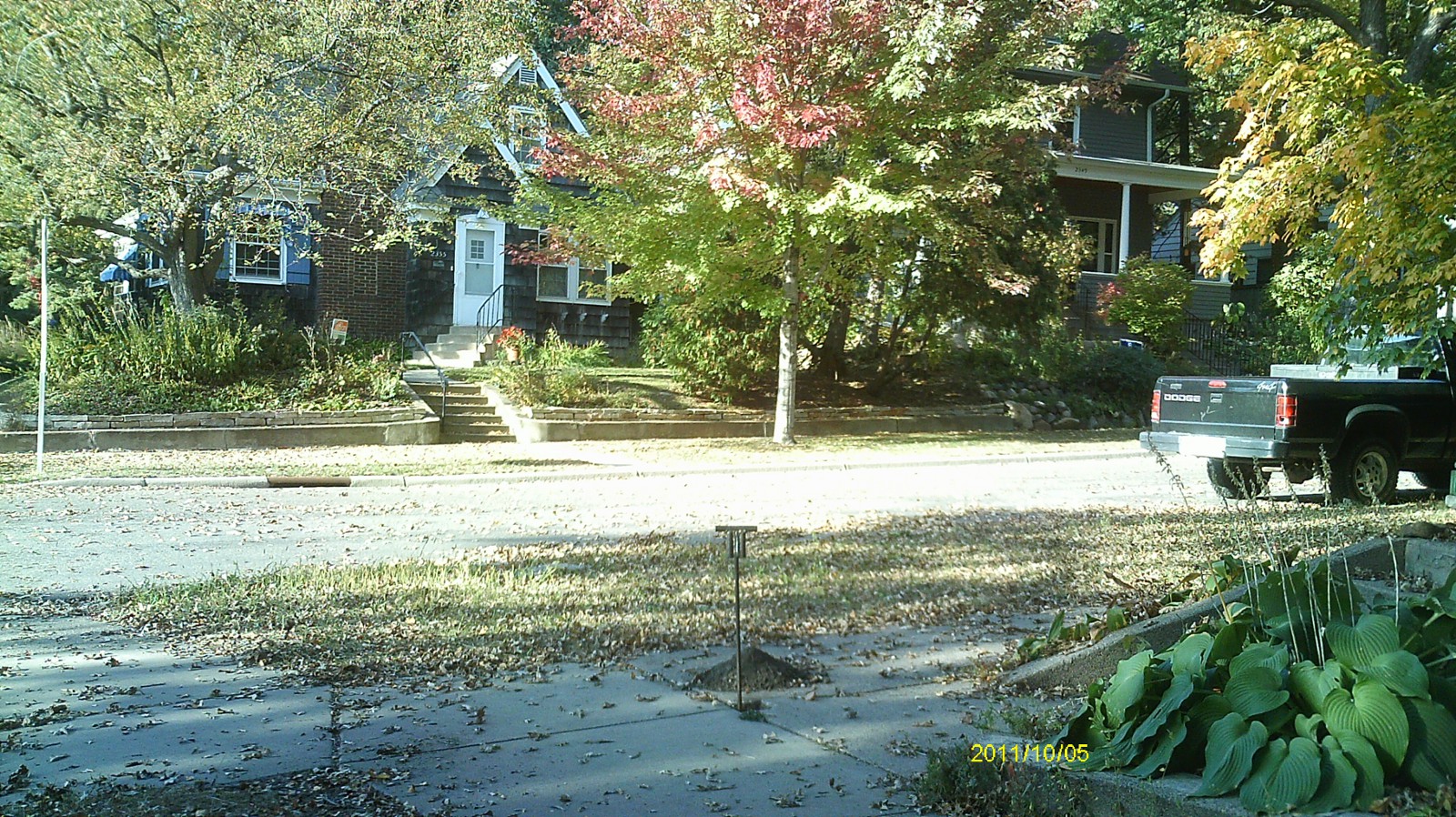
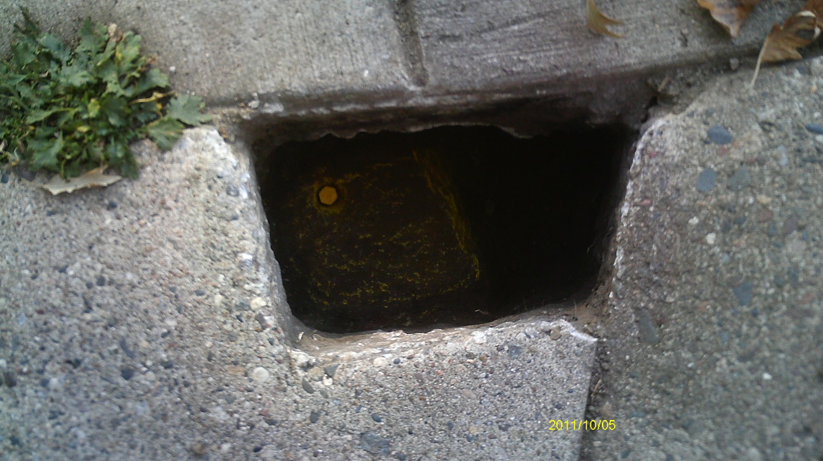
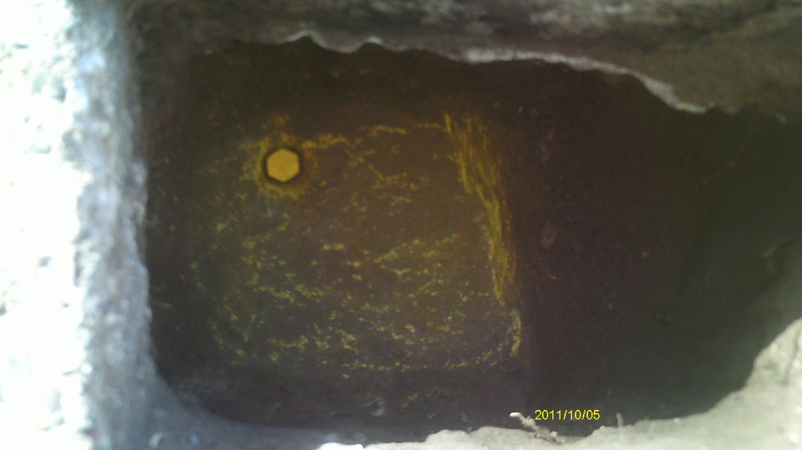
| 10/5/2011 | Found GM 0.6 ft below sidewalk grade. PK placed in center hole and photos taken. |
| 8/9/2001 | Found GM 0.65 ft below sidewalk grade. |
| 7/14/2000 | Found concrete monument at Elev 226.87 ft. See 2000/p8121/monuments/monts.sdr (pt 5047) |
| 5/24/2000 | Found GM 0.1' below sidewalk grade in walk cutout. |
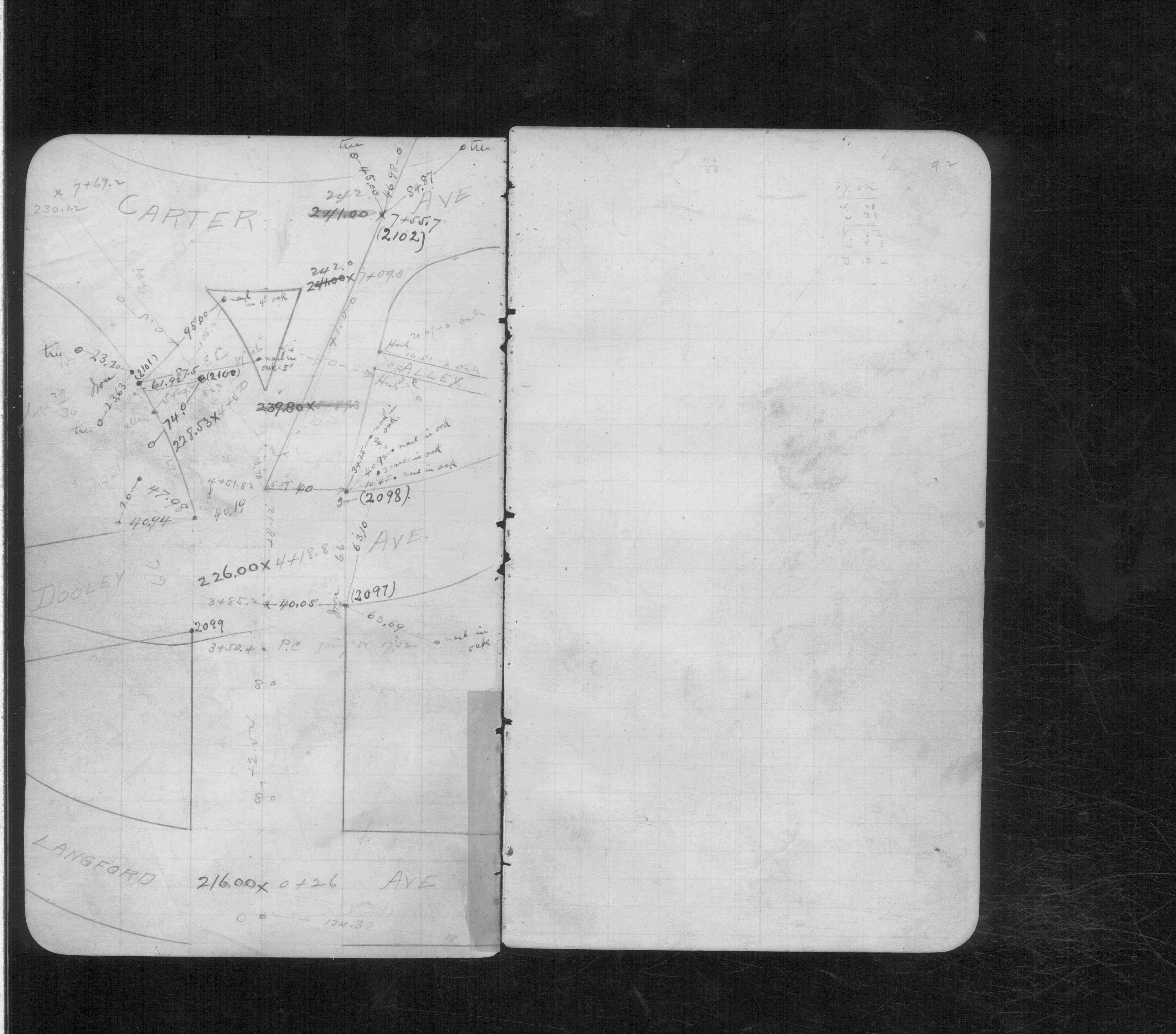
| 2/1/1890 | (Unknown date Feb __, 1890 ) Monument set by Chas A Hunt after grading. See CS 611 p.92 |
Above is NOT an all inclusive history of this point. Please review all the links below.
| PLS NOTES | Field | Cross Section | Sewer | J.B. Irvine | Monument | River Survey |
|---|---|---|---|---|---|---|
| CS 0611p.92 |
| FILE | SURVEYOR | LIC. NO. | DATE SIGNED | DATE TIED |
|---|---|---|---|---|
| 3517-2097-A.pdf | Samuel D. Gibson | 44880 | August 31, 2012 | March 13, 2012 |
| FILE | PHOTO DATE | COMMENTS |
|---|---|---|
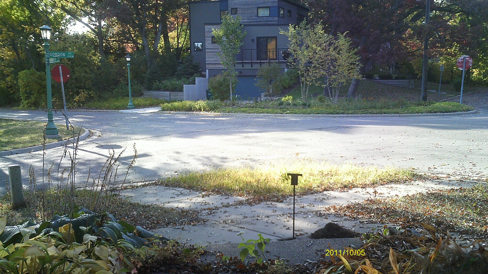
| 3517-2097-6.jpg | October 5, 2011 | Looking west toward intersection. |
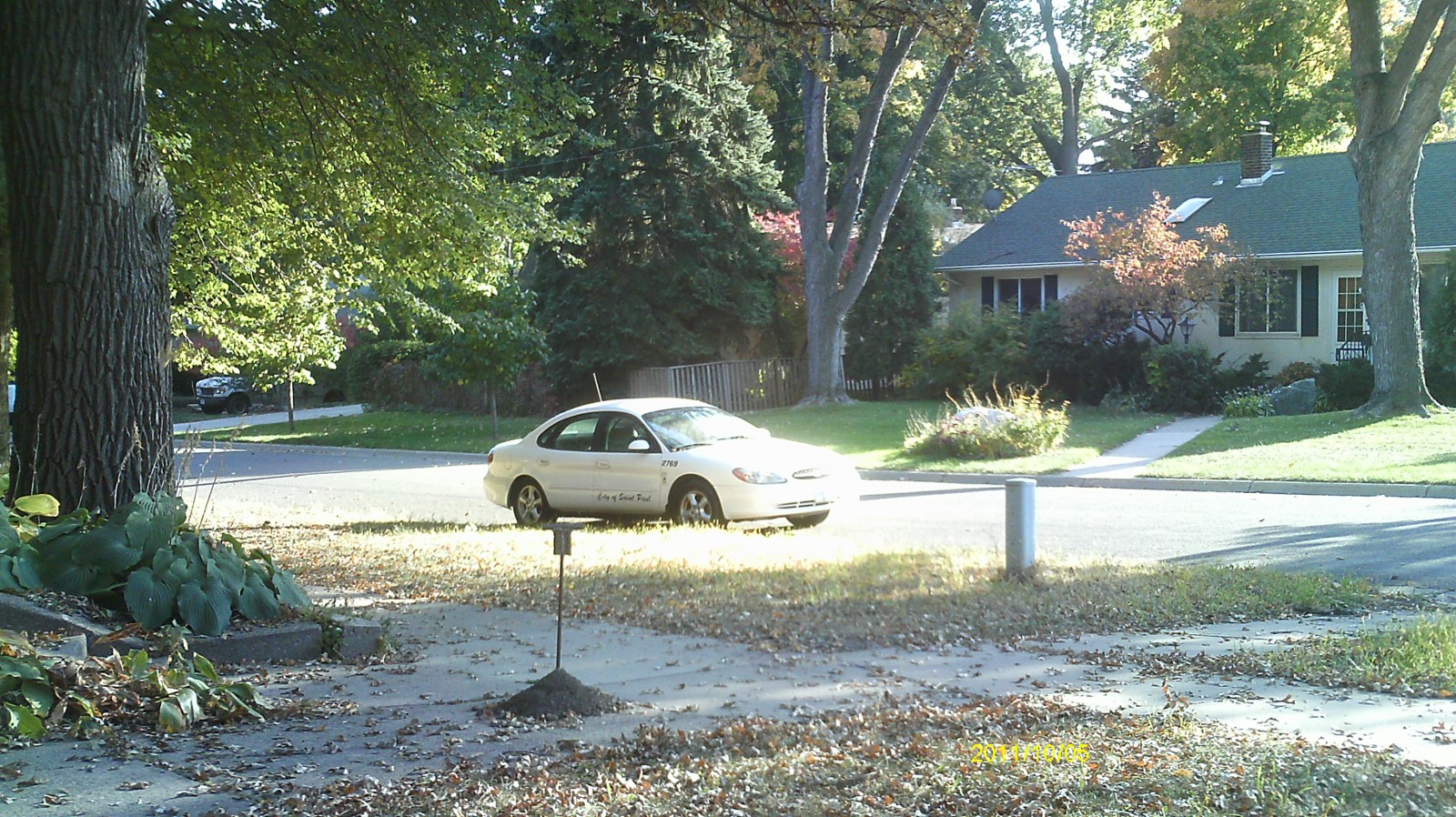
| 3517-2097-5.jpg | October 5, 2011 | Looking south toward Gordon Ave. |
| 3517-2097-4.jpg | October 5, 2011 | Looking east. |
| 3517-2097-3.jpg | October 5, 2011 | Looking north toward Commonwealth Ave. |
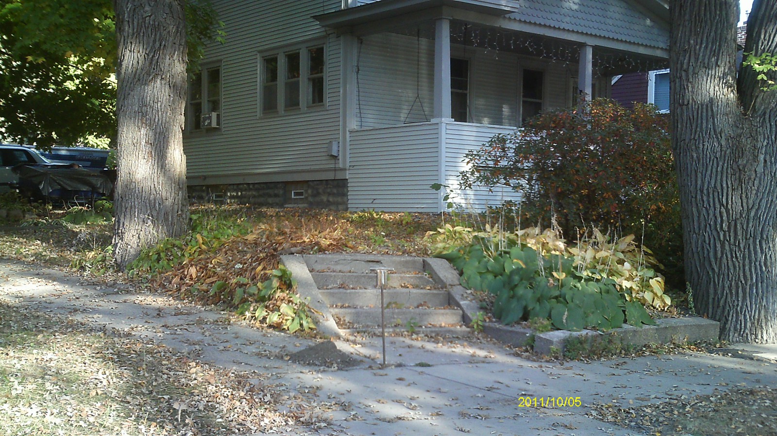
| 3517-2097-2.jpg | October 5, 2011 | Close up of monument location. |
| 3517-2097-1.jpg | October 5, 2011 | Close up of monument. |