| NAD83 COORDINATES (1986 adj.): |
|---|
| X= 590156.158 Y= 157183.016 Z= 000.00 LSQ 02/22/2001 FLT |
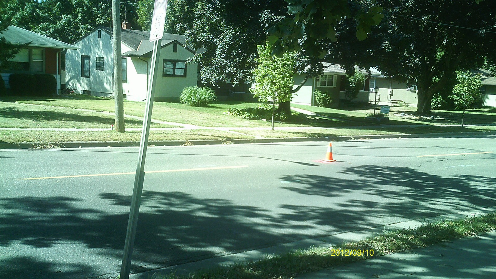
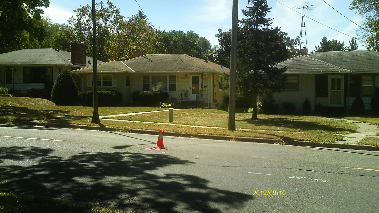
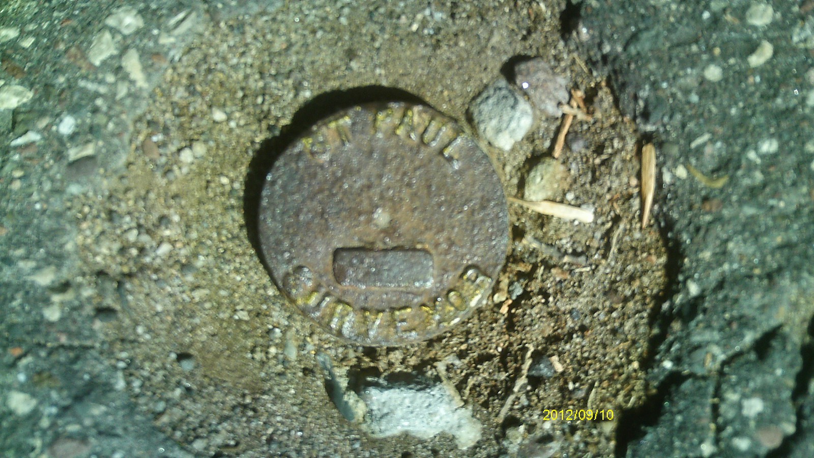
| 9/10/2012 | Found CIM at street grade. Photos taken. |
| 3/6/2001 | Fd CIM at grade and placed ties. See CofL 3548-xxxx-A |
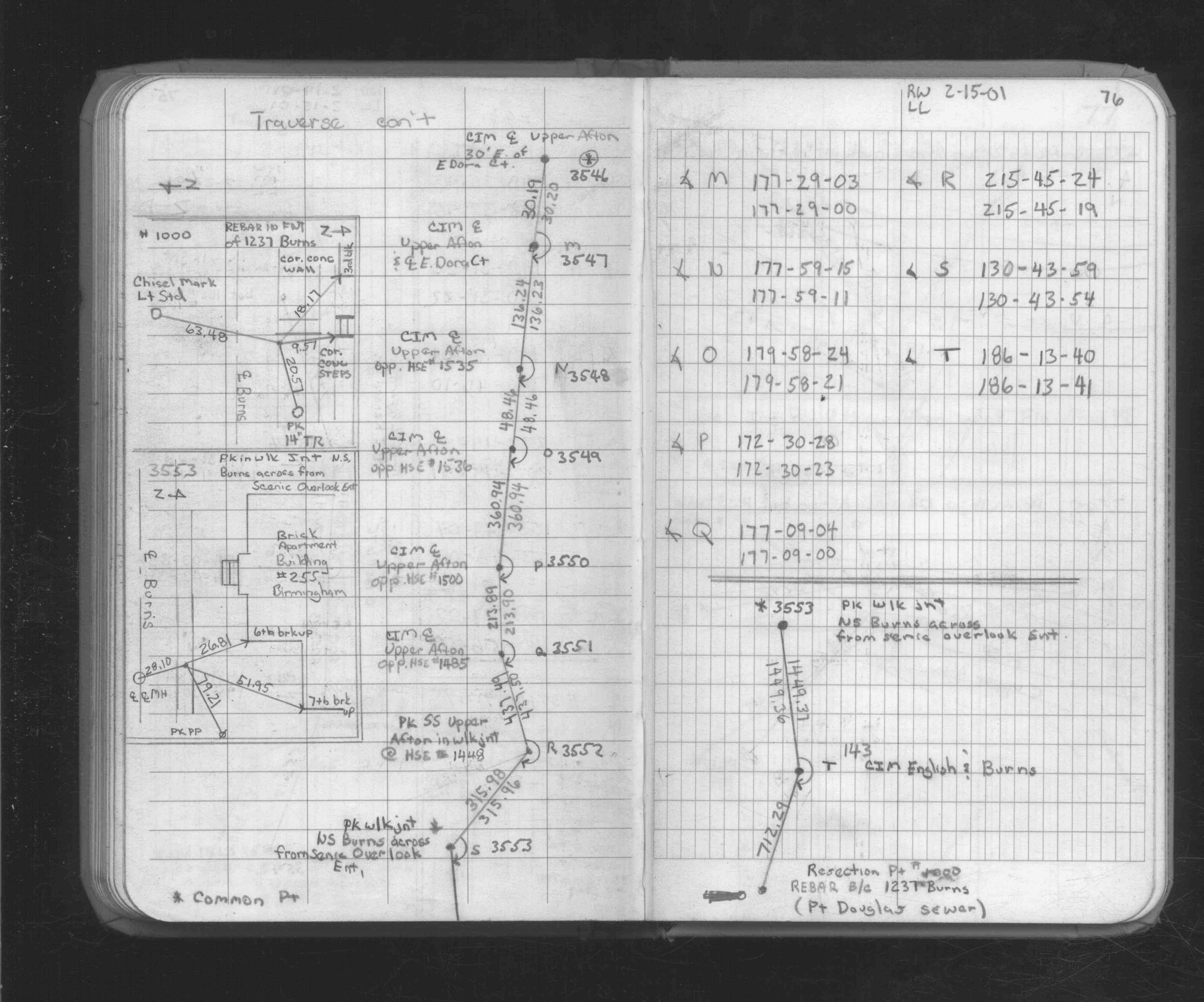
| 2/15/2001 | Traversed through CIM. See FB 1734A p.76 |
| 6/24/1999 | Ron Meyer, RC Surveyor's Office set a 20" CIM marked "St Paul". See CofL 3551-xxxx-A1 & 3551-xxxx-A2 |
| 5/19/1999 | Ron Meyer, RC Surveyor's Office found a 20" CIM marked "St Paul", CIM was removed for road work. See CofL 3551-xxxx-A |
Above is NOT an all inclusive history of this point. Please review all the links below.
| PLS NOTES | Field | Cross Section | Sewer | J.B. Irvine | Monument | River Survey |
|---|---|---|---|---|---|---|
| FB 1734Ap.76 | ||||||
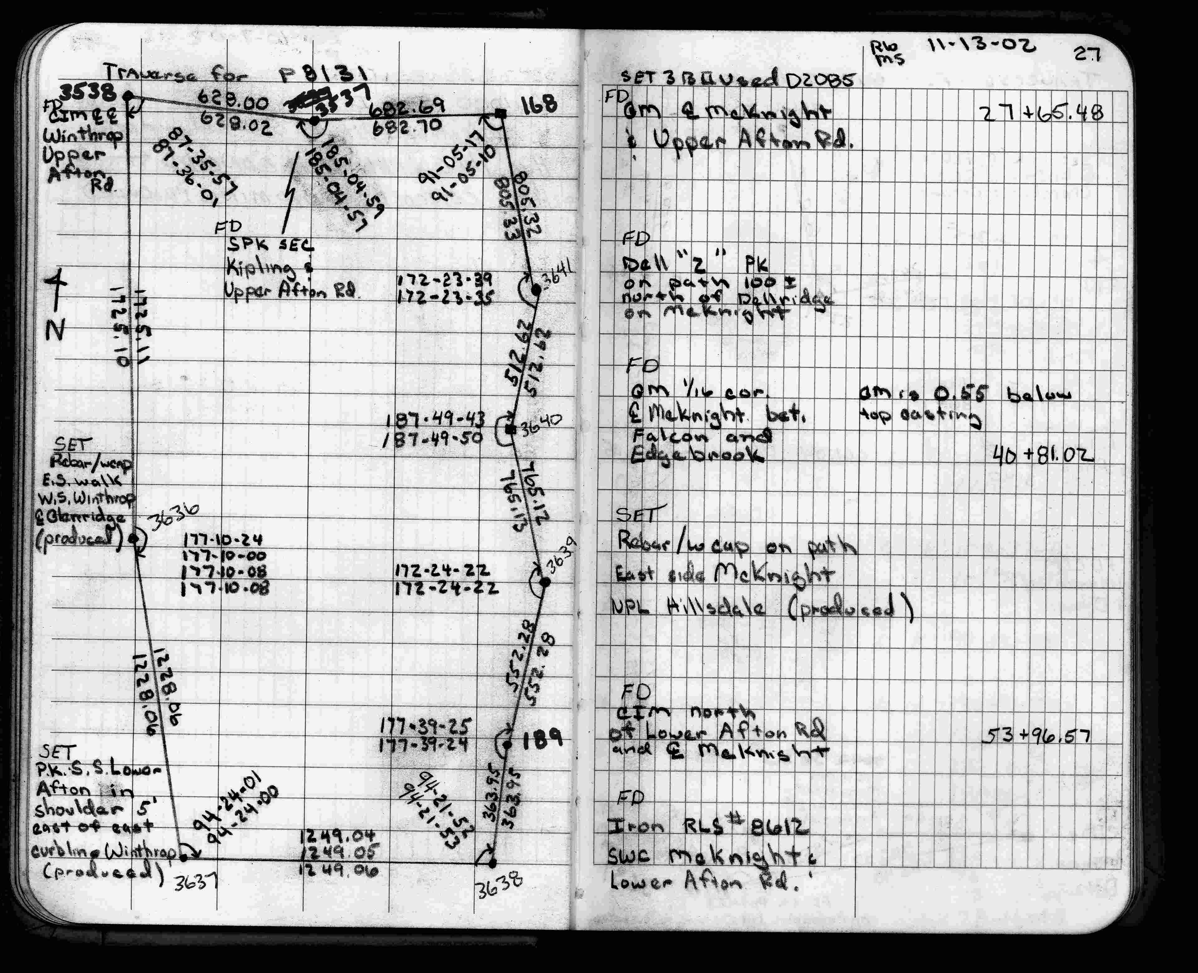
| FB 1735p.27 |
| FILE | SURVEYOR | LIC. NO. | DATE SIGNED | DATE TIED |
|---|---|---|---|---|
| 3548-xxxx-A.tif | Jeffery L. Grosso | 13144 | March 8, 2001 | March 6, 2001 |
| FILE | PHOTO DATE | COMMENTS |
|---|---|---|
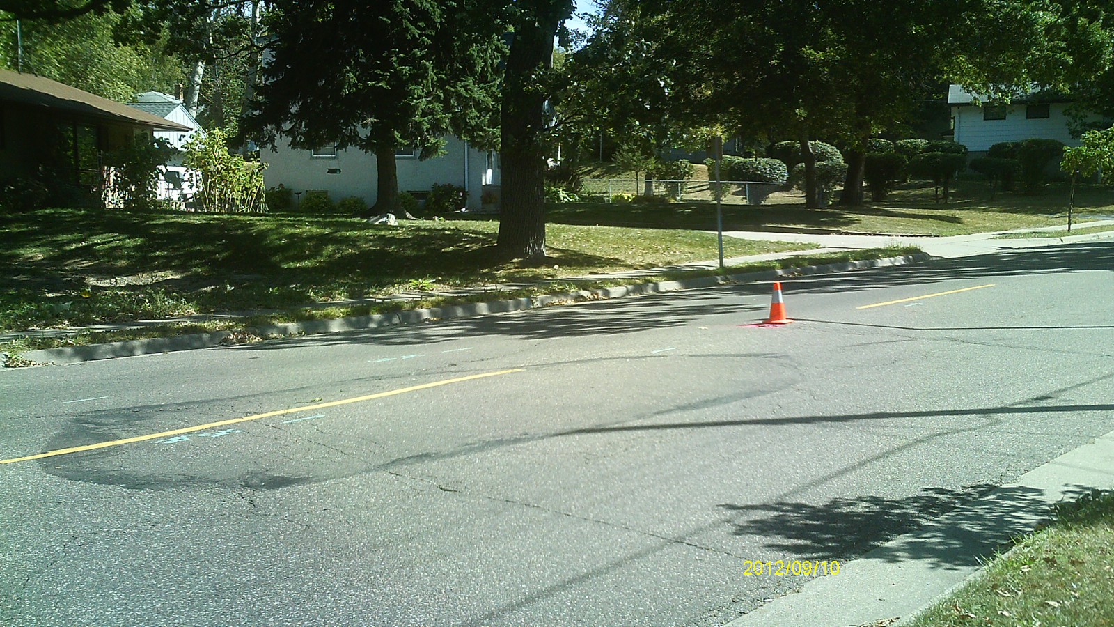
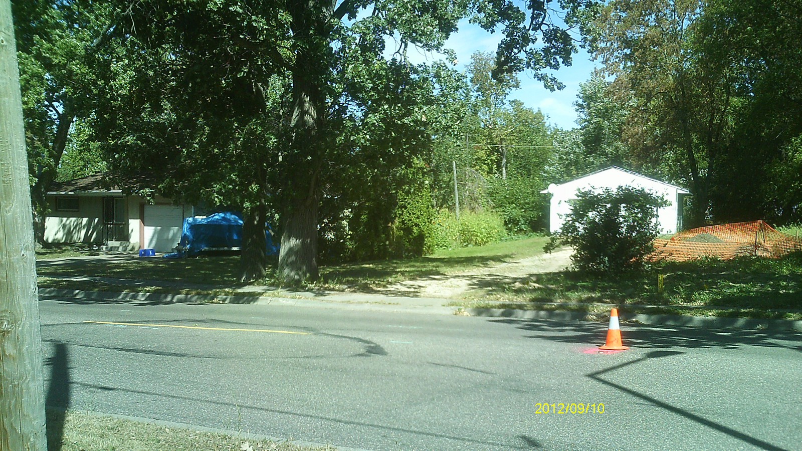
| 3548-__hz-5.jpg | September 10, 2012 | Looking west along Upper Afton Rd. |
| 3548-__hz-4.jpg | September 10, 2012 | Looking south across Upper Afton Rd. |
| 3548-__hz-3.jpg | September 10, 2012 | Looking east along Upper Afton Rd. |
| 3548-__hz-2.jpg | September 10, 2012 | Looking north across Upper Afton Rd. |
| 3548-__hz-1.jpg | September 10, 2012 | Close up of monument. |