| NAD83 COORDINATES (1986 adj.): |
|---|
| X= 582850.548 Y= 148335.266 Z= 000.00 05/16/2002 STB |
| X= 582850.62 Y= 148335.36 Z= 729.4 04/19/2007 RTK-VRS |
| 4/19/2007 | Position on GM established by RTK-VRS GPS Elev 729.4 ft. |
| 4/19/2007 | Fd GM 0.20 ft below sidewalk grade. Placed ties. See CofL 3584-0610A-A |
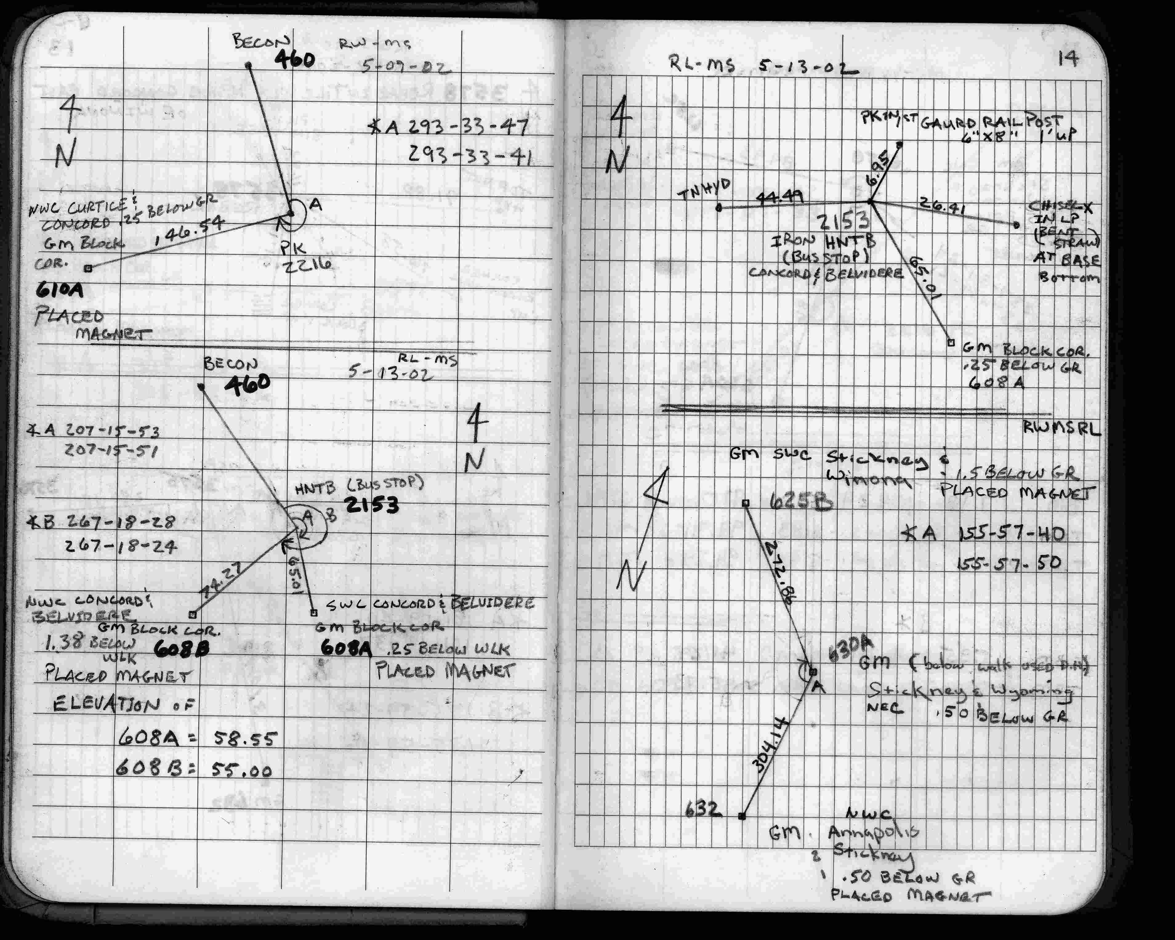
| 5/13/2002 | Located GM by traverse (single stub). See FB 1735 p.14 |
| 5/7/2002 | Fd GM 0.25 ft below grade. Placed magnet in GM. |
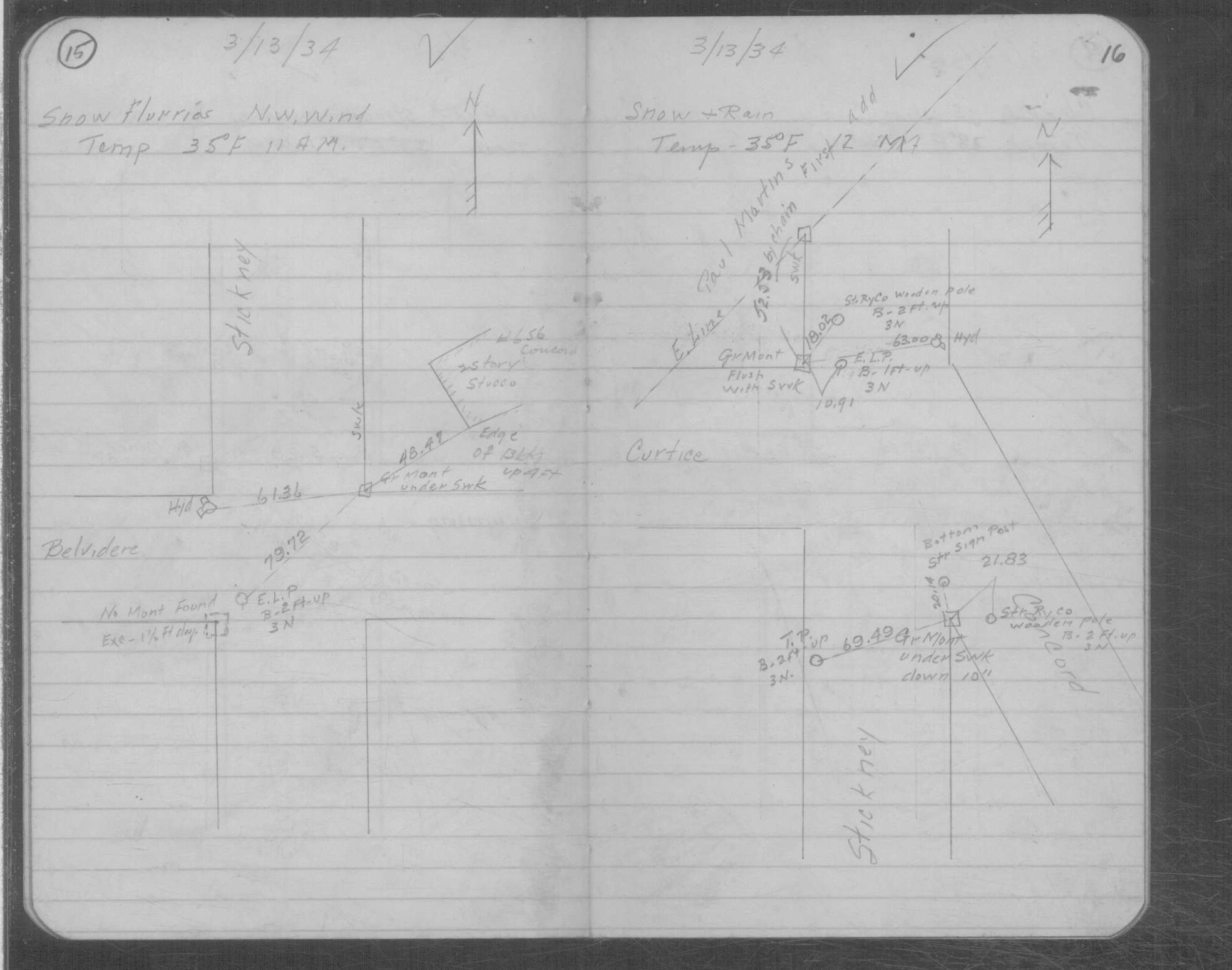
| 3/13/1934 | GM in place. See MSX 2 p.15-16 |
| 1/27/1889 | Monument set by G Saulez. See Old Index Book, Entry 609 & CS 112 p.6 |
| 9/1/1887 | (Unknown date Sep __, 1887 ) Place ties on Monument by P Doddridge. See CS 112 p.5 |
| 2/1/1886 | (Unknown date Feb __, 1886 ) Monument set by F J McCarron |
| 1/1/1885 | (Unknown date ___ __, 1885 ) Hawley and Newell set a iron monument for the plat of Paul Martin's 1st Addition recorded on March 23, 1886. |
Above is NOT an all inclusive history of this point. Please review all the links below.
| PLS NOTES | Field | Cross Section | Sewer | J.B. Irvine | Monument | River Survey |
|---|---|---|---|---|---|---|
| FB 1735p.14 | CS 0112p.05 | MSX 0002 p.015-016 |
| FILE | SURVEYOR | LIC. NO. | DATE SIGNED | DATE TIED |
|---|---|---|---|---|
| 3584-0610A-A.pdf | Samuel D. Gibson | 44880 | April 30, 2007 | April 19, 2007 |
| FILE | PHOTO DATE | COMMENTS |
|---|---|---|
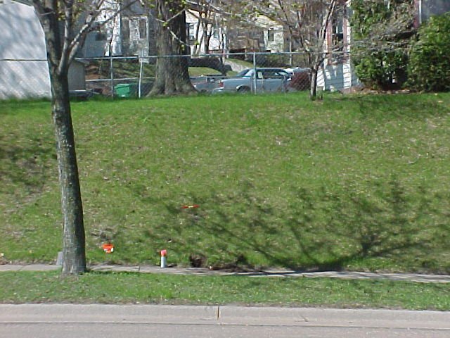
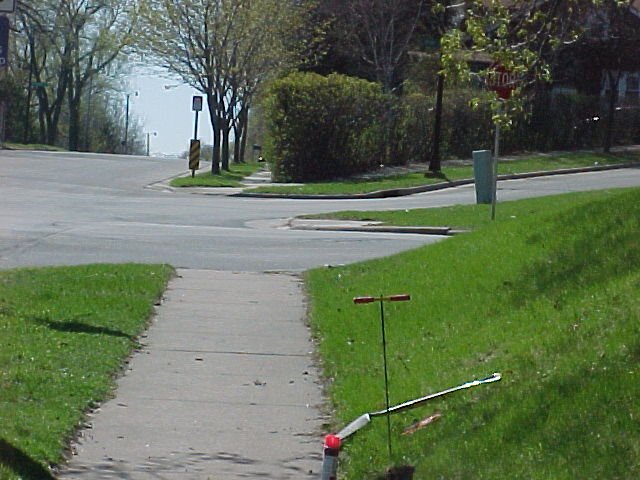
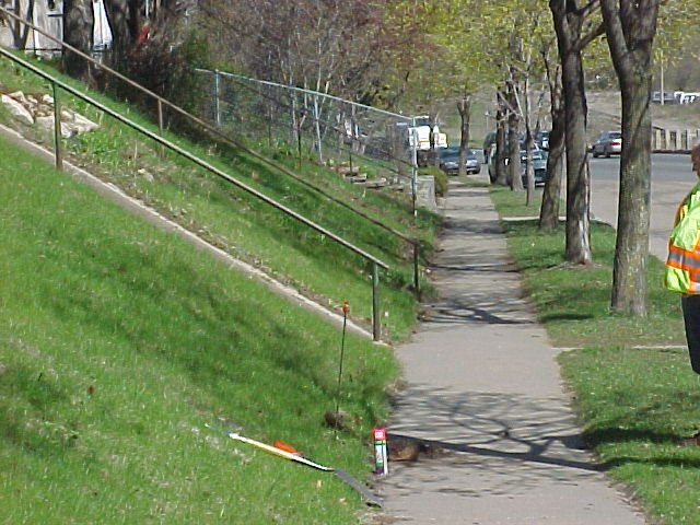
| 3584-0610A-4.jpg | May 3, 2002 | Looking southwesterly Curtice St in background. |
| 3584-0610A-3.jpg | May 3, 2002 | Looking southeasterly along Concord St. |
| 3584-0610A-2.jpg | May 3, 2002 | Looking northwesterly along Concord St. |
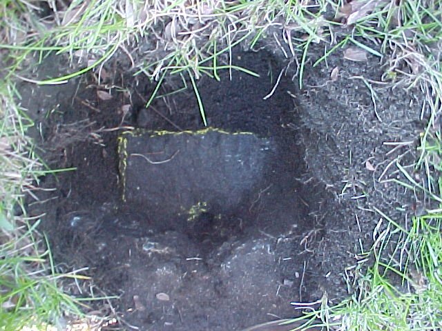
| 3584-0610A-1.jpg | May 3, 2002 | Close up of GM. |