| NAD83 COORDINATES (1986 adj.): |
|---|
| X= 578237.404 Y= 165455.007 Z= 000.00 07/19/2002 STB |
| 10/28/2013 | New sidewalk panel at location obstructs investigation. |
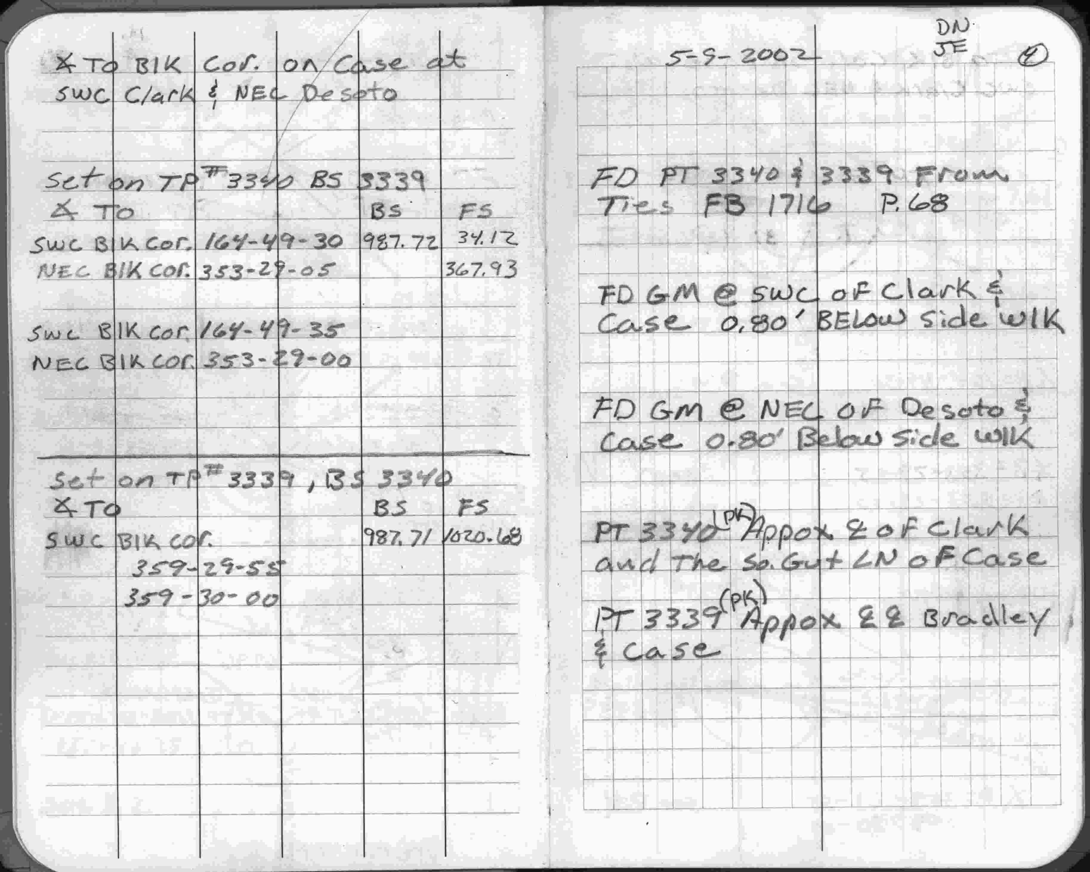
| 5/9/2002 | Fd GM 0.8 ft below sidewalk. See FB 1738 p.4 |
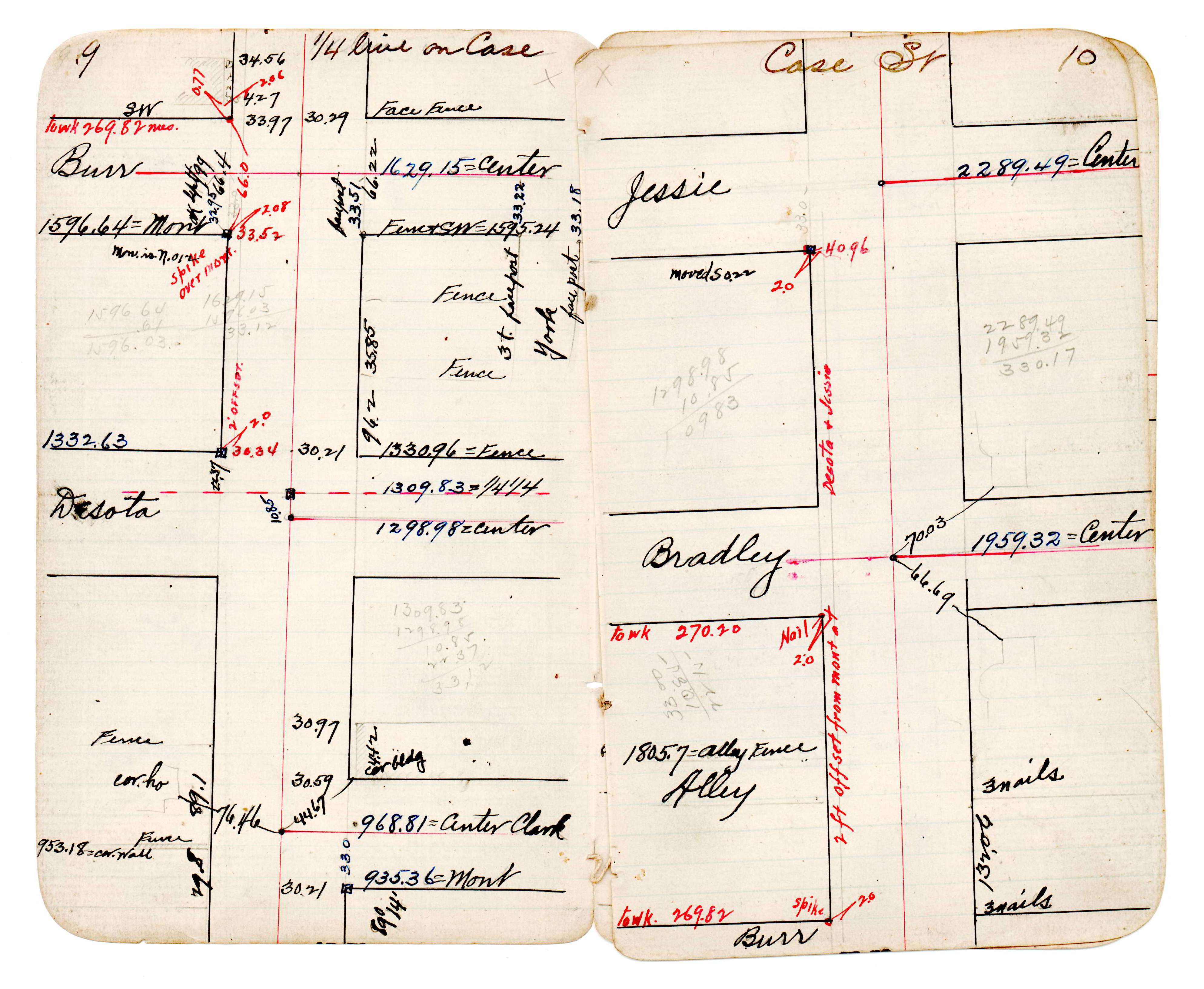
| 1/1/1893 | (Unknown date abt __, 1893 ) J B Irvines survey on 1/4 line on Case. See JBI 23 p.09-10 |
| 1/1/1887 | (Unknown date ___ __, 1887 ) Monument set by Chas Hunt in place of original hub. See Old Index Book, Entry 1240 |
Above is NOT an all inclusive history of this point. Please review all the links below.
| PLS NOTES | Field | Cross Section | Sewer | J.B. Irvine | Monument | River Survey |
|---|---|---|---|---|---|---|
| FB 1738p.04 | JBI 23 p.09-10 |