| NAD83 COORDINATES (1986 adj.): |
|---|
| X= 572202.290 Y= 147028.058 Z= 000.00 LSQ 11/18/2002 FLT |
| X= 572202.149 Y= 147028.036 Z= 000.00 PRO 10/30/2002 CMP |
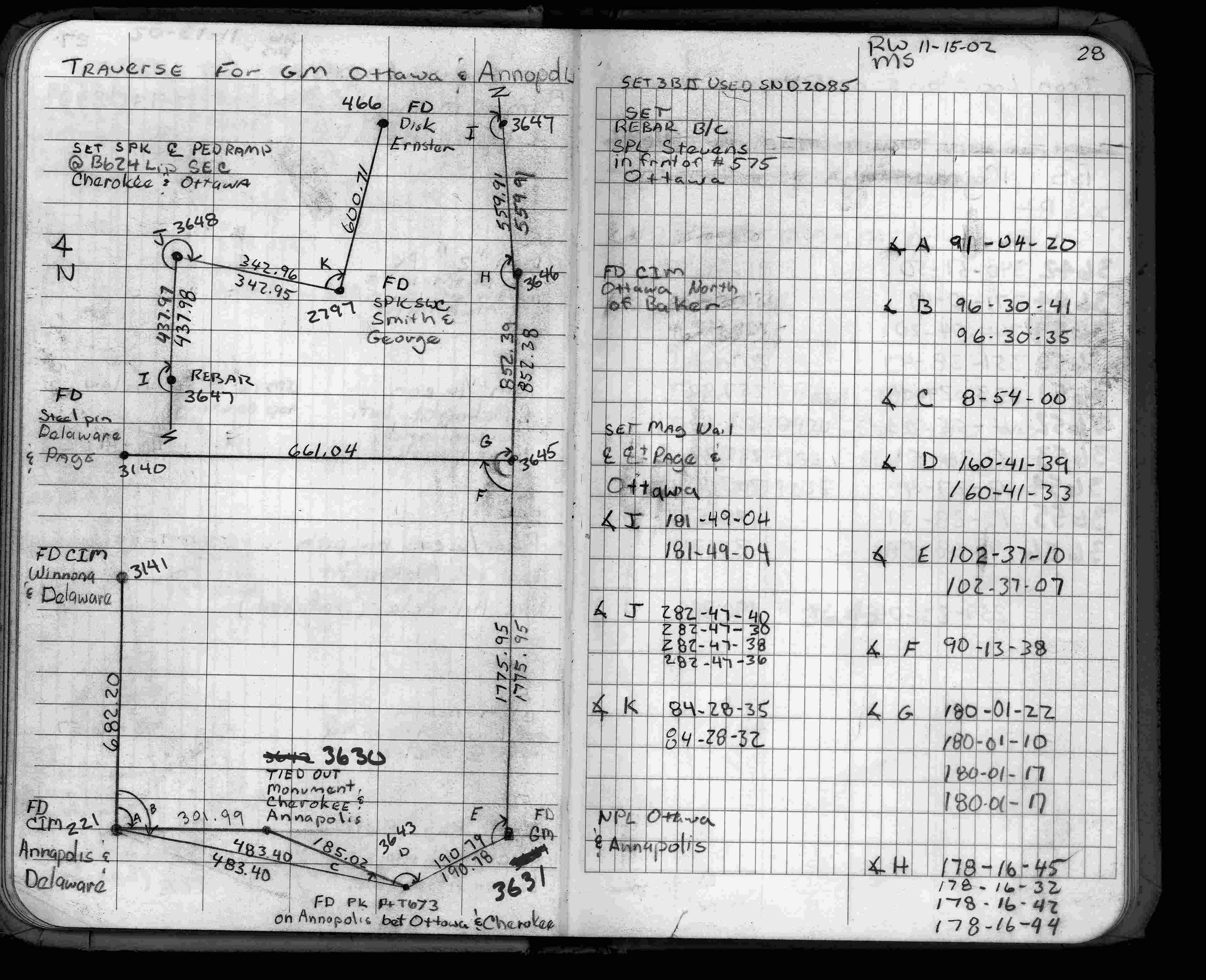
| 4/29/2003 | Placed CIM from ties taken Oct 24, 2002. Placed ties on CIM. See CofL 3630-1970-B |
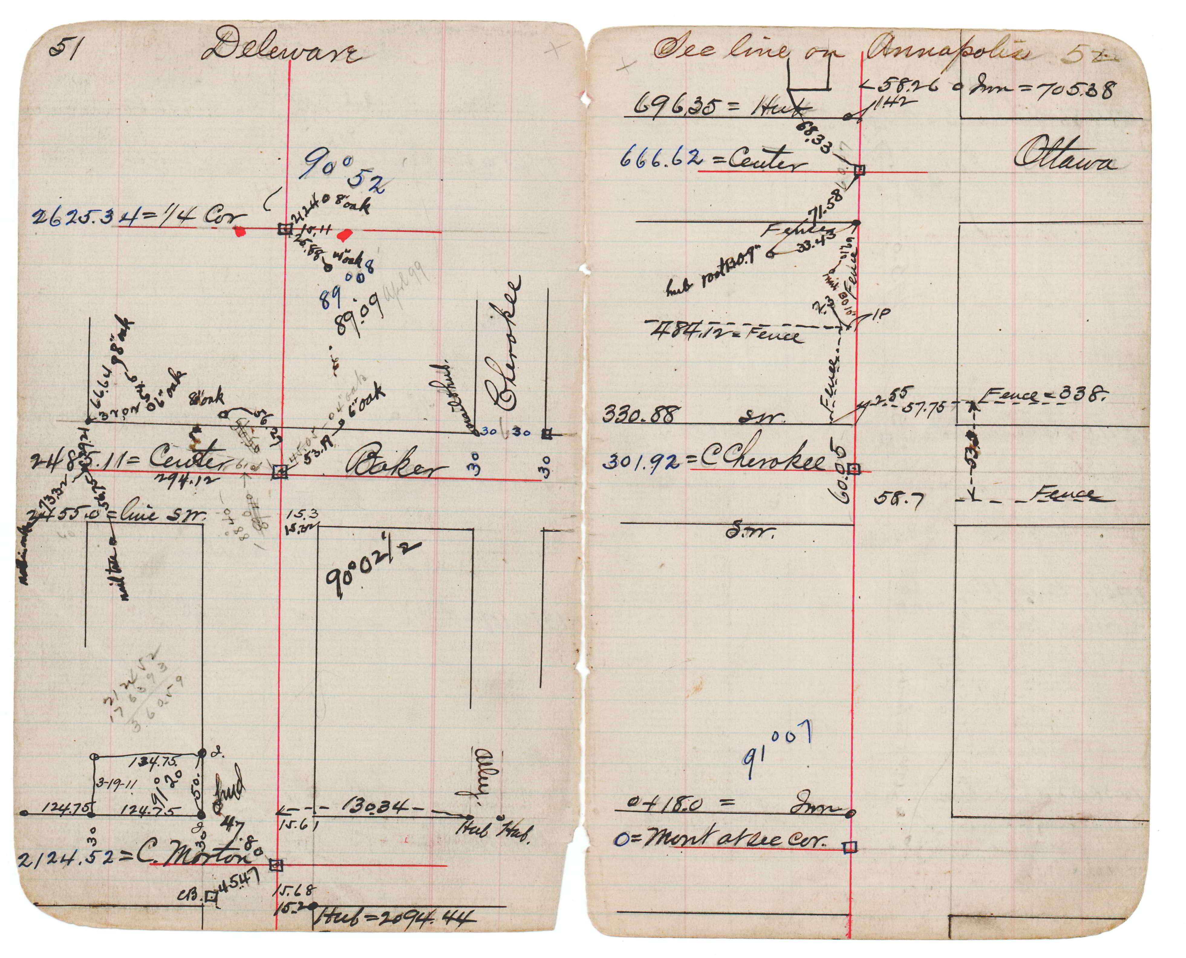
| 10/30/2002 | Computed coordinate position by proration between pts 221 & 3499. See JBI 17 p.51-52 |
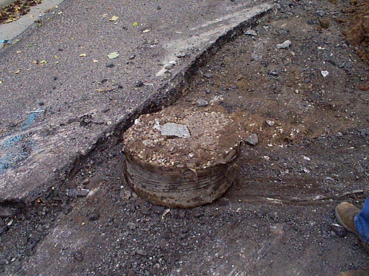
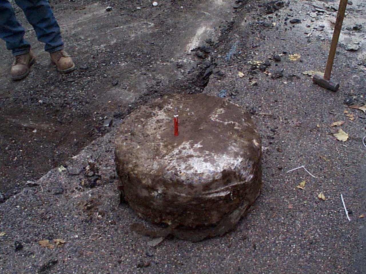
| 10/24/2002 | Fd GM, placed ties, removed GM. Photos taken. See CofL 3630-1970-A |
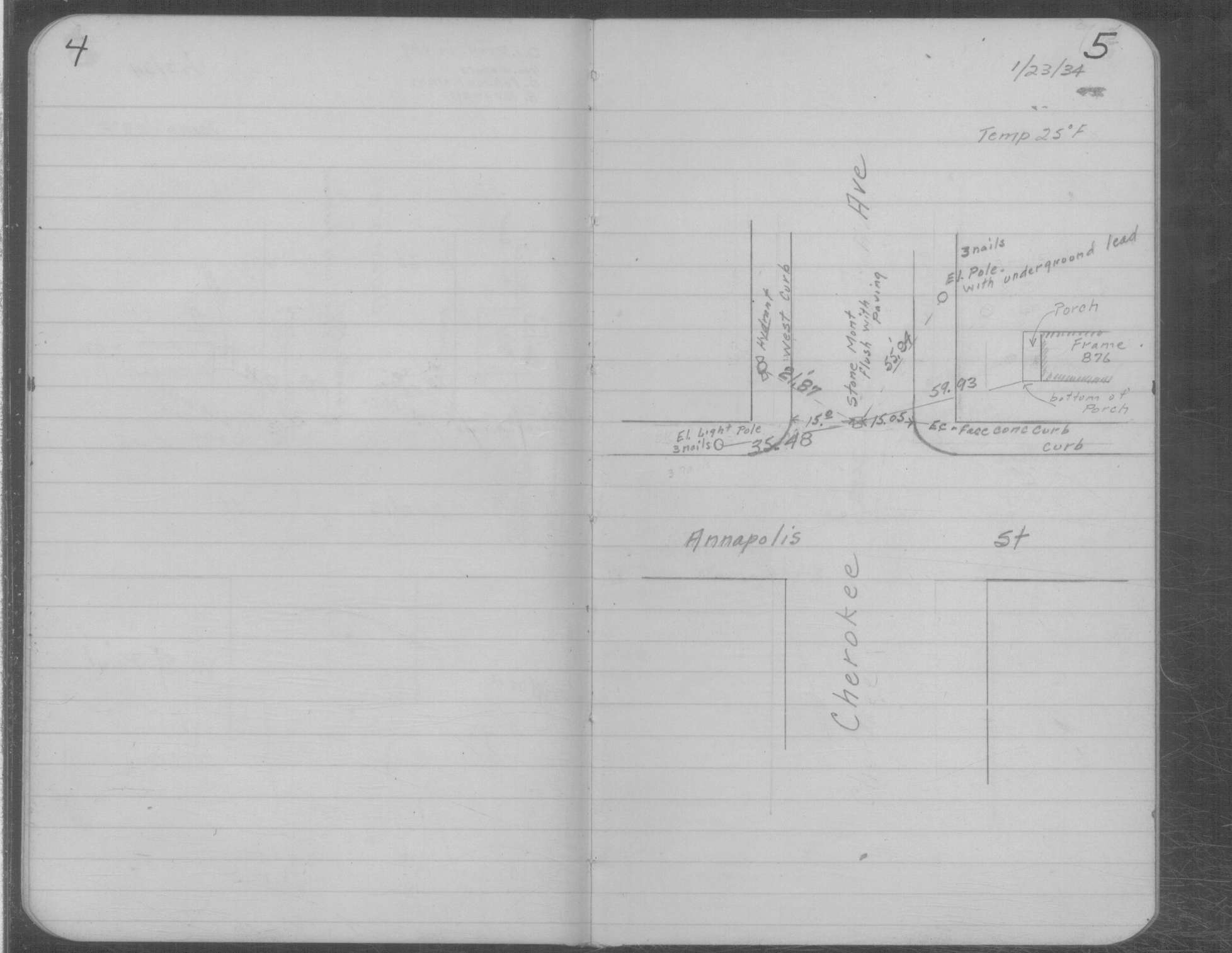
| 1/23/1934 | Placed ties on SM flush with pavement. See MSX 1 p.4-5 |
| 10/28/1890 | Monument set by J H Armstrong |
| 1/1/1890 | (Unknown date abt __, 189? ) Monument at Sta 3+01.92 on Annapolis at Cherokee. See JBI 17 p.51-52 |
Above is NOT an all inclusive history of this point. Please review all the links below.
| PLS NOTES | Field | Cross Section | Sewer | J.B. Irvine | Monument | River Survey |
|---|---|---|---|---|---|---|
| FB 1735p.28 | JBI 17 p.51-52 | MSX 0001 p.004-005 |
| FILE | SURVEYOR | LIC. NO. | DATE SIGNED | DATE TIED |
|---|---|---|---|---|
| 3630-1970-B.tif | Michael P. Murphy | 41001 | September 18, 2003 | April 29, 2003 |
| 3630-1970-A.tif | Jeffery L. Grosso | 13144 | February 13, 2003 | October 24, 2002 |
| FILE | PHOTO DATE | COMMENTS |
|---|---|---|
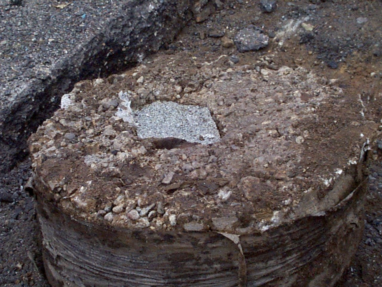
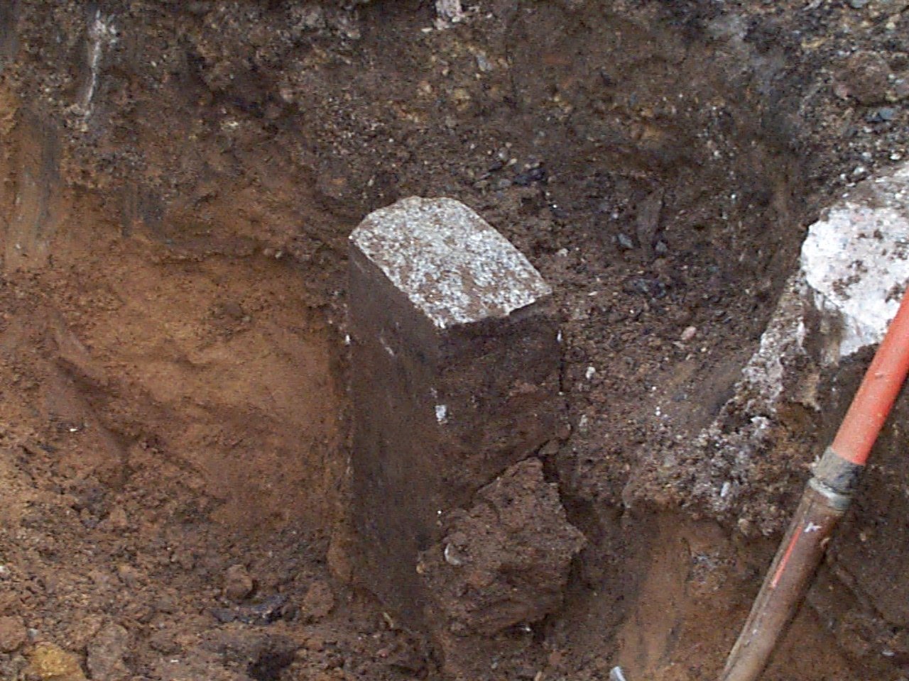
| 3630-1970-4.jpg | October 24, 2002 | Close up of GM in concrete cyclinder. Sheared off piece turned upside down. |
| 3630-1970-3.jpg | October 24, 2002 | Close up of GM in concrete (bottom of part sheared off). |
| 3630-1970-2.jpg | October 24, 2002 | Close up of marker in DH in concrete over GM (this part sheared off). |
| 3630-1970-1.jpg | October 24, 2002 | Close up of GM in position after top was sheared off. |