| NAD83 COORDINATES (1986 adj.): |
|---|
| X= 598013.727 Y= 153582.682 Z= 000.00 LSQ 11/14/2002 FLT |
| 11/15/2002 | Place ties on GM in casting. See CofL 3640-2254-A |
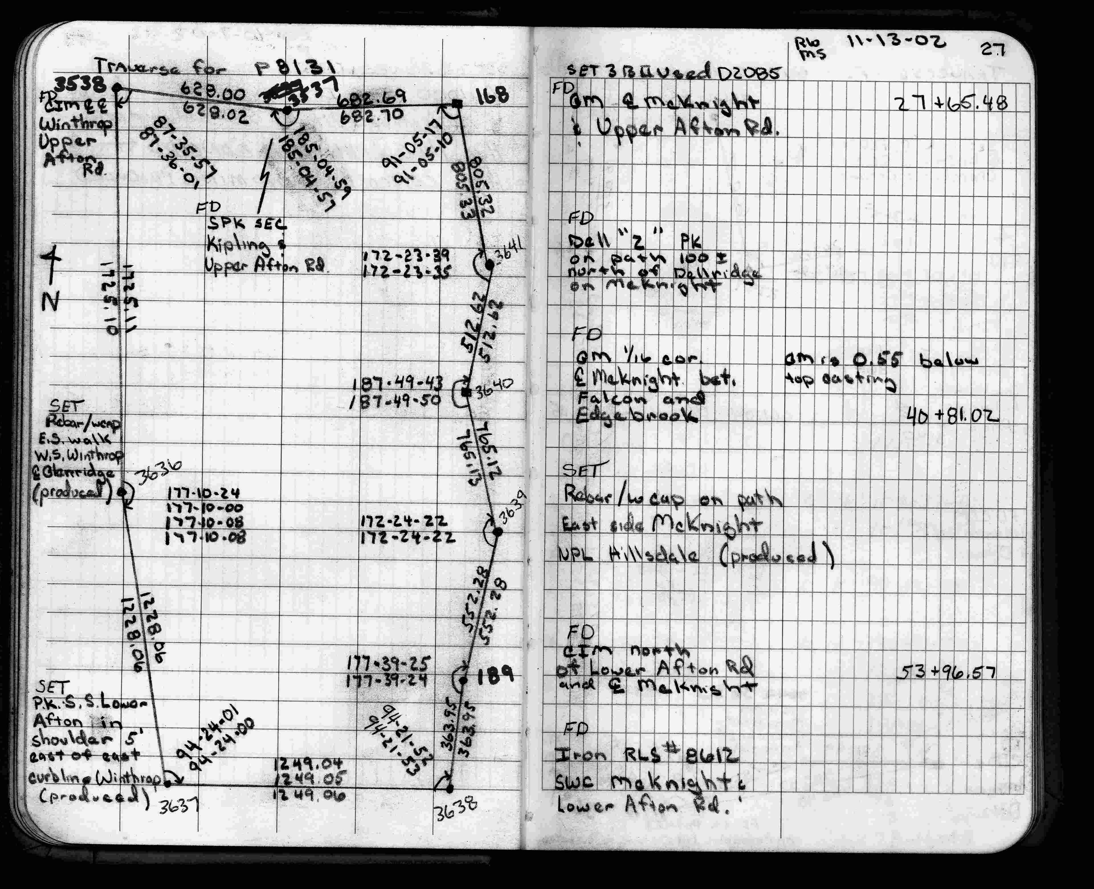
| 11/13/2002 | Fd GM in casting. Traversed through. See FB 1735 p.27 |
| 9/14/1998 | Place 12" dia casting over GM, left GM as found. See CofL 189N 0189N-2254-A |
| 7/13/1998 | Fd GM 6" below grade, place transit ties, left GM as found. See CofL 189N 0189N-2254-A |
| 3/1/1891 | (Unknown date Mar __, 1891 ) Monument set by J H Armstrong. See Std Map Sec 2-28-22 |
Above is NOT an all inclusive history of this point. Please review all the links below.
| PLS NOTES | Field | Cross Section | Sewer | J.B. Irvine | Monument | River Survey |
|---|---|---|---|---|---|---|
| FB 1735p.27 |
| FILE | SURVEYOR | LIC. NO. | DATE SIGNED | DATE TIED |
|---|---|---|---|---|
| 3640-2254-A.tif | Jeffery L. Grosso | 13144 | February 13, 2003 | November 15, 2002 |
| 0189N-2254-A.tif | Ronald F. Meyer | 9051 | November 18, 1998 | September 14, 1998 |
| FILE | PHOTO DATE | COMMENTS |
|---|---|---|
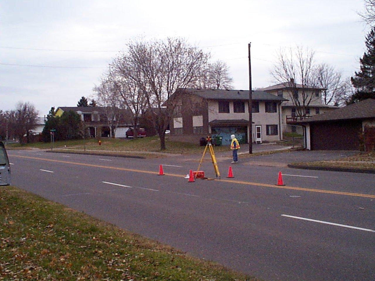
| 3640-2254-3.jpg | November 13, 2002 | Looking southwesterly. |
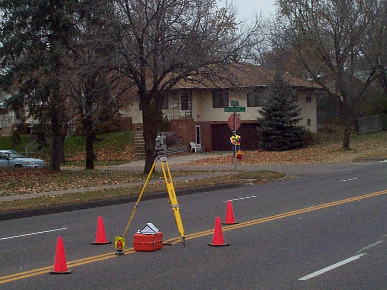
| 3640-2254-2.jpg | November 13, 2002 | Looking northwesterly. |
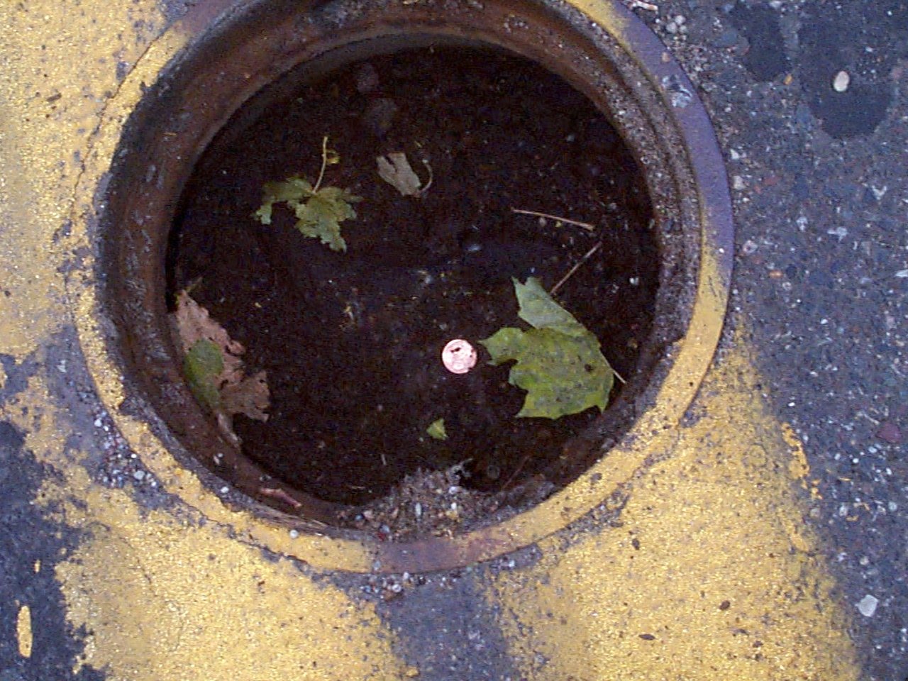
| 3640-2254-1.jpg | November 13, 2002 | Close up of GM in 1 ft diameter casting. (Penny in hole of GM) |