| NAD83 COORDINATES (1986 adj.): |
|---|
| X= 573841.470 Y= 151634.825 Z= 157.1 11/21/2002 RTK-VRS |
| 11/20/2002 | Fd GM 0.60 ft below sidewalk. Established coordinate position by RTK-VRS GPS |
| 8/30/2001 | Fd GM 0.60 ft below sidewalk at back edge of mono walk - M P Murphy |
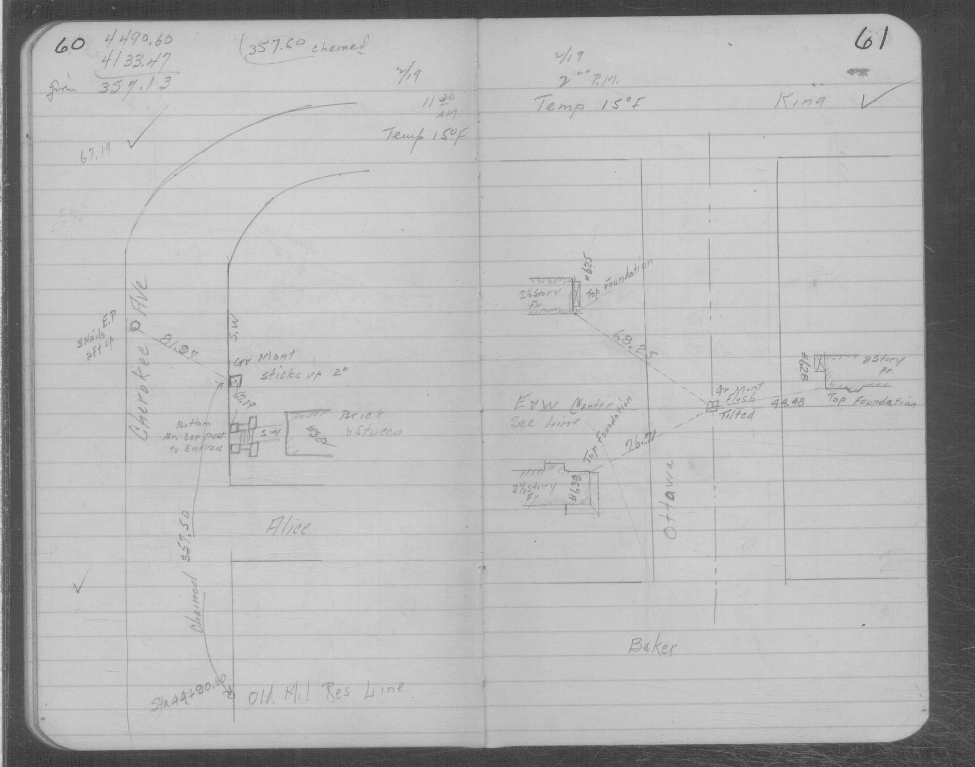
| 2/19/1934 | Placed ties on GM two inches above grade. See MSX 1 p.60-61 |
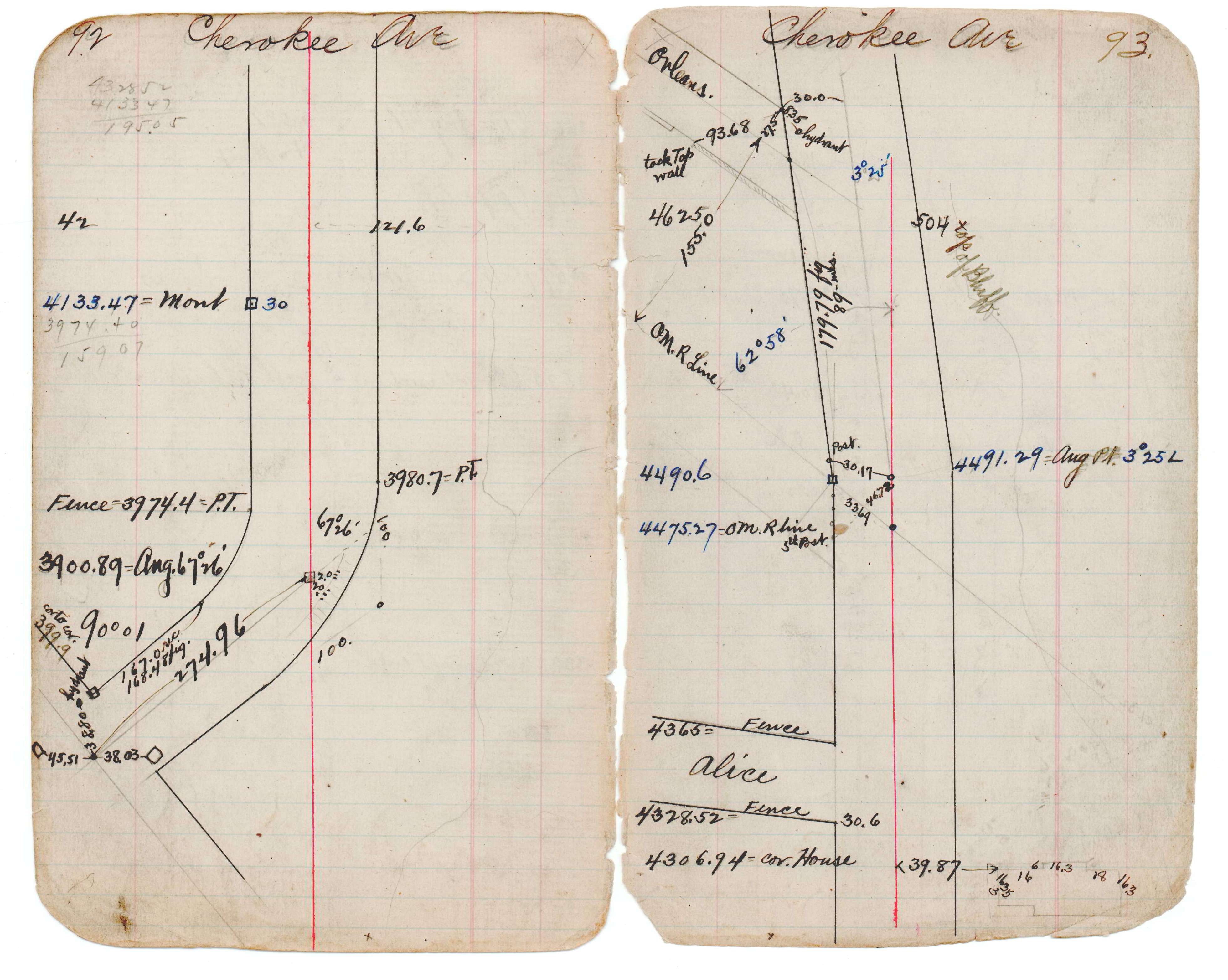
| 12/31/1899 | (Unknown date ___ __, 19?? ) See JBI 17 p.92-93 |
Above is NOT an all inclusive history of this point. Please review all the links below.
| PLS NOTES | Field | Cross Section | Sewer | J.B. Irvine | Monument | River Survey |
|---|---|---|---|---|---|---|
| JBI 17 p.92-93 | MSX 0001 p.060-061 |