| NAD83 COORDINATES (1986 adj.): |
|---|
| X= 586708.363 Y= 164171.640 Z= 000.0 TOT 02/06/2004 DBL |
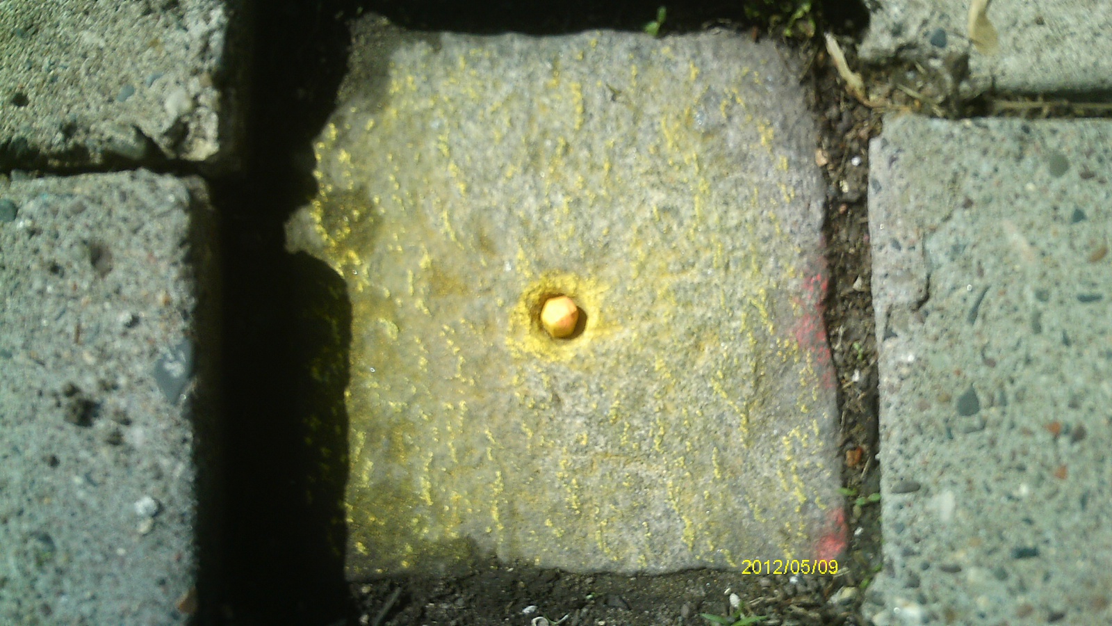
| 5/9/2012 | Found GM 0.2' below sidewalk grade. Photos taken. |
| 2/3/2004 | Fd GM 0.1 ft below sidewalk, placed magnet in center hole, placed ties. See CofL 3735-1035A-A |
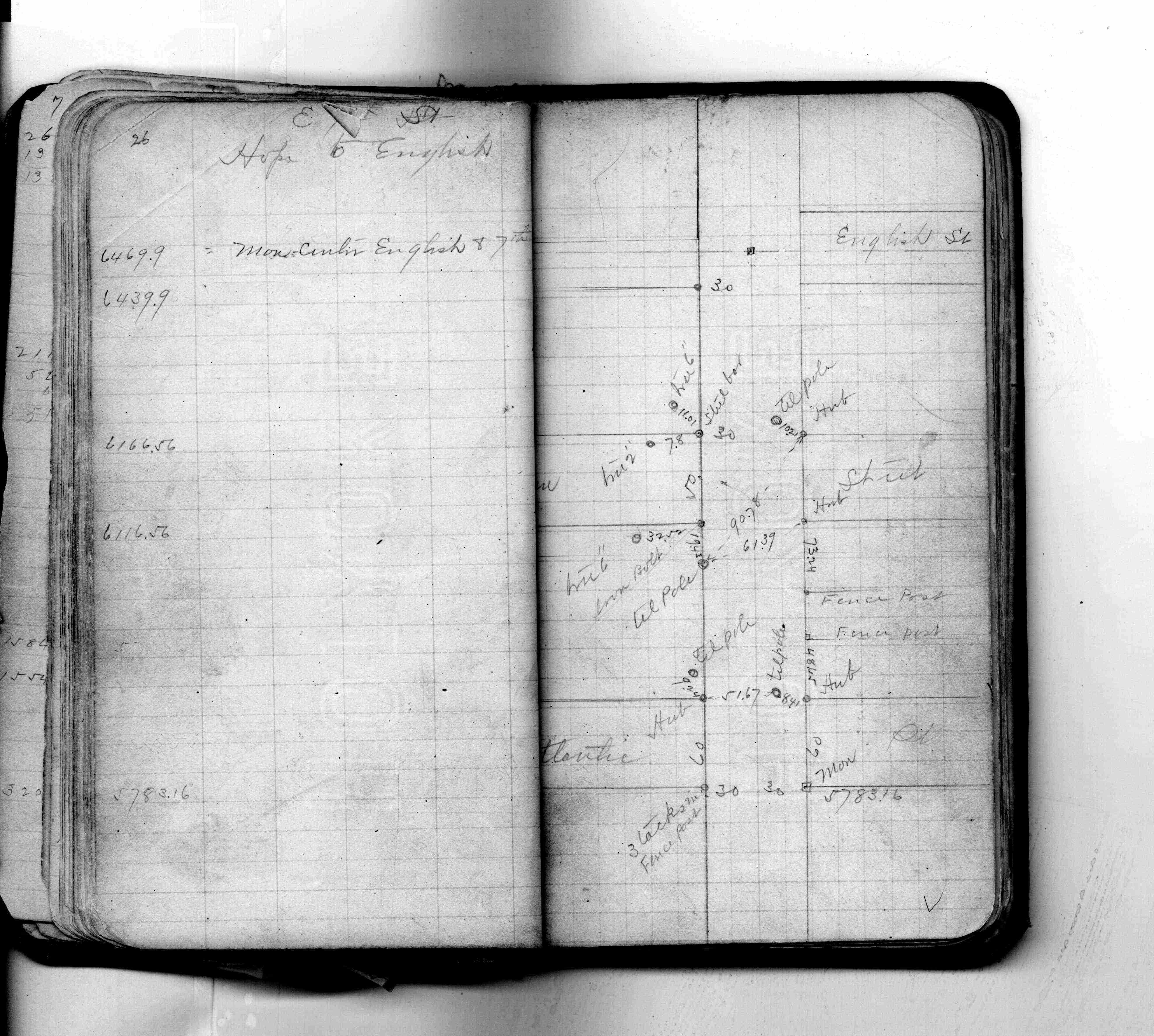
| 7/1/1887 | (Unknown date Jul __, 1887 ) Monument set by J H Armstrong from survey. See FB 206 p.26 |
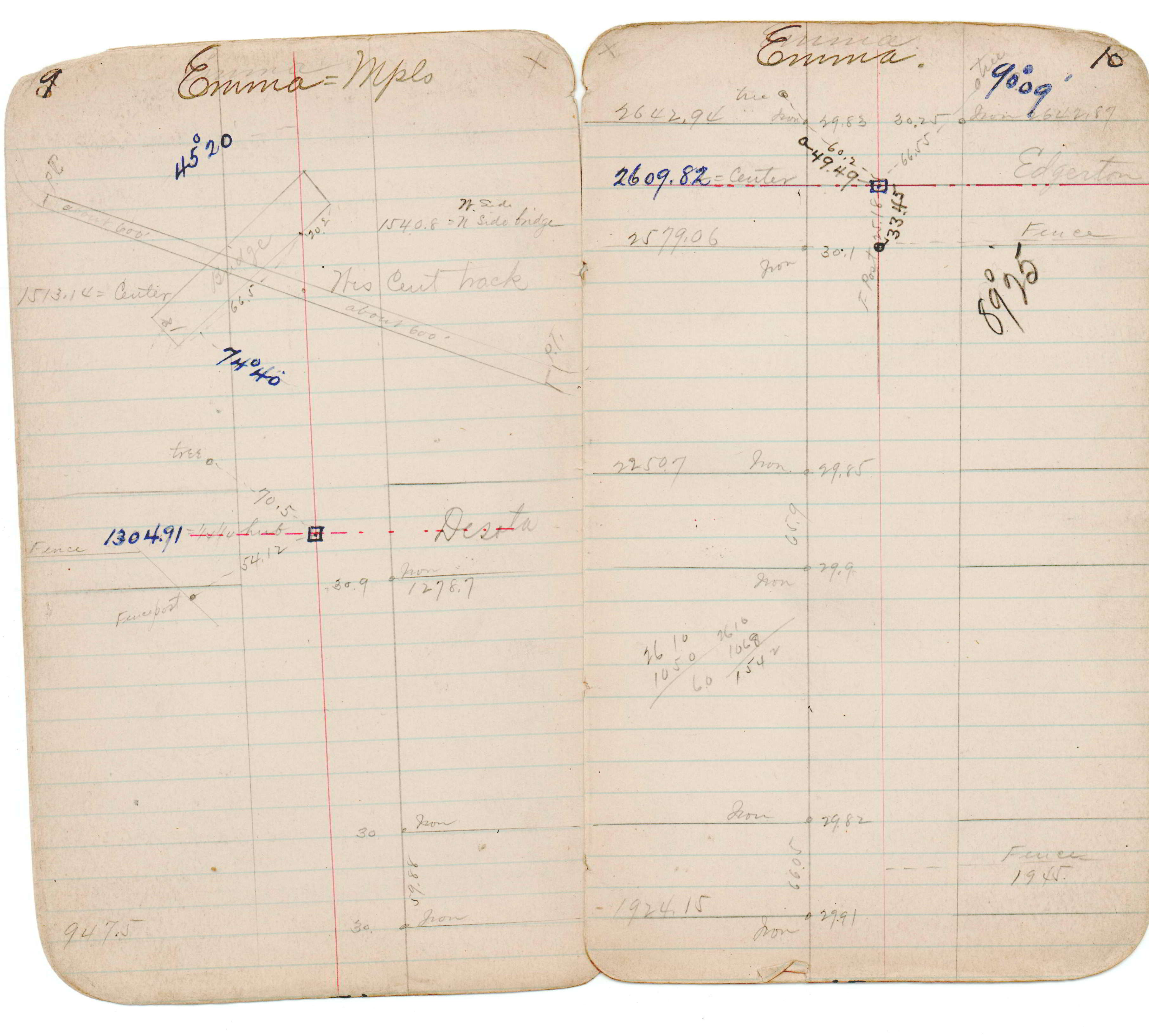
| 1/1/1800 | (Unknown date ___ __, ____ ) See JBI 12 p.09-10 |
Above is NOT an all inclusive history of this point. Please review all the links below.
| PLS NOTES | Field | Cross Section | Sewer | J.B. Irvine | Monument | River Survey |
|---|---|---|---|---|---|---|
| FB 0206p.26 | JBI 12 p.09-10 |
| FILE | SURVEYOR | LIC. NO. | DATE SIGNED | DATE TIED |
|---|---|---|---|---|
| 3735-1035A-A.tif | Michael P. Murphy | 41001 | February 6, 2004 | February 3, 2004 |
| FILE | PHOTO DATE | COMMENTS |
|---|---|---|
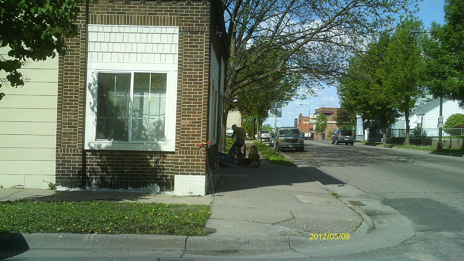
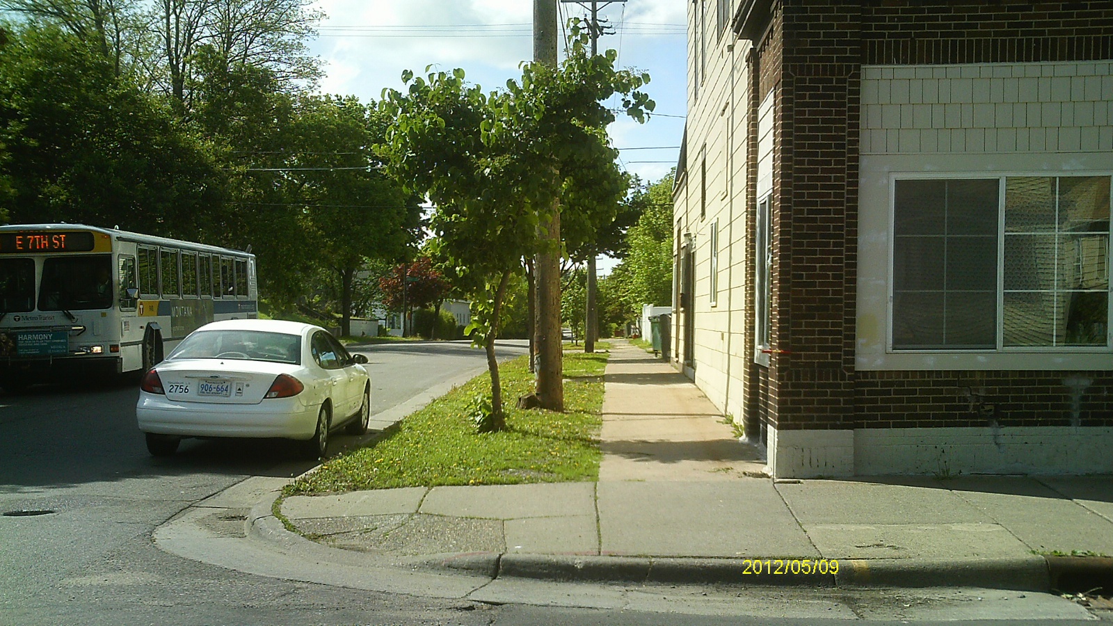
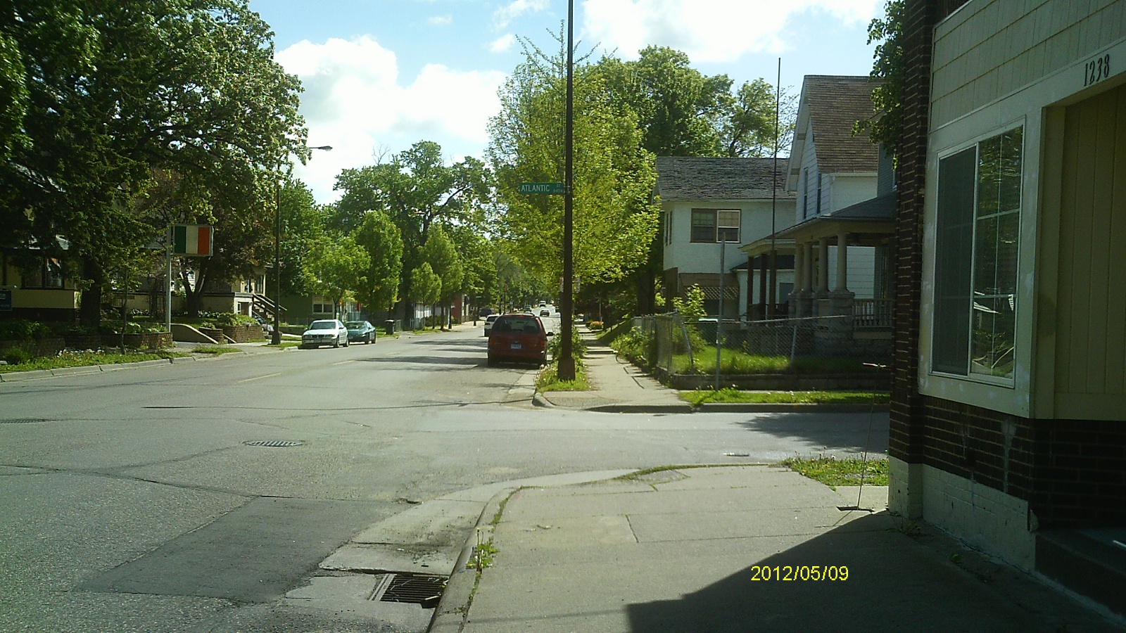
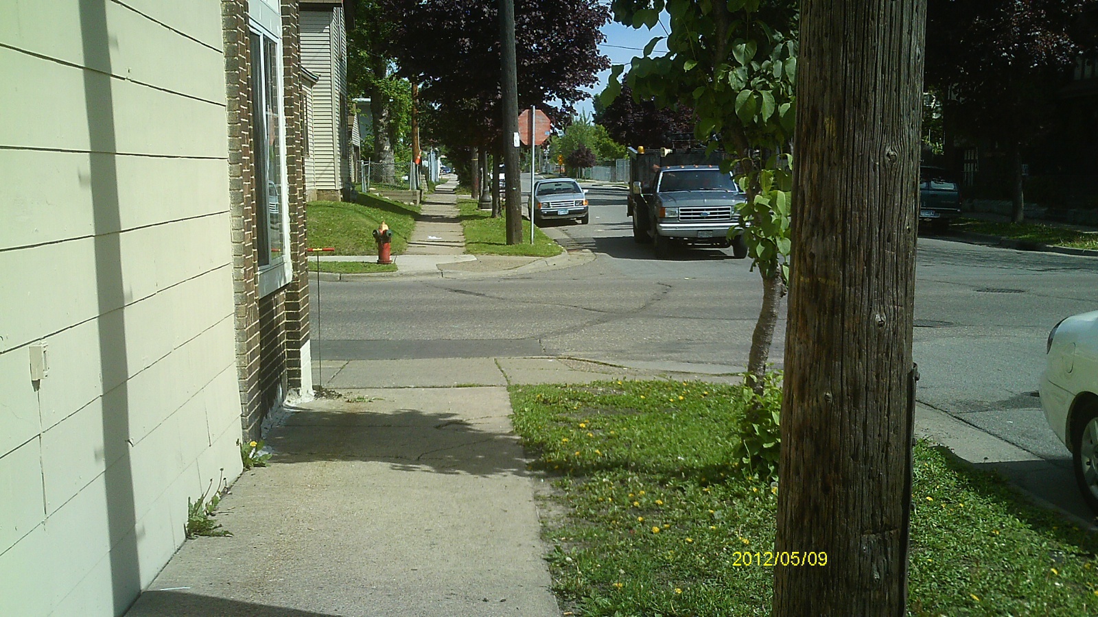
| 3735-1035A-5.jpg | May 9, 2012 | Looking west along Seventh St. |
| 3735-1035A-4.jpg | May 9, 2012 | Looking south along Atlantic St. |
| 3735-1035A-3.jpg | May 9, 2012 | Looking east along Seventh St. |
| 3735-1035A-2.jpg | May 9, 2012 | Looking north along Atlantic St. |
| 3735-1035A-1.jpg | May 9, 2012 | Close up of monument. |