| NAD83 COORDINATES (1986 adj.): |
|---|
| * X= 571790.083 Y= 165458.916 Z= 000.00 CMP 04/15/2004 CMP |
| X= 571790.325 Y= 165458.956 Z= 855.6 01/10/2005 RTK-VRS |
| 10/3/2013 | Found GM in casting. |
| 3/3/2005 | Position on GM established by RTK-VRS GPS. Elev 855.6 ft |
| 1/10/2005 | Position on GM established by RTK-VRS GPS. Photos taken. |
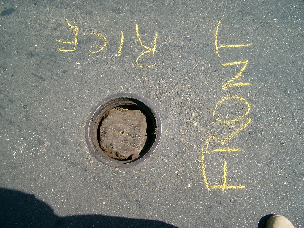
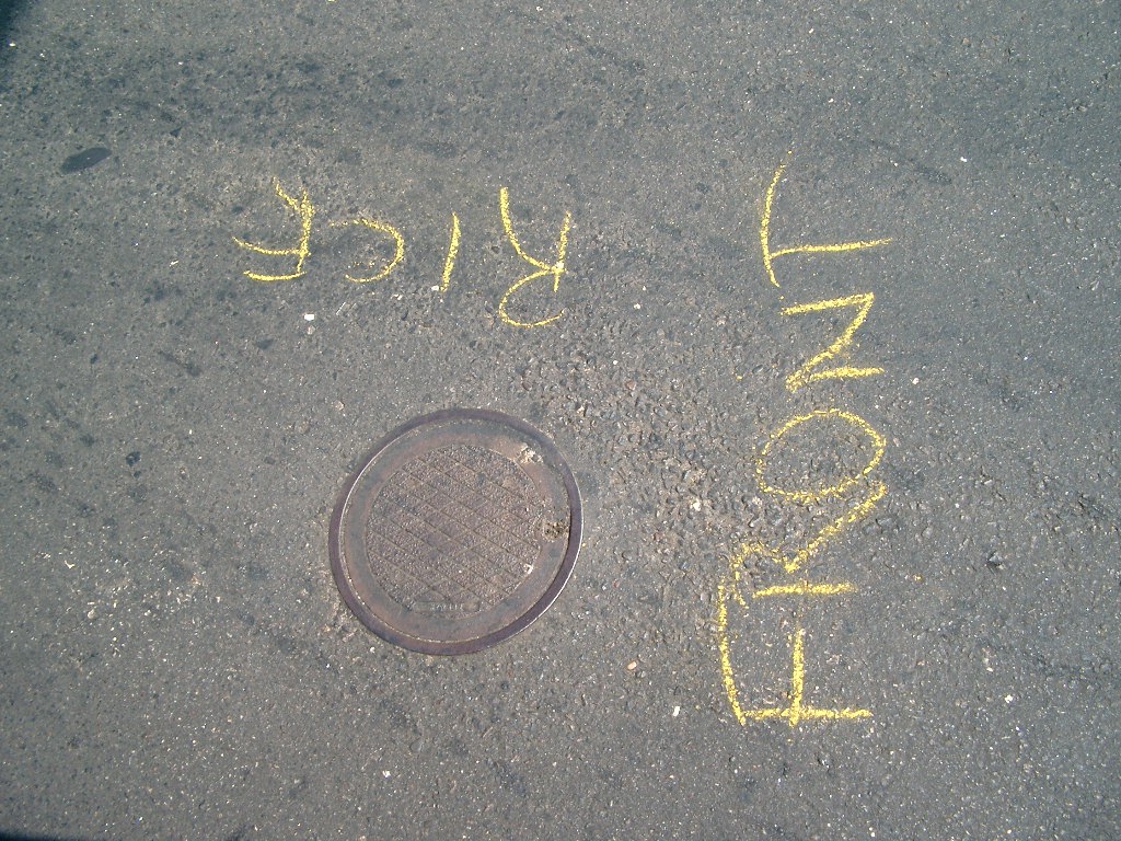
| 8/25/2004 | Small MH casting set over GM during mill/overlay by county contractor under the supervision of the Ramsey County Surveyor's Office |
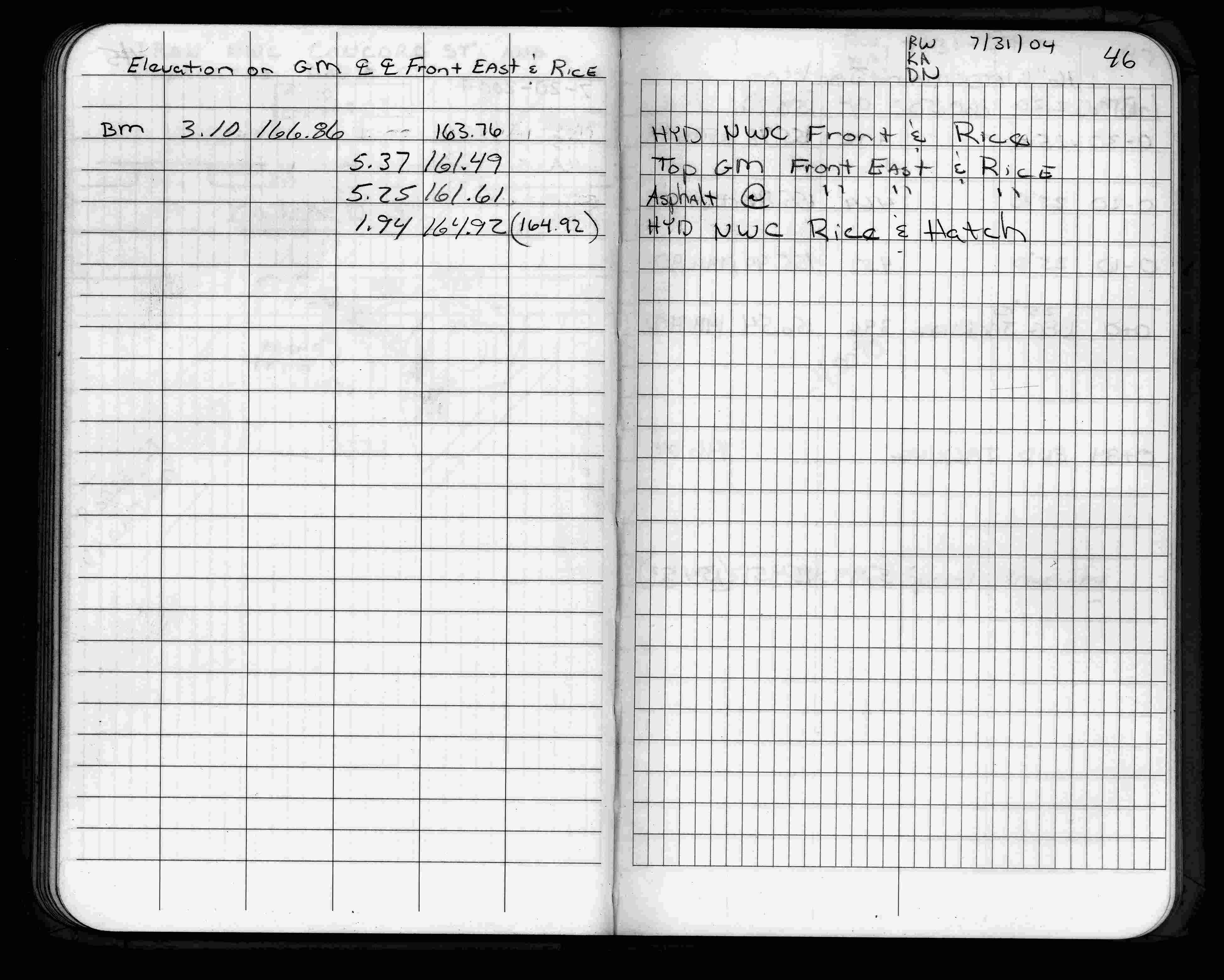
| 7/31/2004 | Elev 161.49 ft on GM. GM 0.12 ft below street surface. See FB 1735 p.46 |
| 4/15/2004 | Calculated GM position 30 ft N of point 0074 and on line between monuments 74 and 53. See CofL 0074-0039-A |
Above is NOT an all inclusive history of this point. Please review all the links below.
| PLS NOTES | Field | Cross Section | Sewer | J.B. Irvine | Monument | River Survey |
|---|---|---|---|---|---|---|
| FB 1735p.46 |
| FILE | SURVEYOR | LIC. NO. | DATE SIGNED | DATE TIED |
|---|---|---|---|---|
| 3740-__cu-A.tif | William J. Cutting | 20576 | August 5, 1991 | August 1, 1991 |
| FILE | PHOTO DATE | COMMENTS |
|---|---|---|
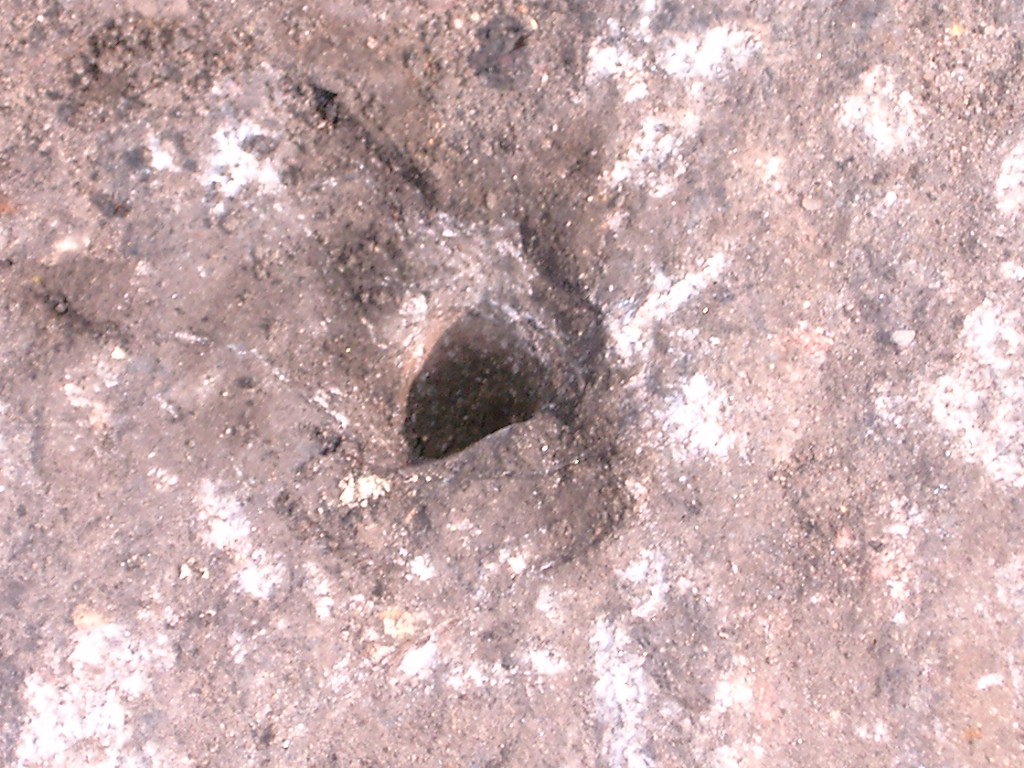
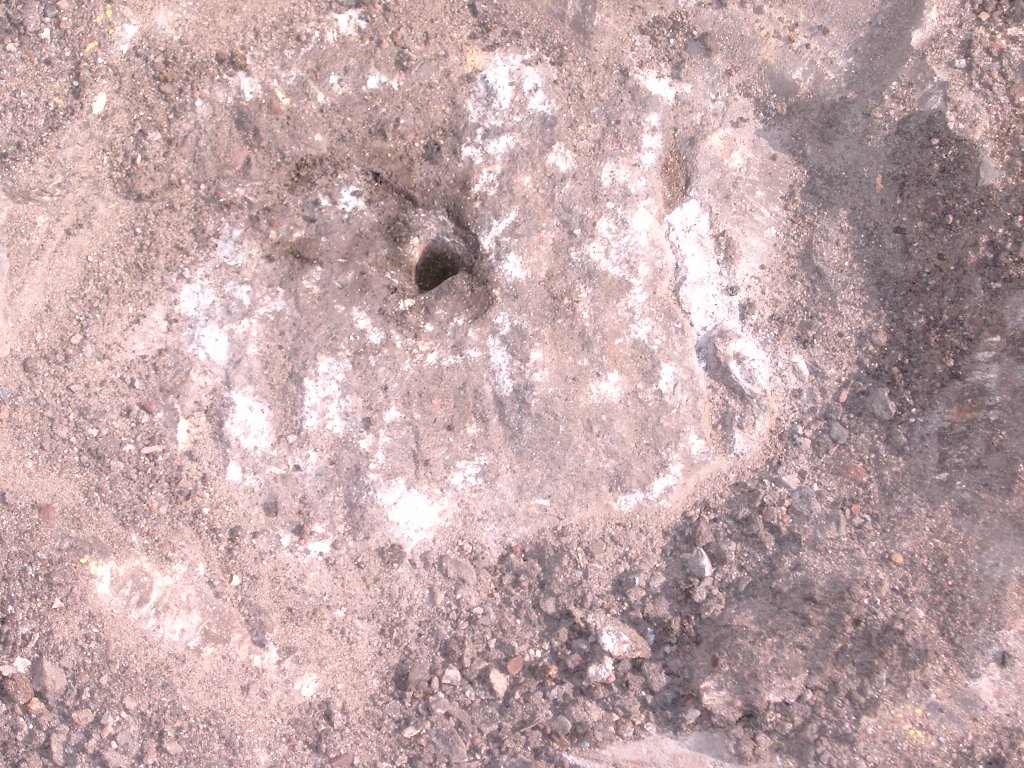
| 3740-__cu-8.jpg | January 10, 2005 | Close up of monument in casting. |
| 3740-__cu-7.jpg | January 10, 2005 | Close up of casting. |
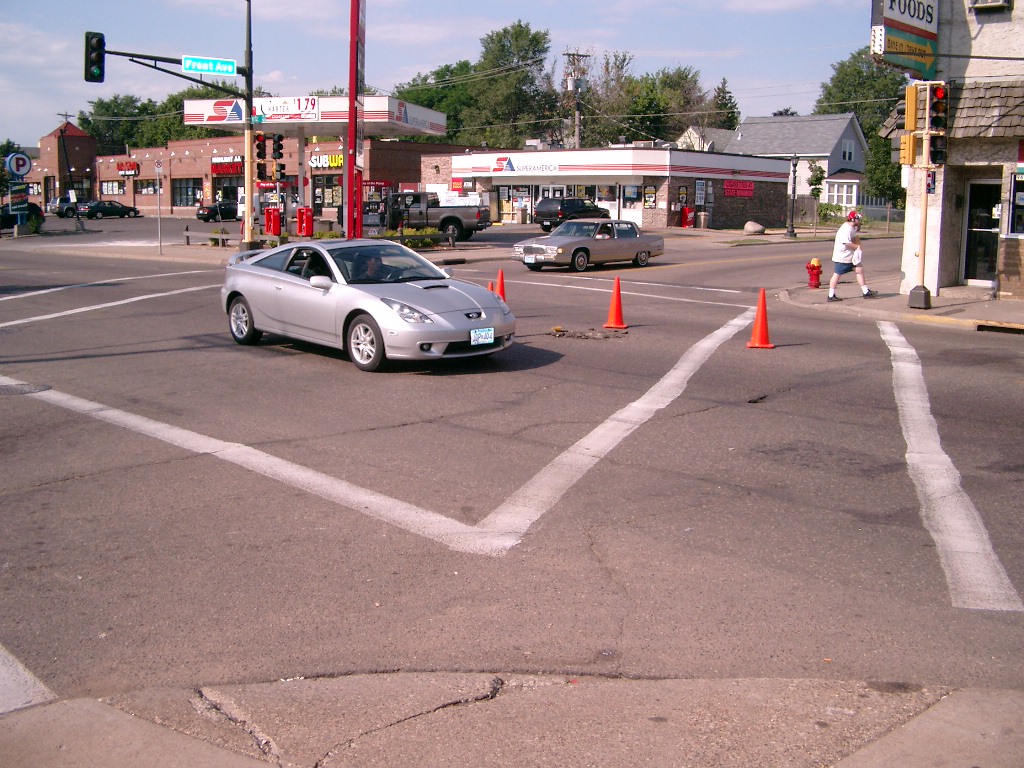
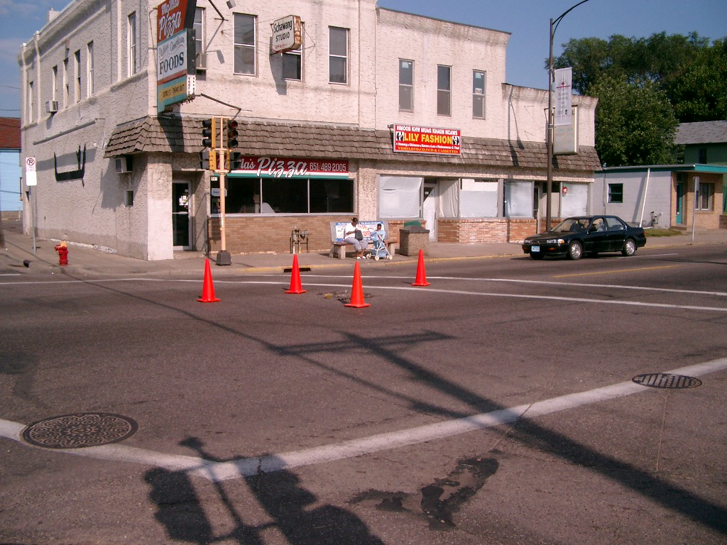
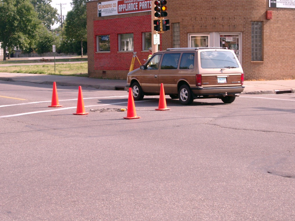
| 3740-__cu-6.jpg | September 13, 2004 | Looking Southwest. |
| 3740-__cu-5.jpg | September 13, 2004 | Looking Northwest. |
| 3740-__cu-4.jpg | September 13, 2004 | Looking Northeast. |
| 3740-__cu-3.jpg | September 13, 2004 | Close up of monument. |
| 3740-__cu-2.jpg | September 13, 2004 | Close up of GM. |
| 3740-__cu-1.jpg | September 13, 2004 | Looking Southeast. |