| NAD83 COORDINATES (1986 adj.): |
|---|
| X= 568541.081 Y= 153091.746 Z= 790.8 12/06/2005 RTK-VRS |
| 12/19/2006 | Fd GM 0.30 ft below grade and tied. See CofL 3794-0379-A |
| 12/9/2005 | Photos taken. |
| 12/6/2005 | Fd GM 0.3 ft below sidewalk. Position established by GPS RTK-VRS. Placed Magnet. |
| 7/6/2005 | GM down 0.3 feet below sidewalk. GM between cyclone fence corner and sidewalk. |
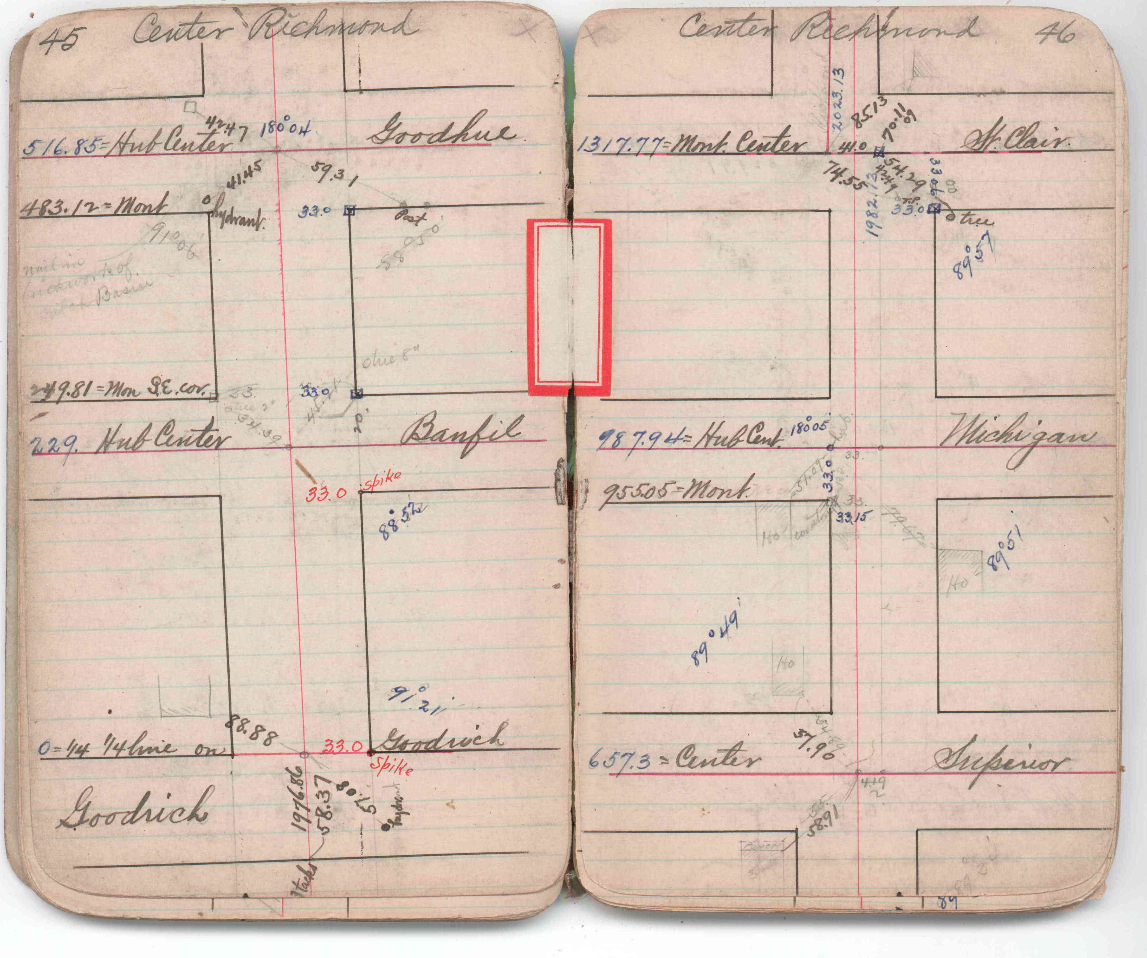
| 1/1/1880 | (Unknown date abt __, 188? ) See JBI 07 p.45-46 |
Above is NOT an all inclusive history of this point. Please review all the links below.
| PLS NOTES | Field | Cross Section | Sewer | J.B. Irvine | Monument | River Survey |
|---|---|---|---|---|---|---|
| JBI 07 p.45-46 |
| FILE | SURVEYOR | LIC. NO. | DATE SIGNED | DATE TIED |
|---|---|---|---|---|
| 3794-0379-A.tif | none | none | none | December 19, 2006 |
| FILE | PHOTO DATE | COMMENTS |
|---|---|---|
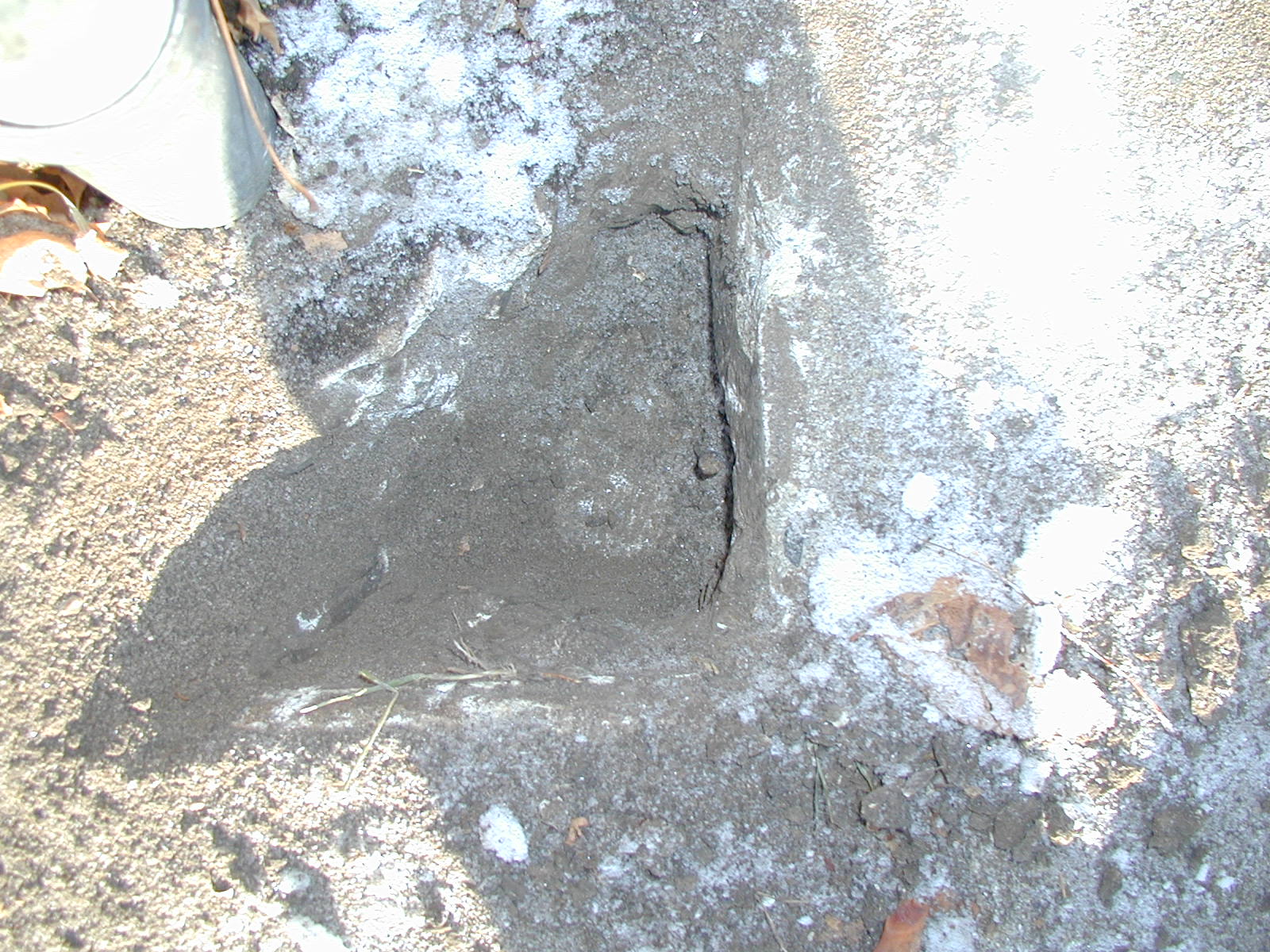
| 3794-0379-5.jpg | December 9, 2005 | Close-up of the granite monument. |
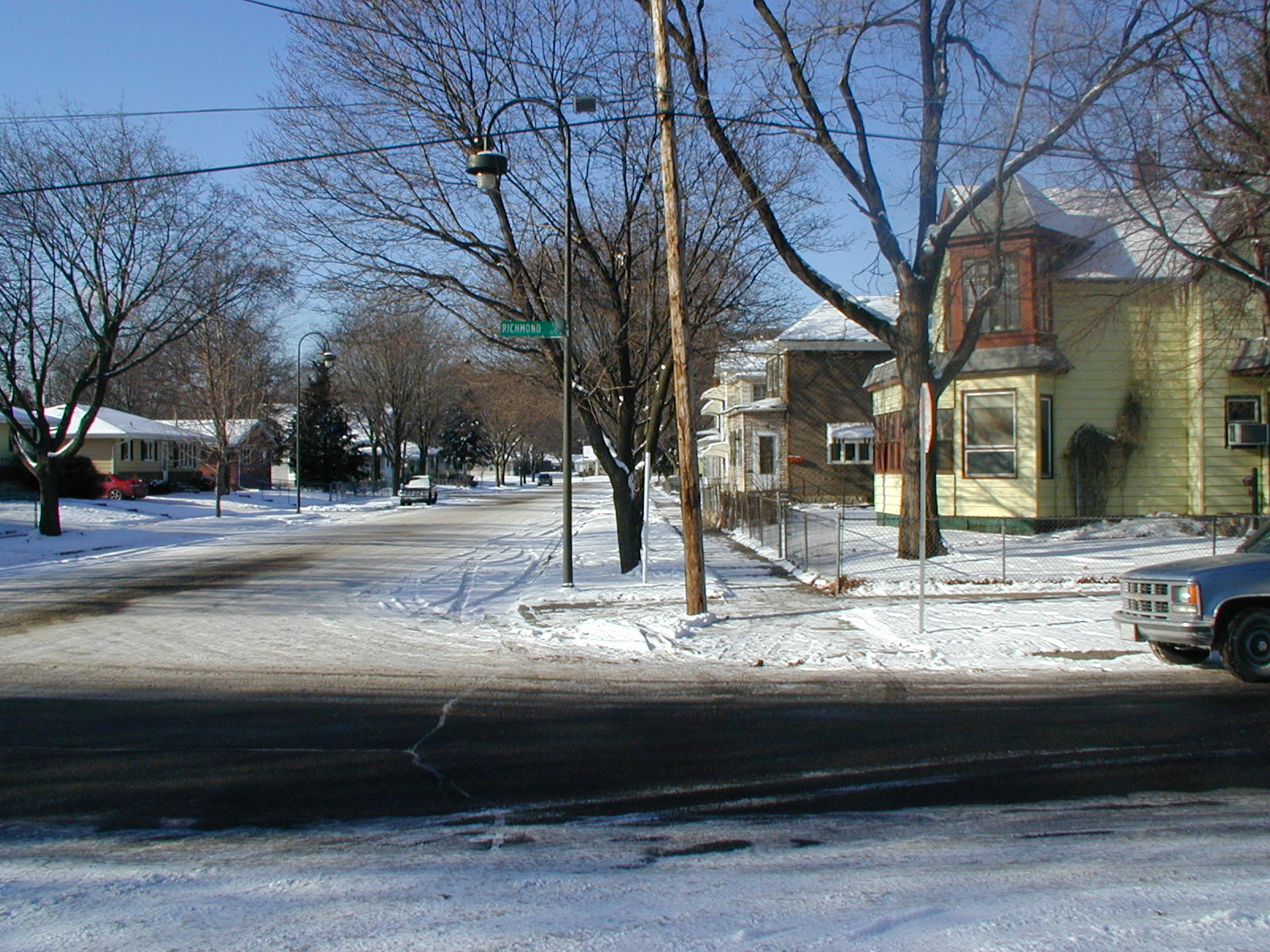
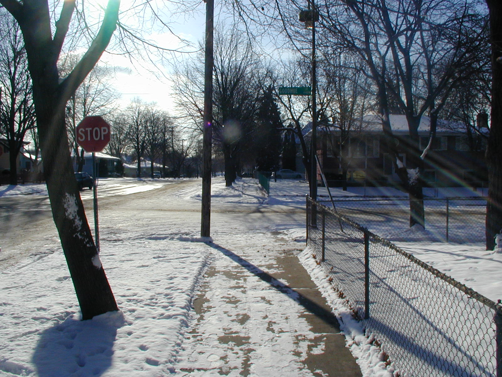
| 3794-0379-4.jpg | December 9, 2005 | Looking West along the North side of Goodhue St. |
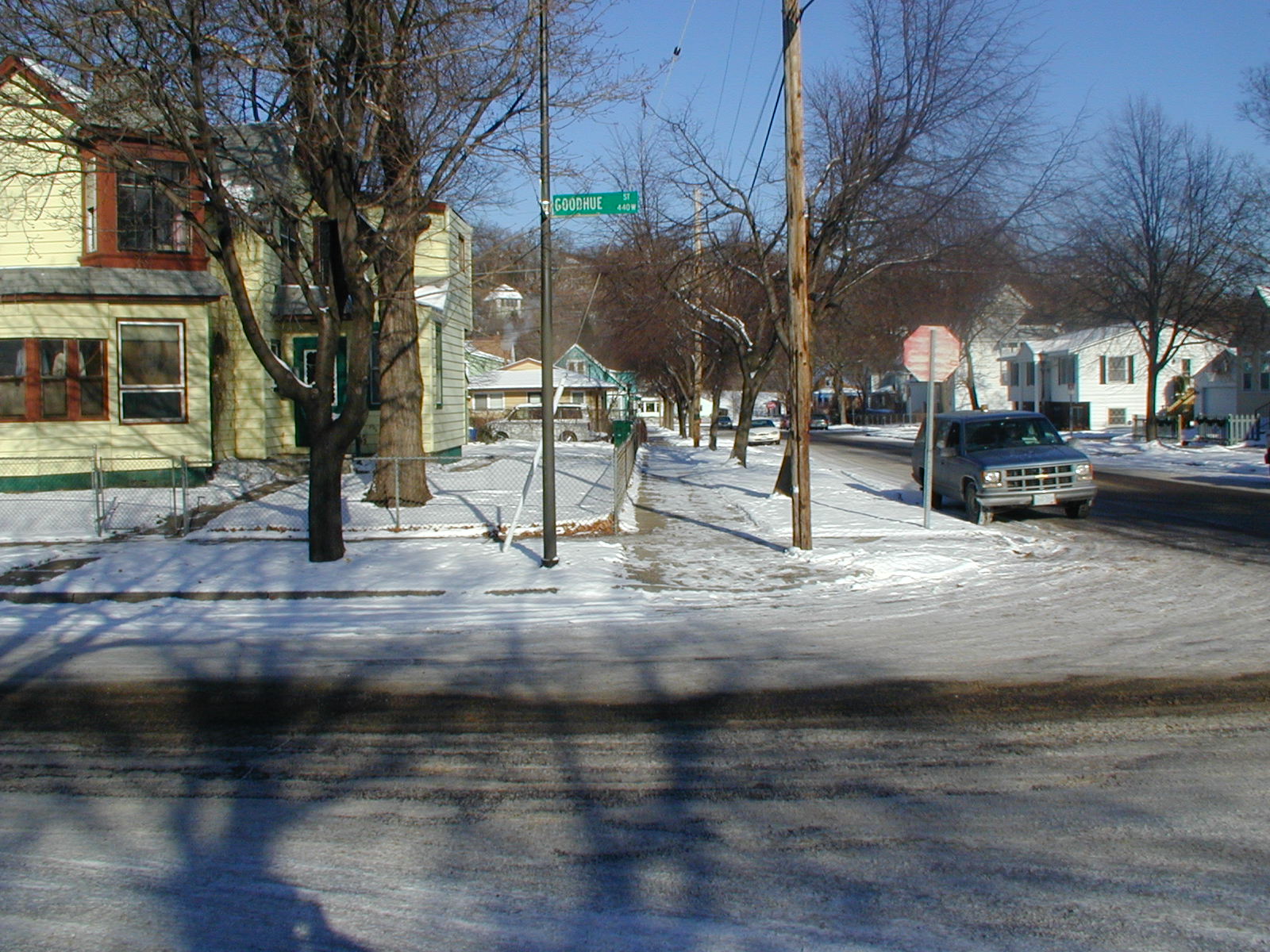
| 3794-0379-3.jpg | December 9, 2005 | Looking East along the North side of Goodhue St. |
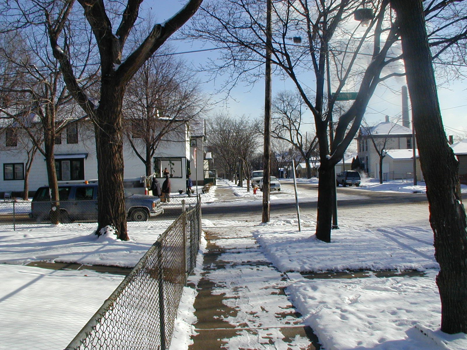
| 3794-0379-2.jpg | December 9, 2005 | Looking North along the West side of Richmond St. |
| 3794-0379-1.jpg | December 9, 2005 | Looking South along the West side of Richmond St. |