| NAD83 COORDINATES (1986 adj.): |
|---|
| X= 563975.519 Y= 153557.026 Z= 919.6 03/27/2006 RTK-VRS |
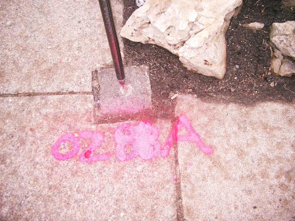
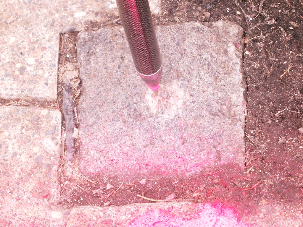
| 4/17/2012 | Found GM at sidewalk grade. Monument tipped slightly to NW. Ties placed using steel tape. |
| 3/27/2006 | Position on GM established by RTK-VRS GPS. Elev 919.6 ft Pin was epoxied in GM. |
| 3/27/2006 | Photos taken. |
| 7/24/1997 | GM recovered. |
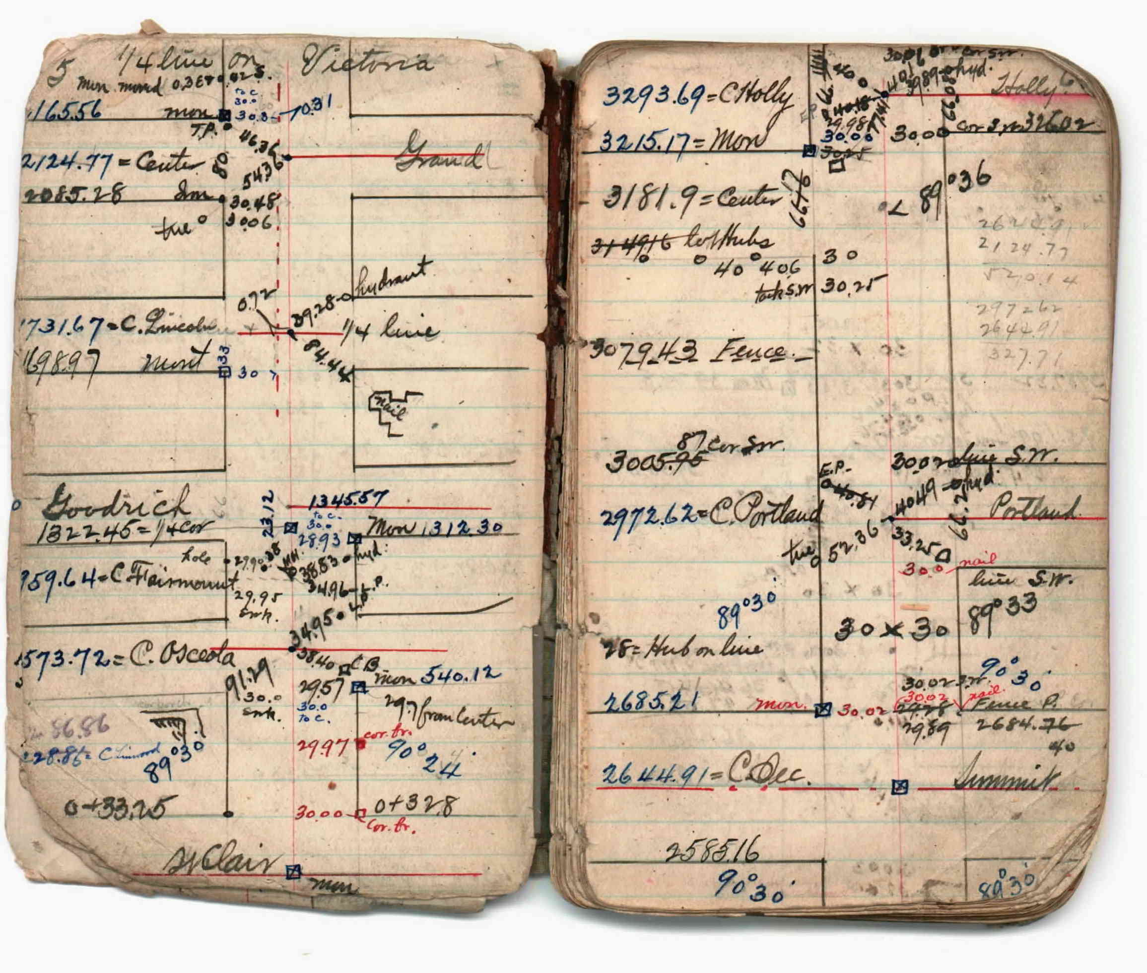
| 1/1/1800 | (Unknown date ___ __, ____ ) Survey on Victoria St from St Clair to Marshall Ave. See JBI 02 p.05-06 |
Above is NOT an all inclusive history of this point. Please review all the links below.
| PLS NOTES | Field | Cross Section | Sewer | J.B. Irvine | Monument | River Survey |
|---|---|---|---|---|---|---|
| JBI 02 p.05-06 |
| FILE | SURVEYOR | LIC. NO. | DATE SIGNED | DATE TIED |
|---|---|---|---|---|
| 3813-0281B-A.pdf | Samuel D. Gibson | 44880 | August 31, 2012 | April 17, 2012 |
| FILE | PHOTO DATE | COMMENTS |
|---|---|---|
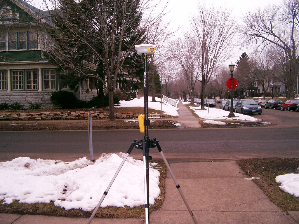
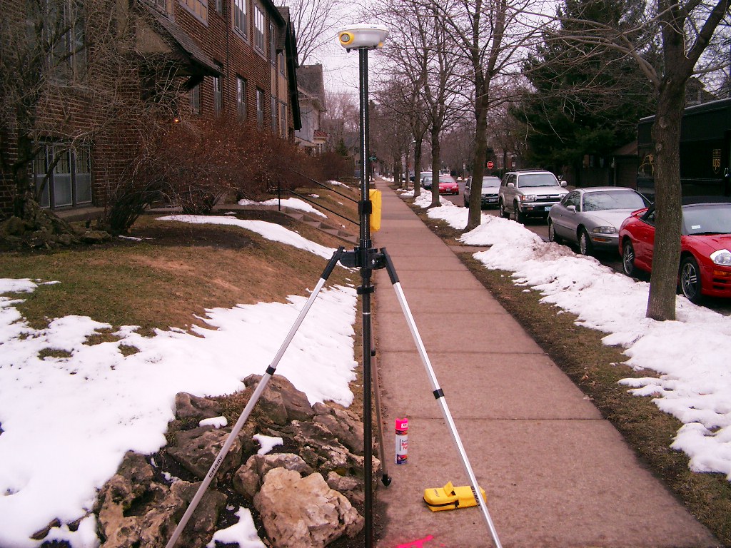
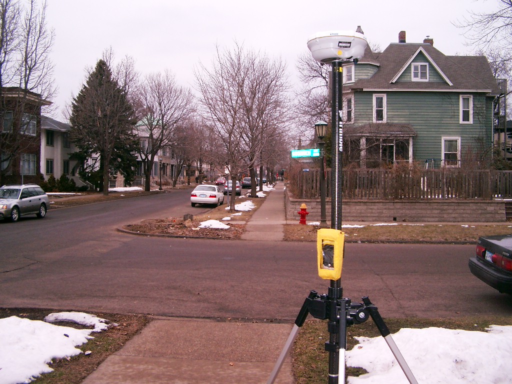
| 3813-0281B-7.jpg | March 27, 2006 | Looking West along the South side of Goodrich Ave. |
| 3813-0281B-6.jpg | March 27, 2006 | Looking South along the East side of Victoria St. |
| 3813-0281B-5.jpg | March 27, 2006 | Looking Southeast at the Southeast corner of Goodrich Ave & Victoria St. |
| 3813-0281B-4.jpg | March 27, 2006 | Looking East along the South side of Goodrich Ave. |
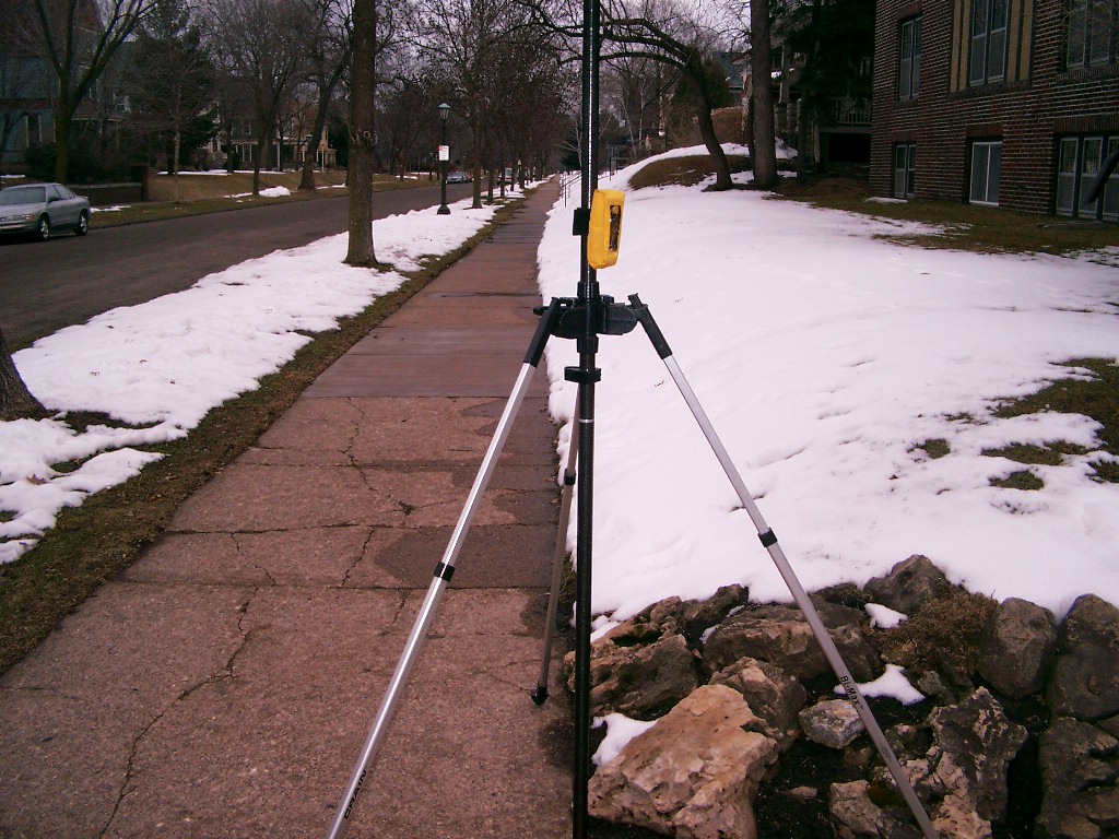
| 3813-0281B-3.jpg | March 27, 2006 | Looking North along the East side of Victoria St. |
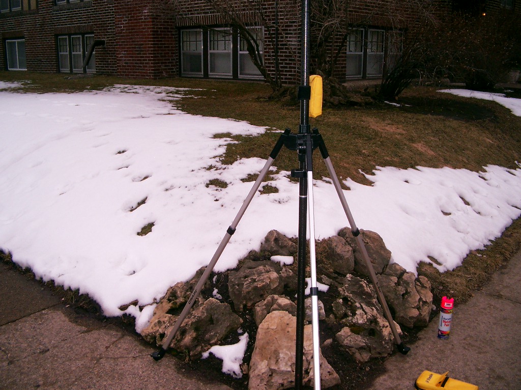
| 3813-0281B-2.jpg | March 27, 2006 | Close-up of the granite monument. |
| 3813-0281B-1.jpg | March 27, 2006 | Close-up of the granite monument. |