| NAD83 COORDINATES (1986 adj.): |
|---|
| X= 562666.351 Y= 152280.920 Z= 905.6 03/27/2006 RTK-VRS |
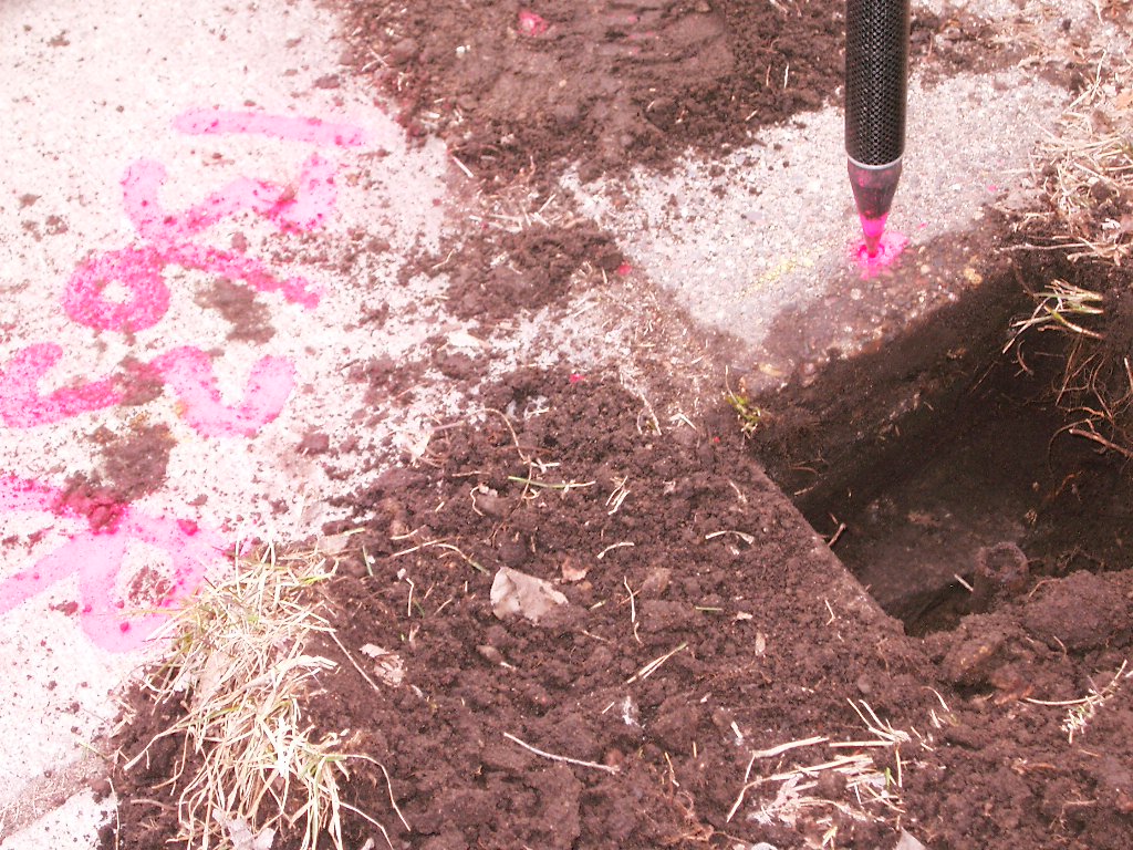
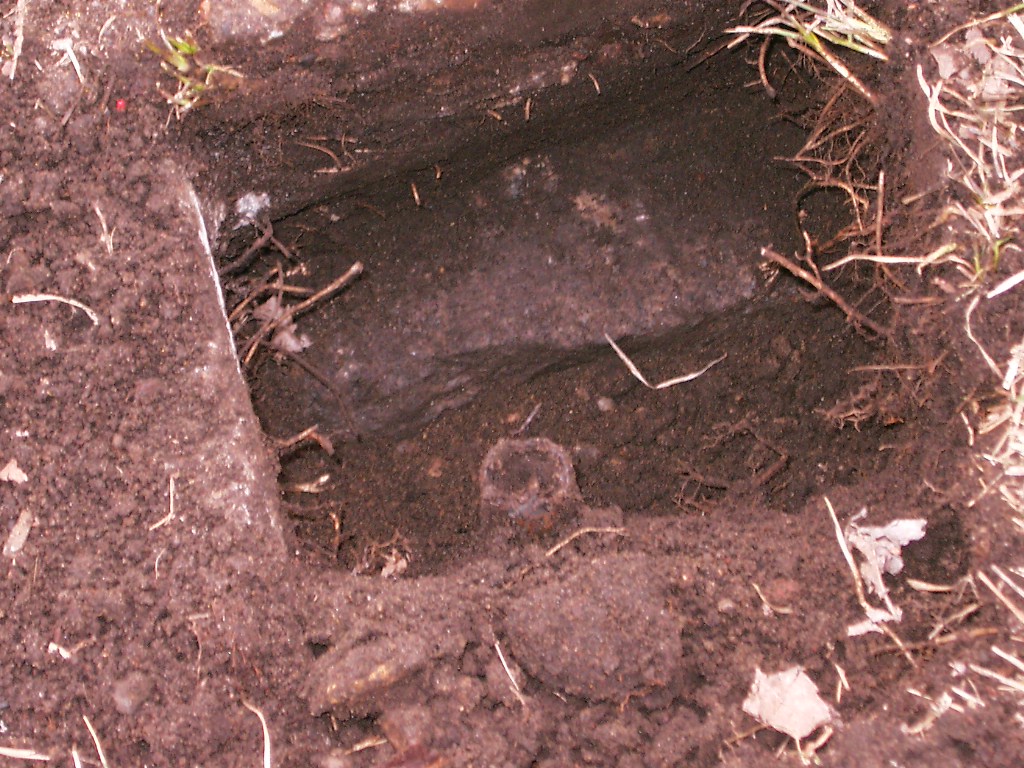
| 3/27/2006 | Position on GM established by RTK-VRS GPS. Elev 905.6 ft. Center hole of monument under drill hole in sidewalk. |
| 3/27/2006 | Photos taken. |
| 1/1/1900 | (Unknown date ___ __, 19?? ) Elev 210.965 ft on GM. See Old Benches Book, Entry 1664 |
| 7/1/1888 | (Unknown date Jul __, 1888 ) Monument set by J H Armstrong |
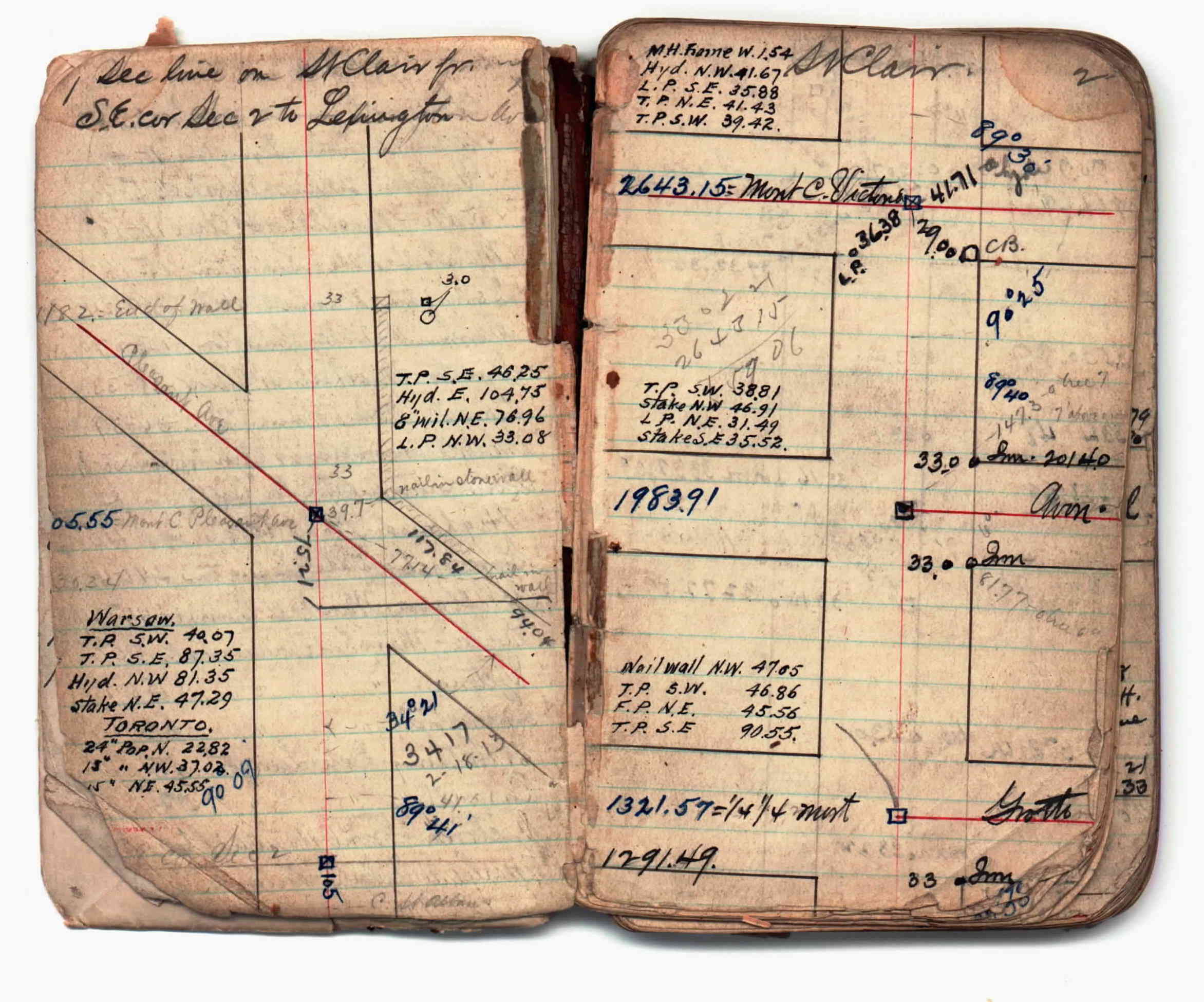
| 1/1/1800 | (Unknown date ___ __, ____ ) Survey on St Clair from Dale St to Lexington Ave. See JBI 02 p.01-02 |
Above is NOT an all inclusive history of this point. Please review all the links below.
| PLS NOTES | Field | Cross Section | Sewer | J.B. Irvine | Monument | River Survey |
|---|---|---|---|---|---|---|
| JBI 02 p.01-02 |
| FILE | PHOTO DATE | COMMENTS |
|---|---|---|
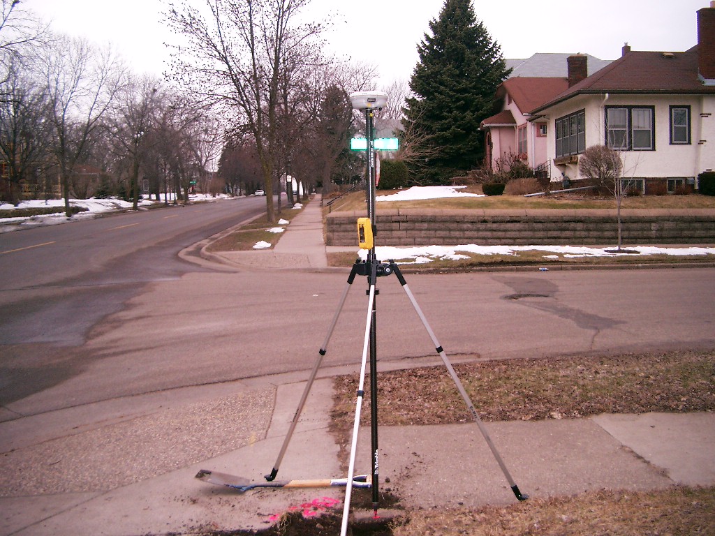
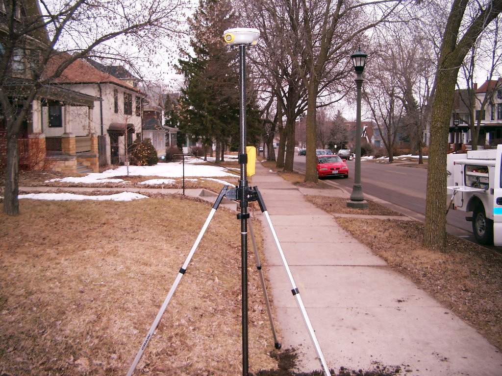
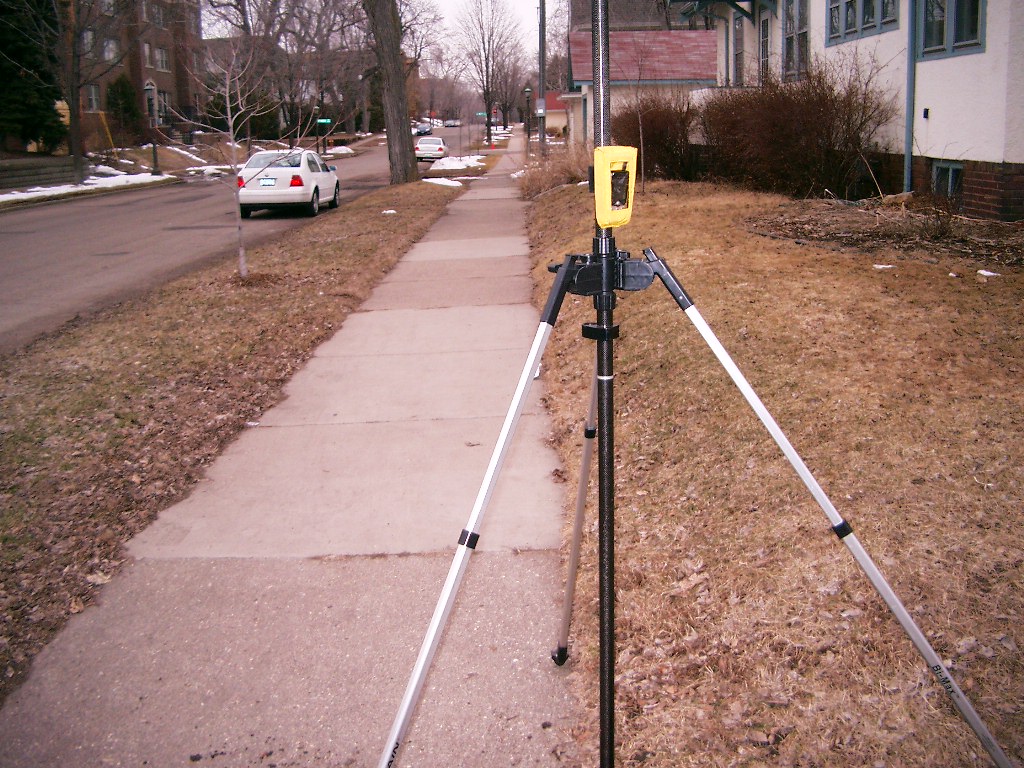
| 3814-1363B-9.jpg | March 27, 2006 | Looking West along the North side of St. Clair Ave. |
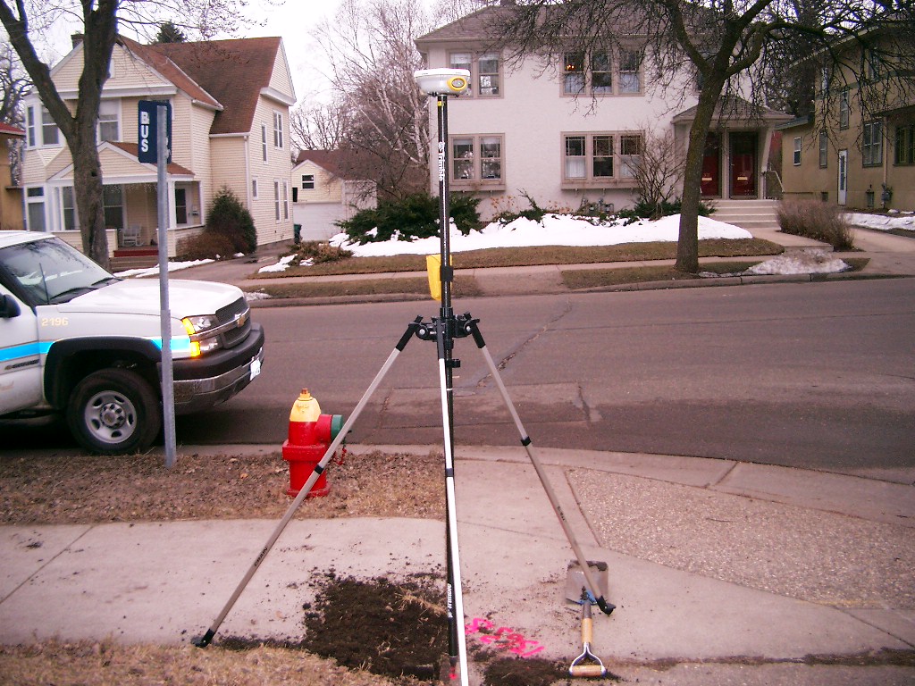
| 3814-1363B-8.jpg | March 27, 2006 | Looking South along the East side of Chastworth St. |
| 3814-1363B-7.jpg | March 27, 2006 | Looking East along the North side of St. Clair Ave. |
| 3814-1363B-6.jpg | March 27, 2006 | Looking North along the East side of Chatsworth St. |
| 3814-1363B-4.jpg | March 27, 2006 | Close-up of the granite monument. |
| 3814-1363B-1.jpg | March 27, 2006 | Close-up of the granite monument. |