| NAD83 COORDINATES (1986 adj.): |
|---|
| X= 567555.121 Y= 154013.143 Z= 876.9 03/30/2006 RTK-VRS |
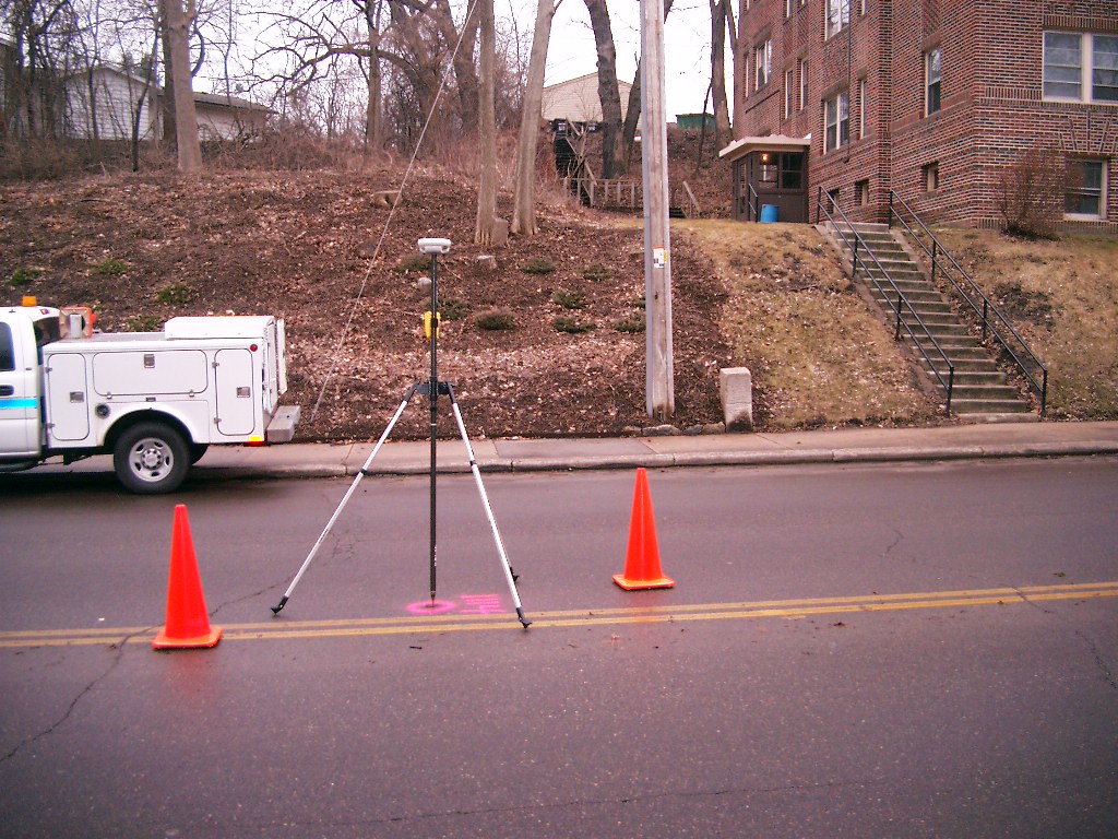
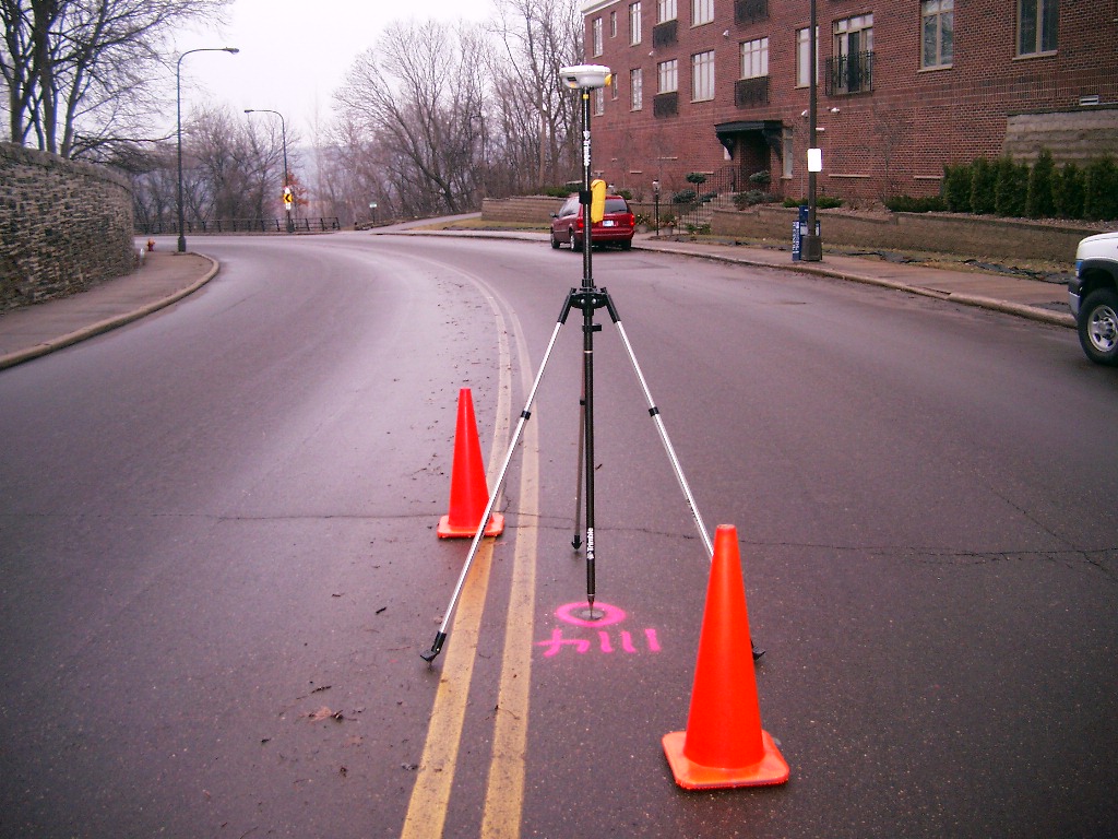
| 3/30/2006 | Position on CIM established by RTK-VRS GPS. Elev 876.9 ft. Photos taken. |
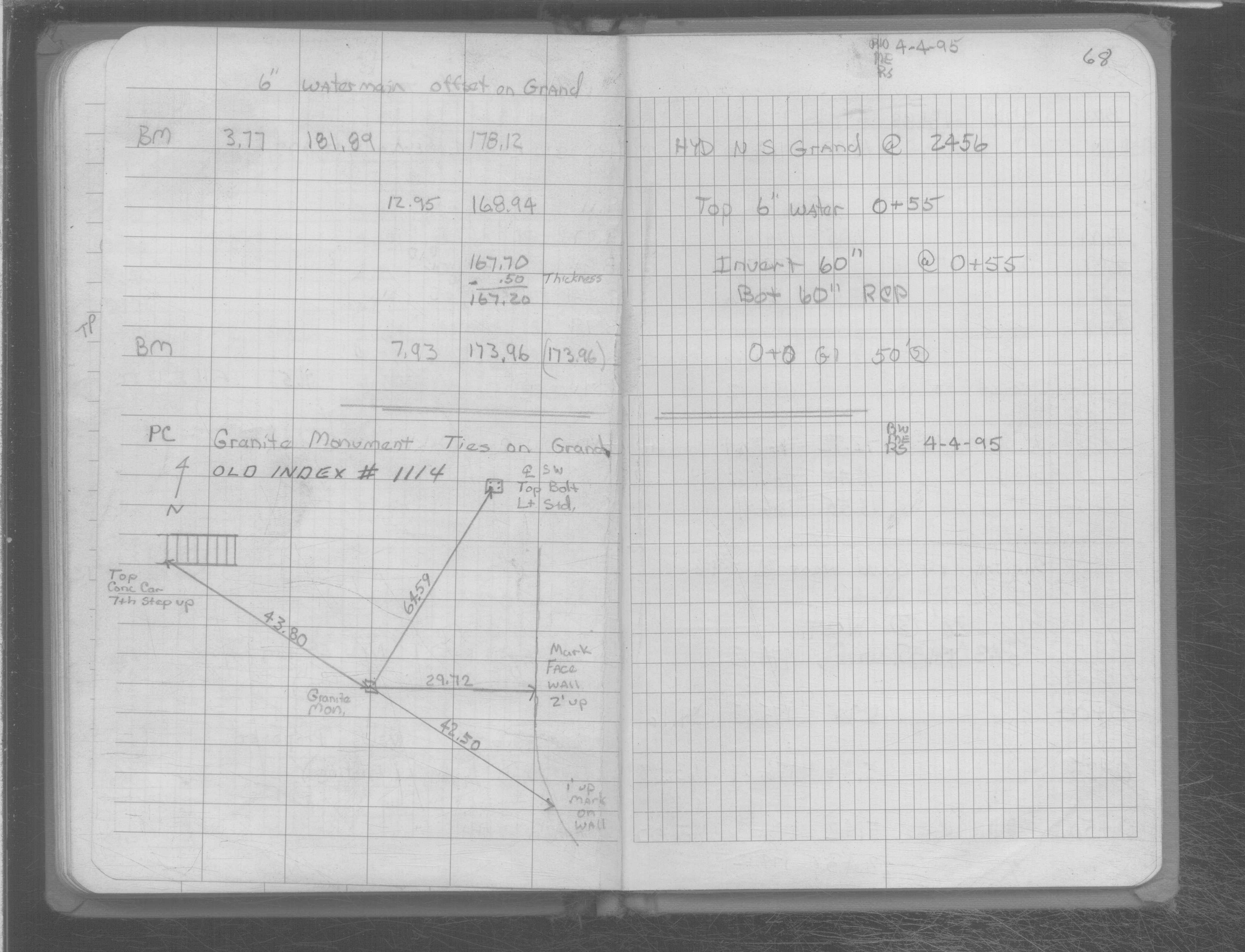
| 6/1/1995 | (Unknown date Jun __, 1995 ) See SB 666D p.68 GM at PC on Grand Ave S of Lincoln Ave |
| 4/4/1995 | Fd GM. Tied in SB 666D p.68 |
| 1/1/1995 | (Unknown date ___ __, 1995 ) Set CIM in concrete based from ties dated 04-04-1995. |
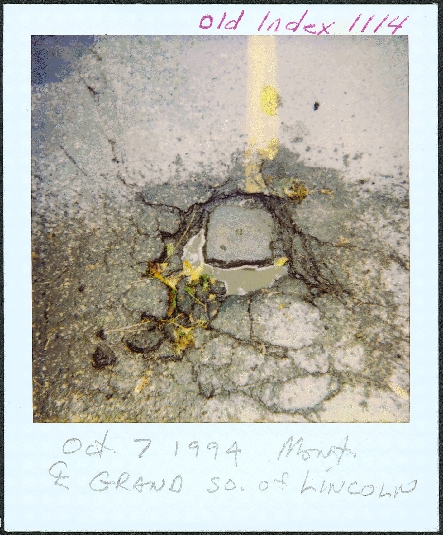
| 10/7/1994 | Fd GM. Photos taken. See Misc monument folder. |
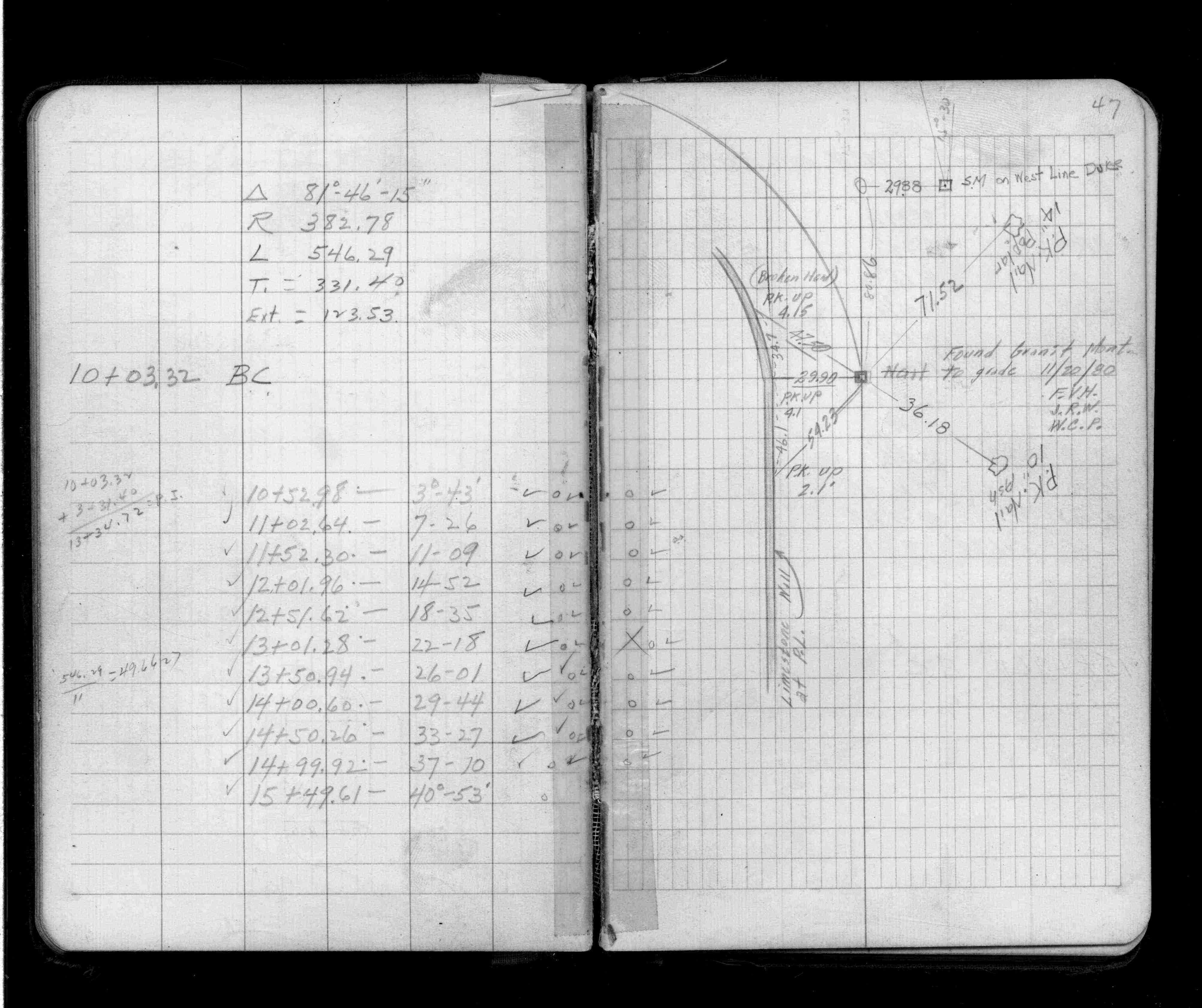
| 11/1/1980 | (Unknown date Nov __, 1980 ) Fd GM at grade. See FB 1389 p.47 |
| 1/1/1887 | (Unknown date ___ __, 1887 ) Monument set by Johnson as paved |
Above is NOT an all inclusive history of this point. Please review all the links below.
| PLS NOTES | Field | Cross Section | Sewer | J.B. Irvine | Monument | River Survey |
|---|---|---|---|---|---|---|
| FB 1389p.47 | SB 0666Dp.68 |
| FILE | PHOTO DATE | COMMENTS |
|---|---|---|
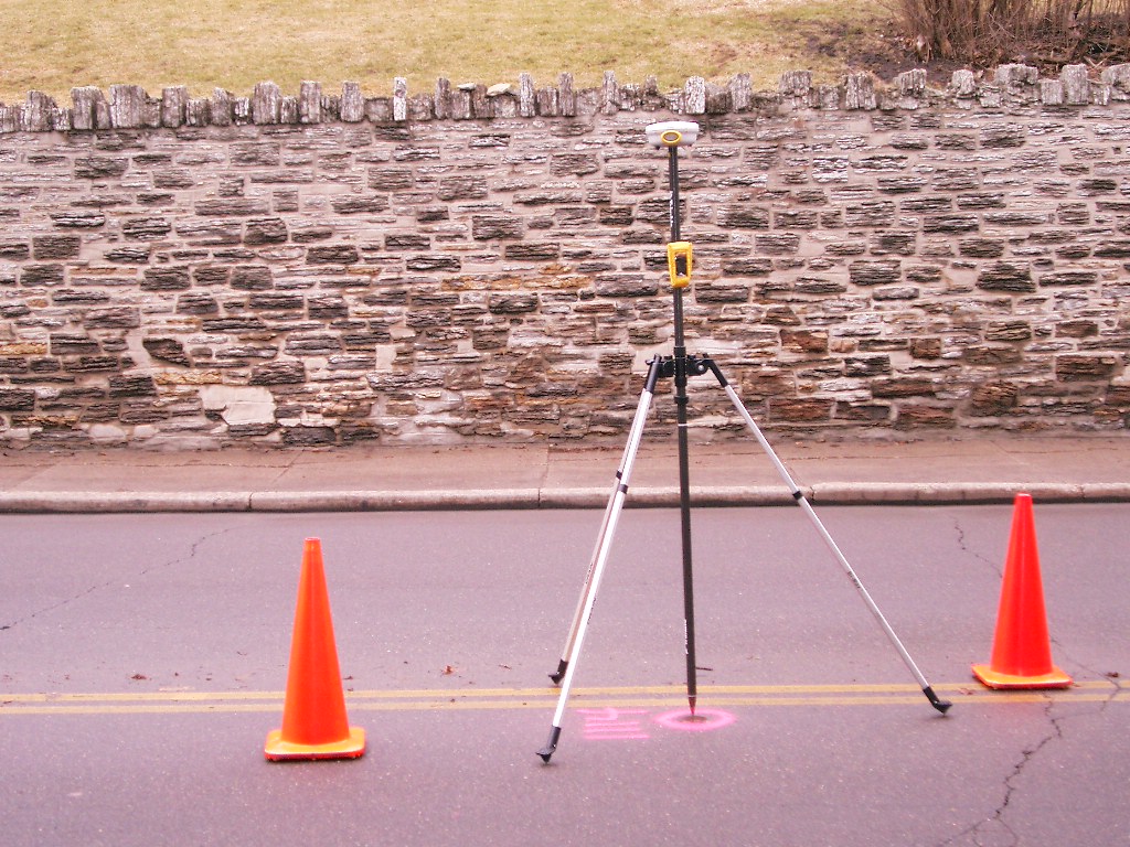
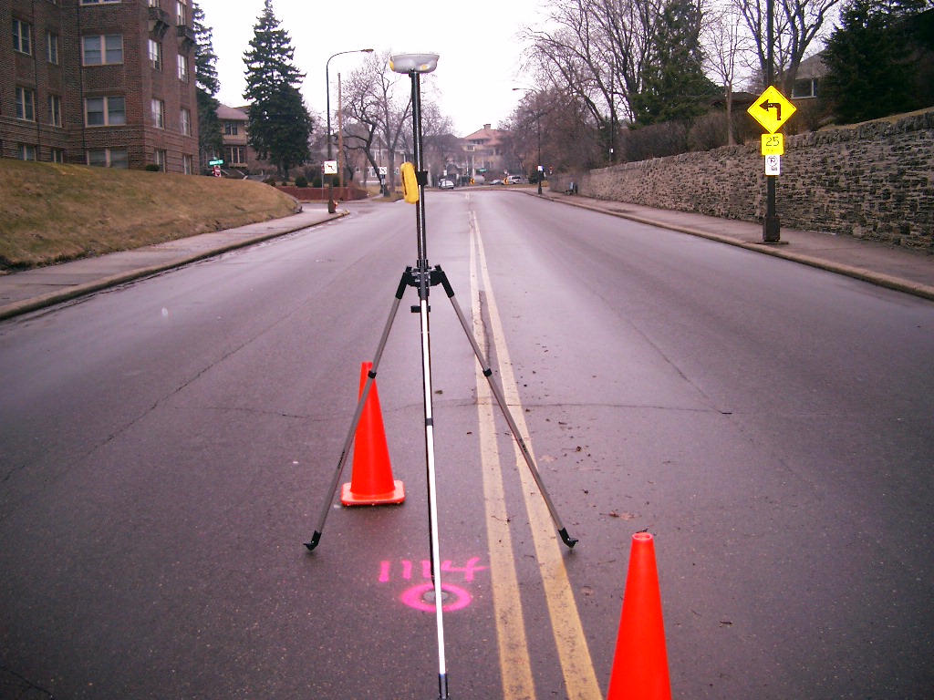
| 3820-1114-6.jpg | March 30, 2006 | looking Southwest perpendicular to Grand Ave. |
| 3820-1114-5.jpg | March 30, 2006 | looking Southeast along Grand Ave. |
| 3820-1114-4.jpg | March 30, 2006 | looking Northeast perpendicular to Grand Ave. |
| 3820-1114-3.jpg | March 30, 2006 | looking Northwest along Grand Ave. |
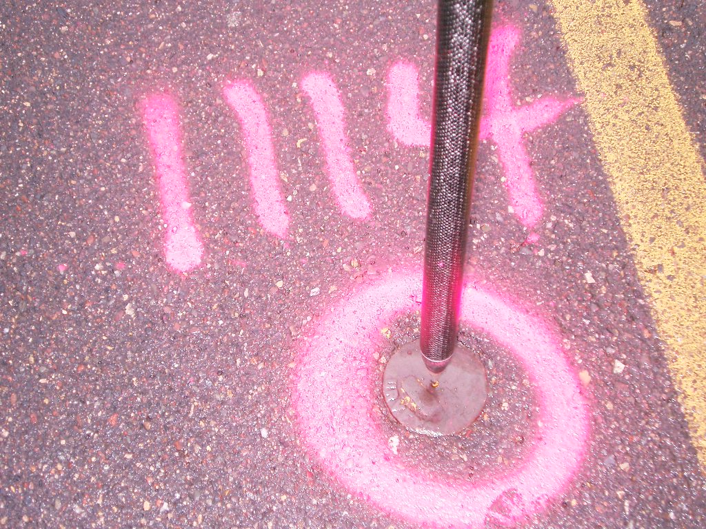
| 3820-1114-2.jpg | March 30, 2006 | Close-up of the cast iron monument. |
| 3820-1114-8.jpg | October 7, 1994 | Close-up of the granite monument. |
| 3820-1114-7.jpg | October 7, 1994 | Close-up of the granite monument. |