| NAD83 COORDINATES (1986 adj.): |
|---|
| X= 550753.575 Y= 150956.389 Z= 210.4 05/16/2006 RTK-VRS |
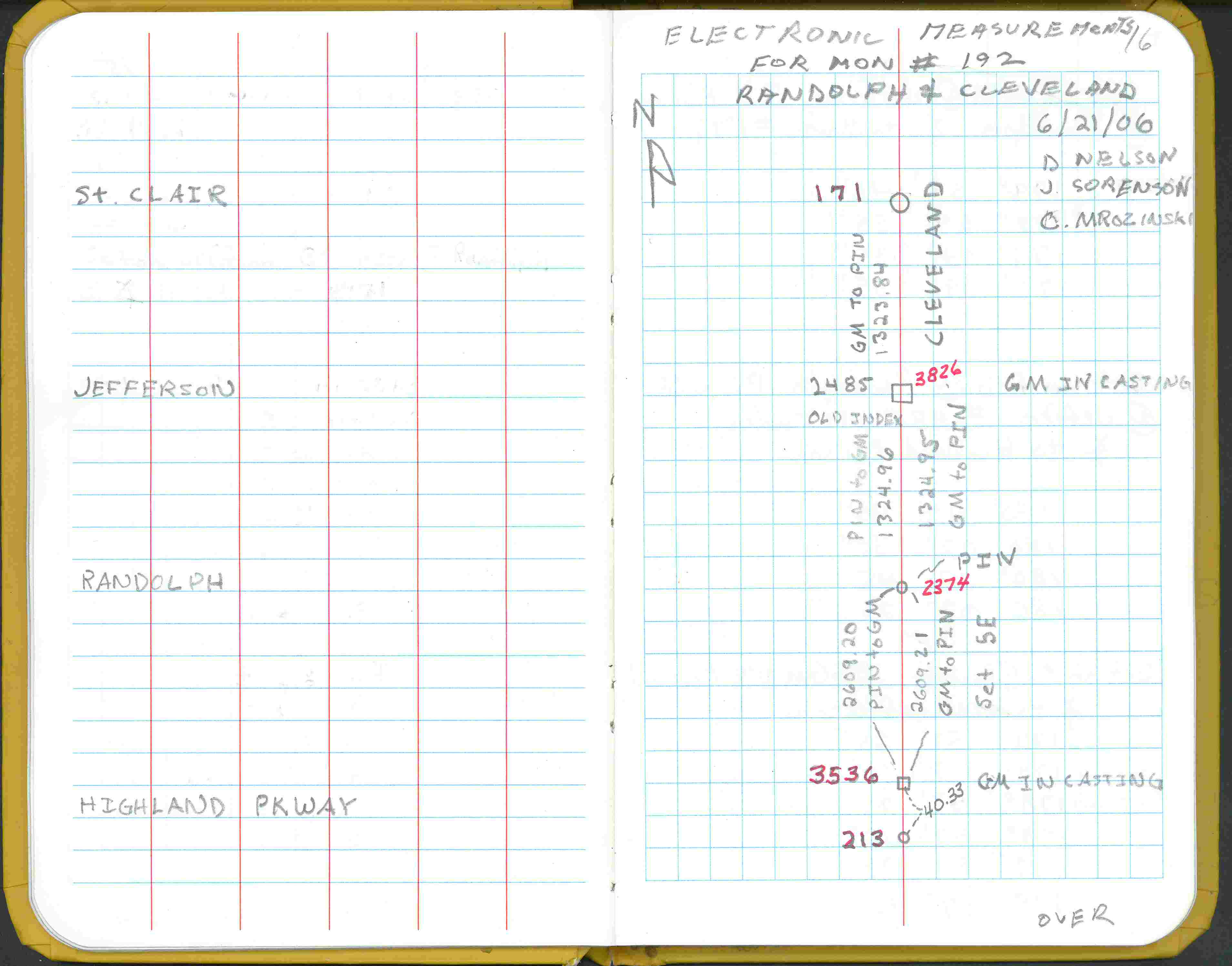
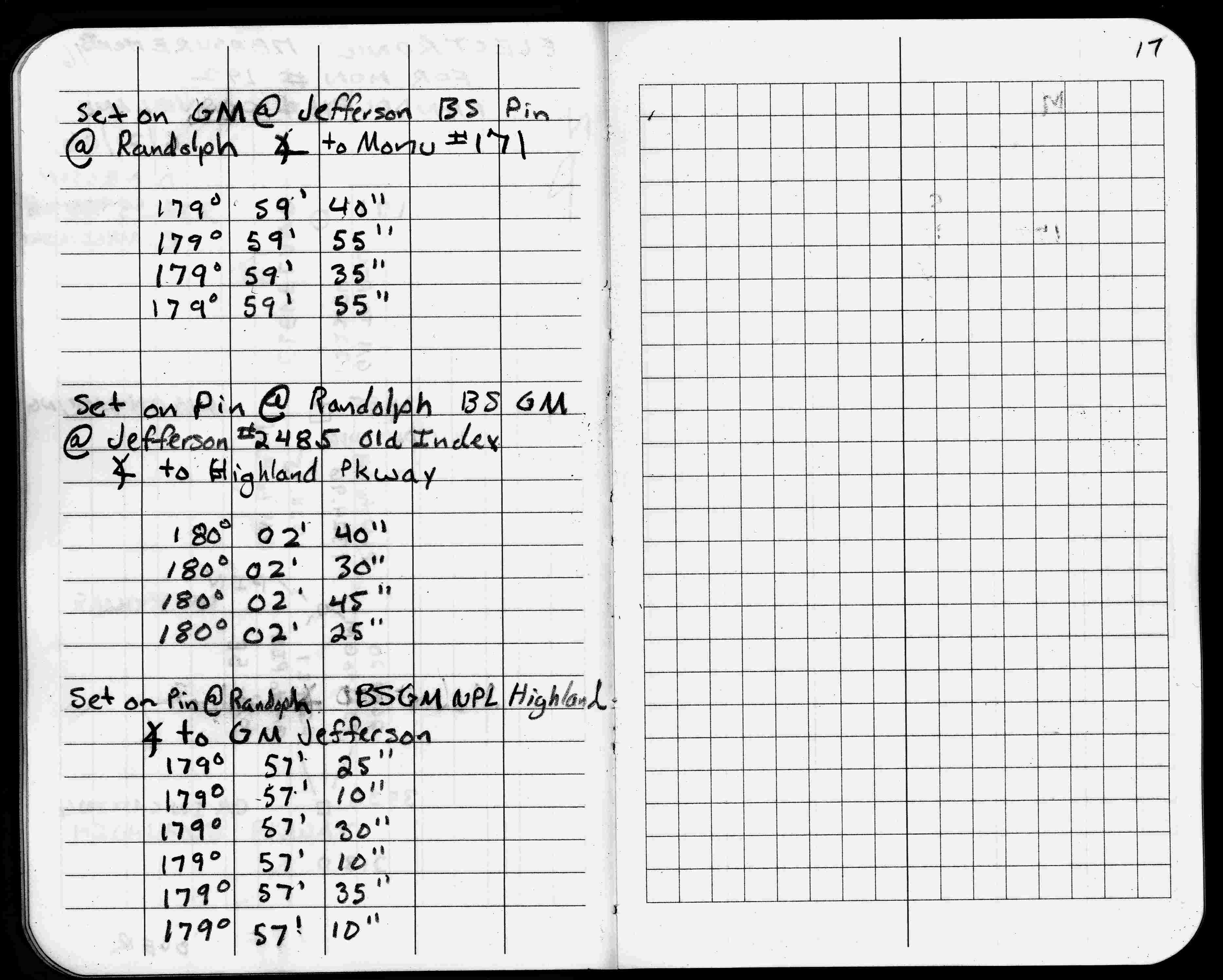
| 6/21/2006 | Electronic meas. on Cleveland btwn St Clair & Jefferson. See FB 1738 p.16,17 |
| 6/21/2006 | Electronic meas. on Cleveland btwn Randolph & Jefferson. See FB 1738 p.16,17 |
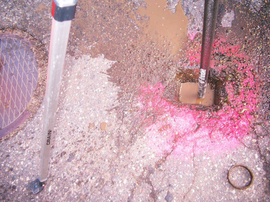
| 5/26/2006 | Photos taken of GM in the casting. |
| 5/25/2006 | Placed small MH casting over GM. |
| 5/16/2006 | Position on GM established by RTK-VRS GPS Elev 904.5 ft Photos taken. |
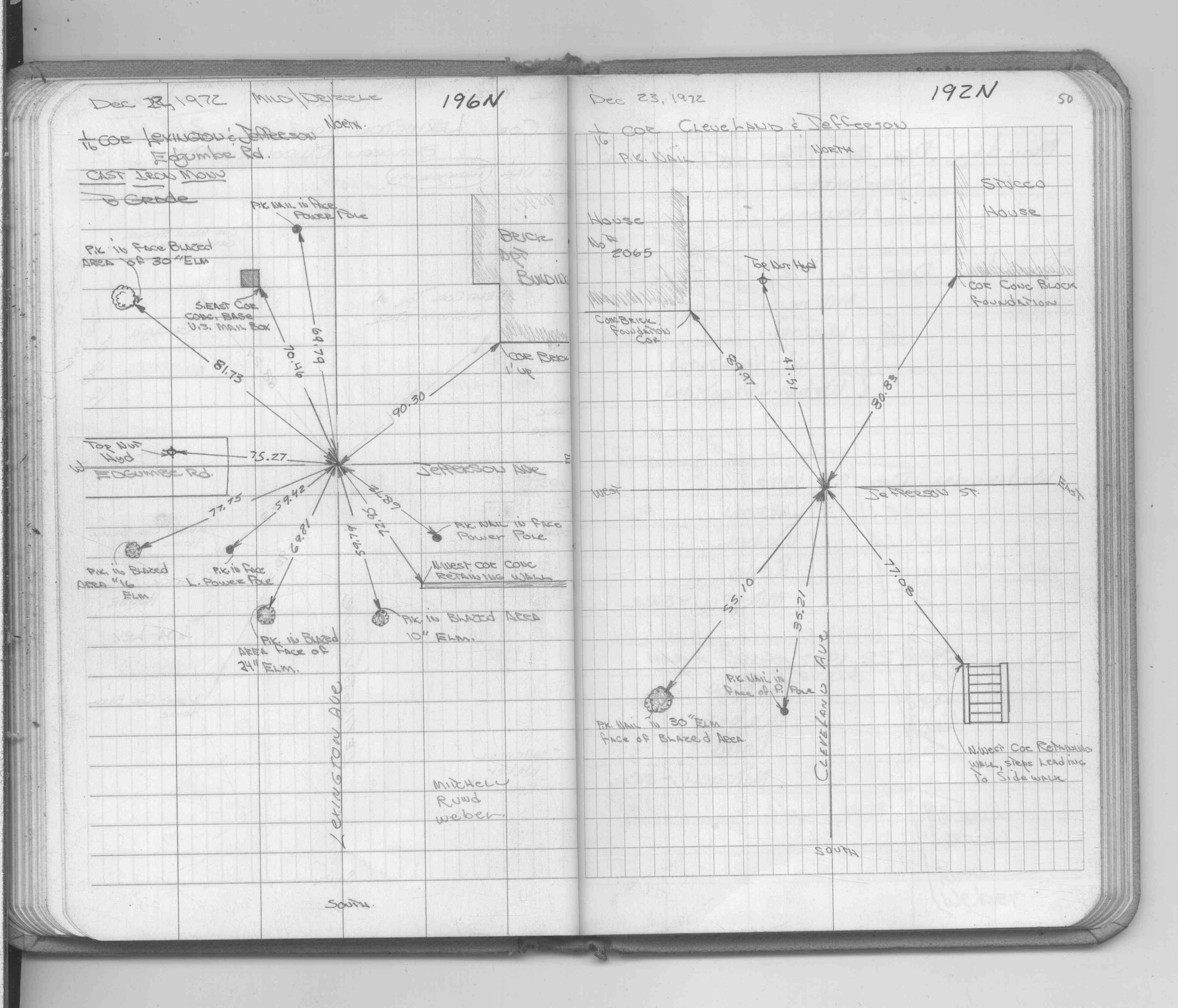
| 12/1/1972 | (Unknown date Dec __, 1972 ) See CofL 3826-2485-A, copied from FB 1689A p.50 |
| 12/1/1972 | (Unknown date Dec __, 1972 ) Placed ties on pk nail. See FB 1689A p.50 |
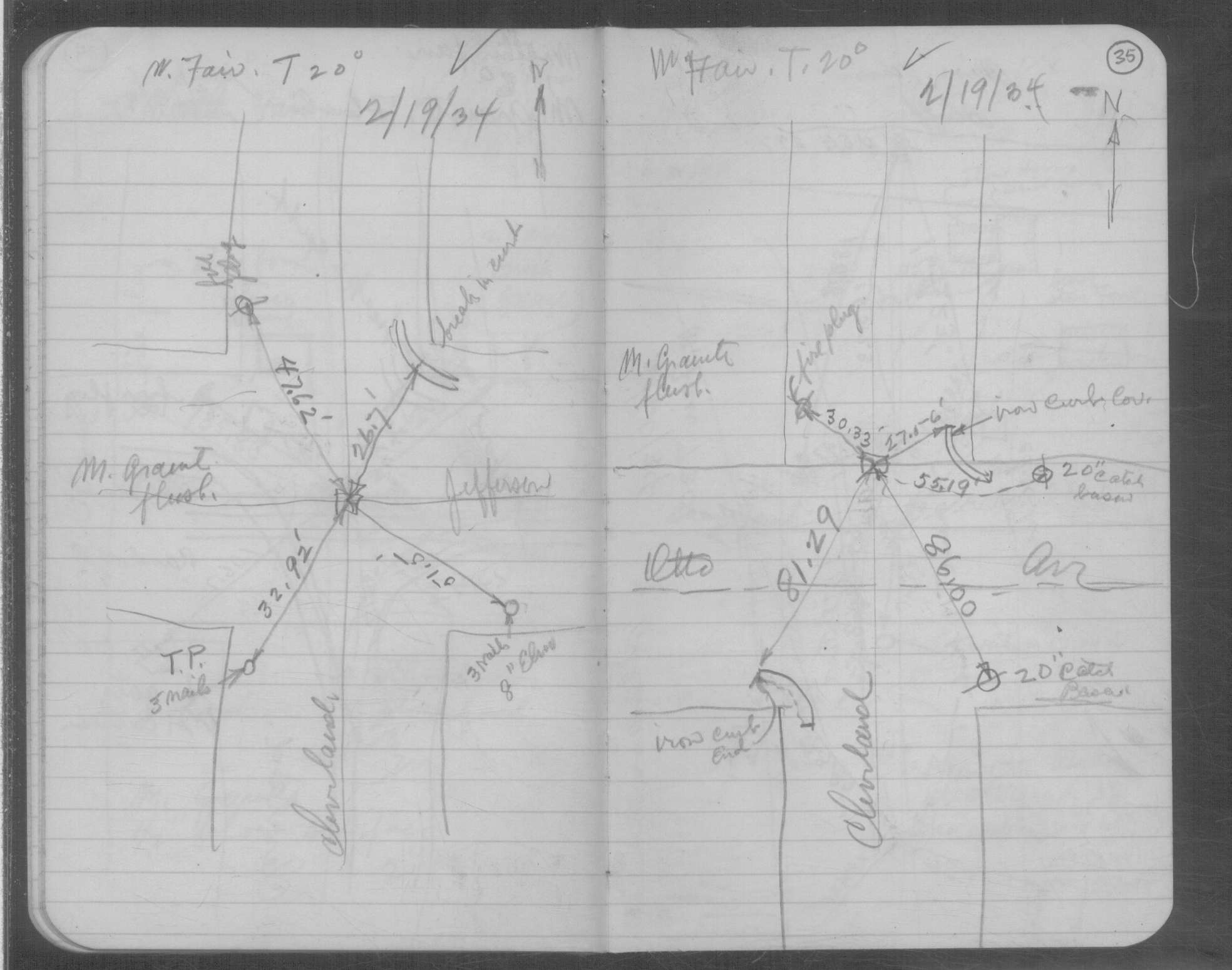
| 2/19/1934 | Placed ties on the GM at grade. See book MSX 4 p.35 |
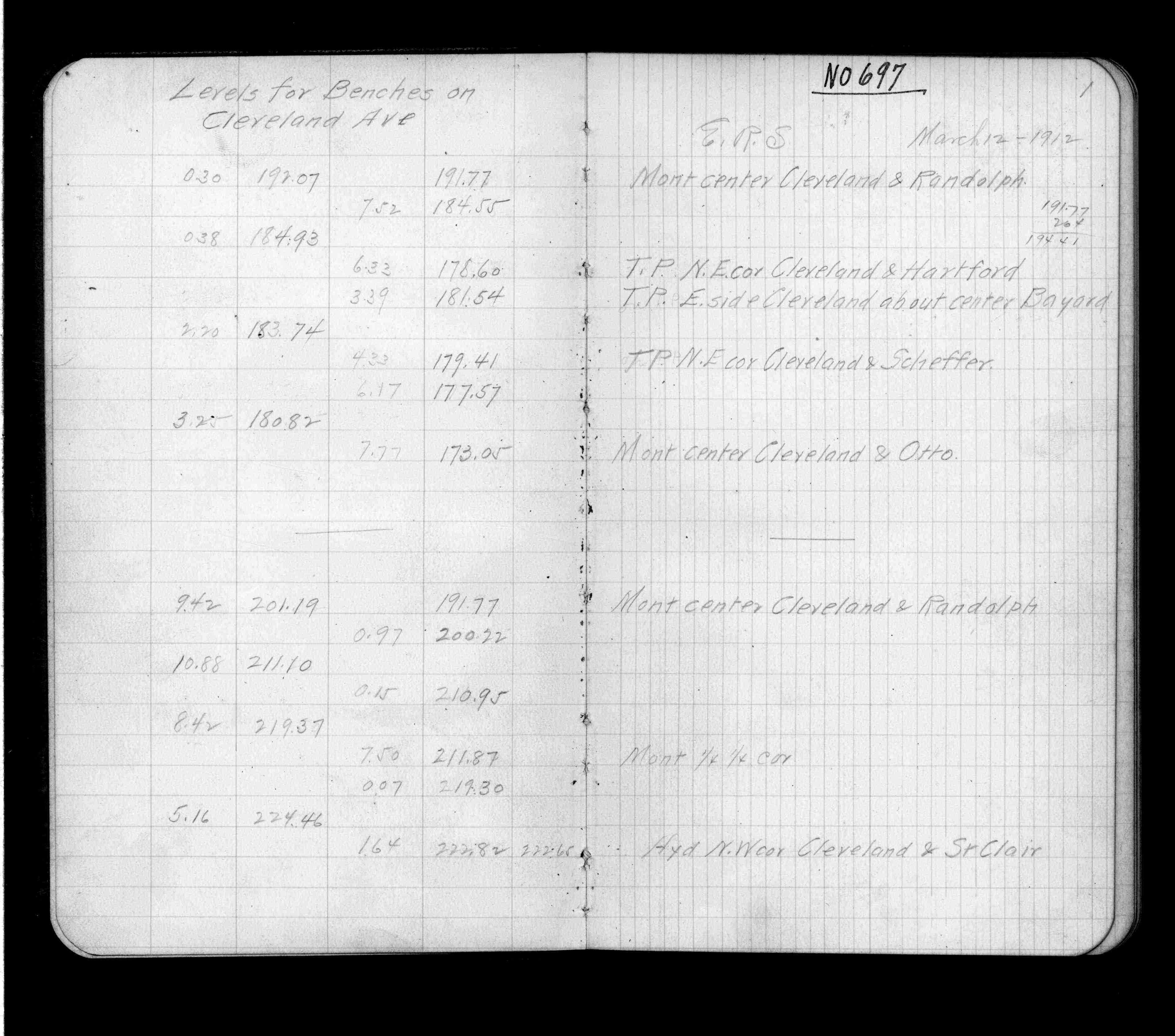
| 3/12/1912 | Elev 211.87 ft. See FB 697 p.1 |
| 12/23/1891 | Monument set by J B Irvine |
Above is NOT an all inclusive history of this point. Please review all the links below.
| PLS NOTES | Field | Cross Section | Sewer | J.B. Irvine | Monument | River Survey |
|---|---|---|---|---|---|---|
| FB 0697p.01 | MSX 0004 p.035 | |||||
| FB 1689Ap.50 | ||||||
| FB 1738p. 16 ,17 |
| FILE | SURVEYOR | LIC. NO. | DATE SIGNED | DATE TIED |
|---|---|---|---|---|
| 3826-2485-A.tif | none | none | none | none |
| FILE | PHOTO DATE | COMMENTS |
|---|---|---|
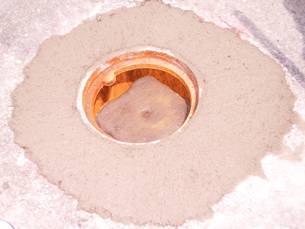
| 3826-2485-9.jpg | May 26, 2006 | Close-up of the granite monument. |
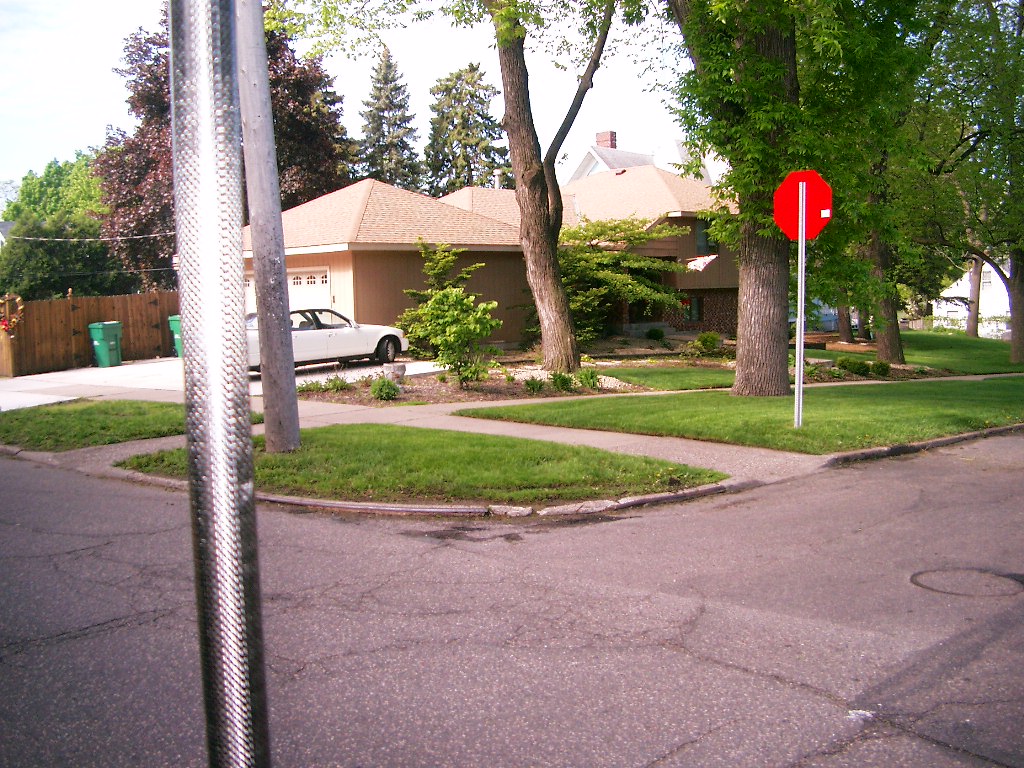
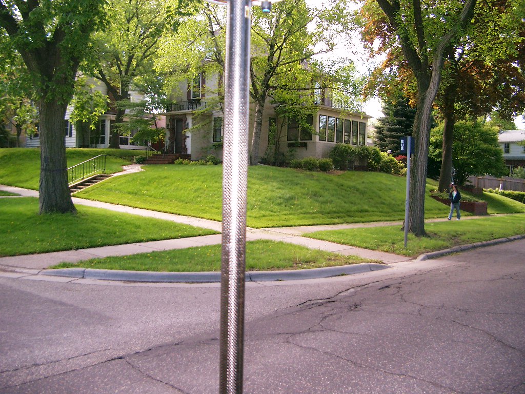
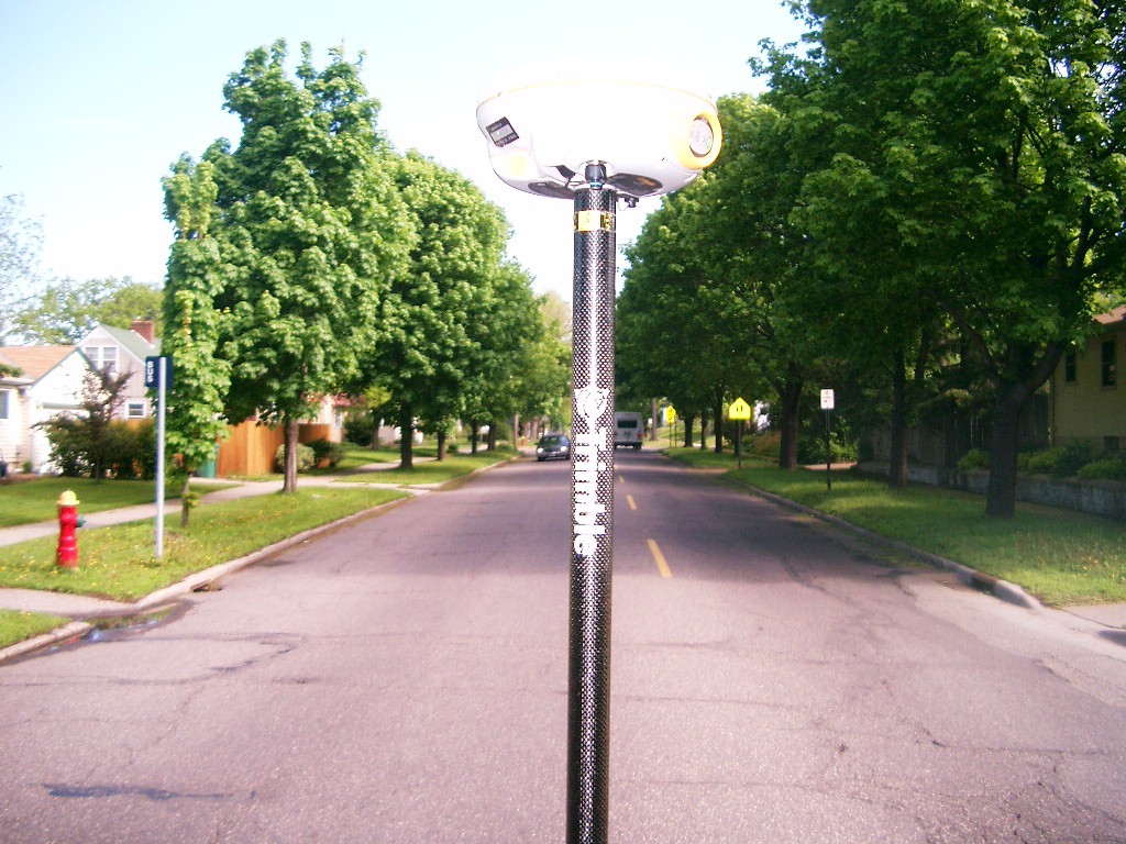
| 3826-2485-8.jpg | May 16, 2006 | Looking Southwest at Cleveland Ave. & Jefferson Ave. |
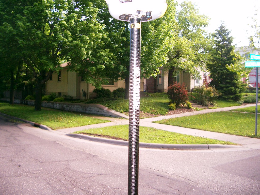
| 3826-2485-6.jpg | May 16, 2006 | Looking Southeast at Cleveland Ave. & Jefferson Ave. |
| 3826-2485-5.jpg | May 16, 2006 | Looking Northeast at Cleveland Ave. & Jefferson Ave. |
| 3826-2485-4.jpg | May 16, 2006 | Looking North along Cleveland Ave. at Jefferson Ave. |
| 3826-2485-3.jpg | May 16, 2006 | Close-up of the granite monument. |