| NAD83 COORDINATES (1986 adj.): |
|---|
| X= 561278.577 Y= 150633.055 Z= 920.0 08/18/2006 RTK-VRS |
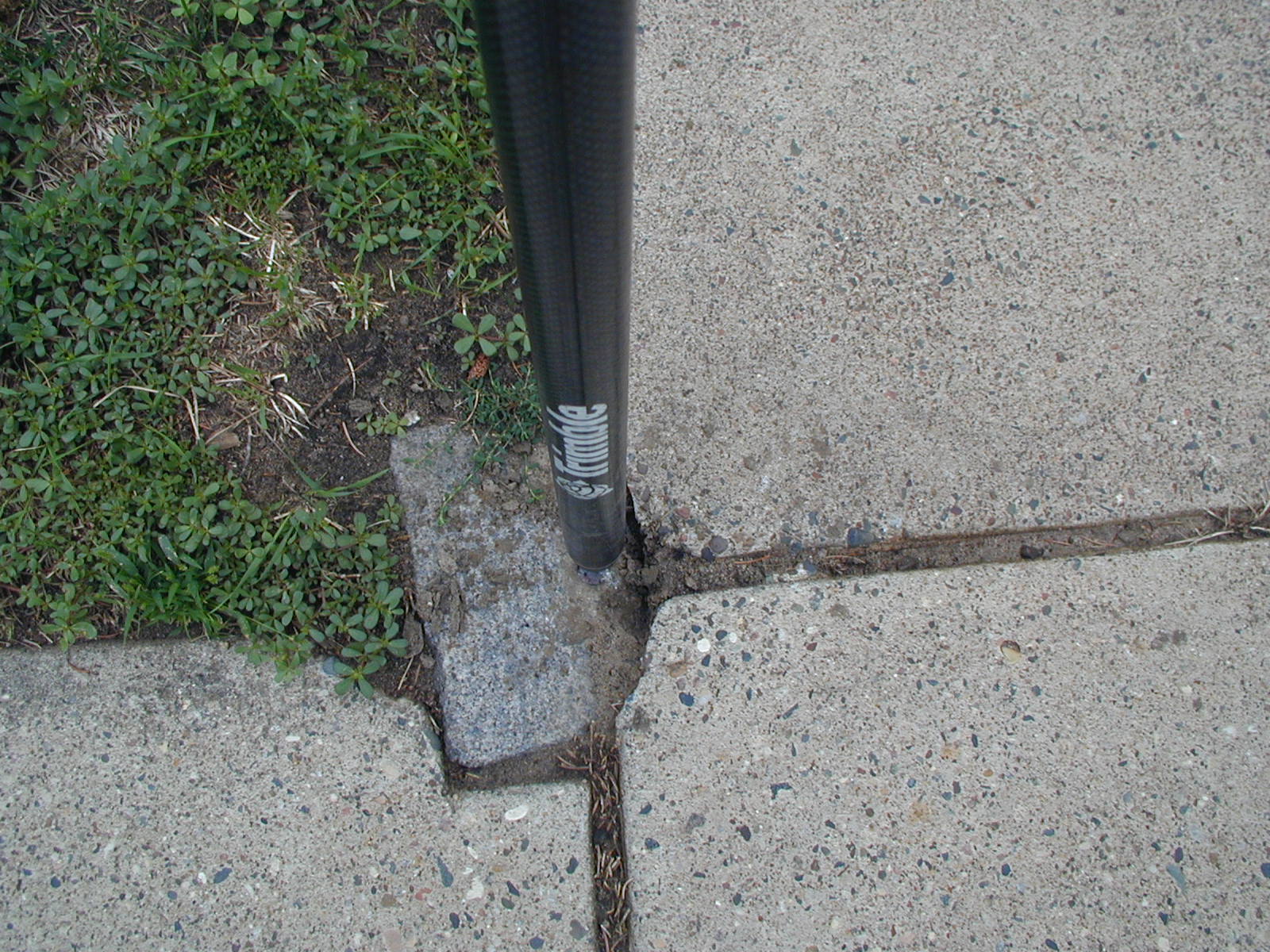
| 11/27/2012 | Found GM at sidewalk grade. |
| 12/28/2006 | Fd GM 0.35 ft below grade. Placed ties. See CofL 3831-1613A-A |
| 8/18/2006 | Position on GM established by RTK-VRS GPS. Elev 920.0 ft |
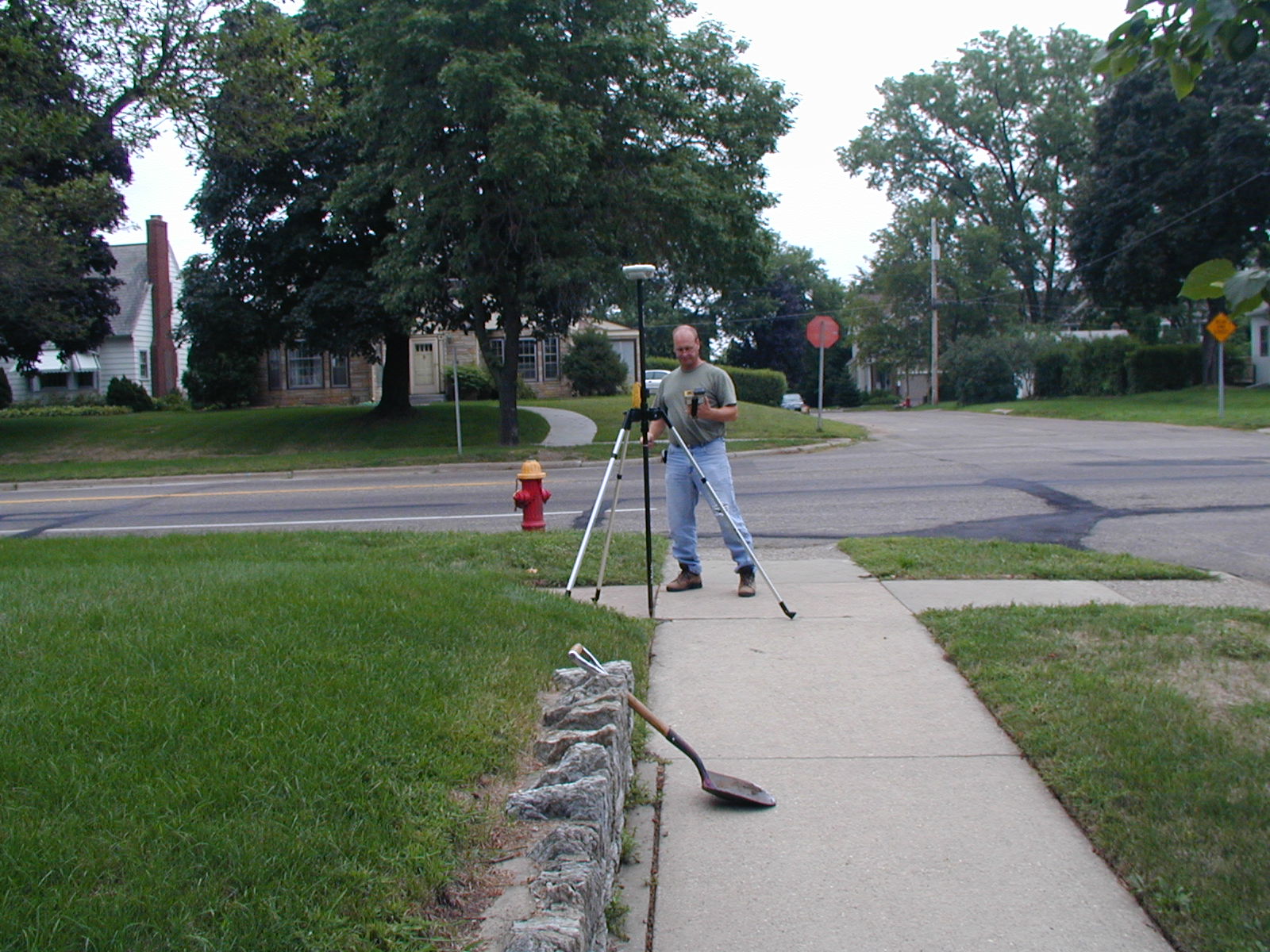
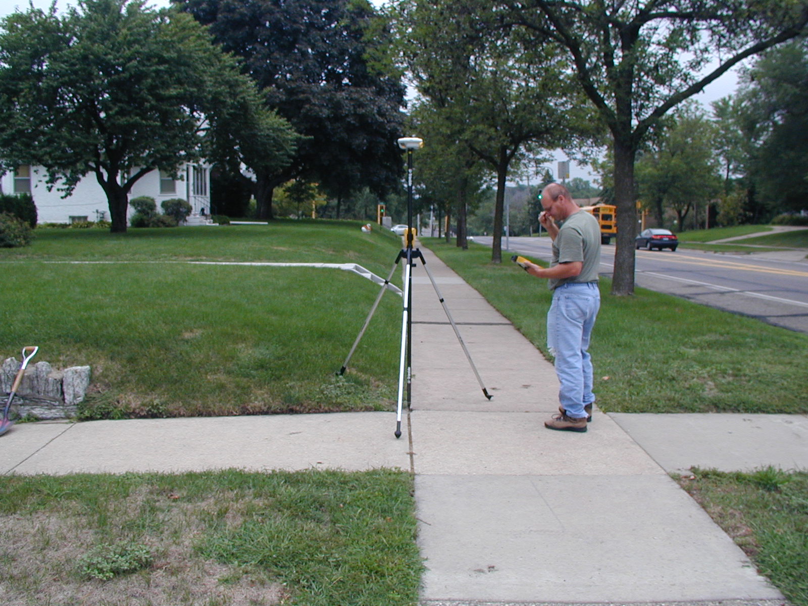
| 8/17/2006 | Fd GM at grade. Photos taken. |
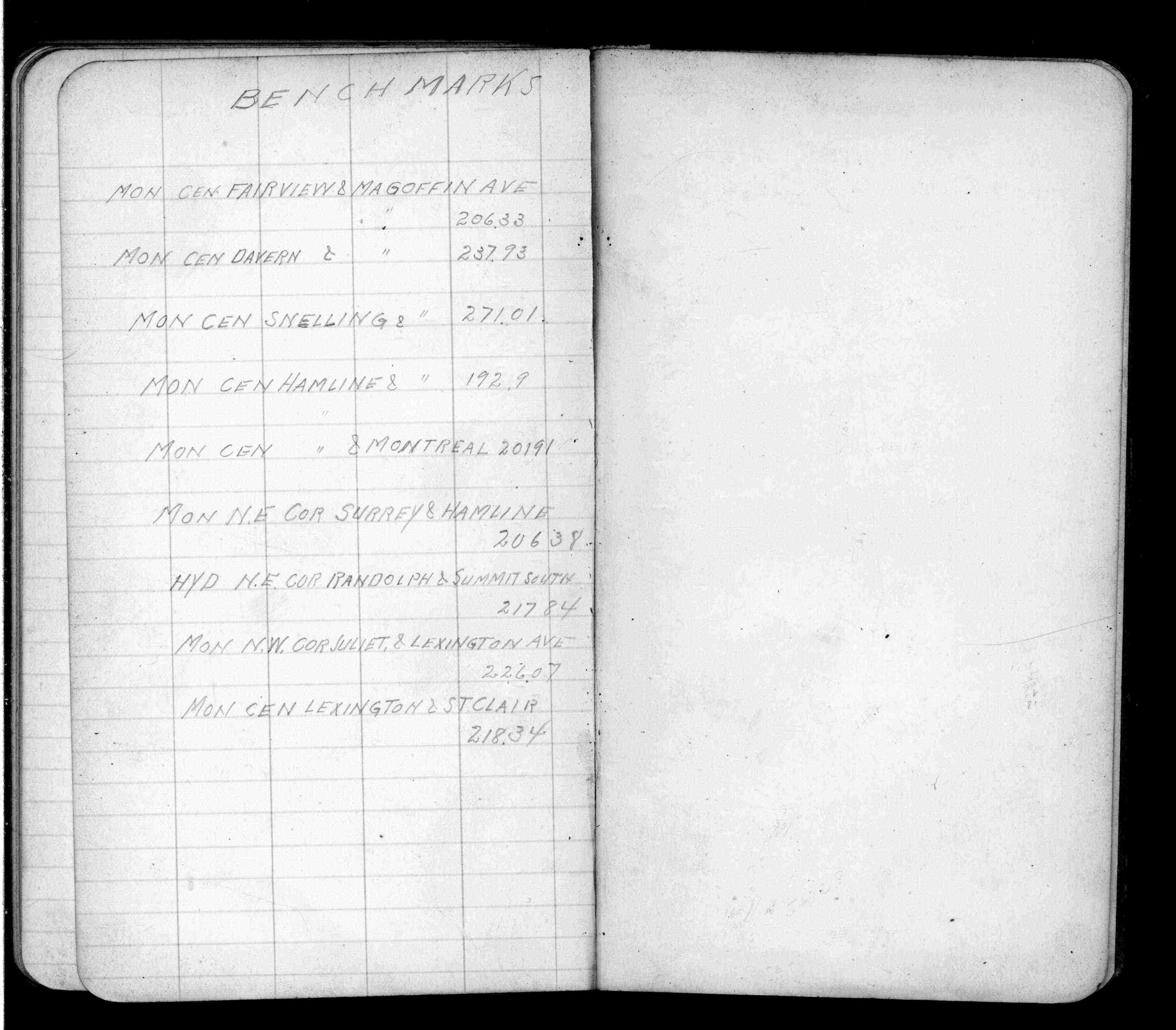
| 1/1/1912 | Recorded elevation of 226.07 on the monument. See FB 675 p.79 |
| 8/21/1889 | Monument set by McCoy after grading |
Above is NOT an all inclusive history of this point. Please review all the links below.
| PLS NOTES | Field | Cross Section | Sewer | J.B. Irvine | Monument | River Survey |
|---|---|---|---|---|---|---|
| FB 0675p.79 |
| FILE | SURVEYOR | LIC. NO. | DATE SIGNED | DATE TIED |
|---|---|---|---|---|
| 3831-1613A-A.tif | none | none | none | December 28, 2006 |
| FILE | PHOTO DATE | COMMENTS |
|---|---|---|
| 3831-1613A-4.jpg | August 17, 2006 | Looking South along the West side of Lexington Pkwy. |
| 3831-1613A-3.jpg | August 17, 2006 | Looking West along the North side of Juliet Ave. |
| 3831-1613A-3.jpg | August 17, 2006 | Looking East along the North side of Juliet Ave. |
| 3831-1613A-2.jpg | August 17, 2006 | Looking North along the West side of Lexington Pkwy. |
| 3831-1613A-1.jpg | August 17, 2006 | Close-up of the granite monument. |