| NAD83 COORDINATES (1986 adj.): |
|---|
| X= 573225.63 Y= 150997.41 Z= 888.8 01/12/2007 RTK-VRS |
| 1/12/2007 | Position on GM established by RTK-VRS GPS Elev 888.8 ft. |
| 1/4/2007 | Photos taken. |
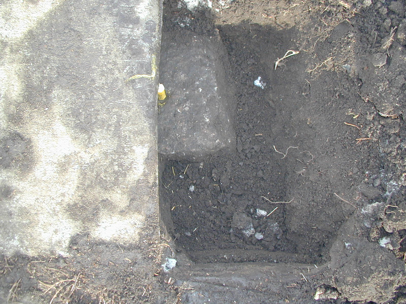
| 1/2/2007 | Placed ties on GM 0.30 ft below walk. See CofL 3837-2745-A |
| 1/1/1900 | (Unknown date Jan __, 1900 ) Monument set by F J McCarron |
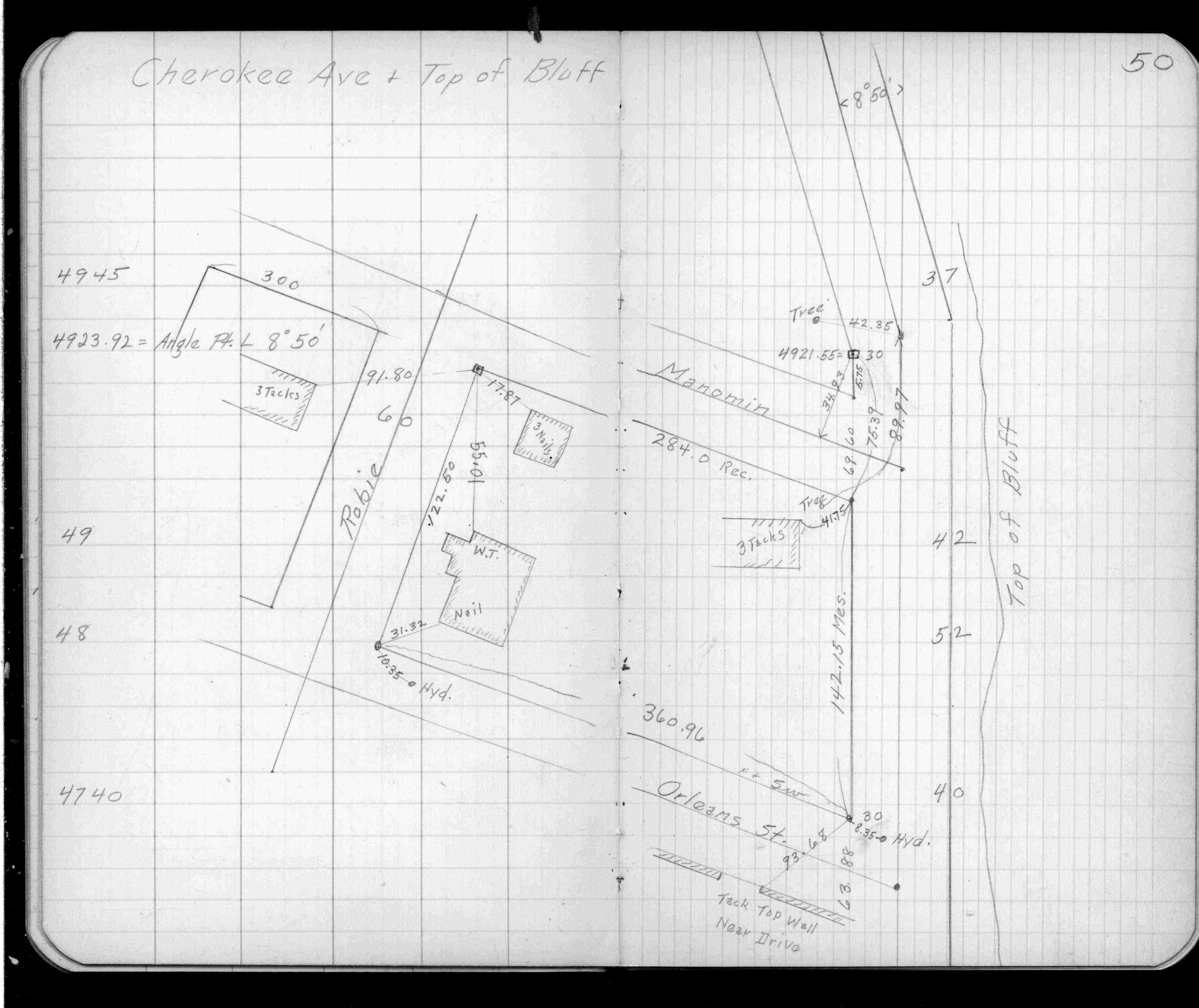
| 5/1/1890 | (Unknown date May __, 1890 ) Placed ties. See FB 320 p.50 |
Above is NOT an all inclusive history of this point. Please review all the links below.
| PLS NOTES | Field | Cross Section | Sewer | J.B. Irvine | Monument | River Survey |
|---|---|---|---|---|---|---|
| FB 0320p.50 |
| FILE | SURVEYOR | LIC. NO. | DATE SIGNED | DATE TIED |
|---|---|---|---|---|
| 3837-2745-A.tif | none | none | none | January 2, 2007 |
| FILE | PHOTO DATE | COMMENTS |
|---|---|---|
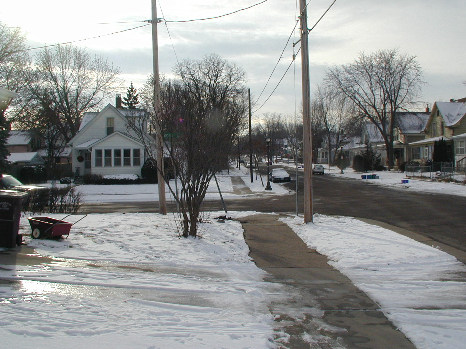
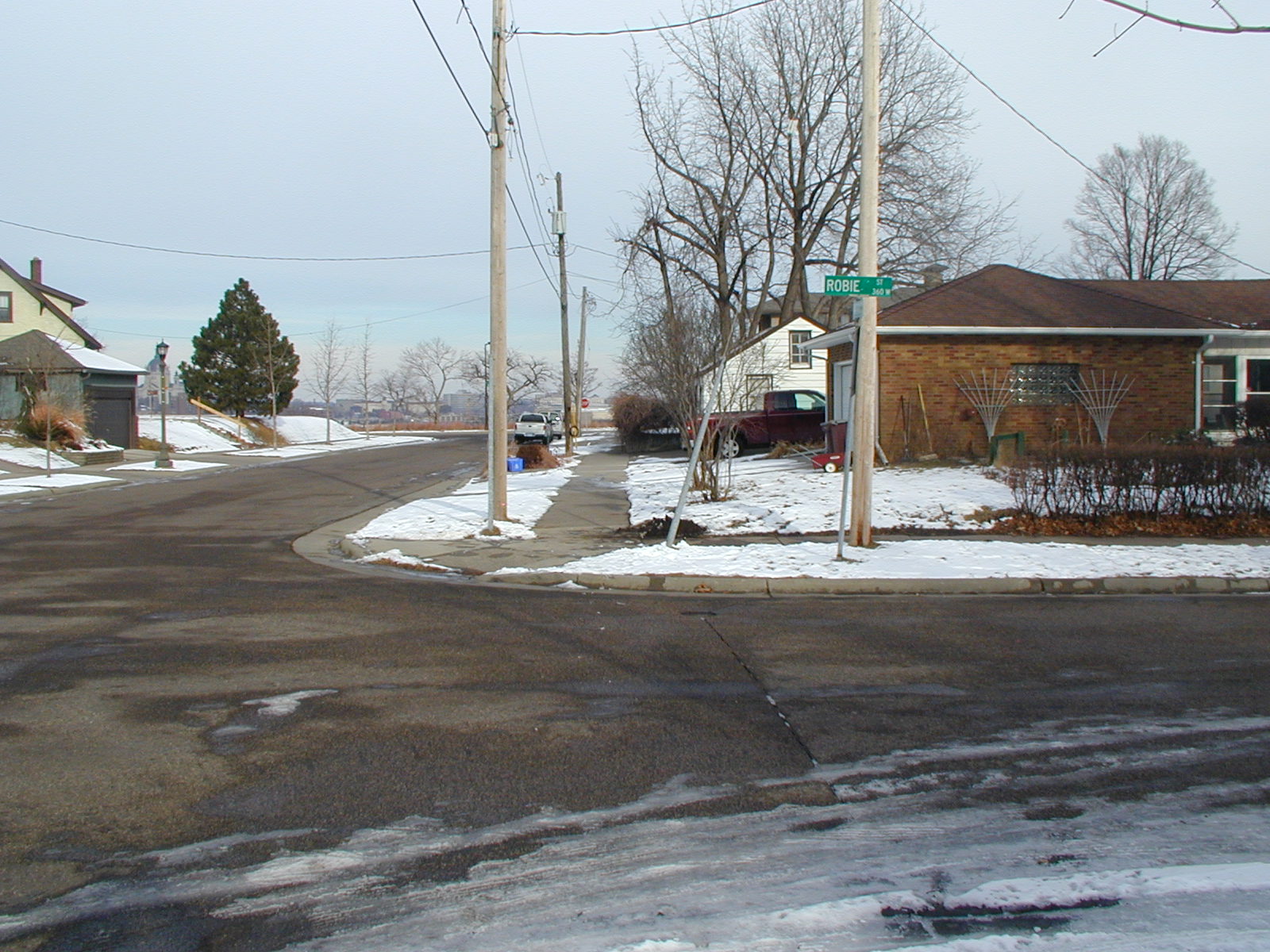
| 3837-2745-5.jpg | January 4, 2007 | Looking West along the North side of Robie St. |
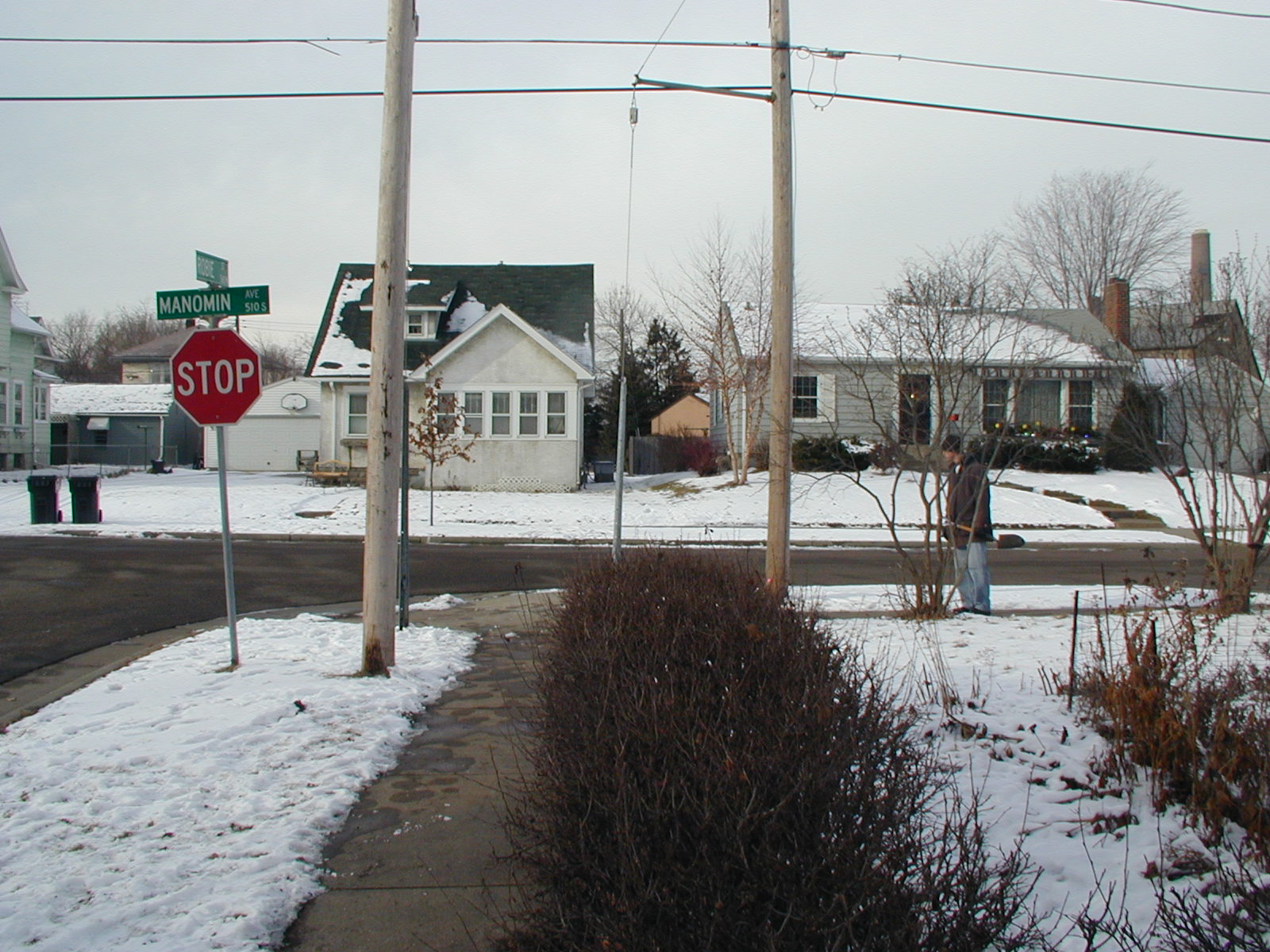
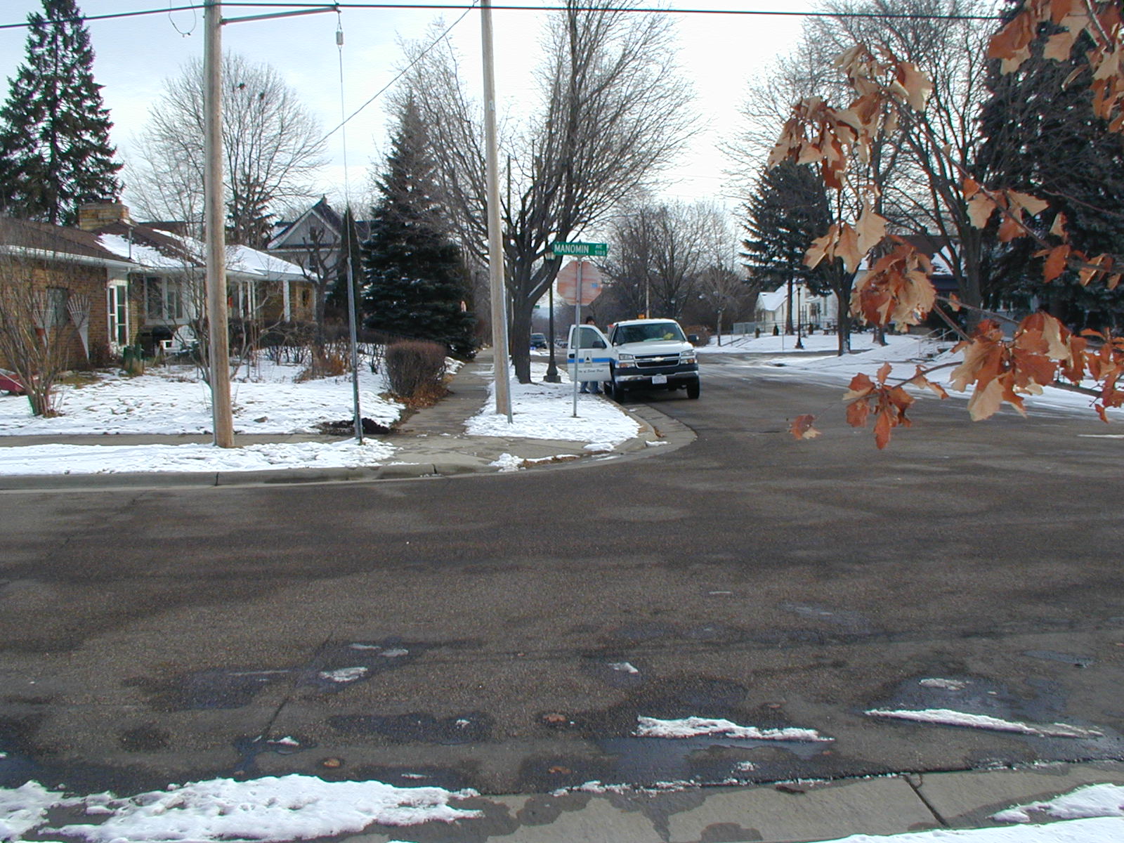
| 3837-2745-4.jpg | January 4, 2007 | Looking South along the East side of Manomin Ave. |
| 3837-2745-3.jpg | January 4, 2007 | Looking East along the North side of Robie St. |
| 3837-2745-2.jpg | January 4, 2007 | Looking North along the East side of Manomin Ave. |
| 3837-2745-1.jpg | January 4, 2007 | Close-up of GM under sidewalk. |