| NAD83 COORDINATES (1986 adj.): |
|---|
| X= 584768.77 Y= 166169.63 Z= 904.3 03/13/2007 RTK-VRS |
| 4/13/2007 | Position on GM established by RTK-VRS GPS Elev 904.3 ft. |
| 4/13/2007 | Photos taken. |
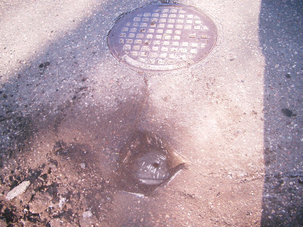
| 4/13/2007 | Fd GM 0.2 ft below grade, Placed ties. See CofL 3846-1655-B |
| 9/14/1995 | Fd GM 0.2 ft below grade, placed ties, left monument as fd. See CofL xxxx-1655-A |
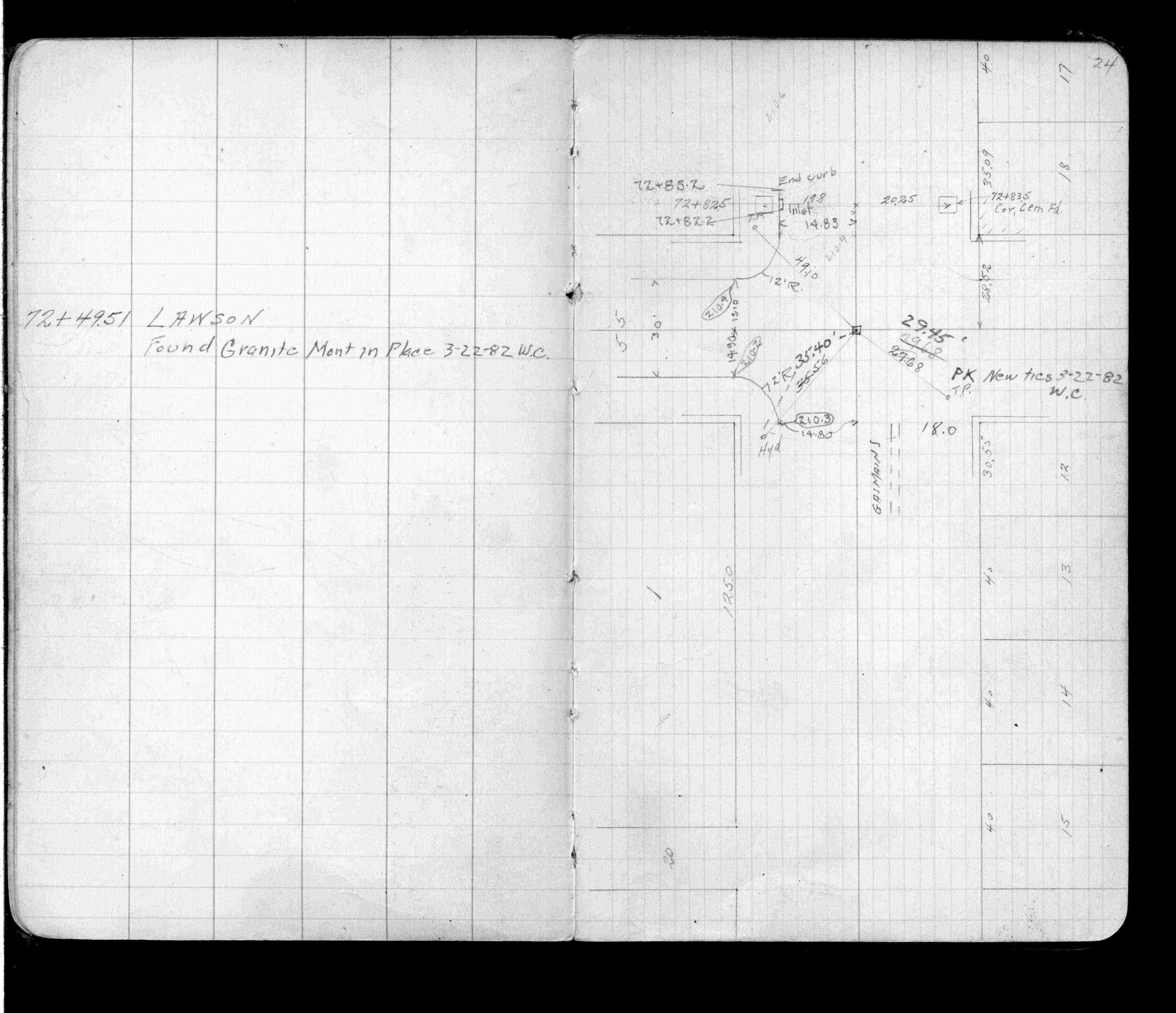
| 3/1/1982 | (Unknown date Mar __, 1982 ) Placed ties on GM. See FB 1055 p.24 |
| 10/5/1889 | Monument set by J H Armstrong. see FB 298 |
Above is NOT an all inclusive history of this point. Please review all the links below.
| PLS NOTES | Field | Cross Section | Sewer | J.B. Irvine | Monument | River Survey |
|---|---|---|---|---|---|---|
| FB 1055p.24 |
| FILE | SURVEYOR | LIC. NO. | DATE SIGNED | DATE TIED |
|---|---|---|---|---|
| 3846-1655-B.pdf | Samuel D. Gibson | 44880 | April 30, 2007 | April 13, 2007 |
| 3846-1655-A.tif | none | none | none | none |
| FILE | PHOTO DATE | COMMENTS |
|---|---|---|
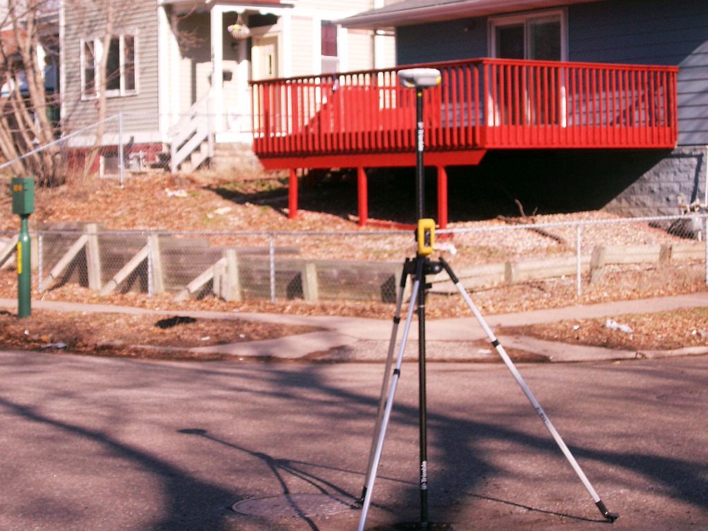
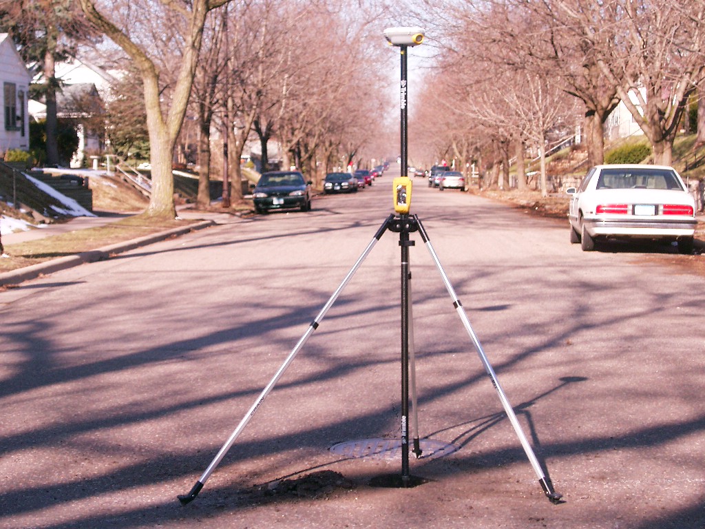
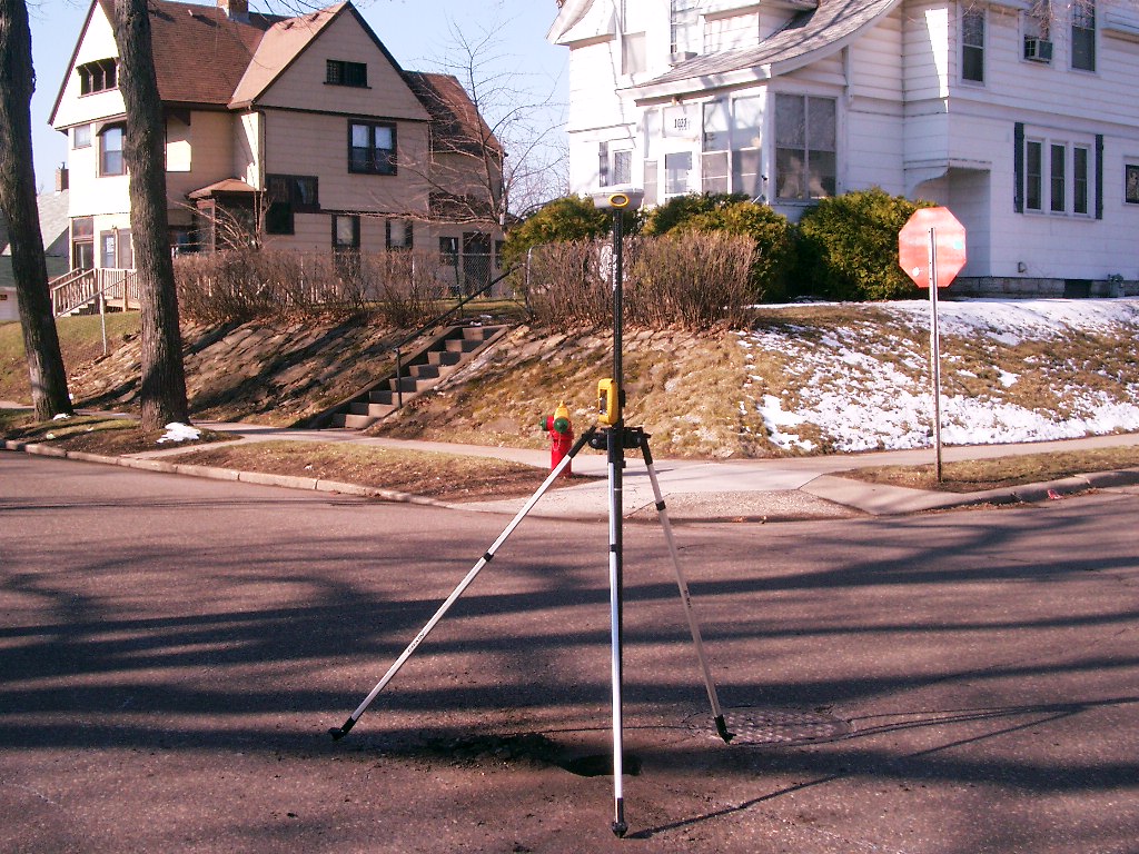
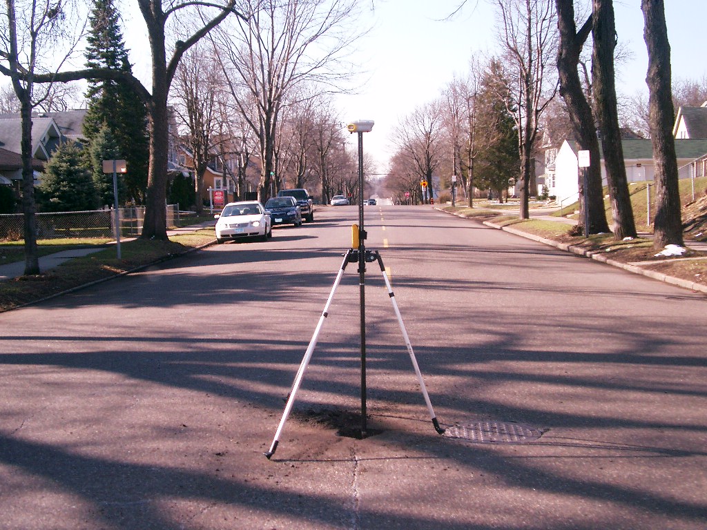
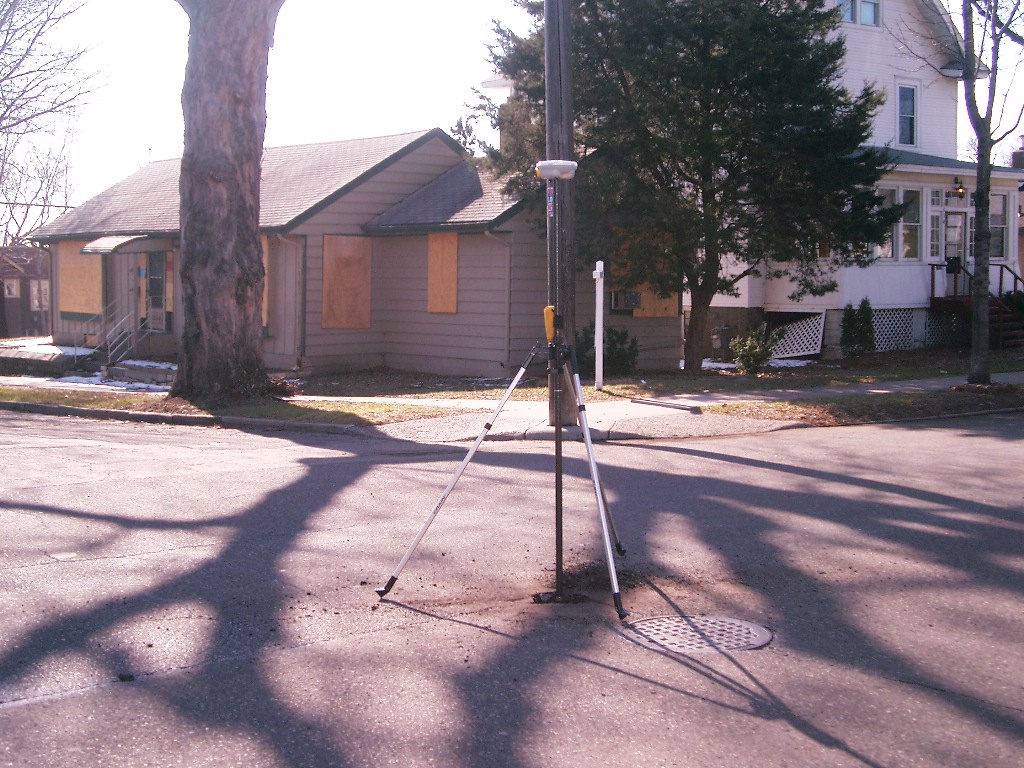
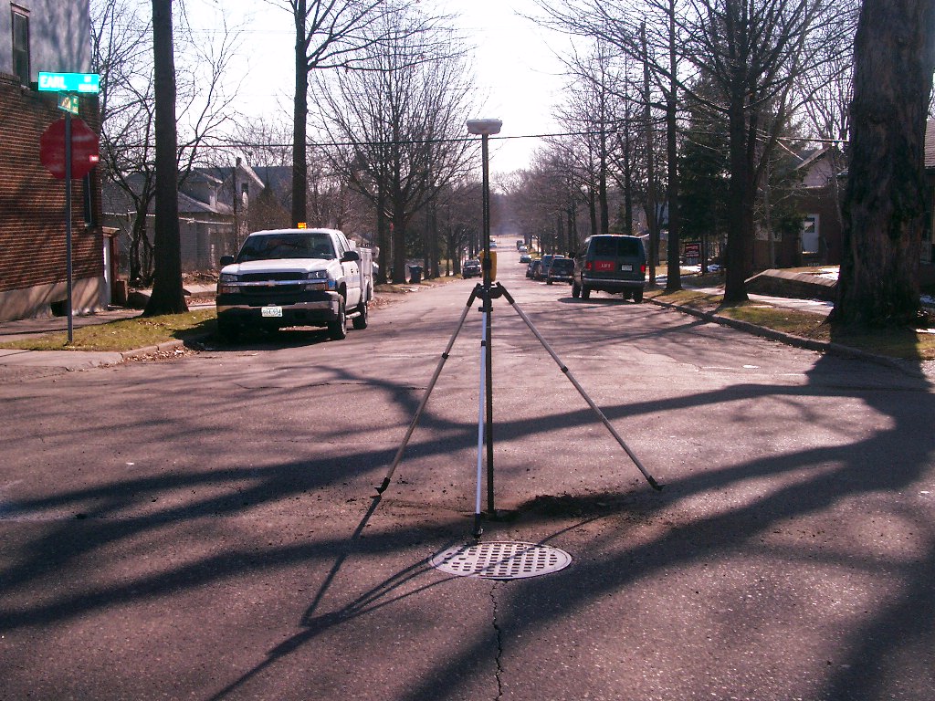
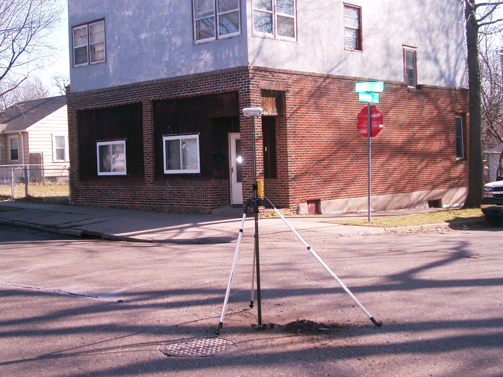
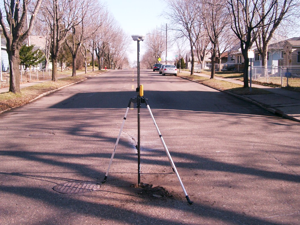
| 3846-1655-9.jpg | April 13, 2007 | Looking Northwest from center of Earl-Lawson. |
| 3846-1655-8.jpg | April 13, 2007 | Looking West along center of Lawson. |
| 3846-1655-7.jpg | April 13, 2007 | Looking Southwest from center of Earl-Lawson. |
| 3846-1655-6.jpg | April 13, 2007 | Looking South along center of Earl. |
| 3846-1655-5.jpg | April 13, 2007 | Looking Southeast from center of Earl-Lawson. |
| 3846-1655-4.jpg | April 13, 2007 | Looking East along center of Lawson. |
| 3846-1655-3.jpg | April 13, 2007 | Looking Northeast from center of Earl-Lawson. |
| 3846-1655-2.jpg | April 13, 2007 | Looking North along center of Earl. |
| 3846-1655-1.jpg | April 13, 2007 | Close-up of GM 0.2' below asphalt. |