| NAD83 COORDINATES (1986 adj.): |
|---|
| X= 591970.23 Y= 170439.07 Z= 933.8 04/08/2008 RTK-VRS |
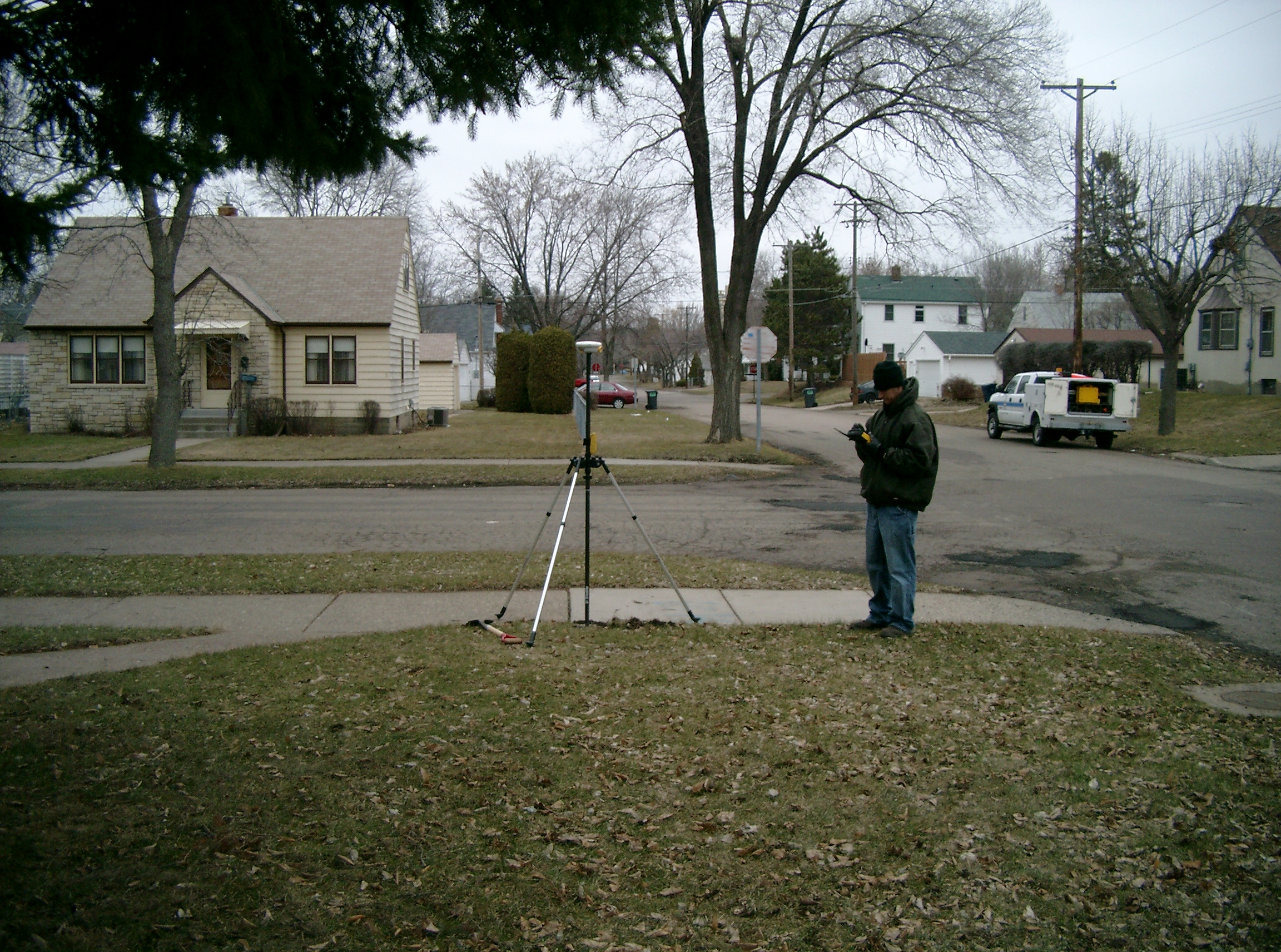
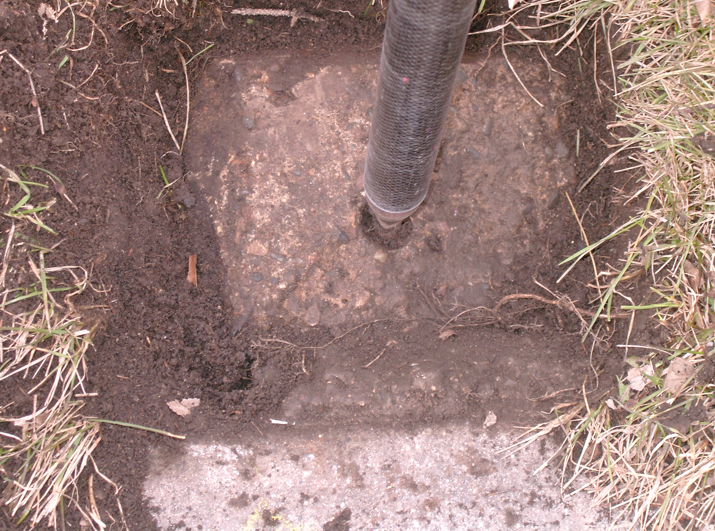
| 4/9/2008 | Fd a Concrete monument 0.15 ft below grade. Set ties. Photos taken. |
| 4/8/2008 | Position on Concrete monument set by RTK-VRS GPS Elev 239.7 ft. See CofL 3854-__kr-A |
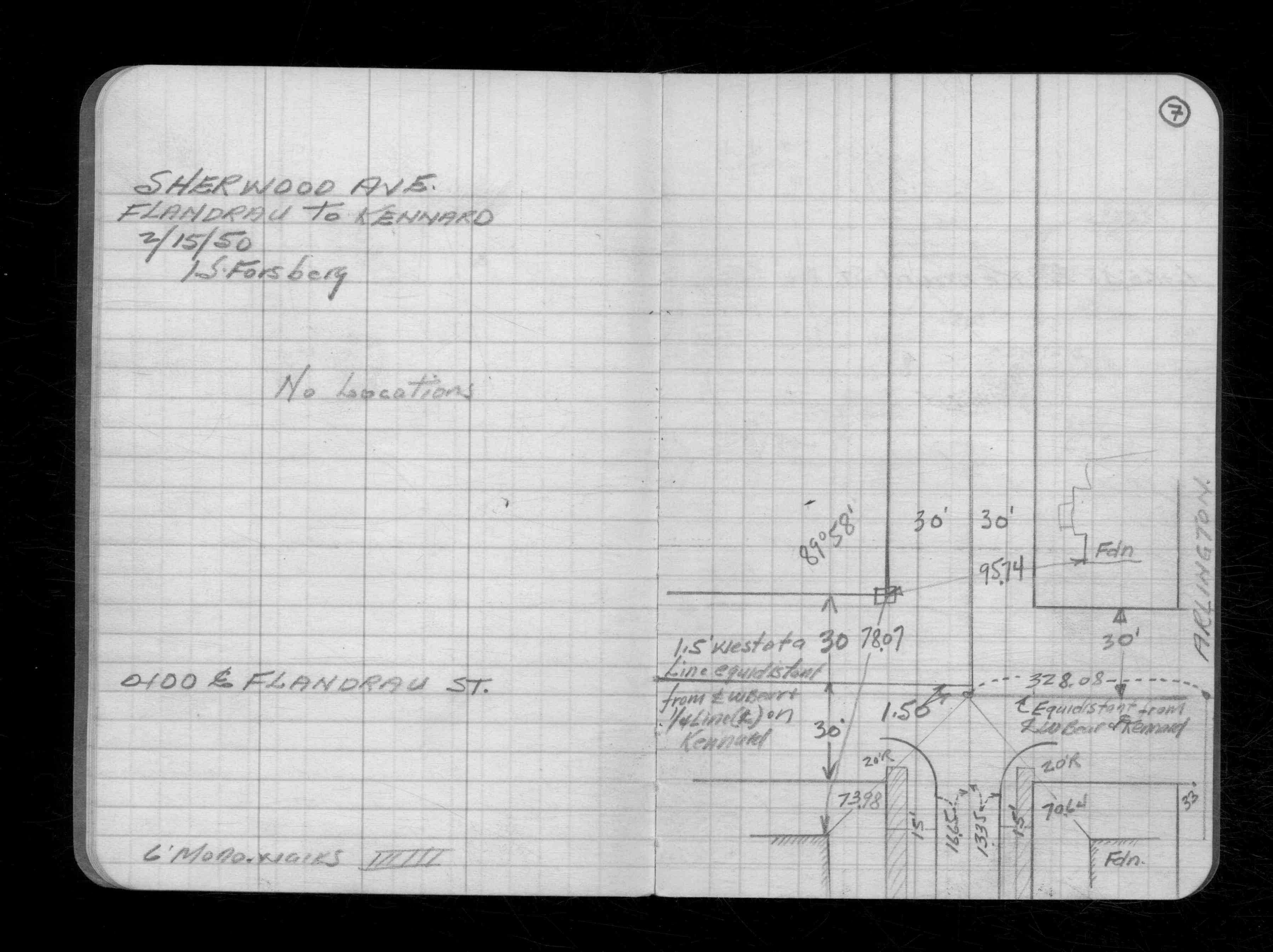
| 2/15/1950 | Monument is 31.5 ft west of CL Flandrau St. See CS 2192 p.07 |
Above is NOT an all inclusive history of this point. Please review all the links below.
| PLS NOTES | Field | Cross Section | Sewer | J.B. Irvine | Monument | River Survey |
|---|---|---|---|---|---|---|
| CS 2192p.07 |
| FILE | PHOTO DATE | COMMENTS |
|---|---|---|
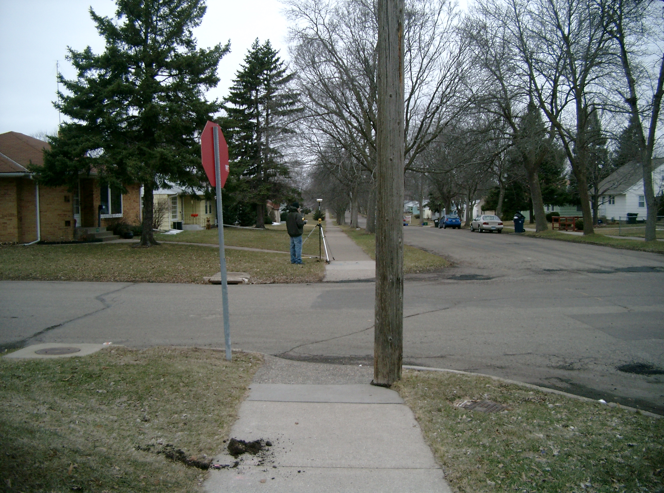
| 3854-__kr-5.jpg | April 9, 2008 | Looking West along the South side of Sherwood Ave. |
| 3854-__kr-4.jpg | April 9, 2008 | Looking South along the West side of Flandrau St. |
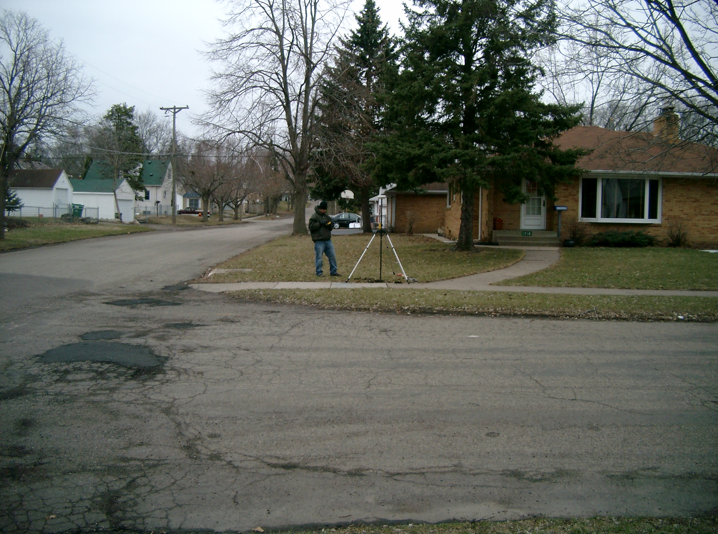
| 3854-__kr-3.jpg | April 9, 2008 | Looking East along the South side of Sherwood Ave. |
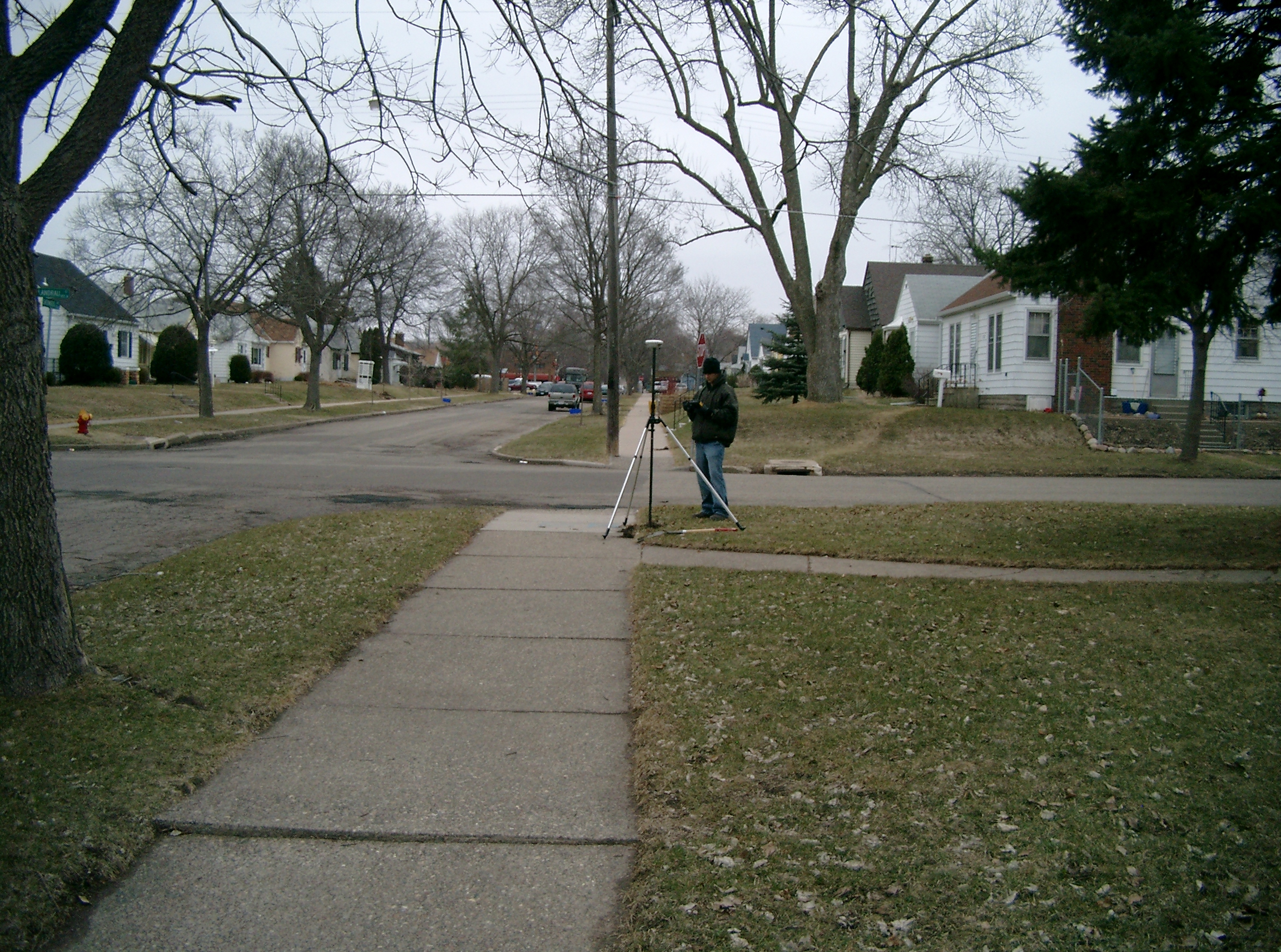
| 3854-__kr-2.jpg | April 9, 2008 | Looking North along the West side of Flandrau St. |
| 3854-__kr-1.jpg | April 9, 2008 | Close-up of monument. |