| NAD83 COORDINATES (1986 adj.): |
|---|
| X= 558031.84 Y= 155393.17 Z= 944.3 12/04/2007 RTK-VRS |
| 11/27/2012 | Probed 1.0 ft below sidewalk grade; no monument found. May have been removed during sidewalk replacement project. It may also be the case that a landscaping stone was misidentified as monument. |
| 12/4/2007 | Position on GM set by RTK-VRS GPS Elev 944.3 ft. |
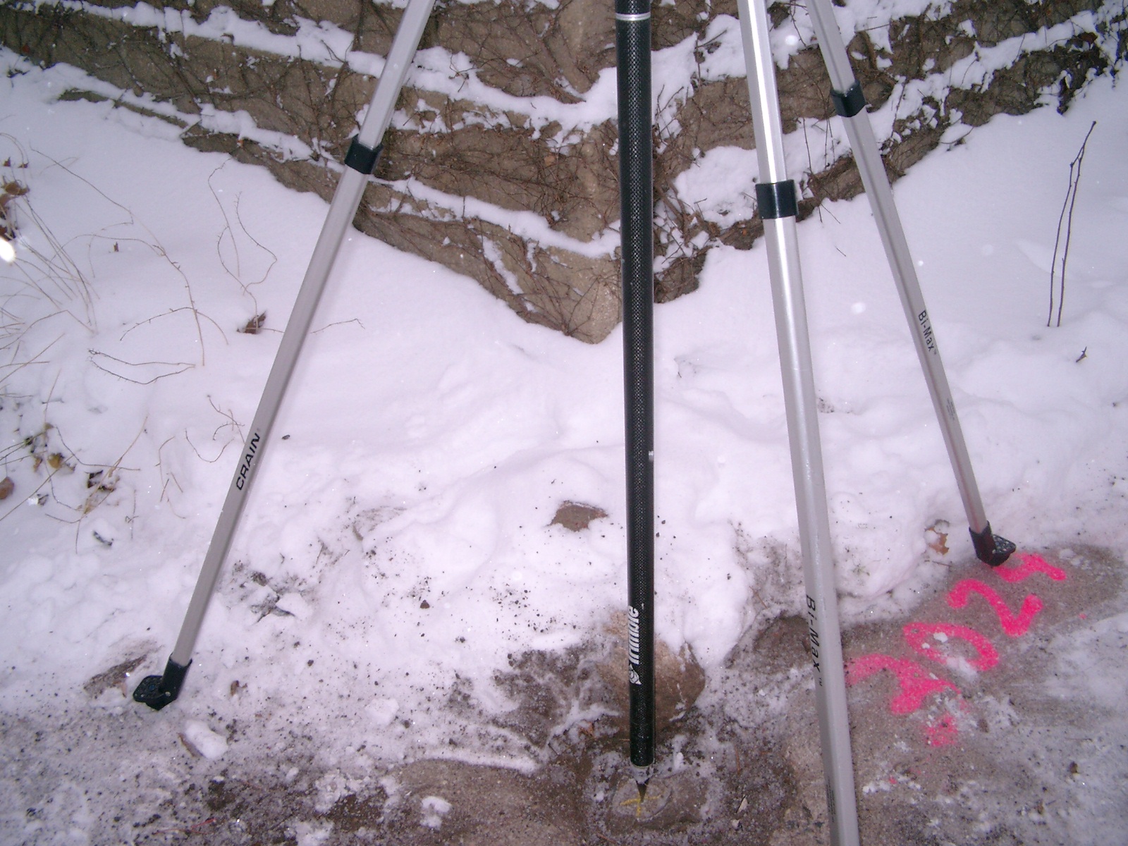
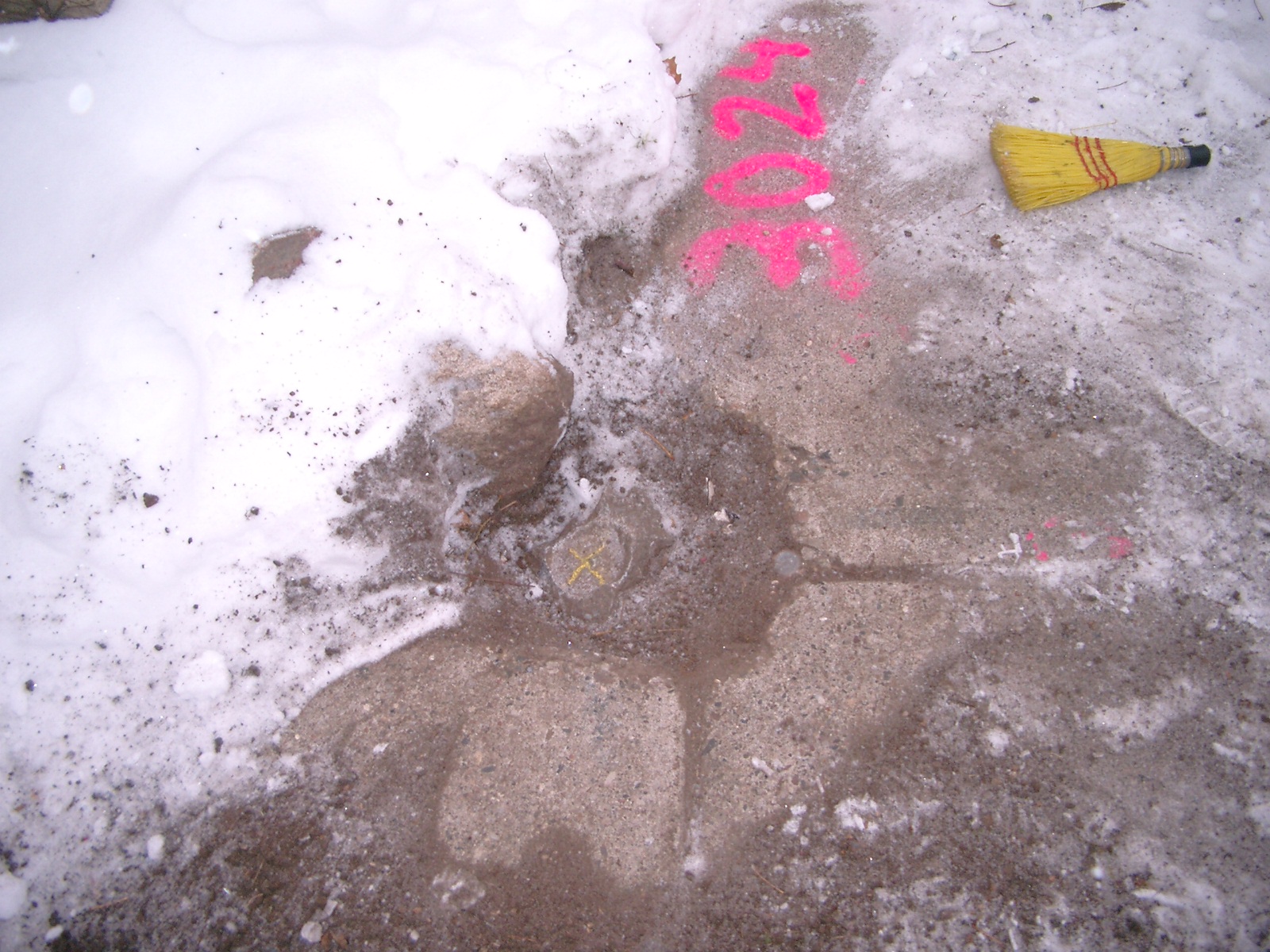
| 12/4/2007 | Fd GM 0.1 ft below sidewalk grade. Photos taken. |
Above is NOT an all inclusive history of this point. Please review all the links below.
| PLS NOTES | Field | Cross Section | Sewer | J.B. Irvine | Monument | River Survey |
|---|---|---|---|---|---|---|
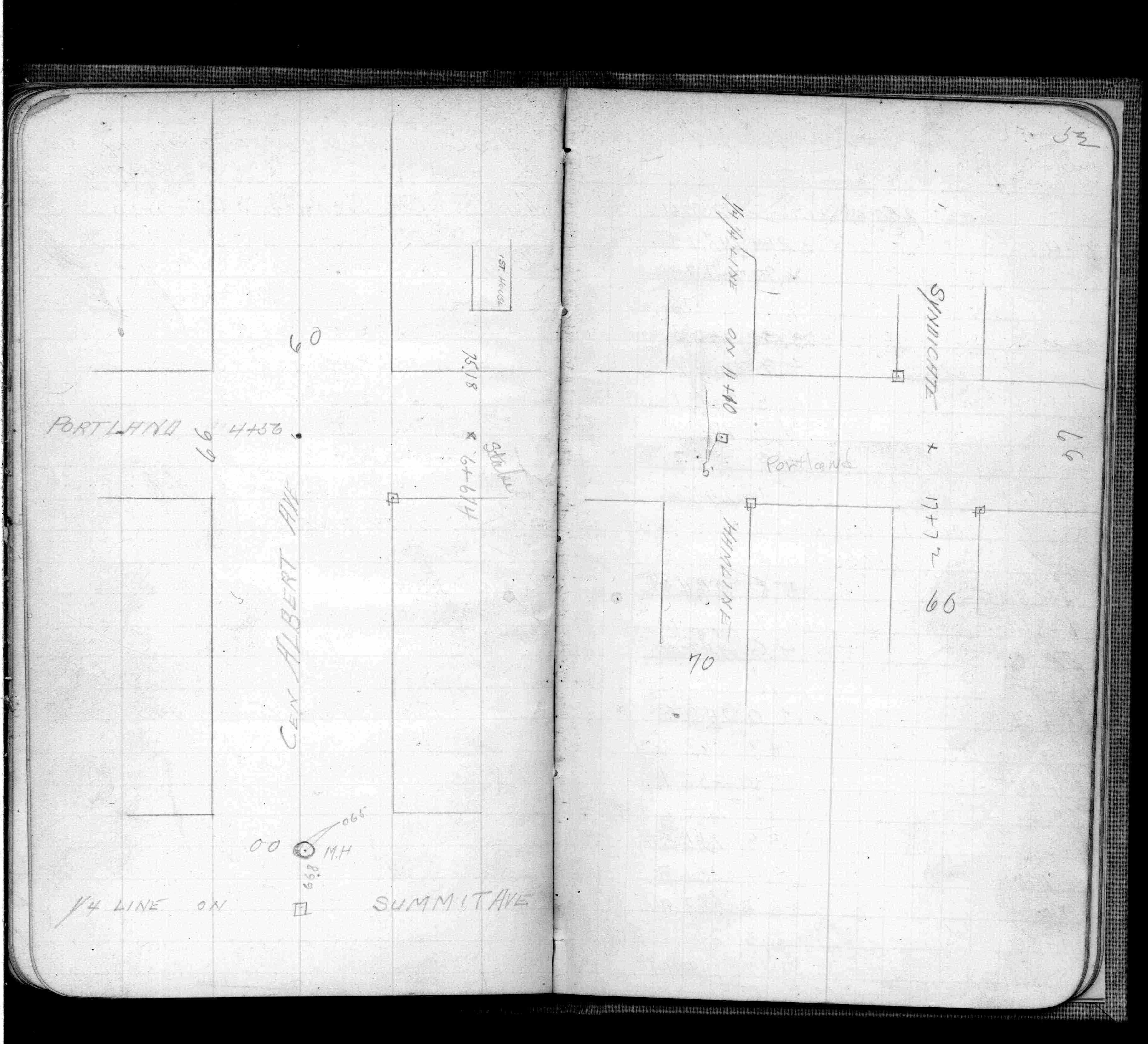
| FB 0497p.52 |
| FILE | PHOTO DATE | COMMENTS |
|---|---|---|
| 3861-3024-6.jpg | December 4, 2007 | Looking West along Portland Ave. across Albert St. |
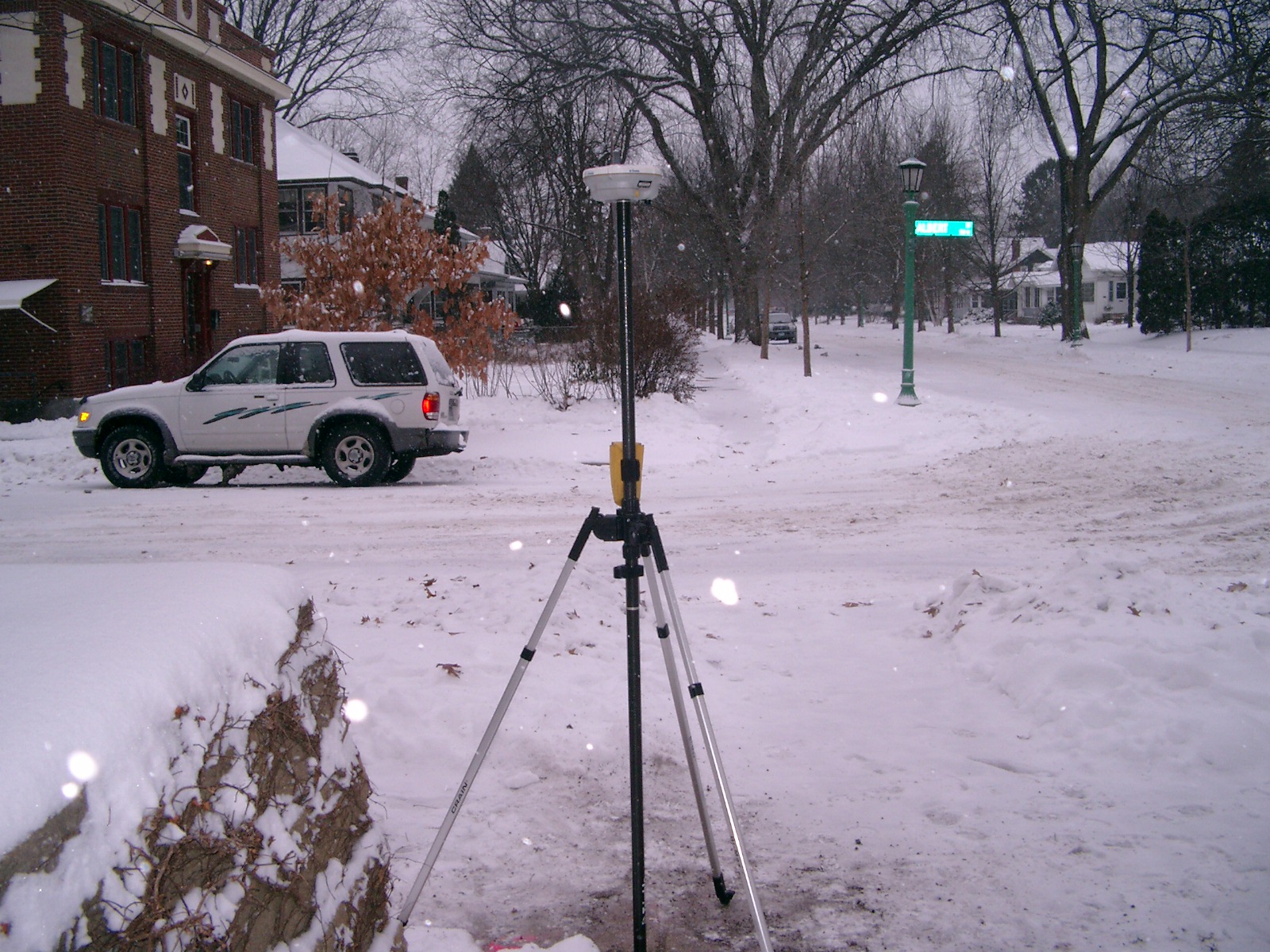
| 3861-3024-5.jpg | December 4, 2007 | Looking South along Albert St. |
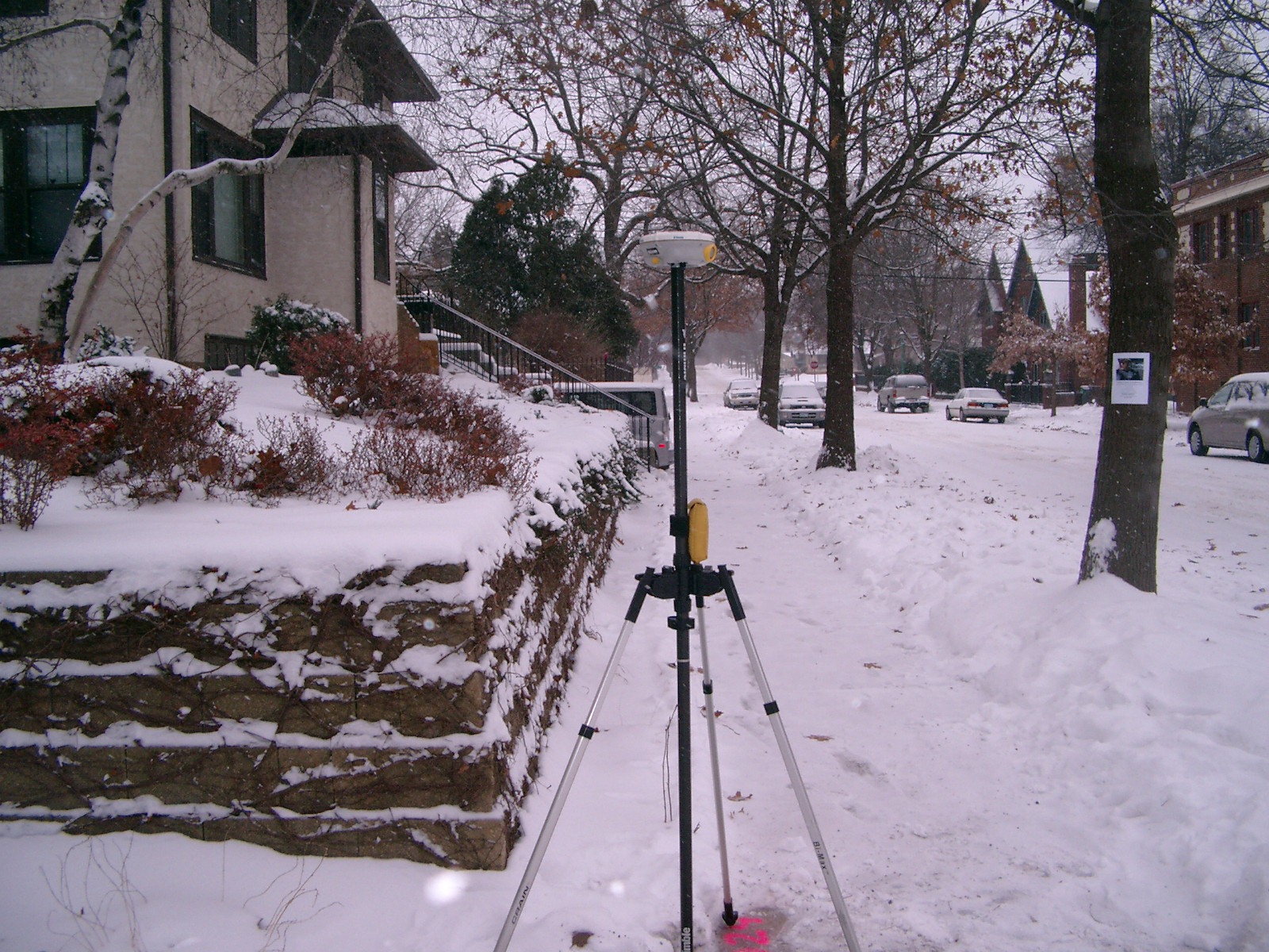
| 3861-3024-4.jpg | December 4, 2007 | Looking East along Portland Ave. |
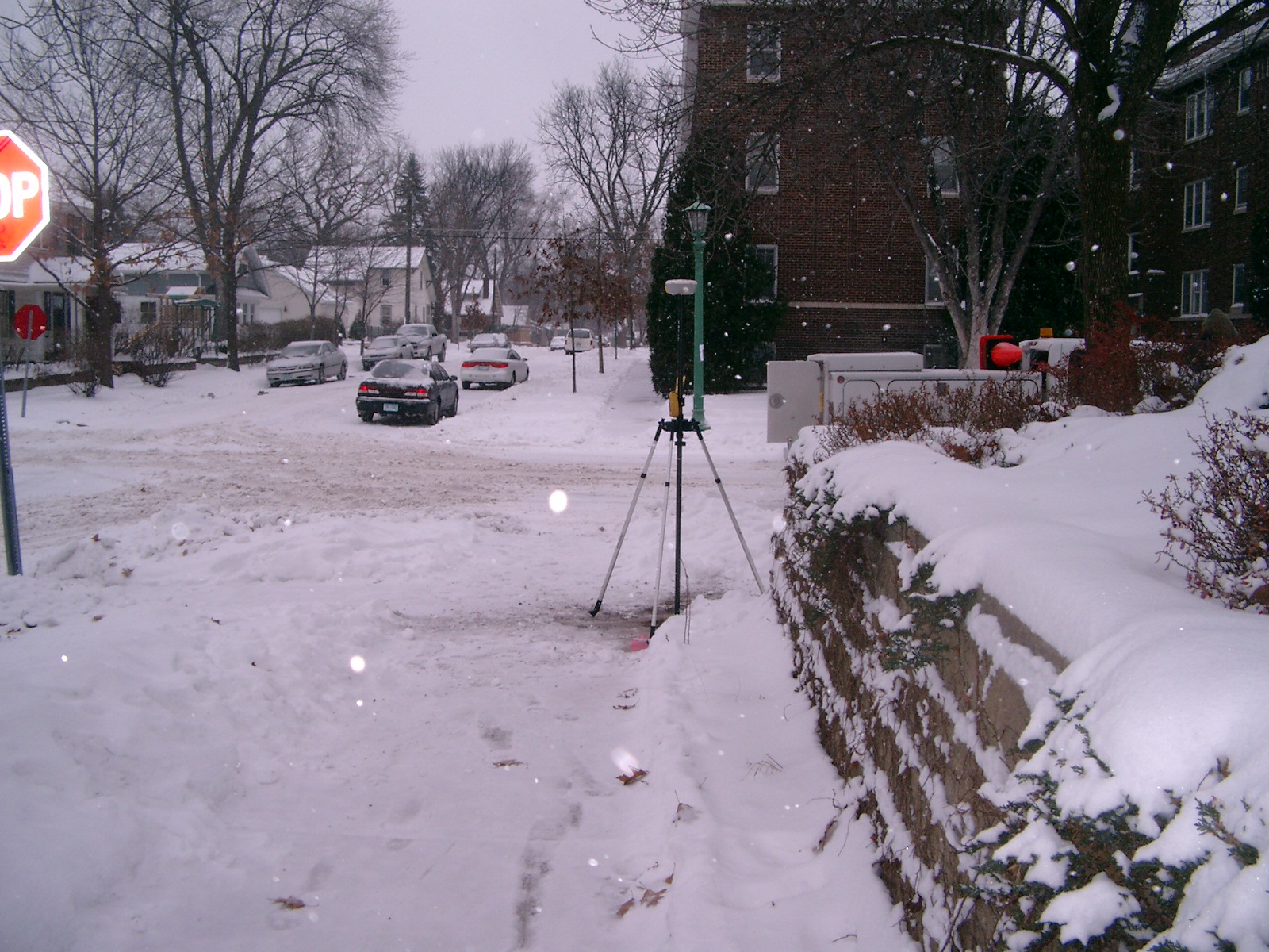
| 3861-3024-3.jpg | December 4, 2007 | Looking North along Albert St. across Portland Ave. |
| 3861-3024-2.jpg | December 4, 2007 | Close-up of GM in proximity to stone retaining wall. |
| 3861-3024-1.jpg | December 4, 2007 | Close-up of GM aprx. .1' below sidewalk grade. |