| NAD83 COORDINATES (1986 adj.): |
|---|
| X= 561318.36 Y= 150932.41 Z= 916.0 05/07/2007 RTK-VRS |
| 5/7/2007 | Fd Mag nail Position established by RTK-VRS GPS Elev 916.0 ft. |
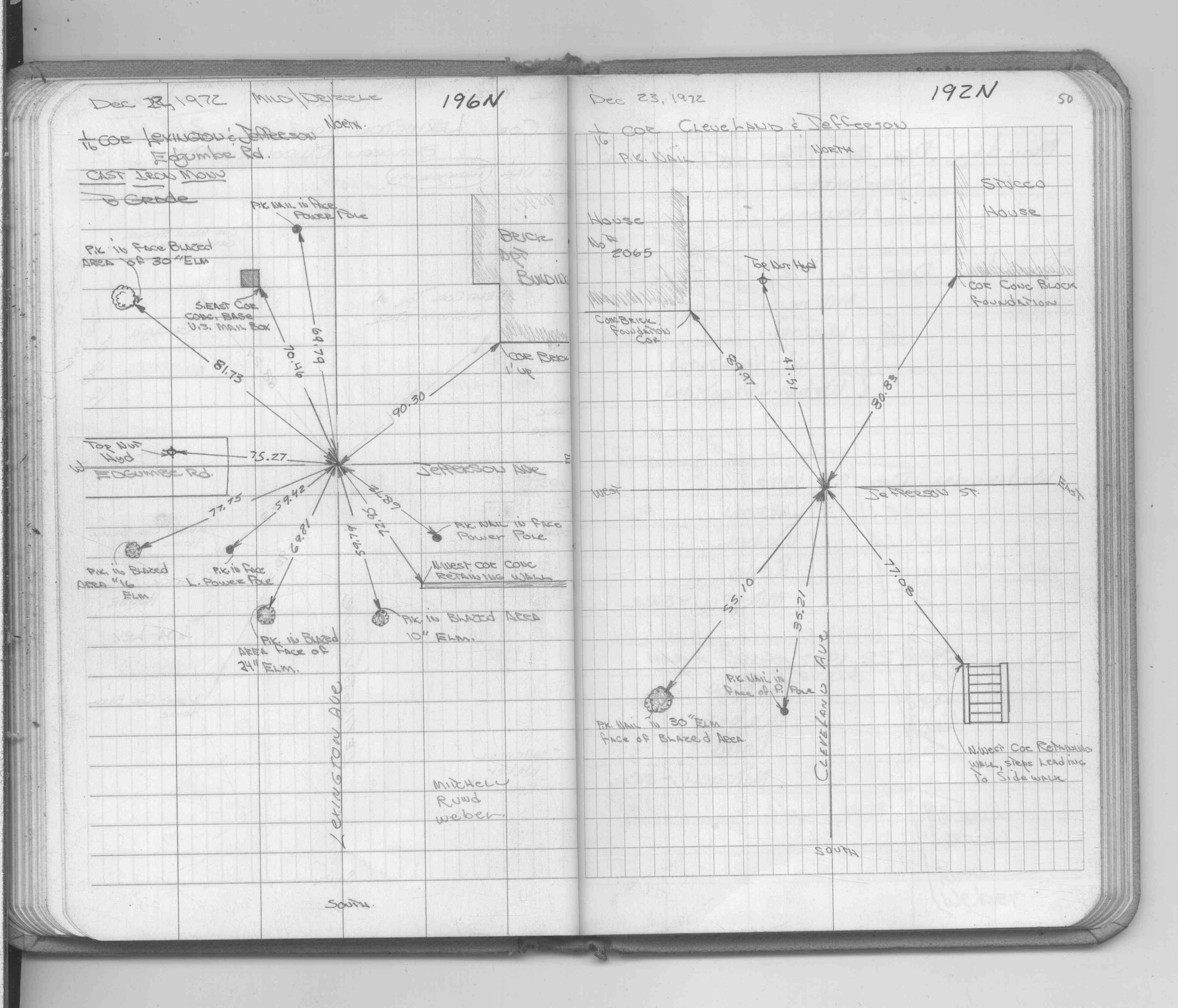
| 12/1/1972 | (Unknown date Dec __, 1972 ) Set CIM to grade, placed ties. See FB 1689A p.50 |
| 12/1/1972 | (Unknown date Dec __, 1972 ) See CofL 0196N-1354-A, copied from FB 1689A p.50 |
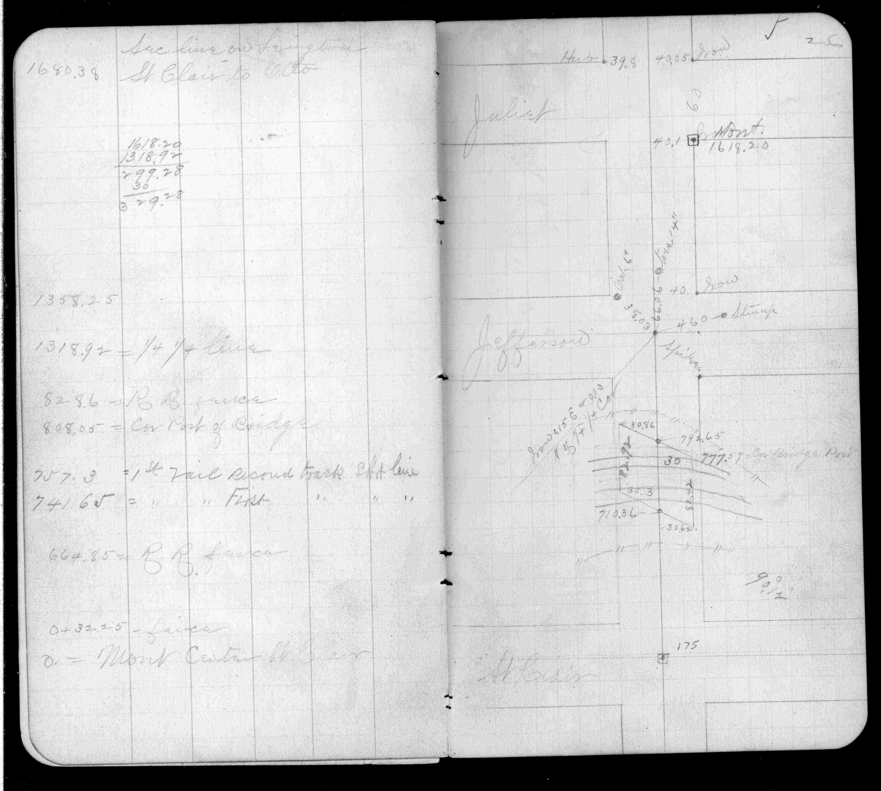
| 7/17/1888 | Monument set by J H Armstrong. See FB 229 p.26 |
Above is NOT an all inclusive history of this point. Please review all the links below.
| PLS NOTES | Field | Cross Section | Sewer | J.B. Irvine | Monument | River Survey |
|---|---|---|---|---|---|---|
| FB 0229CPYp.026 | ||||||
| FB 1689Ap.50 |
| FILE | SURVEYOR | LIC. NO. | DATE SIGNED | DATE TIED |
|---|---|---|---|---|
| 0196N-1354-A.tif | none | none | none | none |