| NAD83 COORDINATES (1986 adj.): |
|---|
| X= 566592.72 Y= 153562.28 Z= 908.3 1/7/2010 RTK-VRS |
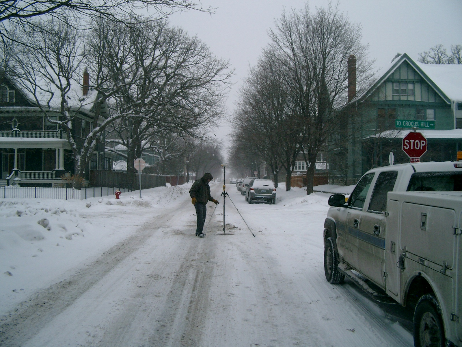
| 1/7/2010 | Set ties in CIM. See CofL 4004-0274B-A.pdf Photos taken. Position established by RTK-VRS Elev. 908.3 ft. |
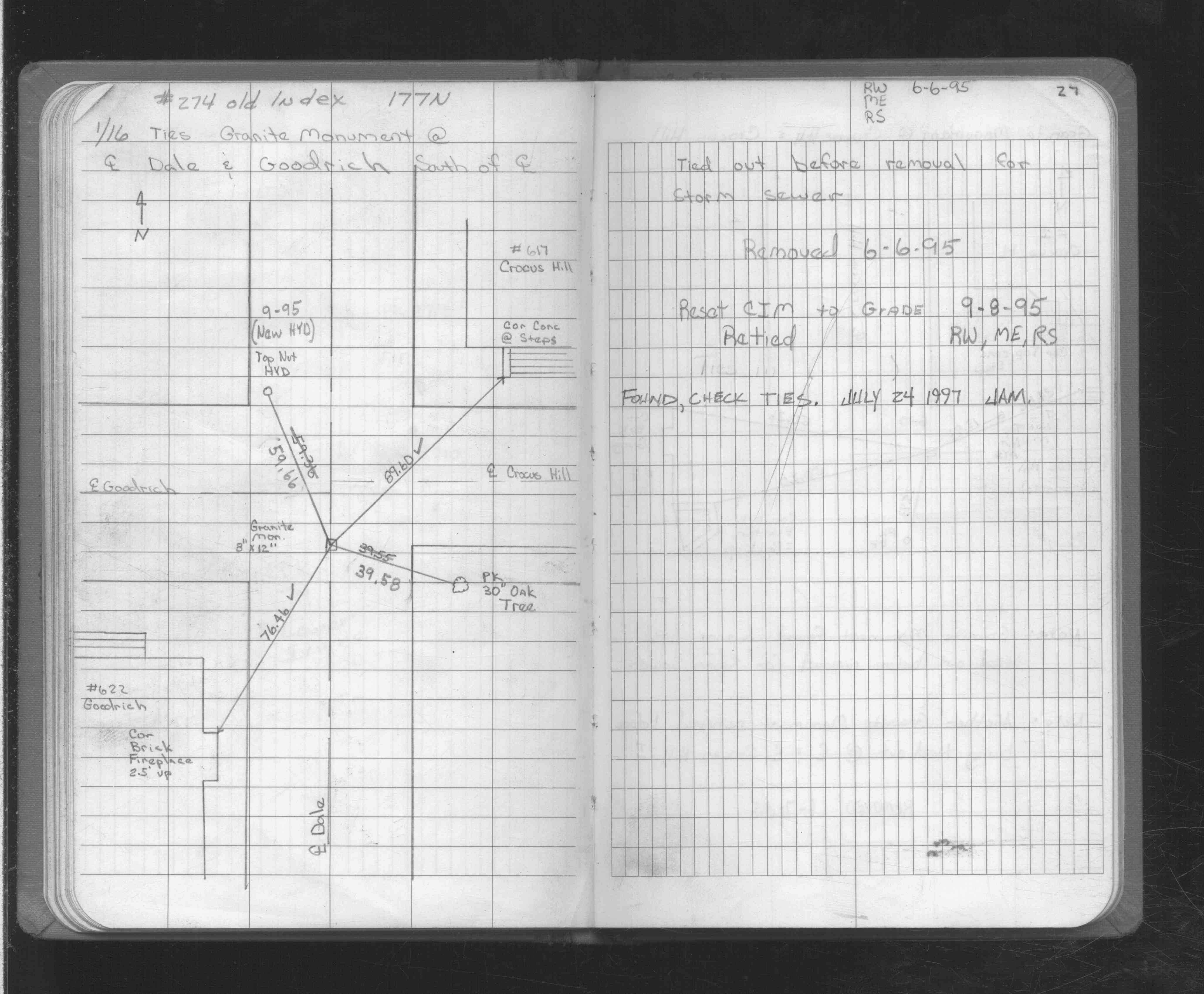
| 7/24/1997 | Recovered CIM and checked ties dated Jun 6, 1995. See FB 1725 p.27 |
| 9/8/1995 | CIM set from ties dated Jun 6, 1995 and retied. See FB 1725 p.27 |
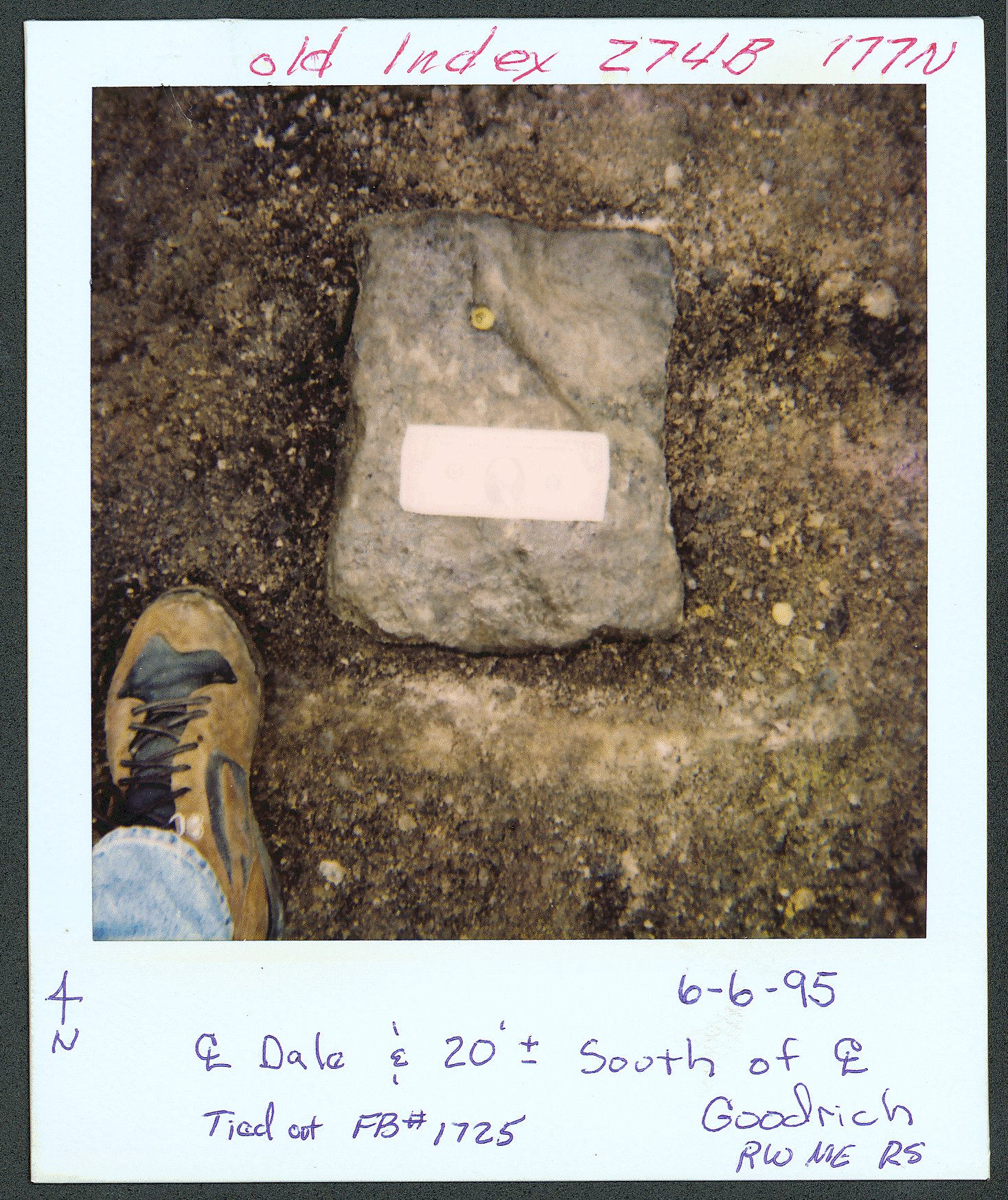
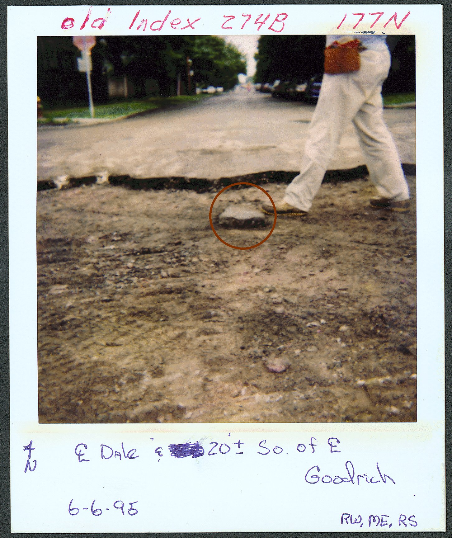
| 6/6/1995 | Photos taken. |
| 6/6/1995 | Fd 8"x12" GM & tied out. See FB 1725 p.27 |
| 6/6/1995 | 8"x12" GM removed for storm sewer construction |
Above is NOT an all inclusive history of this point. Please review all the links below.
| PLS NOTES | Field | Cross Section | Sewer | J.B. Irvine | Monument | River Survey |
|---|---|---|---|---|---|---|
| FB 1725p.27 |
| FILE | SURVEYOR | LIC. NO. | DATE SIGNED | DATE TIED |
|---|---|---|---|---|
| 4004-0274B-A.pdf | Samuel D. Gibson | 44880 | January 20, 2010 | January 7, 2010 |
| FILE | PHOTO DATE | COMMENTS |
|---|---|---|
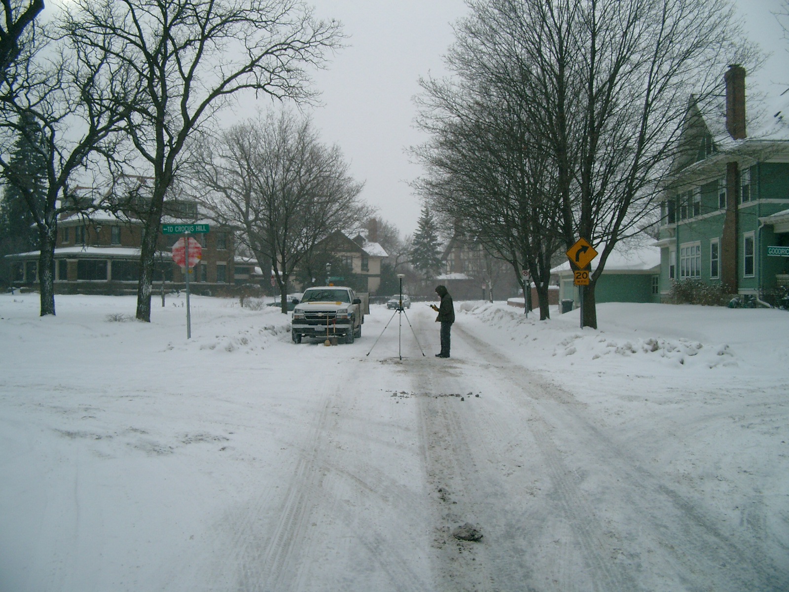
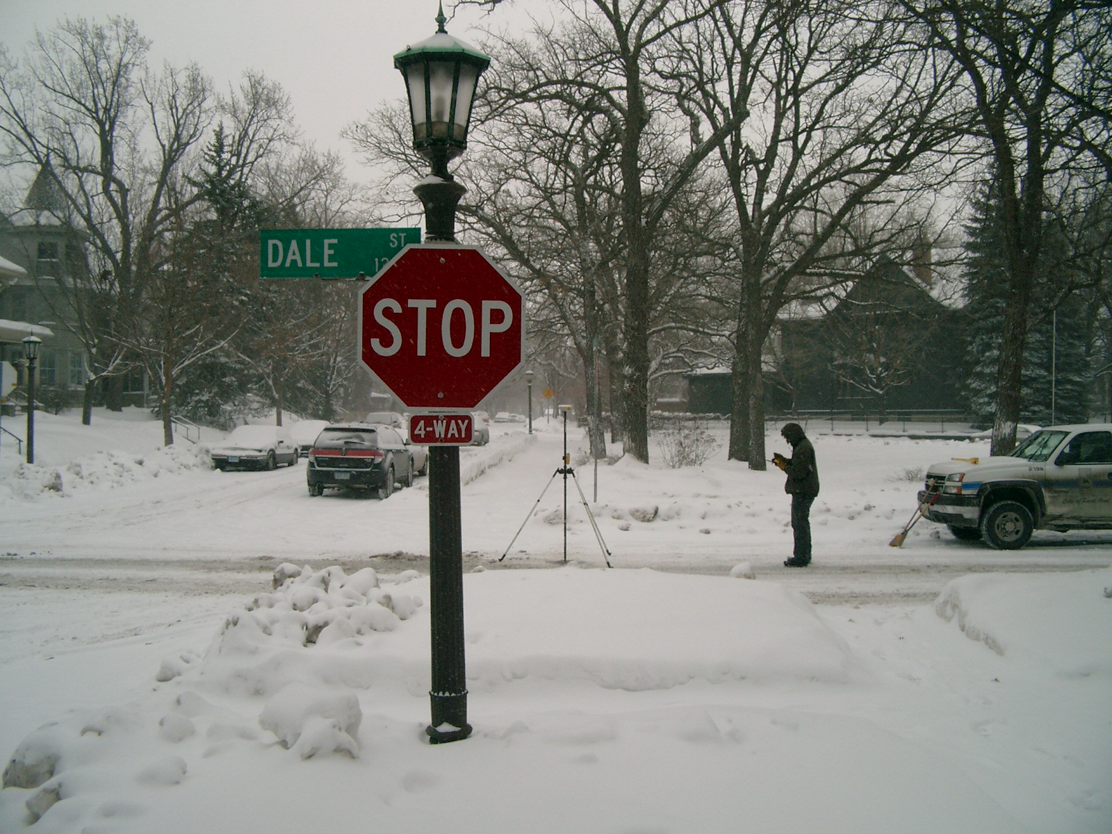
| 4004-0274B-9.jpg | January 7, 2010 | Looking West along the South side of Goodrich Ave. |
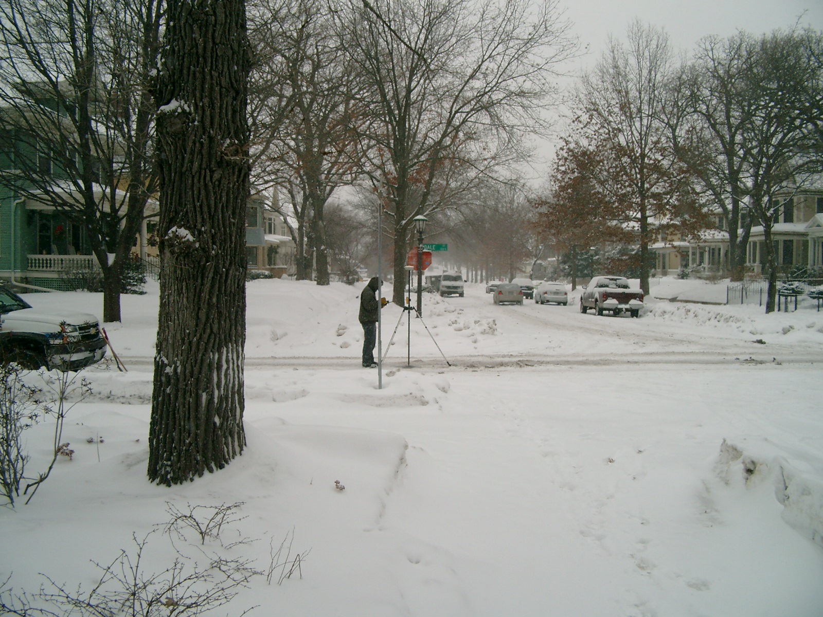
| 4004-0274B-8.jpg | January 7, 2010 | Looking South along the Center of Dale St. |
| 4004-0274B-7.jpg | January 7, 2010 | Looking East along the South side of Goodrich Ave. |
| 4004-0274B-6.jpg | January 7, 2010 | Looking North along the Center of Dale St. |
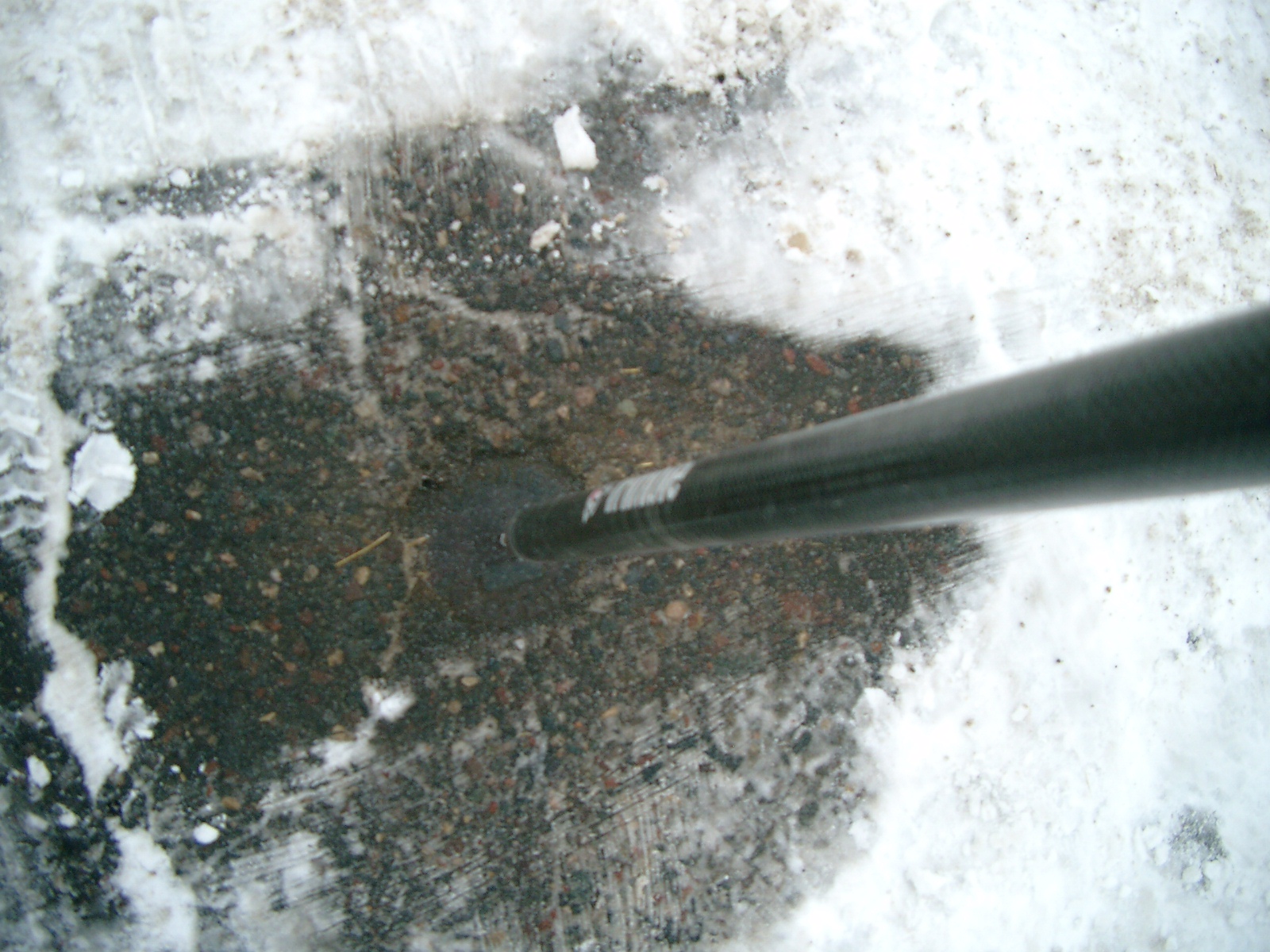
| 4004-0274B-4.jpg | January 7, 2010 | Close-up of the CIM |
| 4004-0274B-3.jpg | April 2, 2002 | Close-up of monument. The hole is marked with yellow chalk at the upper end of the GM. |
| 4004-0274B-1.jpg | April 2, 2002 | Monument shown at the center line of Dale St. and Goodrich Ave. |