| 11/8/2012 | Produced ties to single point on asphalt and got a reading from metal detector indicating CIM in place. No attempt made to expose monument. |
| 7/1/1995 | (Unknown date ___ __, 1995 ) Set CIM |
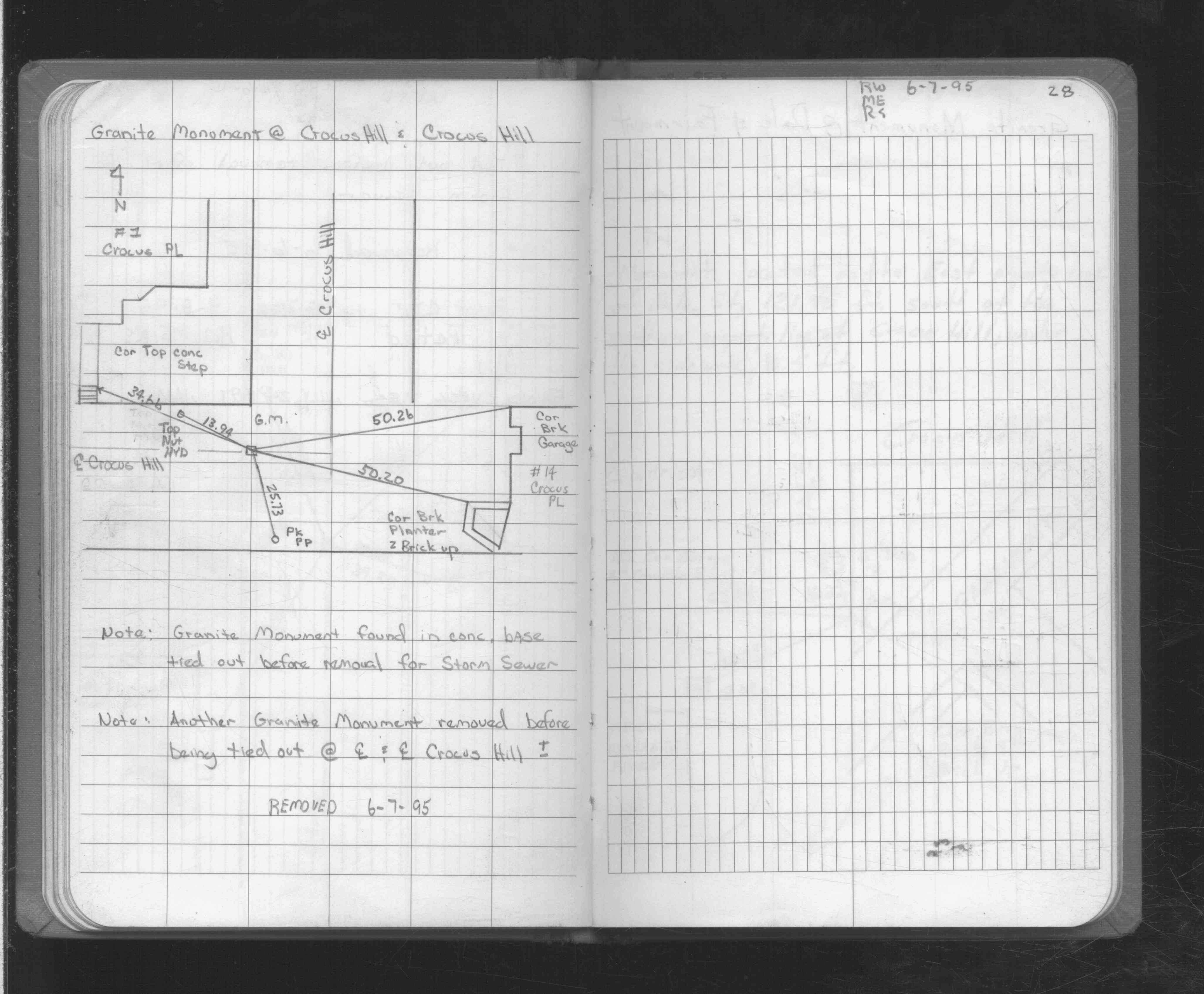
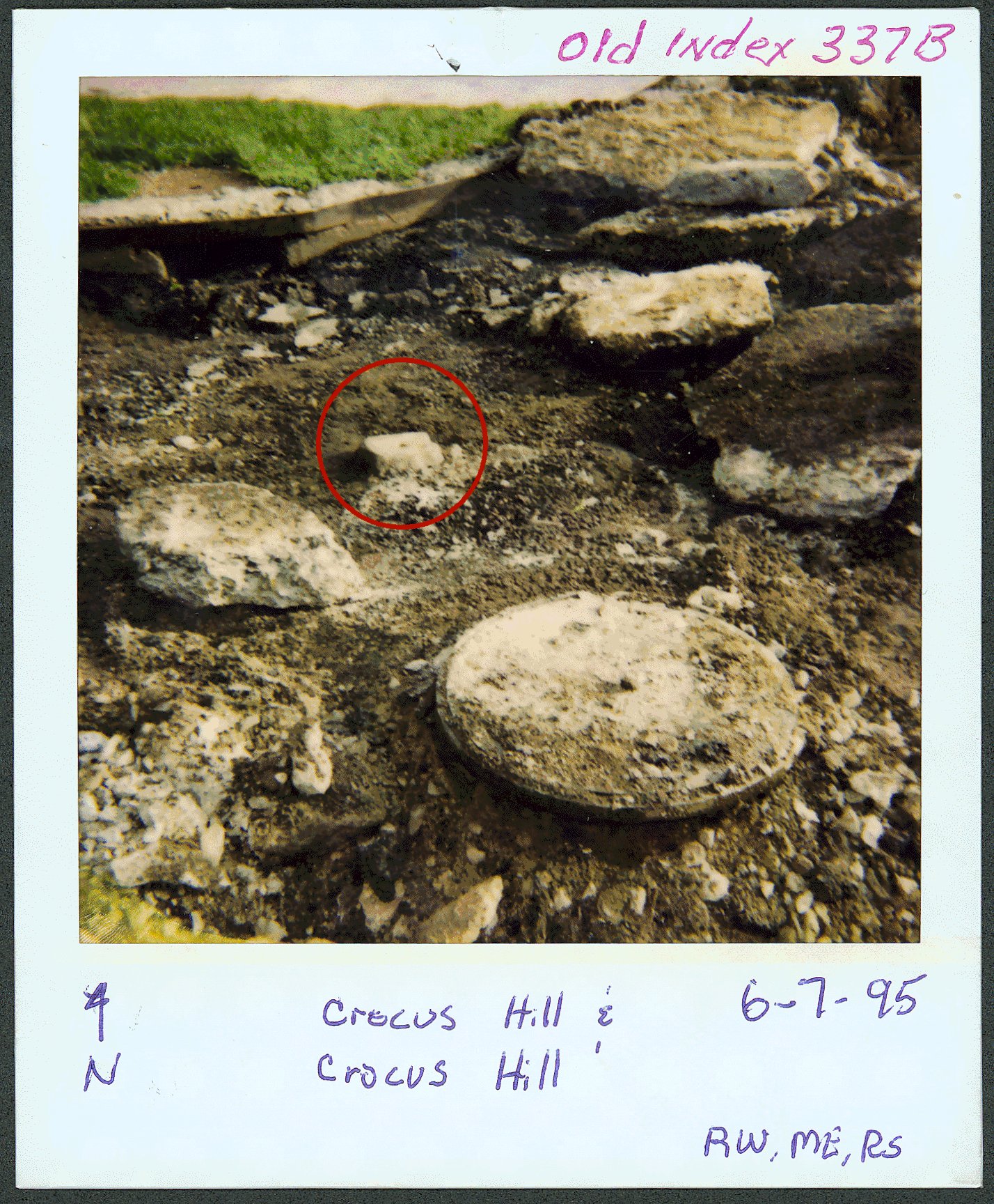
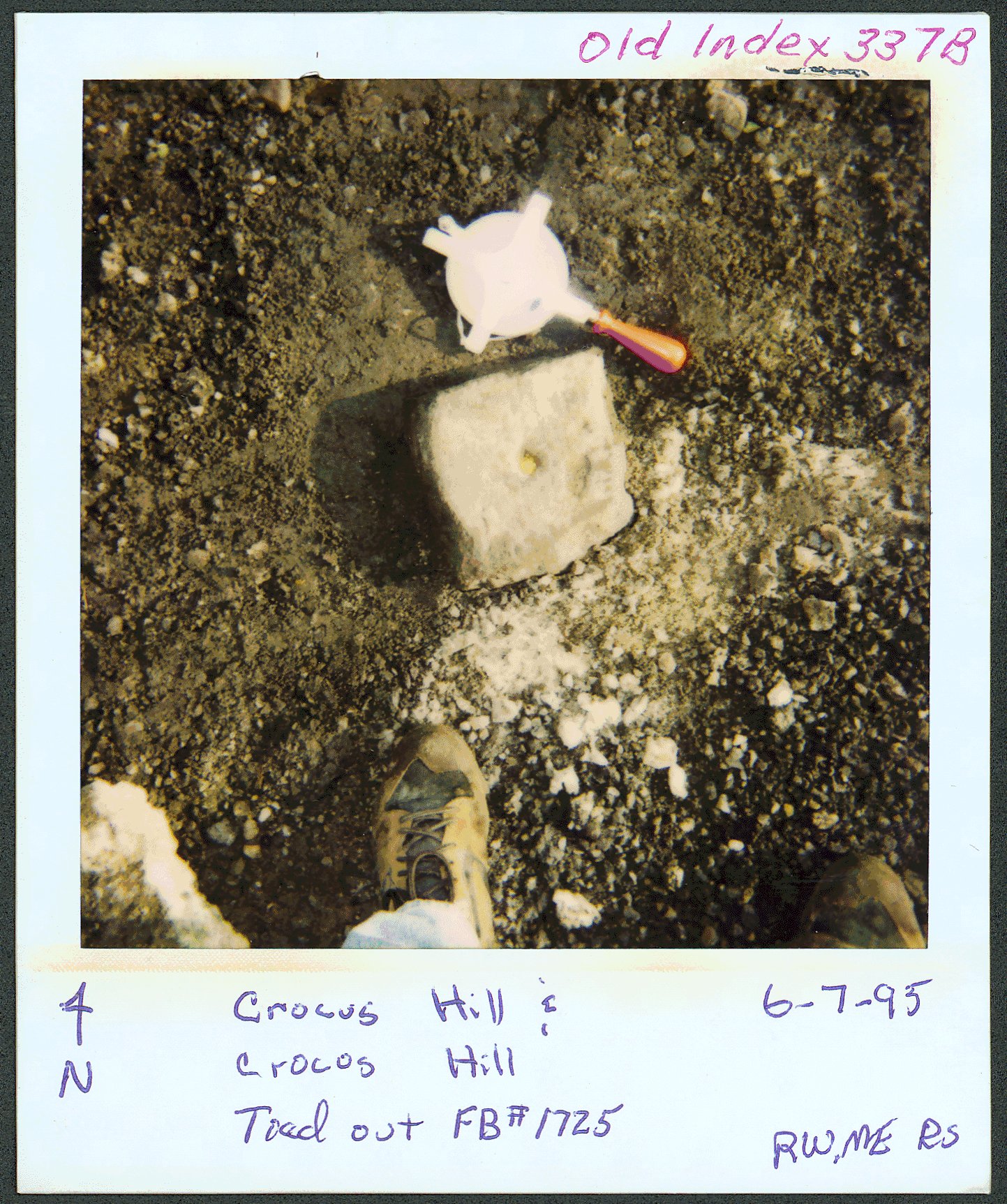
| 6/7/1995 | Fd GM, placed ties. Photos taken. GM removed. See FB 1725 p.28 |
Above is NOT an all inclusive history of this point. Please review all the links below.
| PLS NOTES | Field | Cross Section | Sewer | J.B. Irvine | Monument | River Survey |
|---|---|---|---|---|---|---|
| FB 1725p.28 |
| FILE | PHOTO DATE | COMMENTS |
|---|---|---|
| 4075-0337B-3.jpg | June 7, 1995 | Close-up of granite monument circled in red. |
| 4075-0337B-2.jpg | June 7, 1995 | Close-up of granite monument. |
| 4075-0337B-1.jpg | June 7, 1995 | Granite monument shown circled in red. |