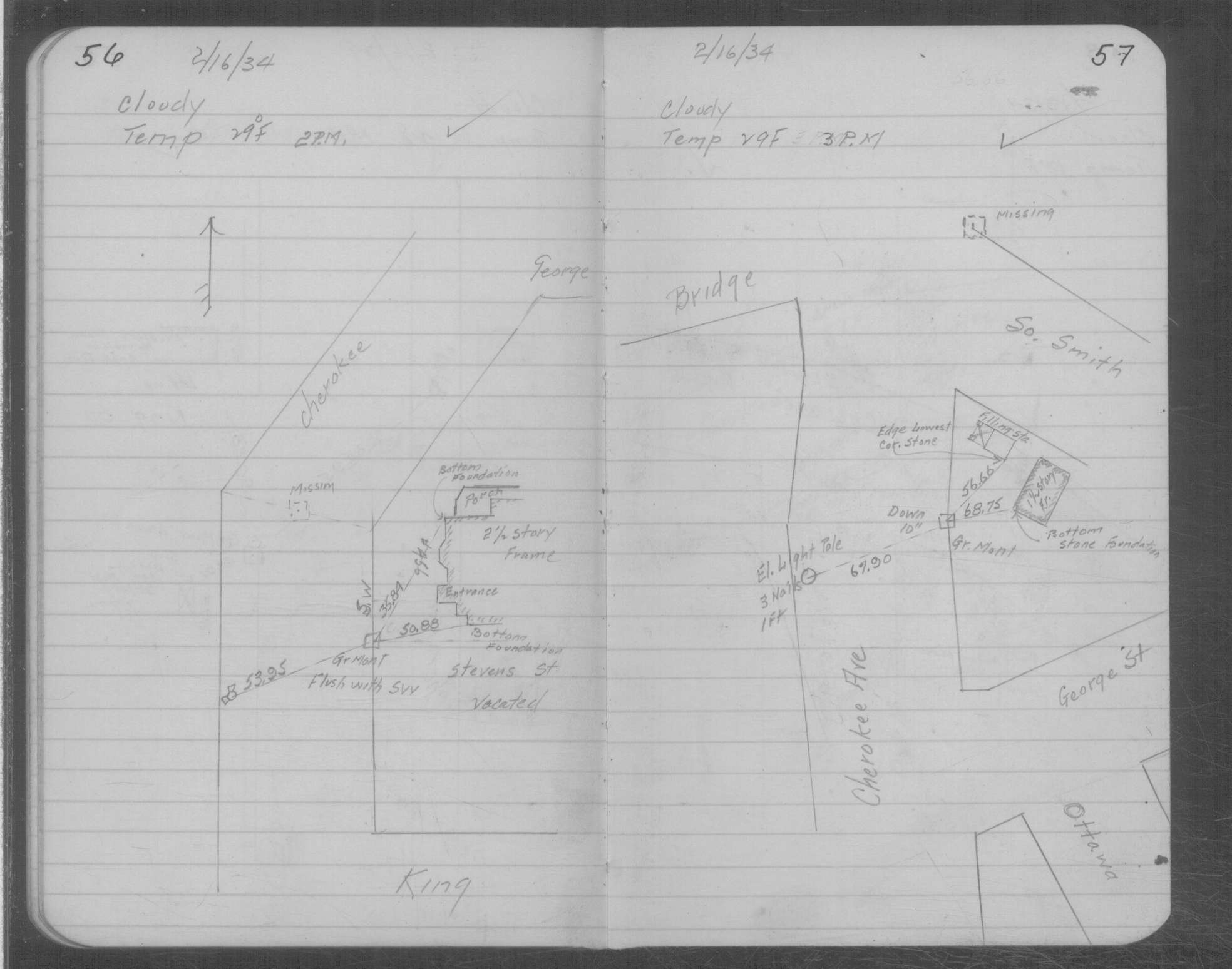
| 2/16/1934 | Placed ties on GM ten inches below grade. See MSX 1 p.56-57 |
| 5/1/1890 | (Unknown date May __, 1890 ) Placed ties. See FB 320 p.52 |
| 1/1/1800 | (Unknown date ___ __, 18?? ) See JBI 17 p.94-95 |
| 1/1/1800 | (Unknown date ___ __, ____ ) Monument at angle in center of Cherokee Ave, taken out by sewer construction |
Above is NOT an all inclusive history of this point. Please review all the links below.
| PLS NOTES | Field | Cross Section | Sewer | J.B. Irvine | Monument | River Survey |
|---|---|---|---|---|---|---|
| MSX 0001 p.056-057 |