| NAD83 COORDINATES (1986 adj.): |
|---|
| X= 581985.49 Y= 148615.98 Z= 772.4 1/12/2010 RTK-VRS |
| 1/20/2010 | Placed ties on the GM. See CofL 4382-0615A-A.pdf |
| 1/15/2010 | Photos taken of the GM. |
| 1/12/2010 | Position established on the GM by RTK-VRS Elev. 772.4 ft. |
| 7/20/2005 | Fd GM at sidewalk grade. Placed magnet in hold of GM. |
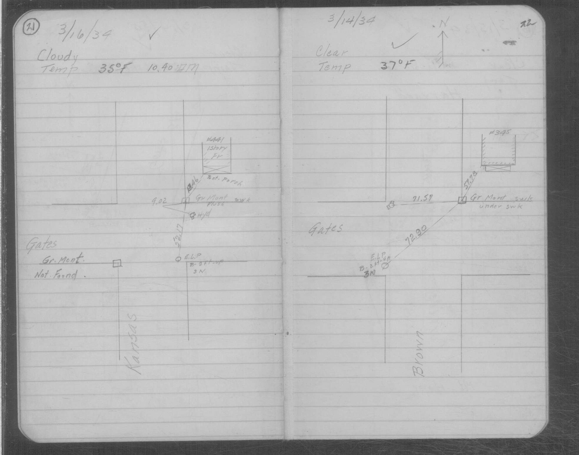
| 3/16/1934 | Placed ties on GM flush with sidewalk. See MSX 2 p.21-22 |
| 11/10/1891 | Monument reset by J B Irvine after grading. |
| 2/1/1886 | (Unknown date Feb __, 1886 ) Monument set by F J McCarron |
Above is NOT an all inclusive history of this point. Please review all the links below.
| PLS NOTES | Field | Cross Section | Sewer | J.B. Irvine | Monument | River Survey |
|---|---|---|---|---|---|---|
| MSX 0002 p.021-022 |
| FILE | SURVEYOR | LIC. NO. | DATE SIGNED | DATE TIED |
|---|---|---|---|---|
| 4382-0615A-A.pdf | Samuel D. Gibson | 44880 | January 20, 2010 | January 15, 2010 |
| FILE | PHOTO DATE | COMMENTS |
|---|---|---|
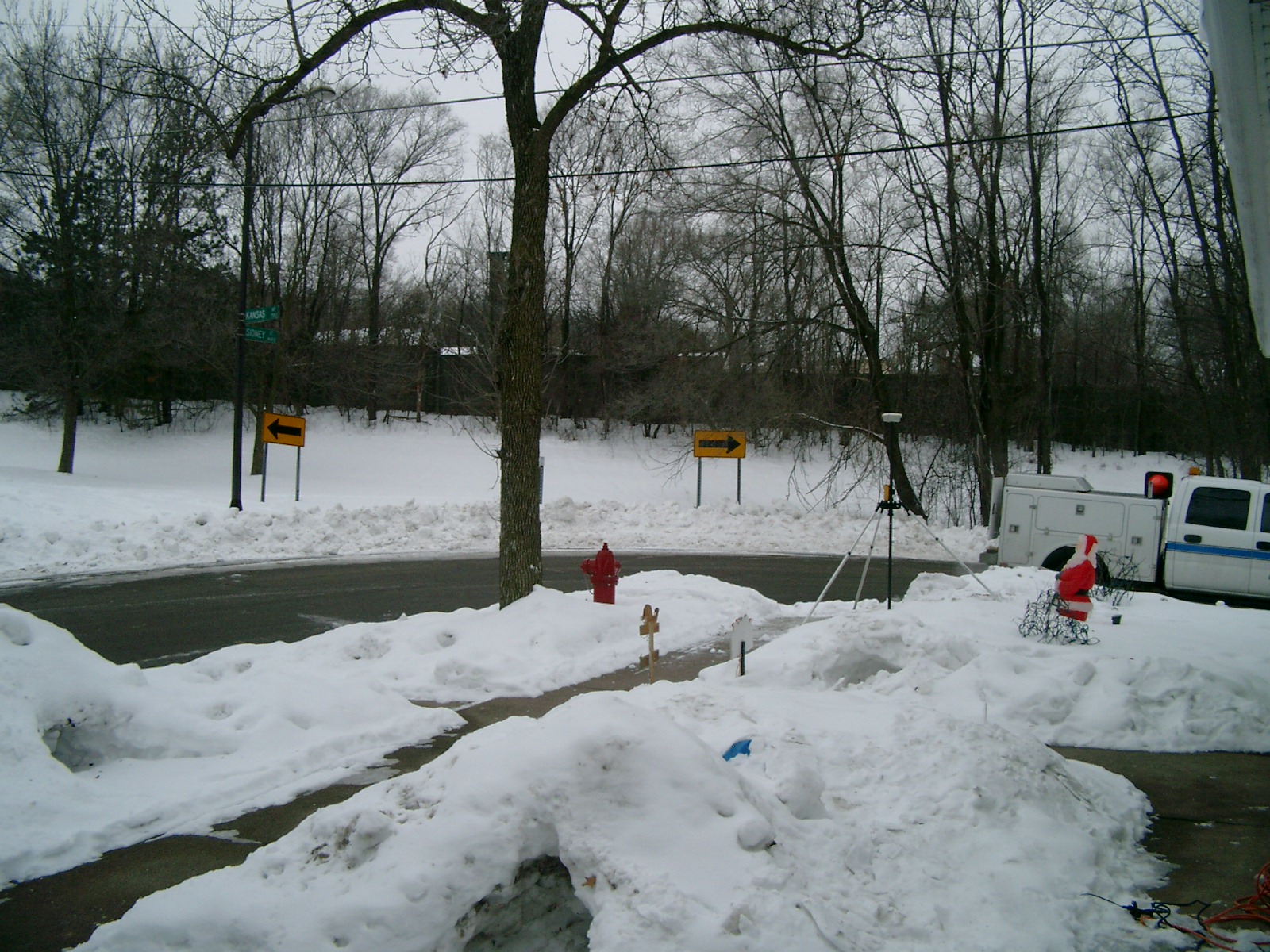
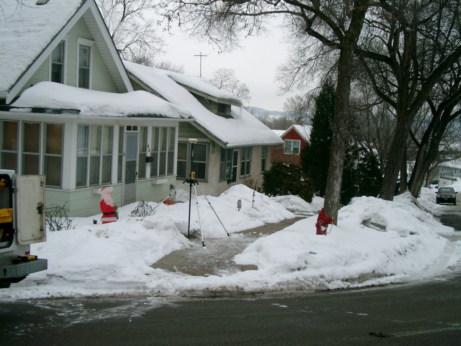
| 4382-0615A-5.jpg | January 15, 2010 | Looking Southwesterly. |
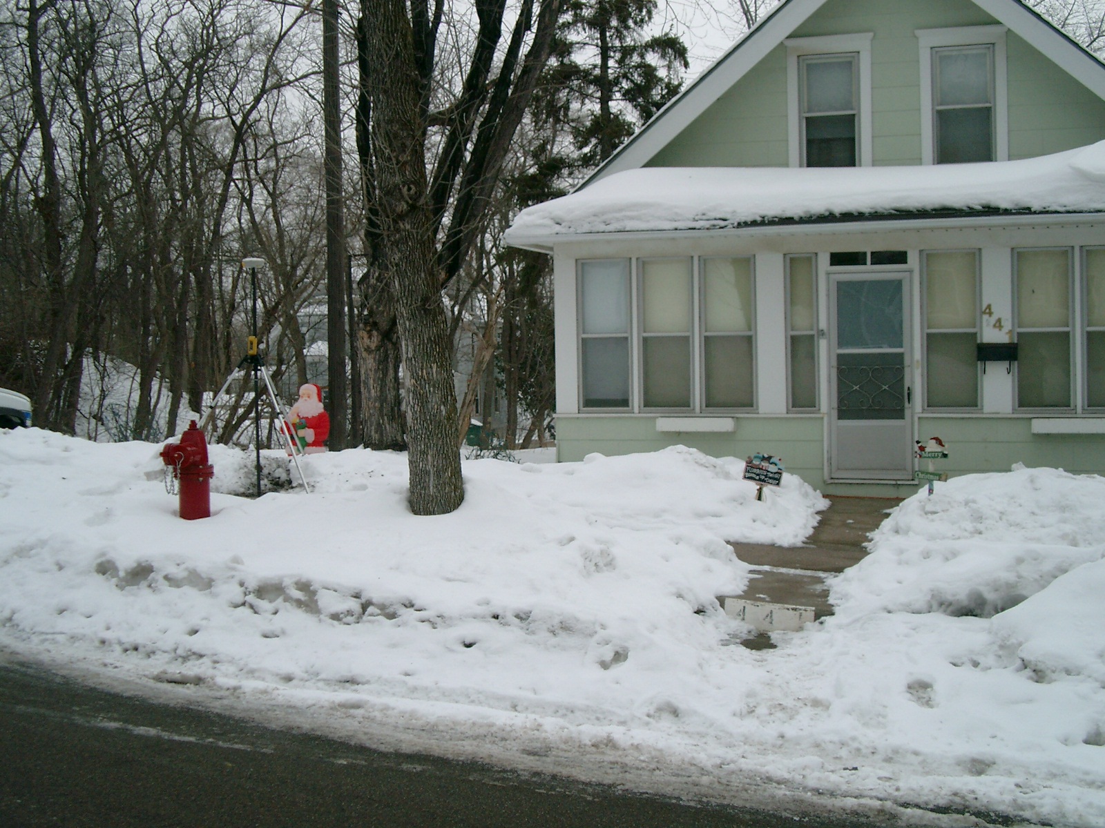
| 4382-0615A-4.jpg | January 15, 2010 | Looking Southeasterly from Kansas Ave. |
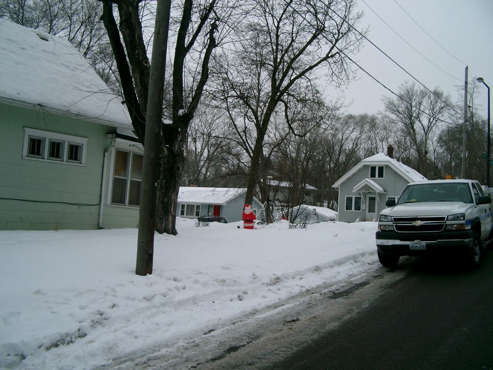
| 4382-0615A-3.jpg | January 15, 2010 | Looking Northeasterly. |
| 4382-0615A-2.jpg | January 15, 2010 | Looking Northwesterly from Sidney St. |
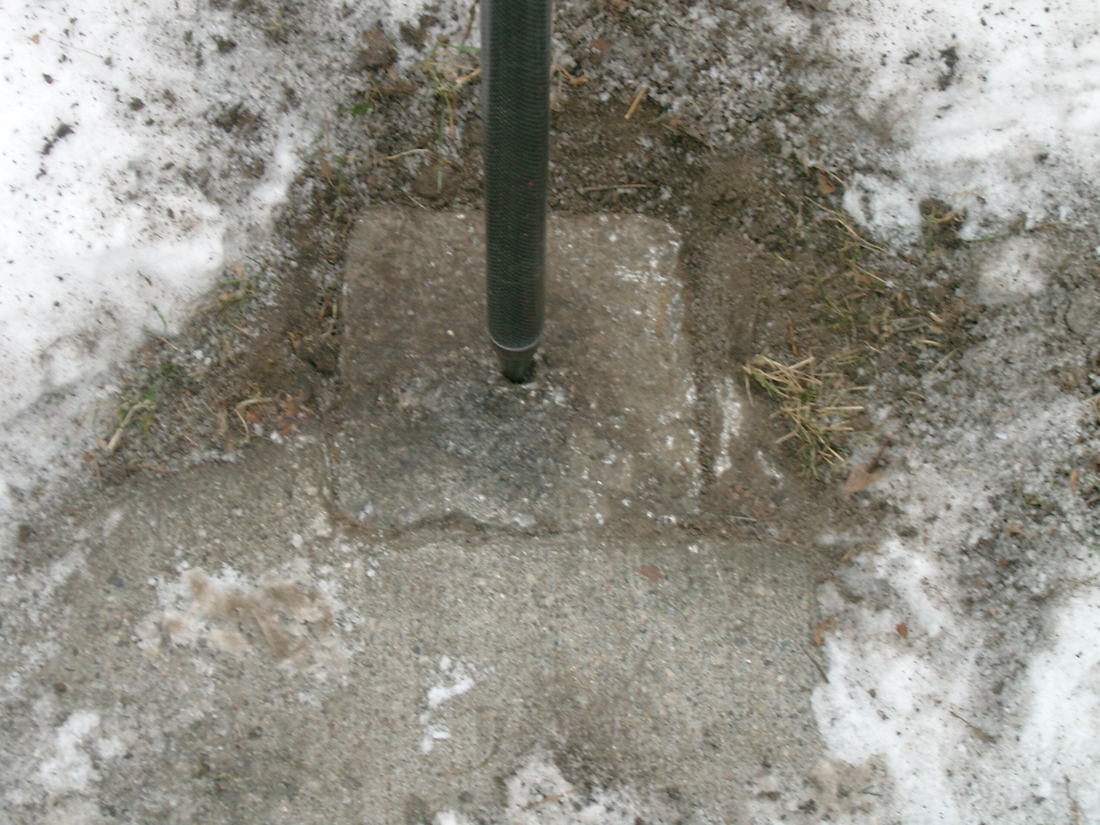
| 4382-0615A-1.jpg | January 15, 2010 | Close-up of the GM. |