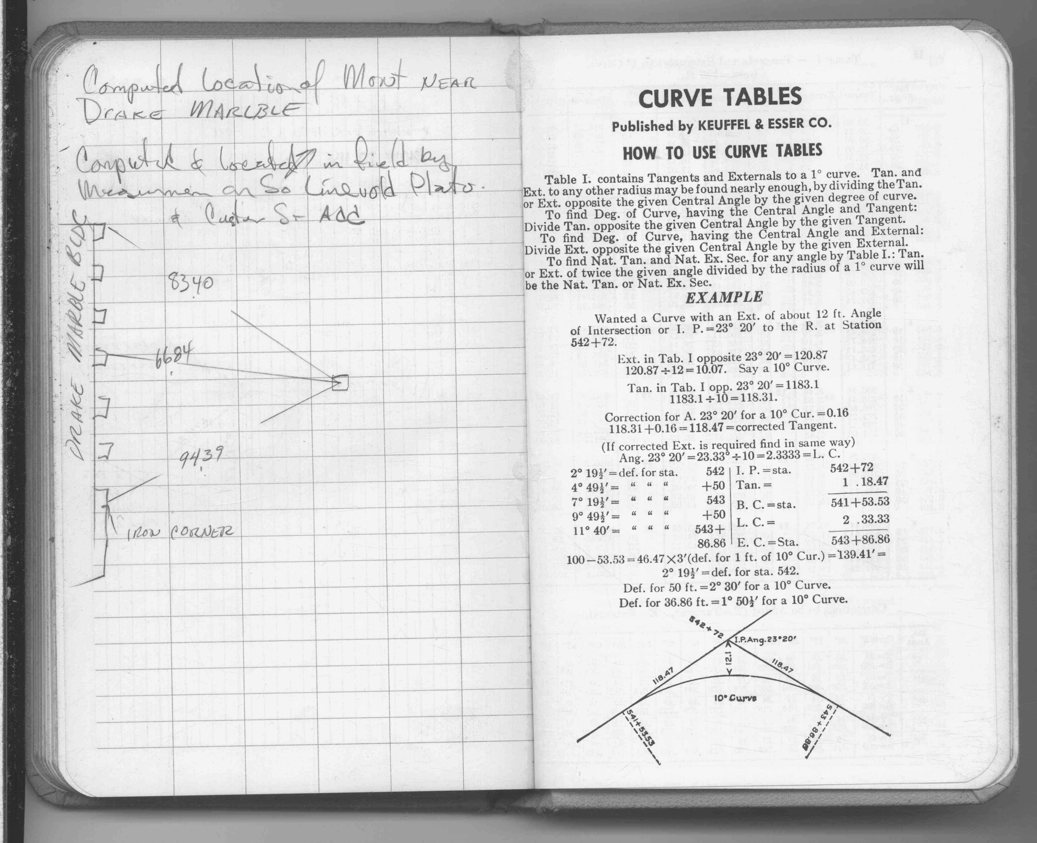
| 1/1/1970 | (Unknown date ___ __, 197? ) Ties for computed monument position near Drake Marble. See FB 1689B p.80 |
| 11/1/1890 | (Unknown date Nov __, 1890 ) Monument set by J H Armstrong |
Above is NOT an all inclusive history of this point. Please review all the links below.
| PLS NOTES | Field | Cross Section | Sewer | J.B. Irvine | Monument | River Survey |
|---|---|---|---|---|---|---|
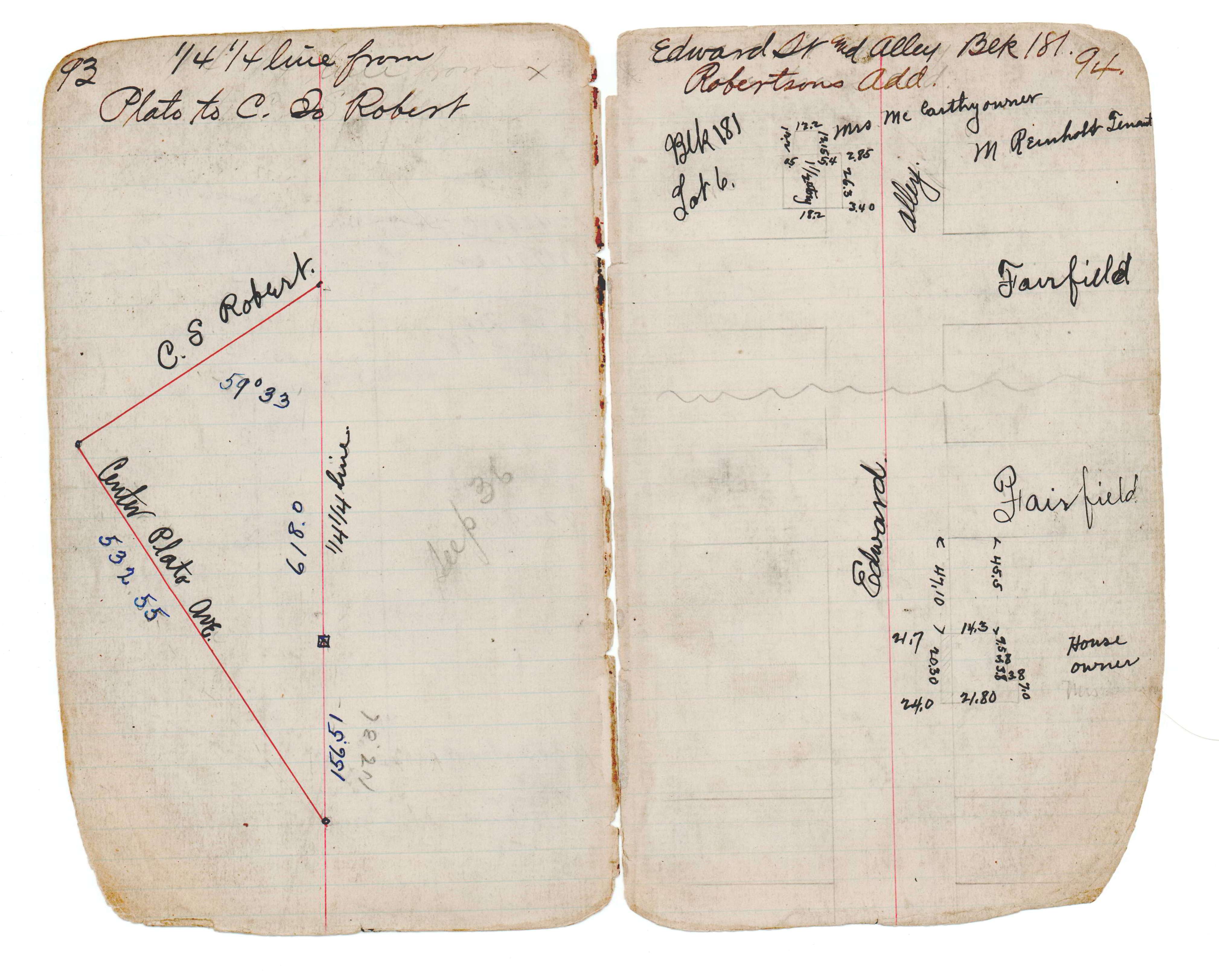
| FB 1689Bp.80 | JBI 19 p.93-94 |