| NAD83 COORDINATES (1986 adj.): |
|---|
| X= 552425.309 Y= 156189.048 Z= 910.954 4/14/2012 RTK-VRS |
| 12/3/2012 | EDM ties placed on GM using Sokkia Set 5. |
| 4/14/2012 | Position on GM established using RTK-VRS GPS. Elev. 216.85 ft. EDM ties placed using Trimble S6. |
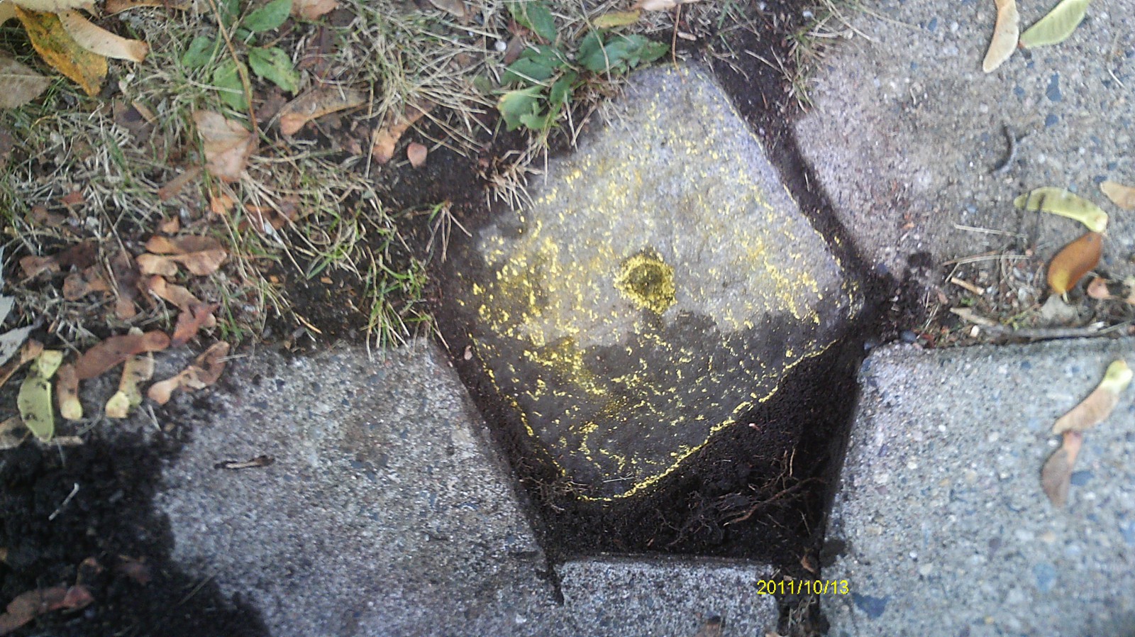
| 10/13/2011 | Found GM at sidewalk grade. Photos taken. |
| 3/28/1890 | Monument reset by J H Armstrong. see FB 257 |
| 1/1/1887 | (Unknown date Jan __, 1887 ) Monument set by T J Murray in place of original iron at block cor |
Above is NOT an all inclusive history of this point. Please review all the links below.
| PLS NOTES | Field | Cross Section | Sewer | J.B. Irvine | Monument | River Survey |
|---|---|---|---|---|---|---|
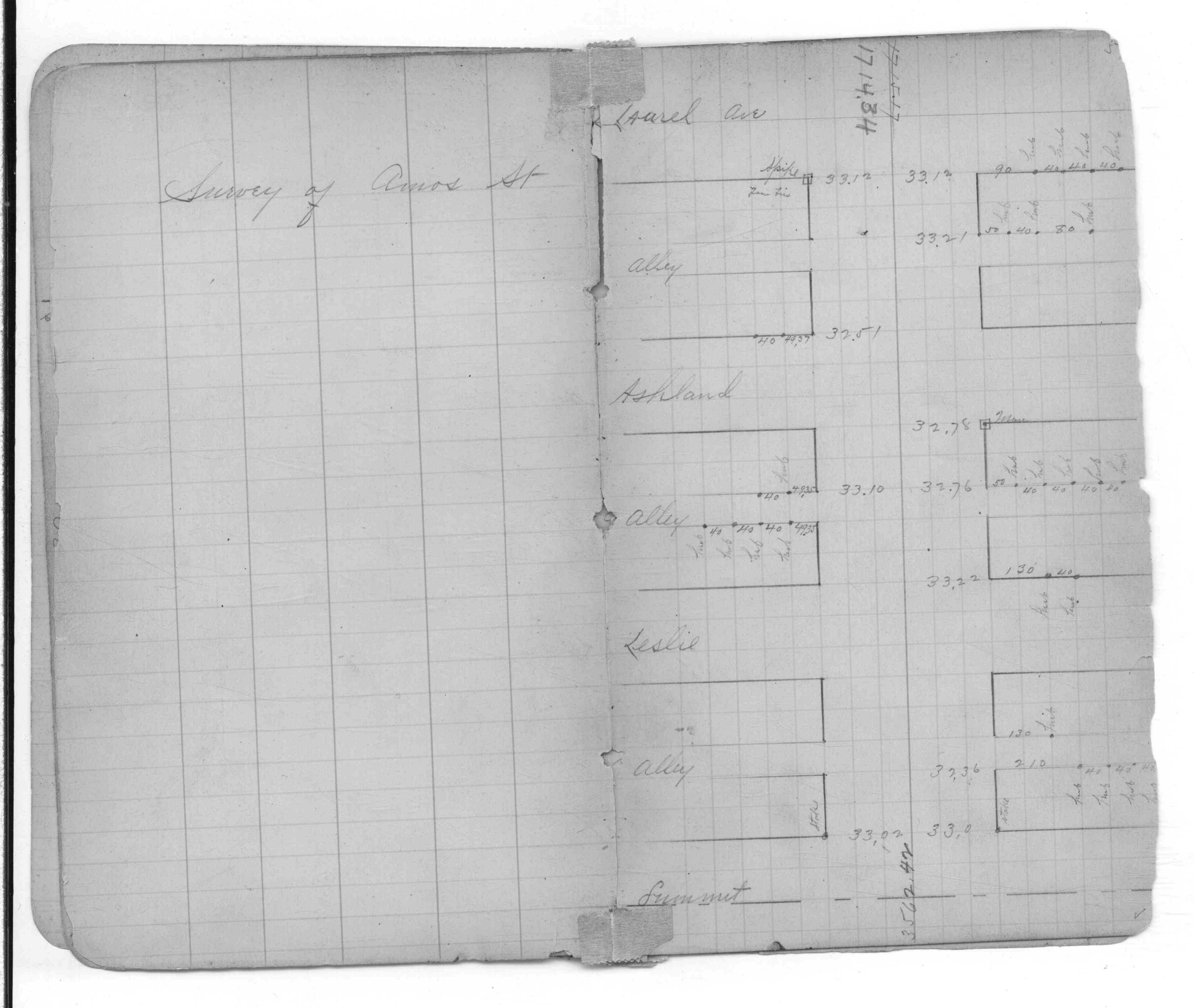
| FB 0257p.57 |
| FILE | SURVEYOR | LIC. NO. | DATE SIGNED | DATE TIED |
|---|---|---|---|---|
| 4637-0851A-B.pdf | Samuel D. Gibson | 44880 | January 2, 2013 | December 3, 2012 |
| 4637-0851A-A.pdf | Samuel D. Gibson | 44880 | August 31, 2012 | March 14, 2012 |
| FILE | PHOTO DATE | COMMENTS |
|---|---|---|
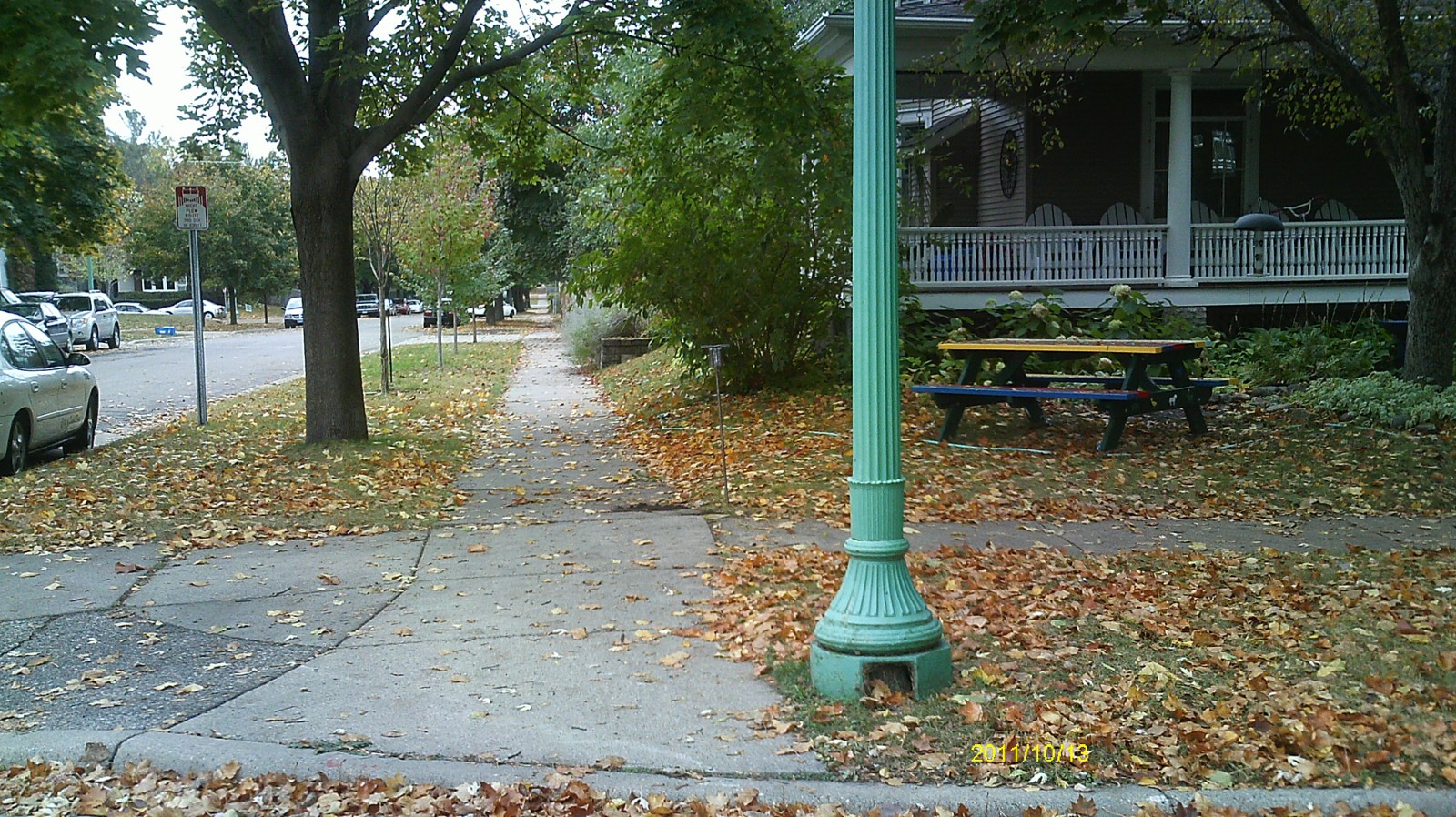
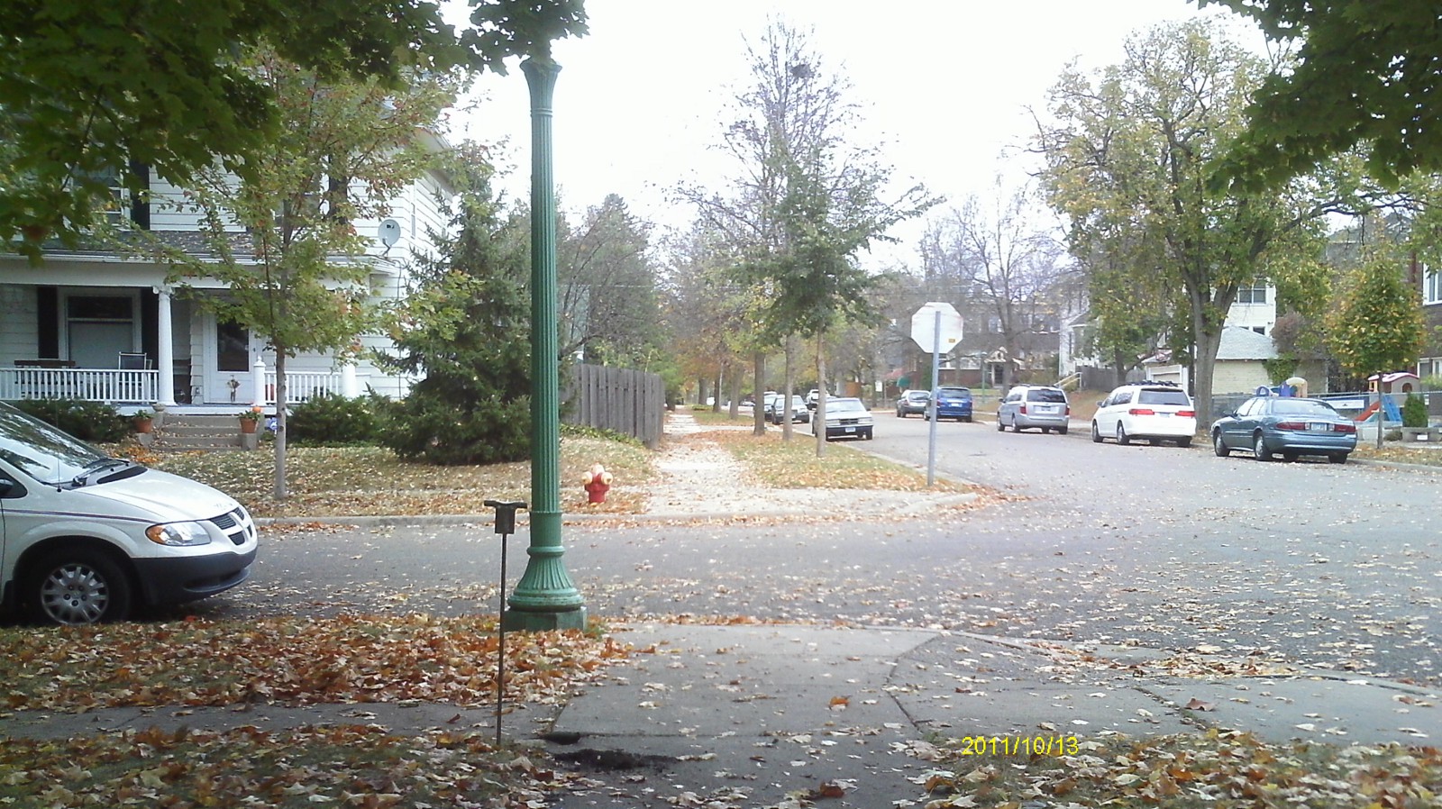
| 4637-0851A-5.jpg | October 13, 2011 | Looking west along Laurel Ave. |
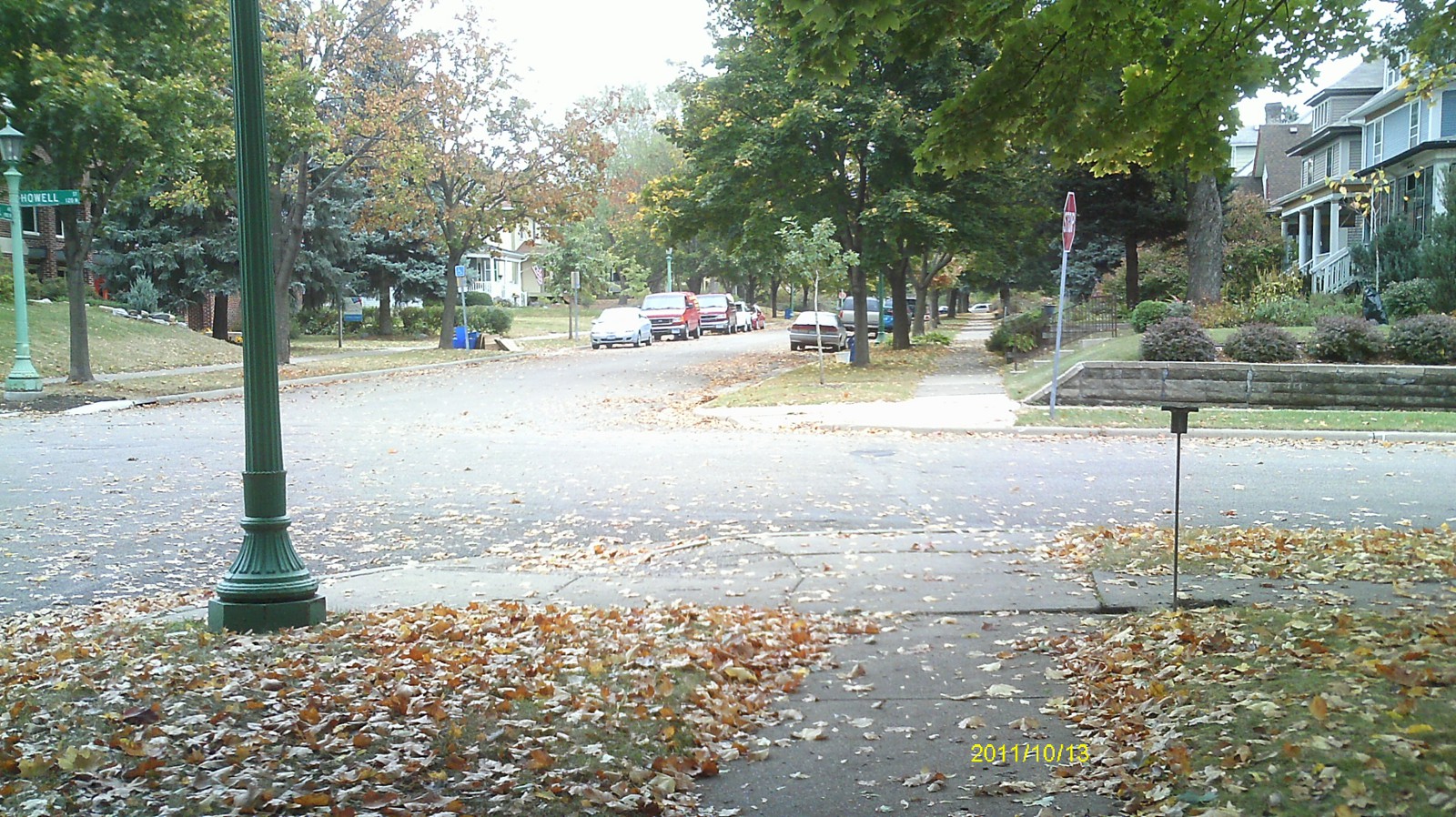
| 4637-0851A-4.jpg | October 13, 2011 | Looking south along Howell St. |
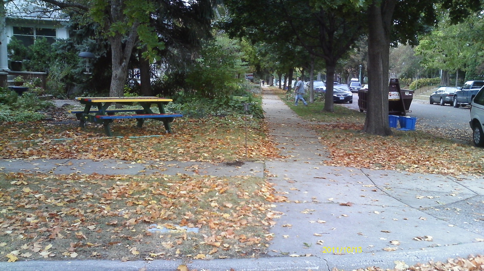
| 4637-0851A-3.jpg | October 13, 2011 | Looking east along Laurel Ave. |
| 4637-0851A-2.jpg | October 13, 2011 | Looking north along Howell St. |
| 4637-0851A-1.jpg | October 13, 2011 | Close up of monument. |