| 2/1/1975 | (Unknown date ___ __, ____ ) Placed ties, position falls on MH. See CofL 0135N-0875-A, copied from FB 1689 p.3 |
| 3/1/1900 | (Unknown date Mar __, 1900 ) Intersection of cuts on manhole by J.B Irvine. |
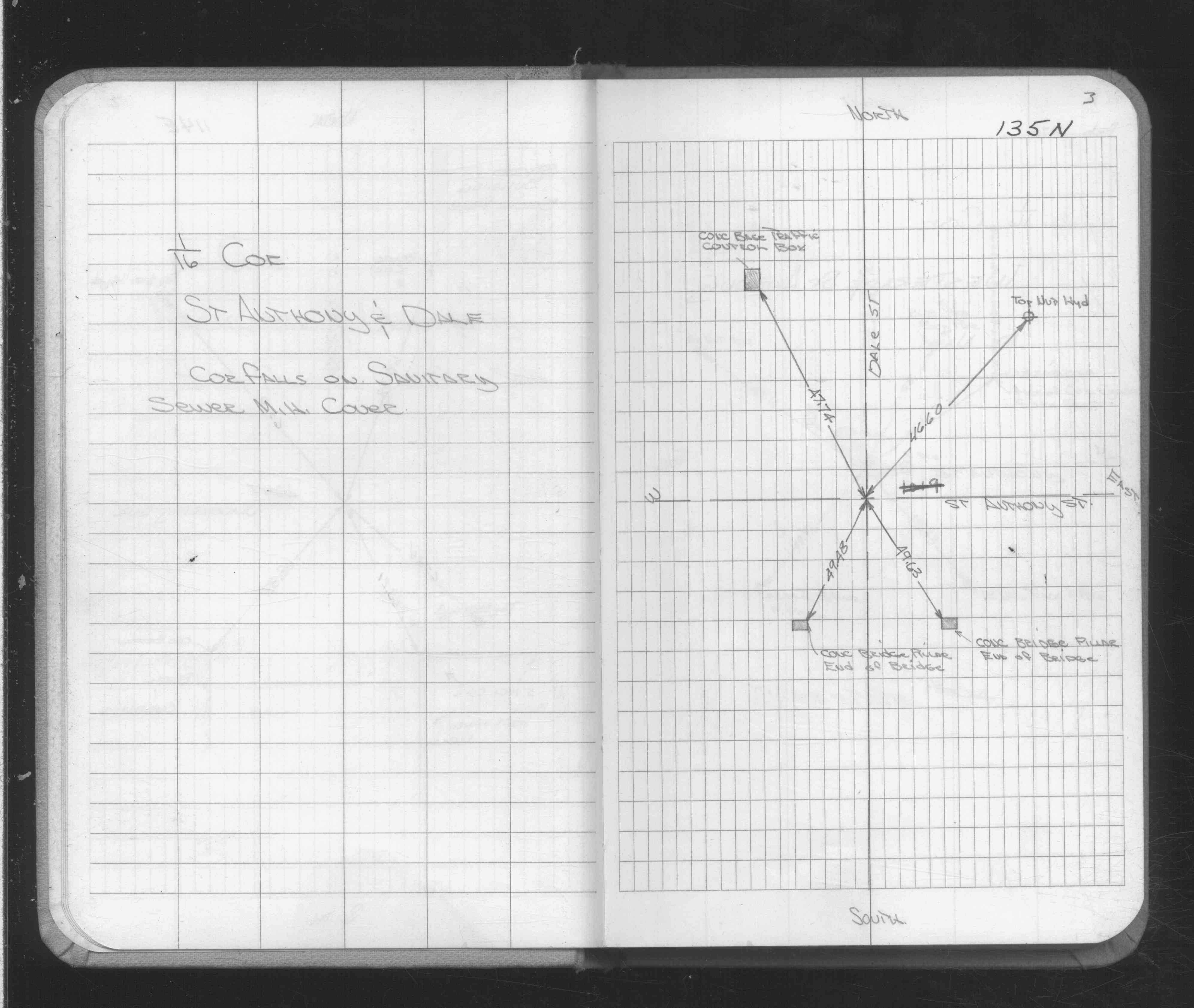
| 1/1/1900 | (Unknown date ___ __, ____ ) Position falls on sanitary MH, placed ties. |
| 1/1/1887 | (Unknown date Jan __, 1887 ) Monument set by McCoy after grading |
Above is NOT an all inclusive history of this point. Please review all the links below.
| PLS NOTES | Field | Cross Section | Sewer | J.B. Irvine | Monument | River Survey |
|---|---|---|---|---|---|---|
| FB 1689p.03 |
| FILE | SURVEYOR | LIC. NO. | DATE SIGNED | DATE TIED |
|---|---|---|---|---|
| 0135N-0875-A.tif | none | none | none | none |