| 4/1/1958 | (Unknown date Apr __, 1958 ) Fd mon't under walk. See FB 1389 p.68 |
| 3/1/1887 | (Unknown date Mar __, 1887 ) Black figures from old notes in Book 106 Red figures from survey by Armstrong |
| 1/1/1800 | (Unknown date ___ __, ____ ) Monument set by H H Fuller |
Above is NOT an all inclusive history of this point. Please review all the links below.
| PLS NOTES | Field | Cross Section | Sewer | J.B. Irvine | Monument | River Survey |
|---|---|---|---|---|---|---|
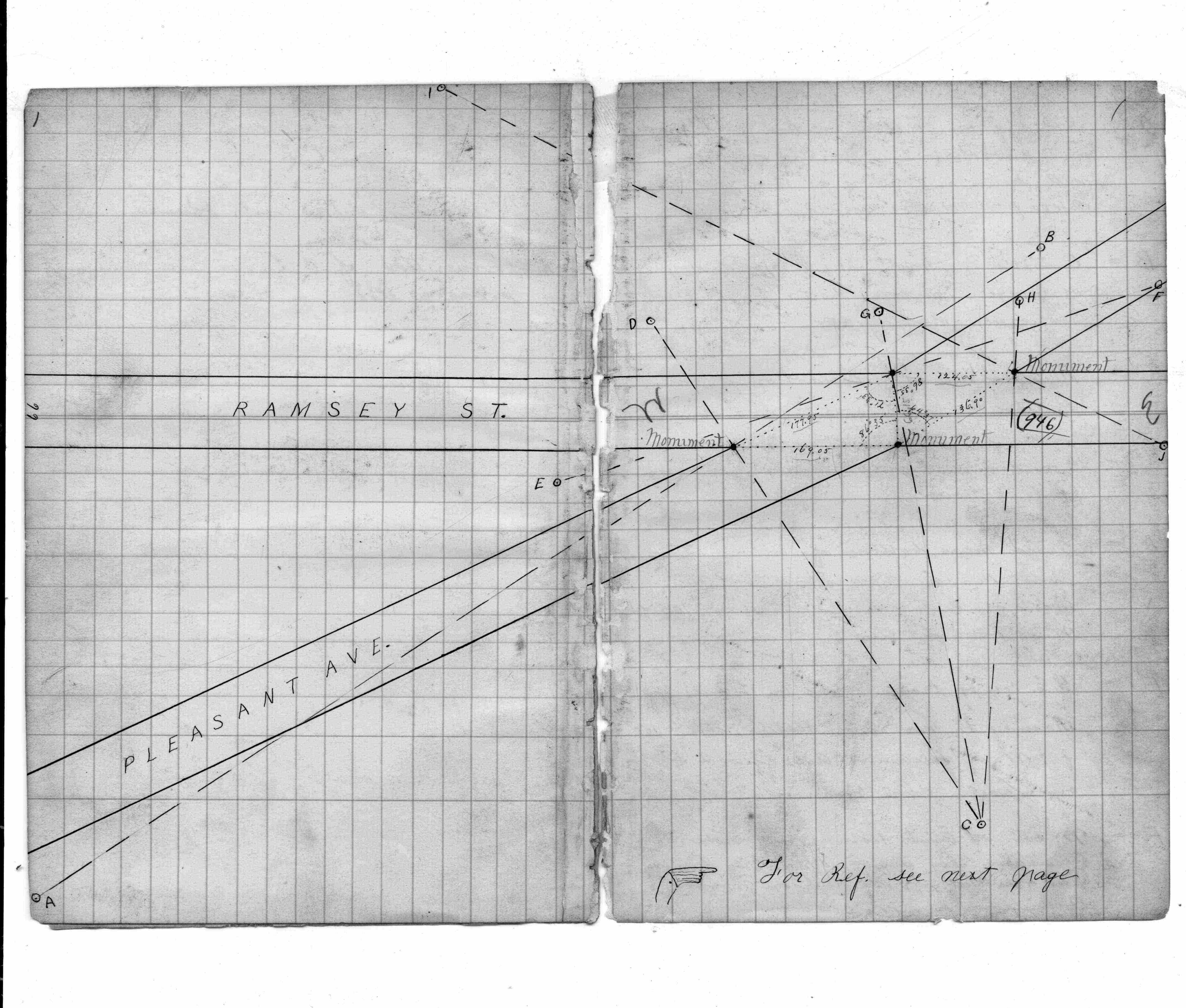
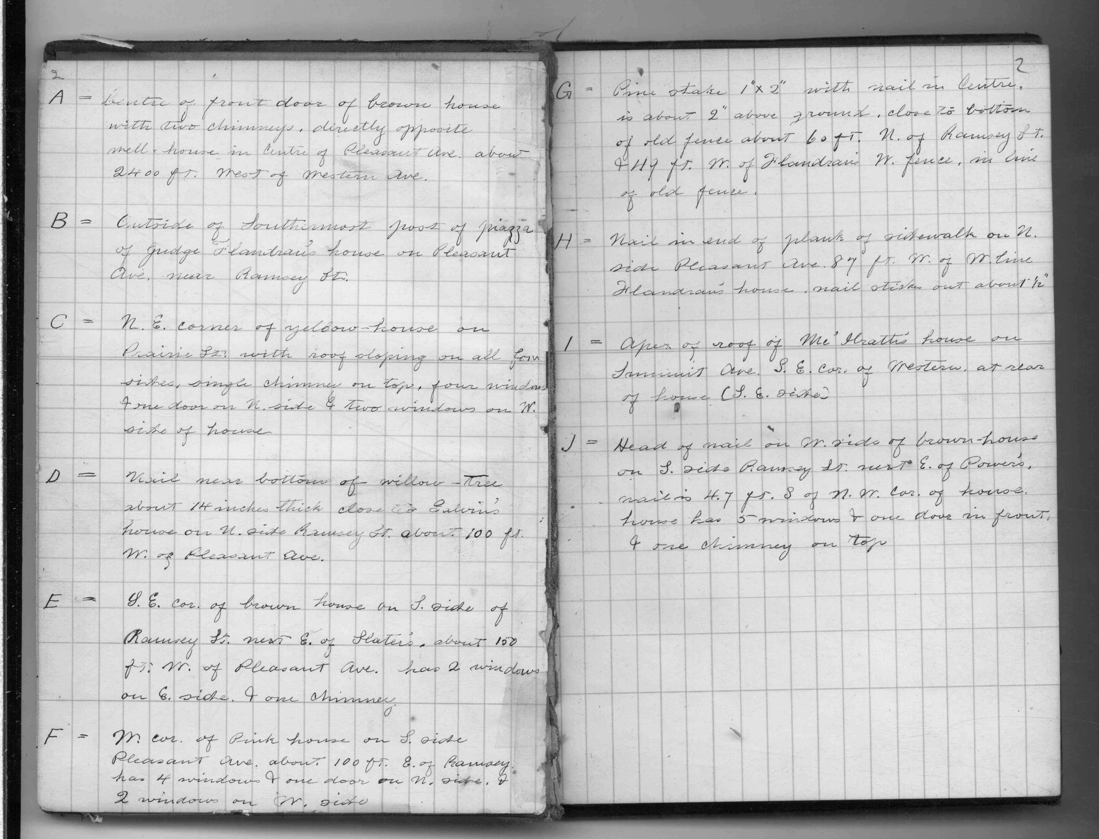
| FB 0106p. 01 ,02 | ||||||
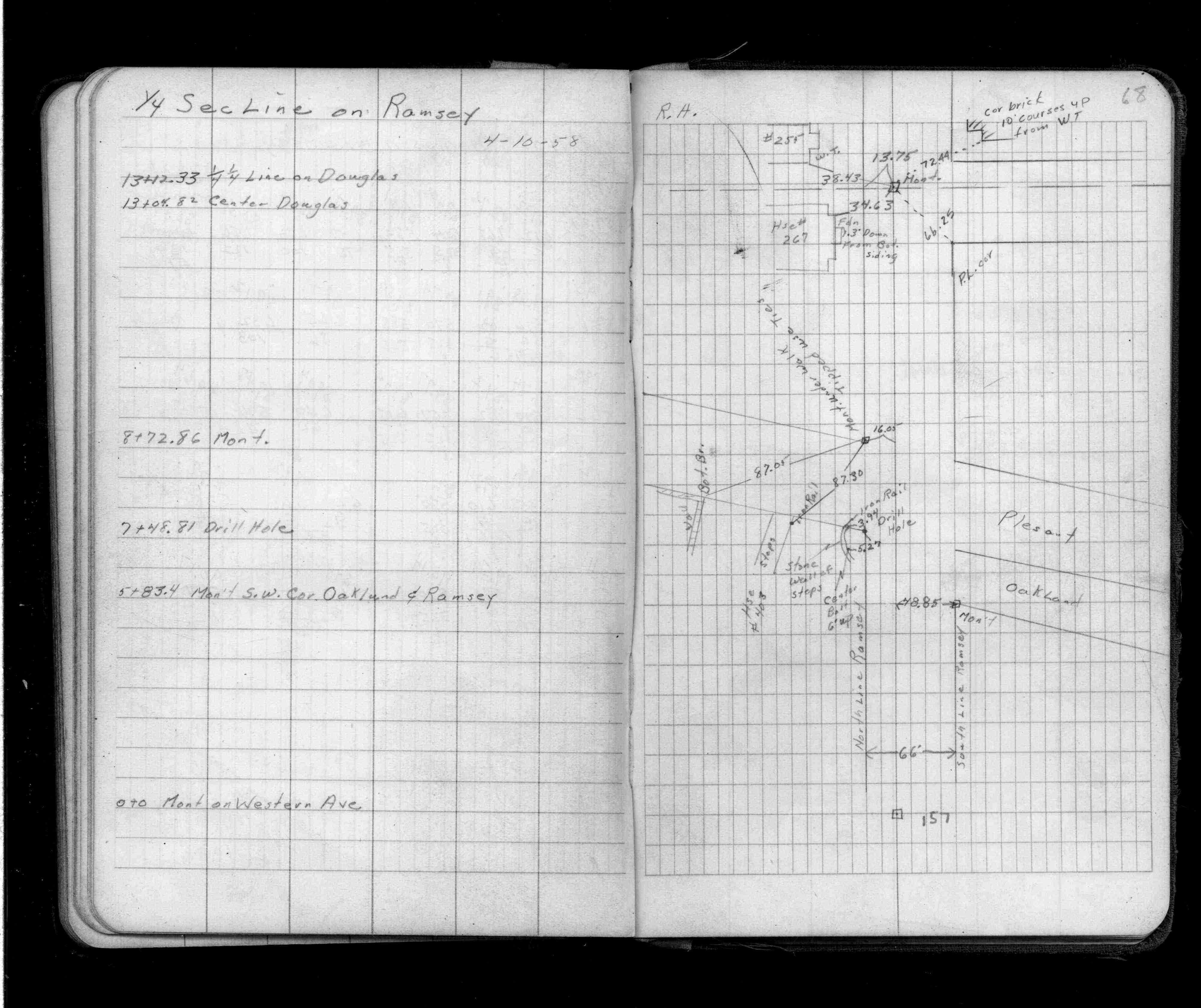
| FB 1389p.68 |