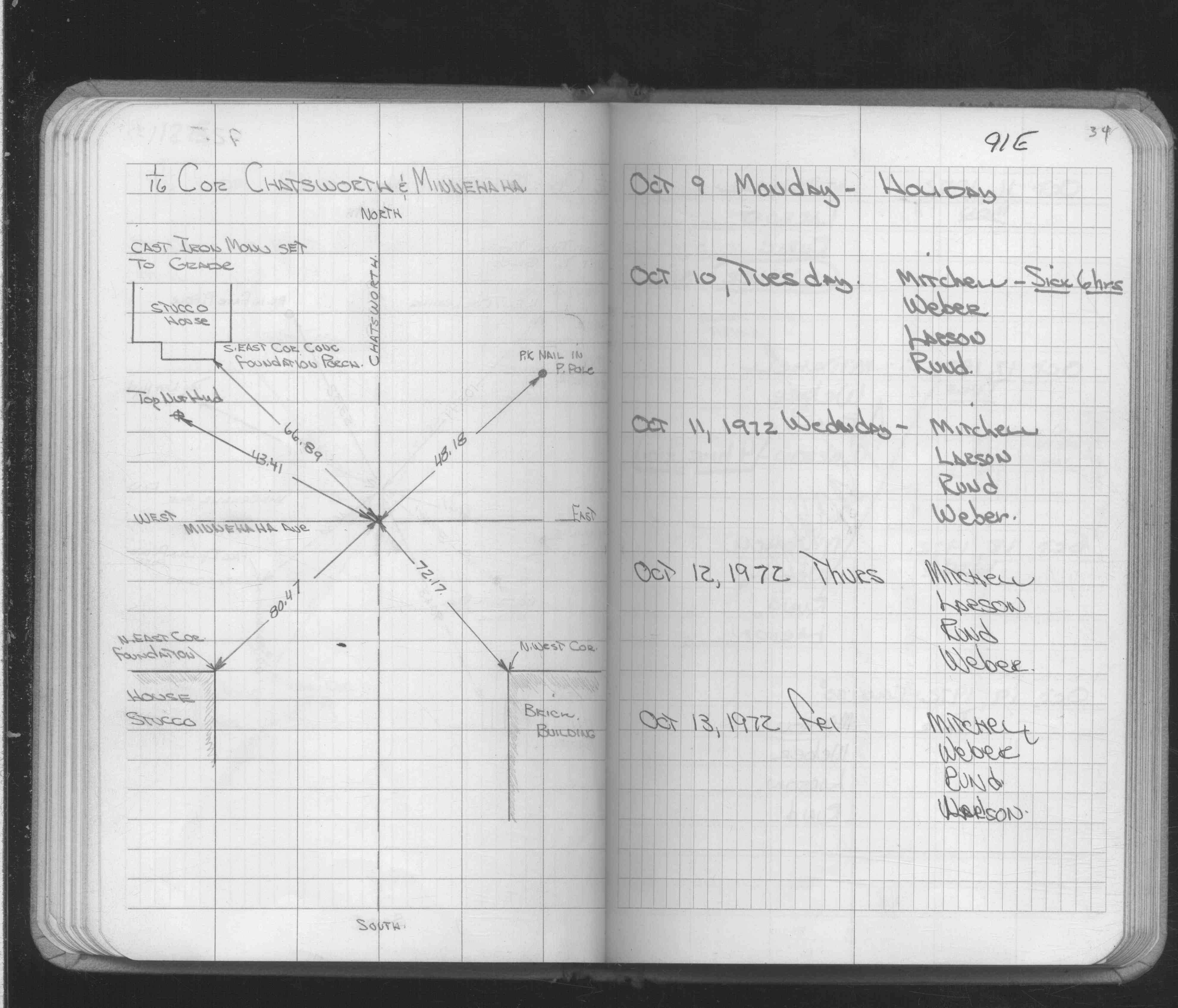
| 10/1/1972 | (Unknown date Oct __, 1972 ) Placed ties on CIM at grade. See CofL 0091E-1000-A, copied from FB 1689A p.34 |
| 12/20/1891 | Monument reset by F J McCarron |
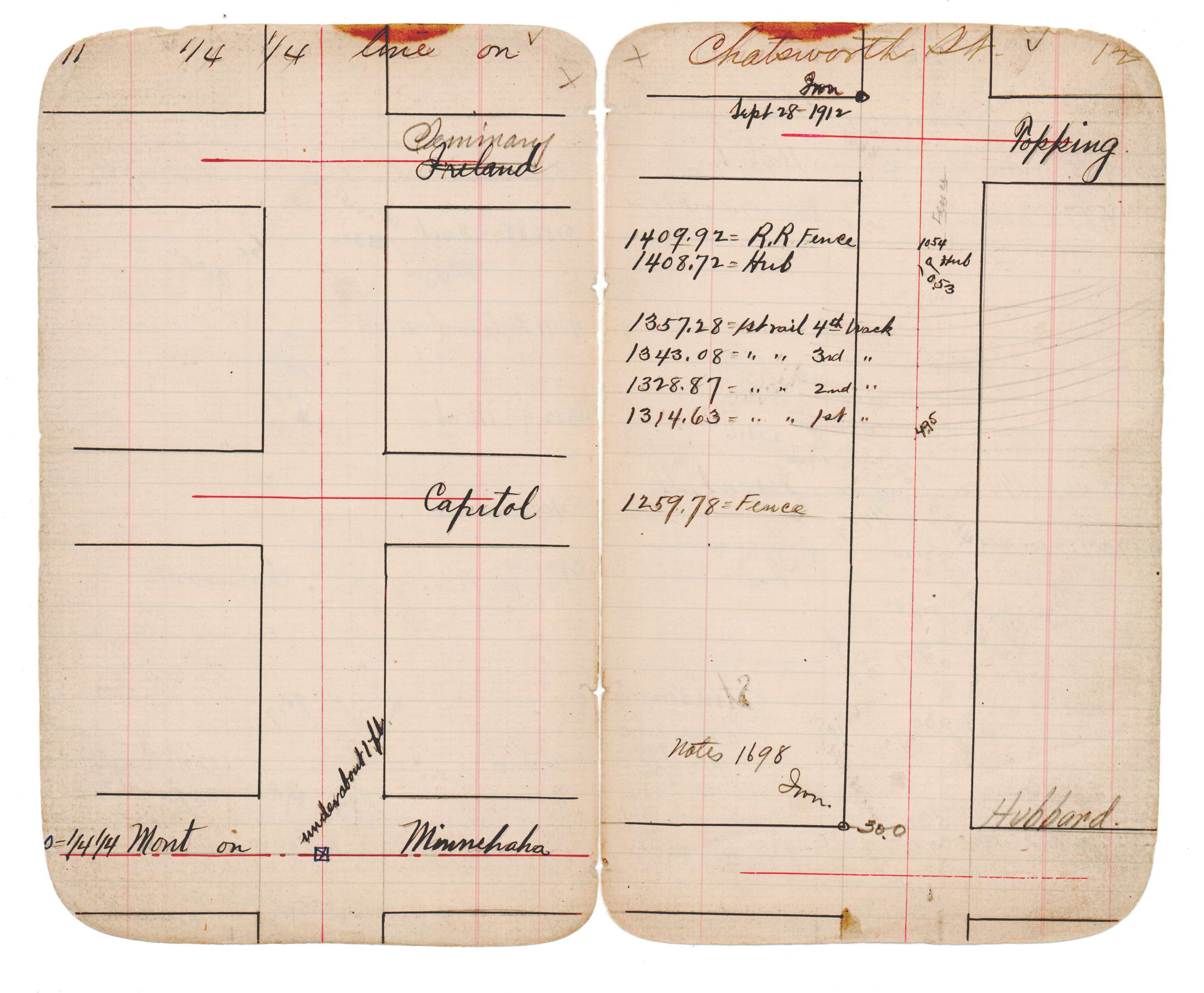
| 1/1/1890 | (Unknown date ___ __, 189? ) See JBI 16 p.11-12 |
| 5/1/1887 | (Unknown date May __, 1887 ) Monument set from survey by Armstrong |
Above is NOT an all inclusive history of this point. Please review all the links below.
| PLS NOTES | Field | Cross Section | Sewer | J.B. Irvine | Monument | River Survey |
|---|---|---|---|---|---|---|
| FB 1689Ap.34 | JBI 16 p.11-12 |
| FILE | SURVEYOR | LIC. NO. | DATE SIGNED | DATE TIED |
|---|---|---|---|---|
| 0091E-1000-A.tif | none | none | none | none |