| 8/29/2013 | Monument not found using magnetic locator. Asphalt obstruction precluded further investigation. |
| 10/17/2003 | Probed down 1.5 feet below existing surface. No monument found. |
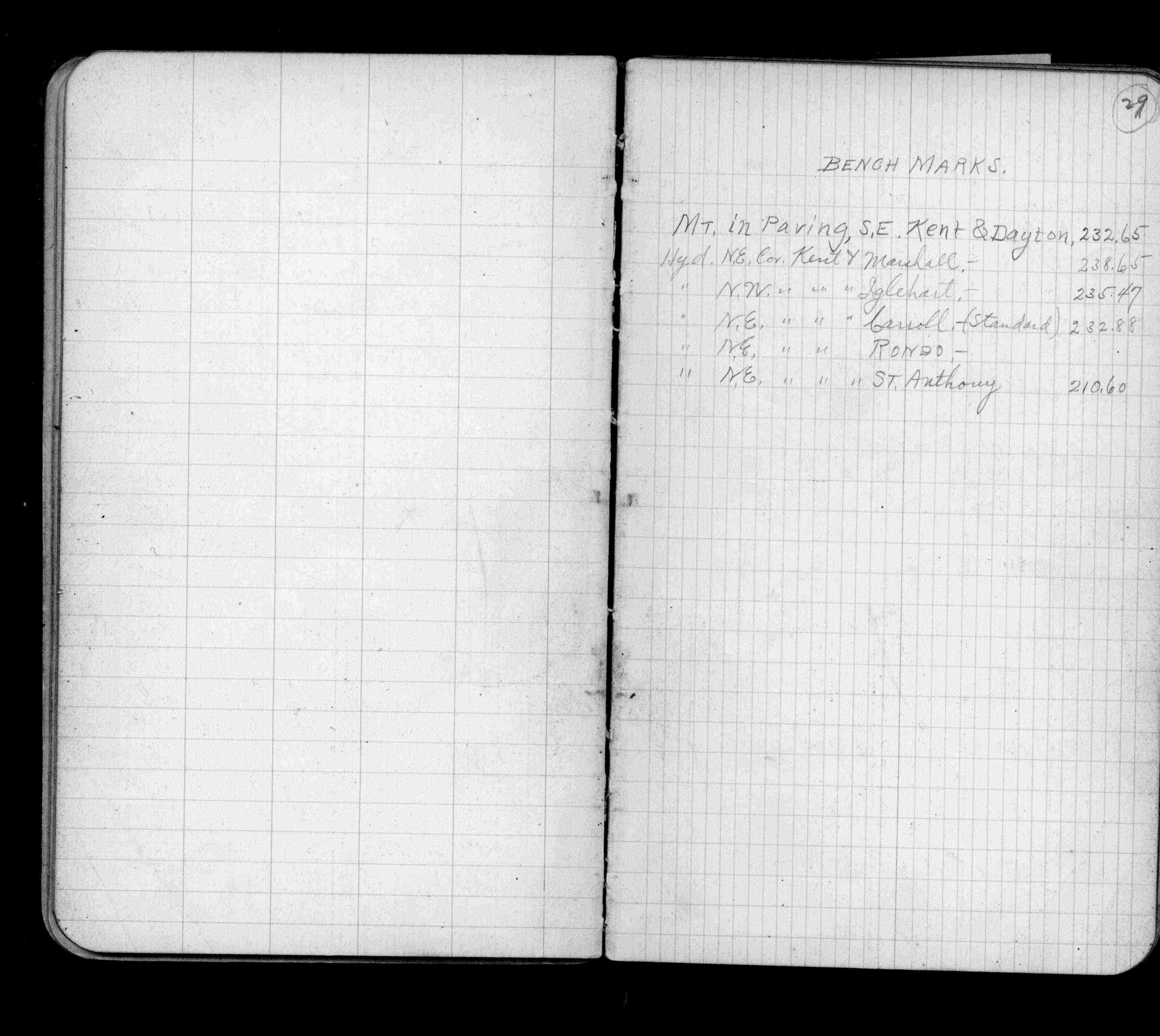
| 1/1/1887 | (Unknown date ___ __, 1887 ) Monument set by Johnson as paved |
| 1/1/1800 | (Unknown date ___ __, 18?? ) Elev 232.650 ft on GM. See Old Benches Book, Entry 1679 SE cor Kent St. and Dayton Ave. |
Above is NOT an all inclusive history of this point. Please review all the links below.
| PLS NOTES | Field | Cross Section | Sewer | J.B. Irvine | Monument | River Survey |
|---|---|---|---|---|---|---|
| FB 0632p.29 |