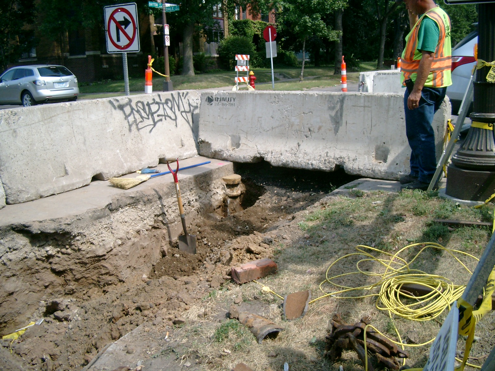
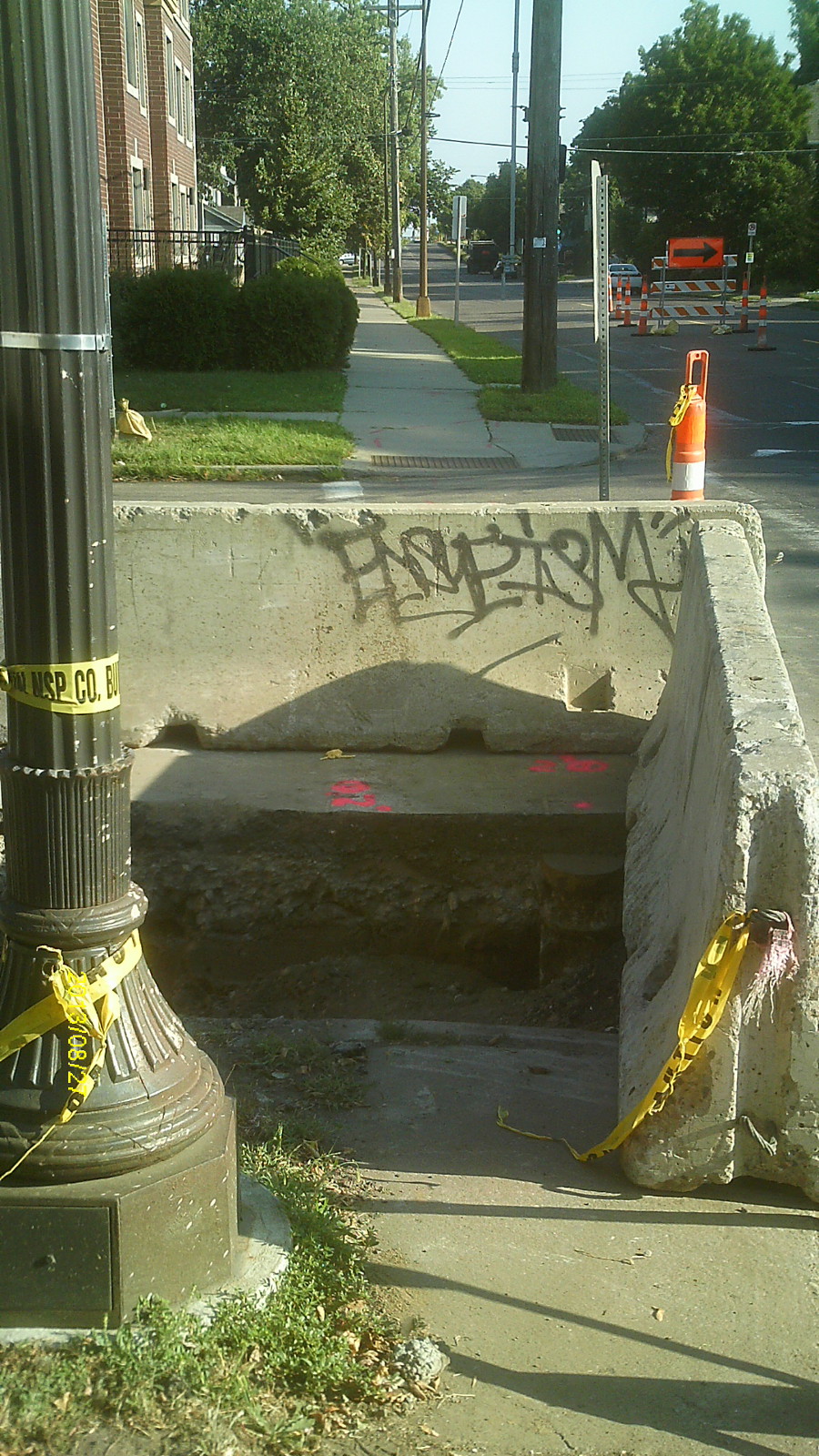
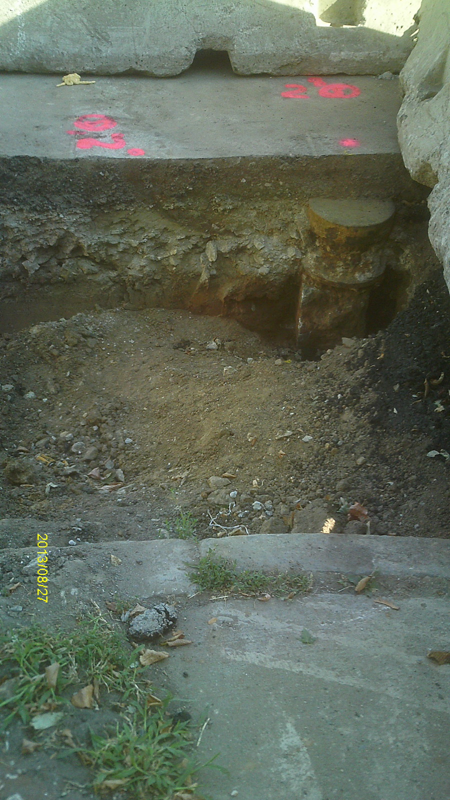
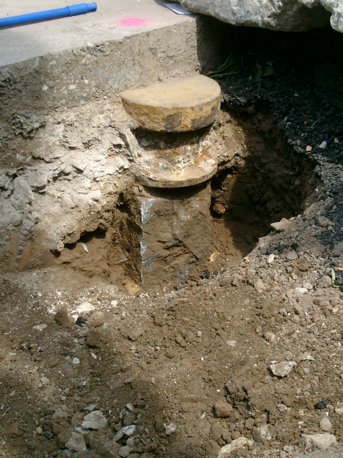
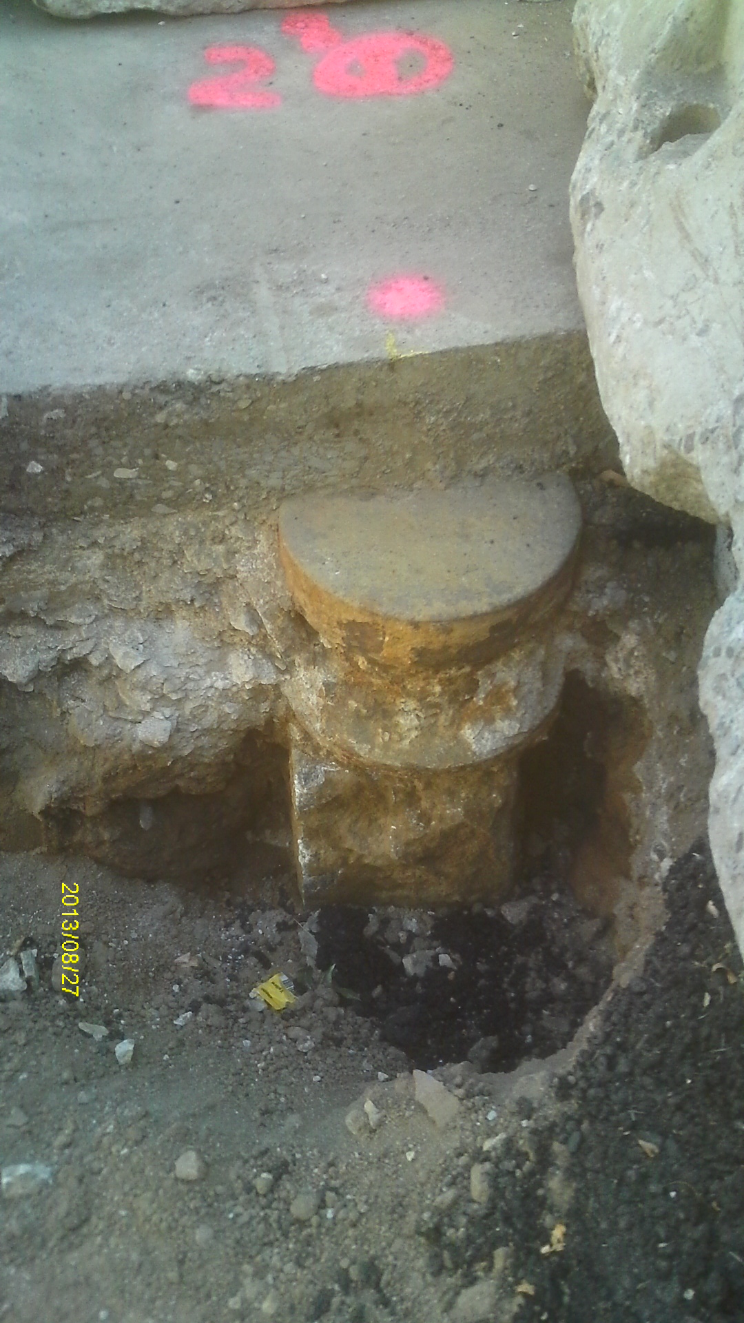
| 8/27/2013 | Found GM appx 0.8 ft below pavement. Large iron disc sits on top of monument, appx 0.3 ft below asphalt. Photos taken. |
| 10/17/2003 | Probed down 1.5 feet below existing surface. No monument found. |
| 1/1/1887 | (Unknown date ___ __, 1887 ) Monument set by Johnson as paved |
Above is NOT an all inclusive history of this point. Please review all the links below.
| PLS NOTES | Field | Cross Section | Sewer | J.B. Irvine | Monument | River Survey |
|---|---|---|---|---|---|---|
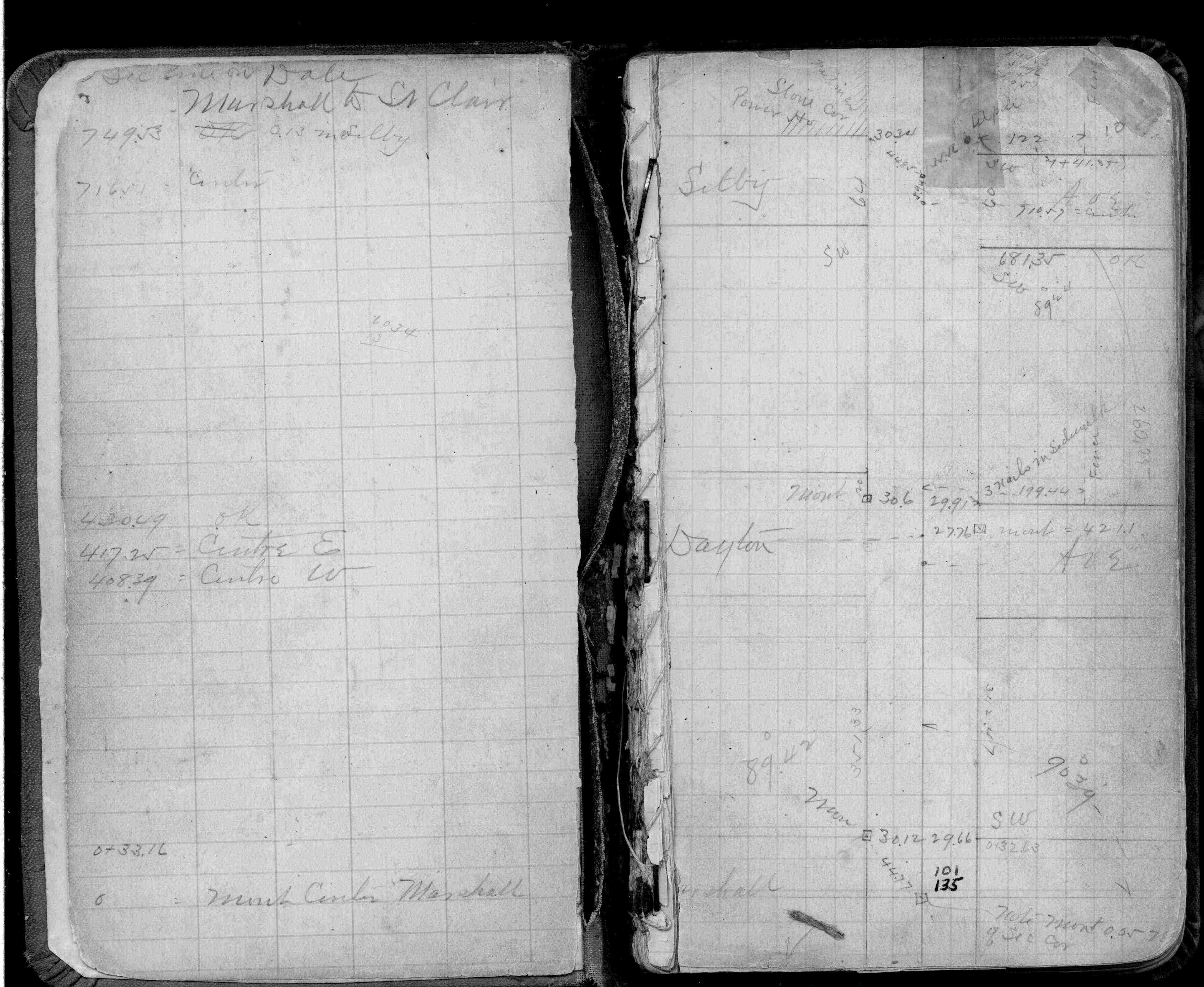
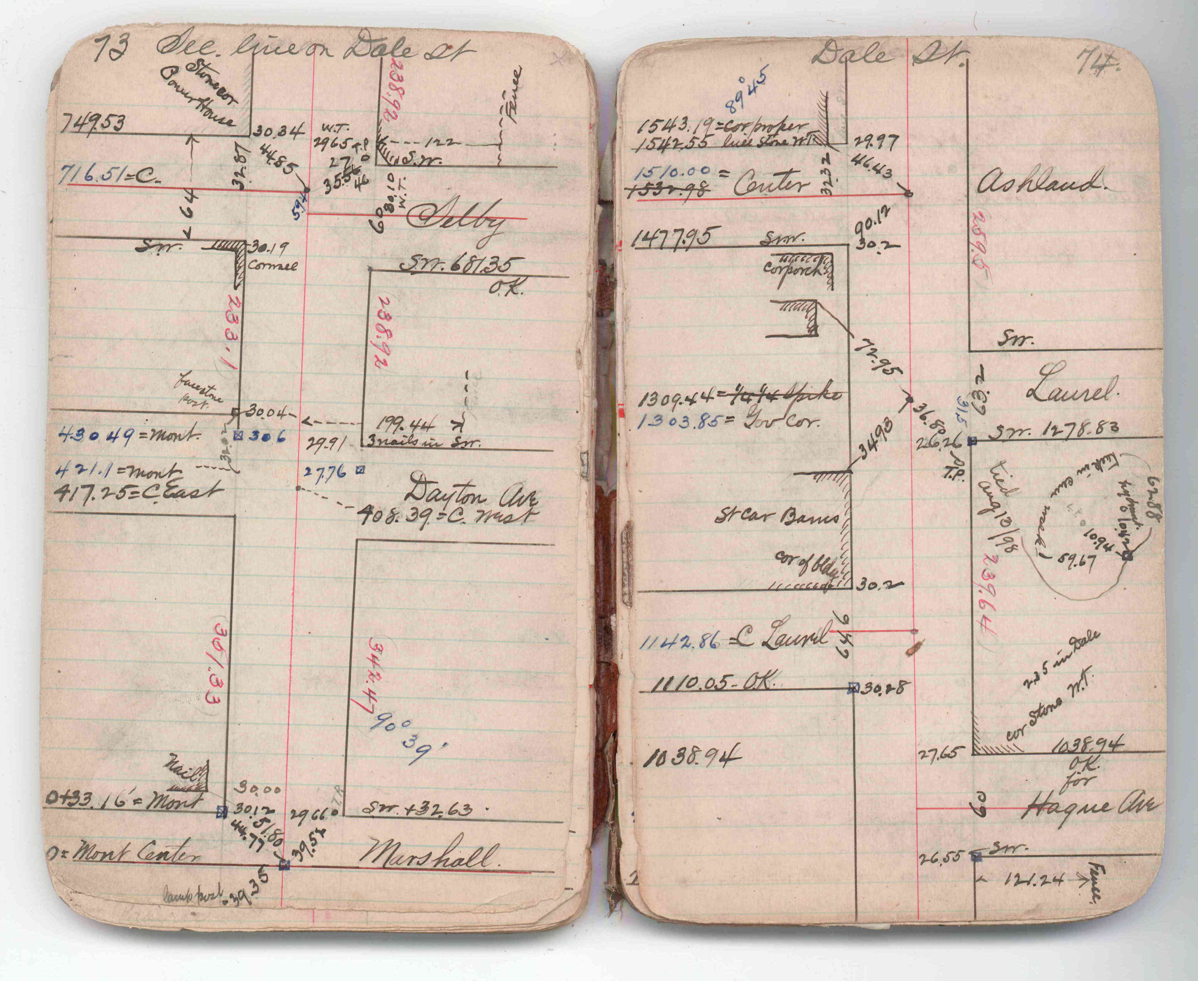
| FB 0220p.10 | JBI 07 p.73-74 |
| FILE | PHOTO DATE | COMMENTS |
|---|---|---|
| 4875-1107A-5.jpg | August 27, 2013 | Looking northeast towards monument. |
| 4875-1107A-4.jpg | August 27, 2013 | Looking north along Dale St. |
| 4875-1107A-3.jpg | August 27, 2013 | Looking north towards monument. |
| 4875-1107A-2.jpg | August 27, 2013 | Close up of monument. |
| 4875-1107A-1.jpg | August 27, 2013 | Close up of monument. |