| 8/21/2006 | Concrete pavement removed. Dug 2' dia hole, dug 2' feet deep, probed an addtional 1'. No monument found. |
| 11/1/1980 | (Unknown date Nov __, 1980 ) Placed ties on RR spike. See SB 625 p.4 |
| 11/1/1972 | (Unknown date Nov __, 1972 ) Set brass plug inplace of nail with disc, placed ties on brass plug, See CofL 0093E-1589-A, copied from FB 1689A p.32 |
| 12/19/1891 | Monument reset by F J McCarron |
| 5/27/1889 | Monument set from survey by J H Armstrong. see FB 276 |
Above is NOT an all inclusive history of this point. Please review all the links below.
| PLS NOTES | Field | Cross Section | Sewer | J.B. Irvine | Monument | River Survey |
|---|---|---|---|---|---|---|
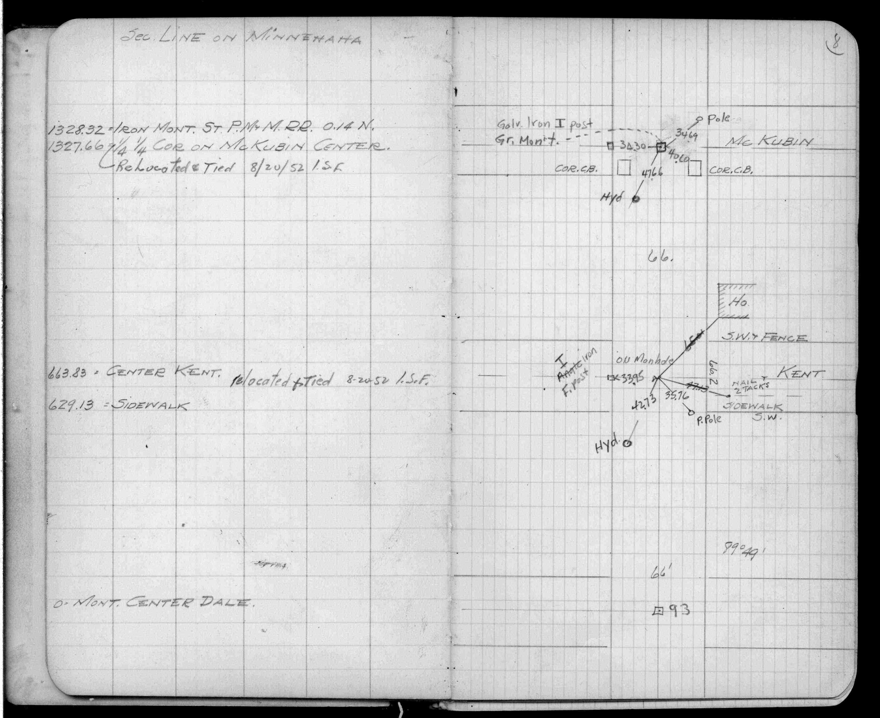
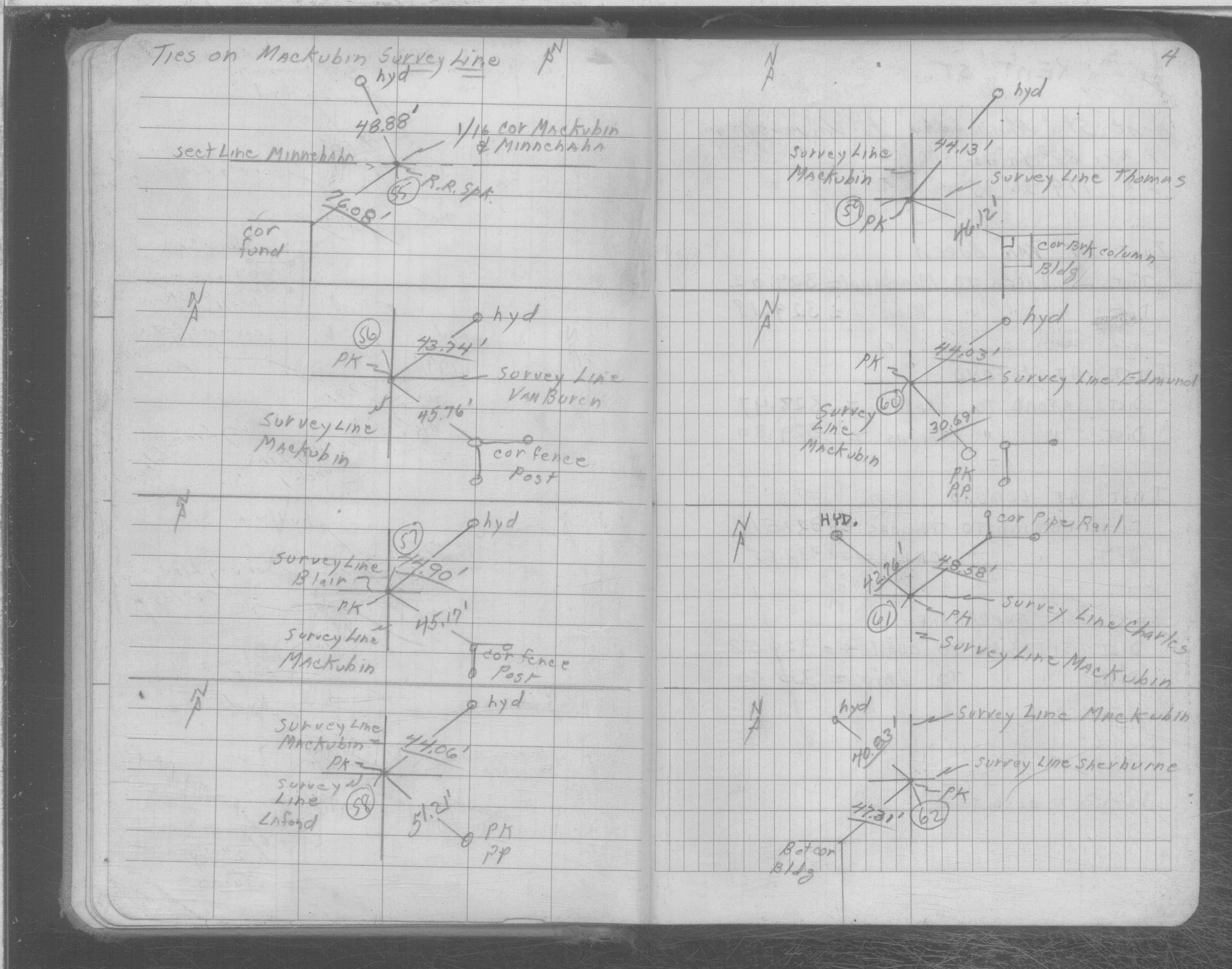
| FB 0276CPYp.08 | SB 0625p.04 |
| FILE | SURVEYOR | LIC. NO. | DATE SIGNED | DATE TIED |
|---|---|---|---|---|
| 0093E-1589-A.tif | none | none | none | none |