| NAD83 COORDINATES (1986 adj.): |
|---|
| X= 566508.289 Y= 166703.562 Z= 877.676 10/20/2011 RTK-VRS |
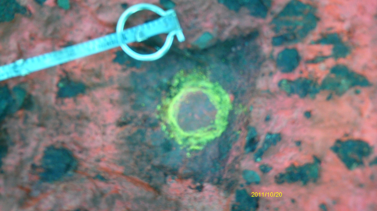
| 10/20/2011 | Position established by RTK-VRS GPS. Elev 183.57 ft. |
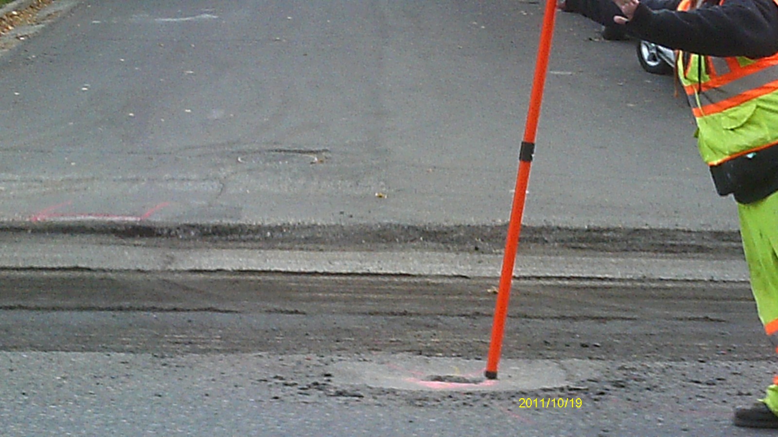
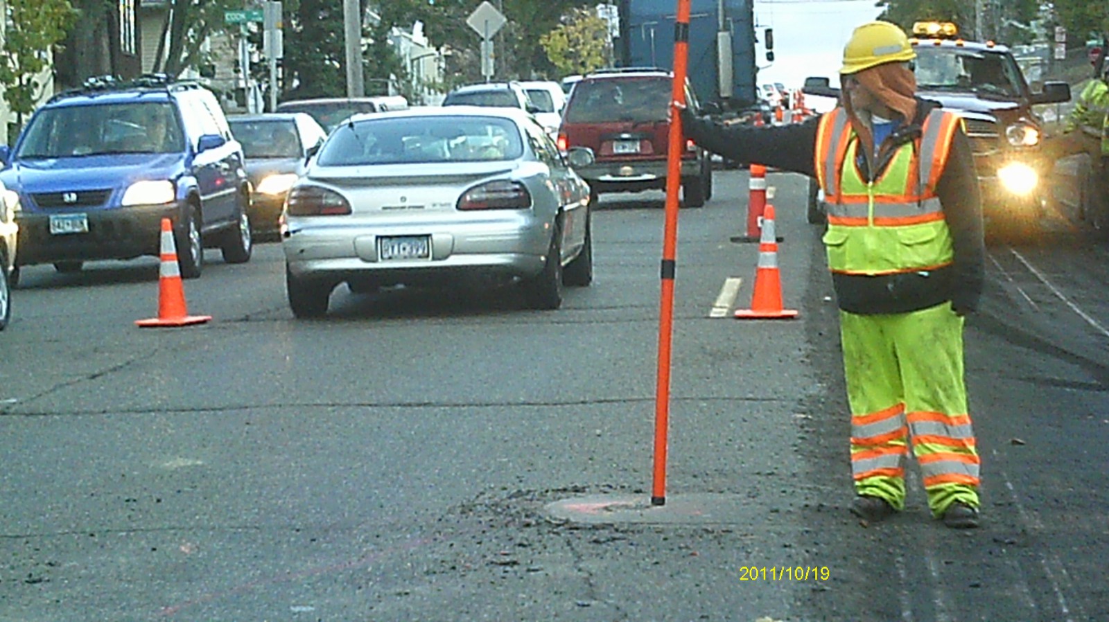
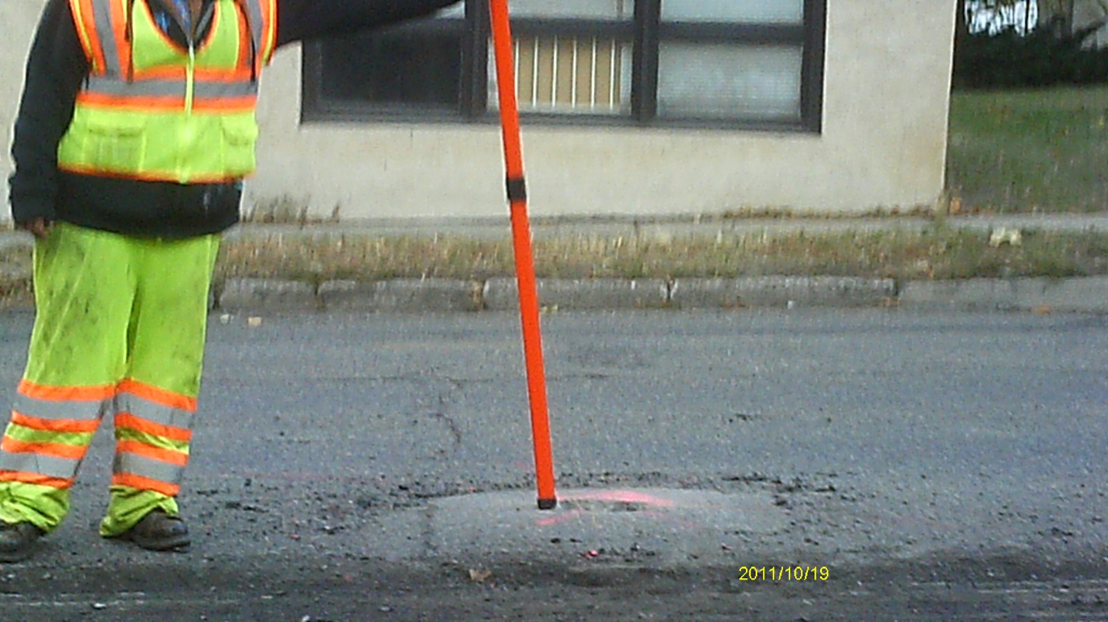
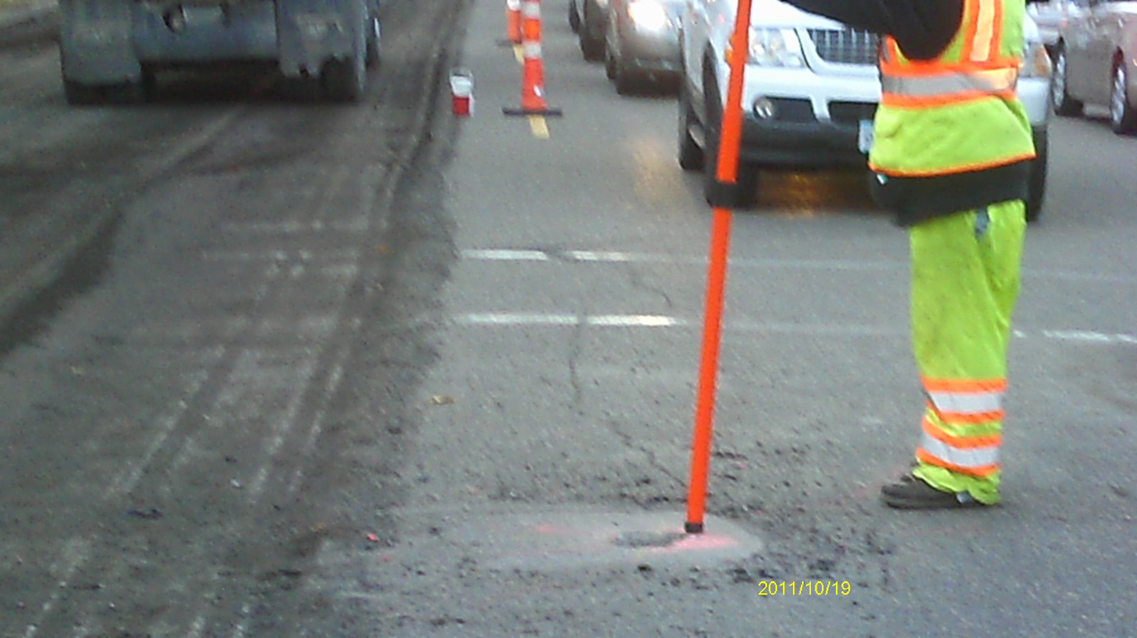
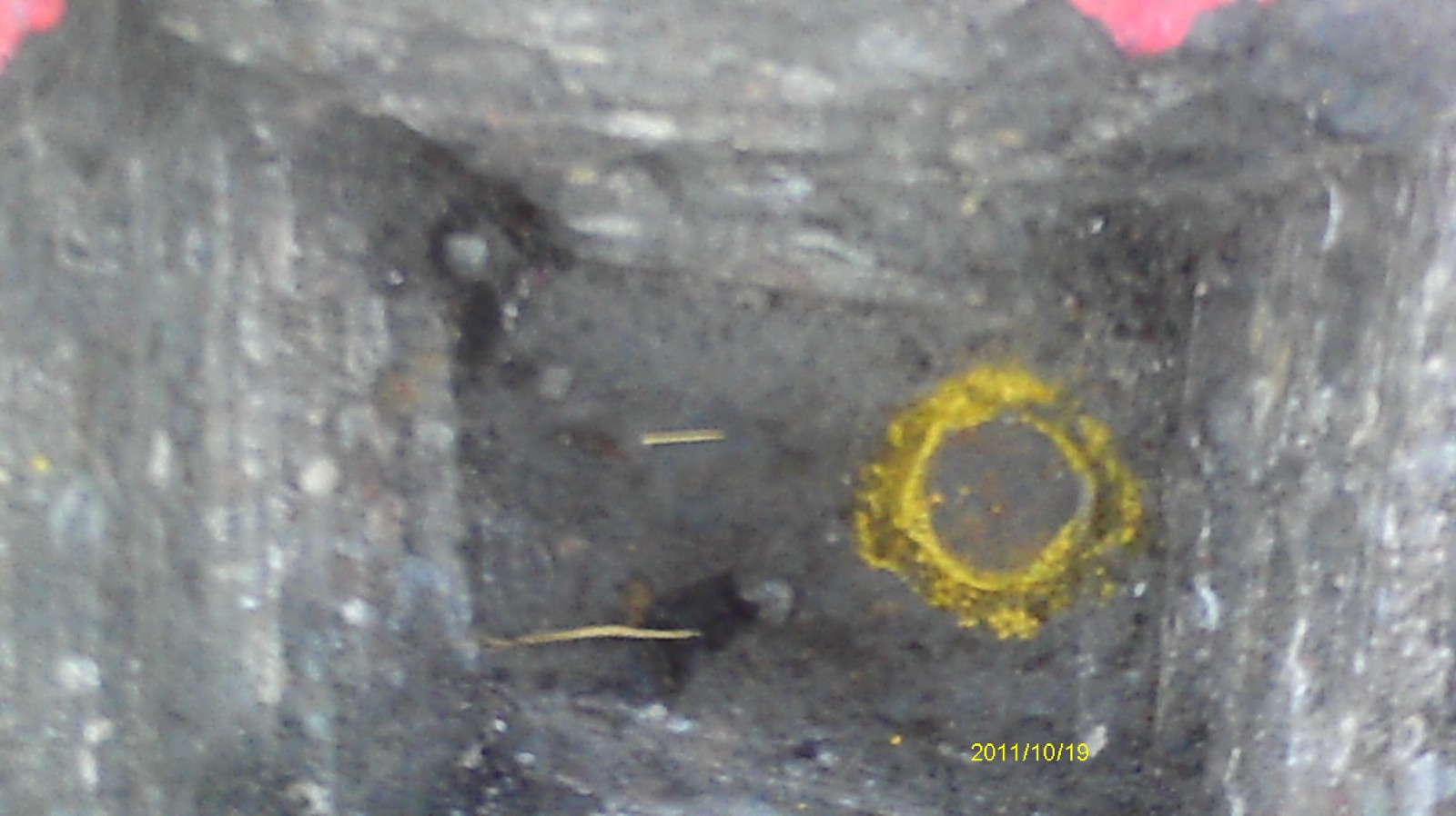
| 10/19/2011 | Found iron w/ hexagonal head 0.3' ft below milled surface of street. Photos taken and EDM ties placed using Trimble S6. |
| 7/14/1997 | Found six sided 1" dia. bolt 0.15 feet below grade & retied. See CofL 0072N-1669-A |
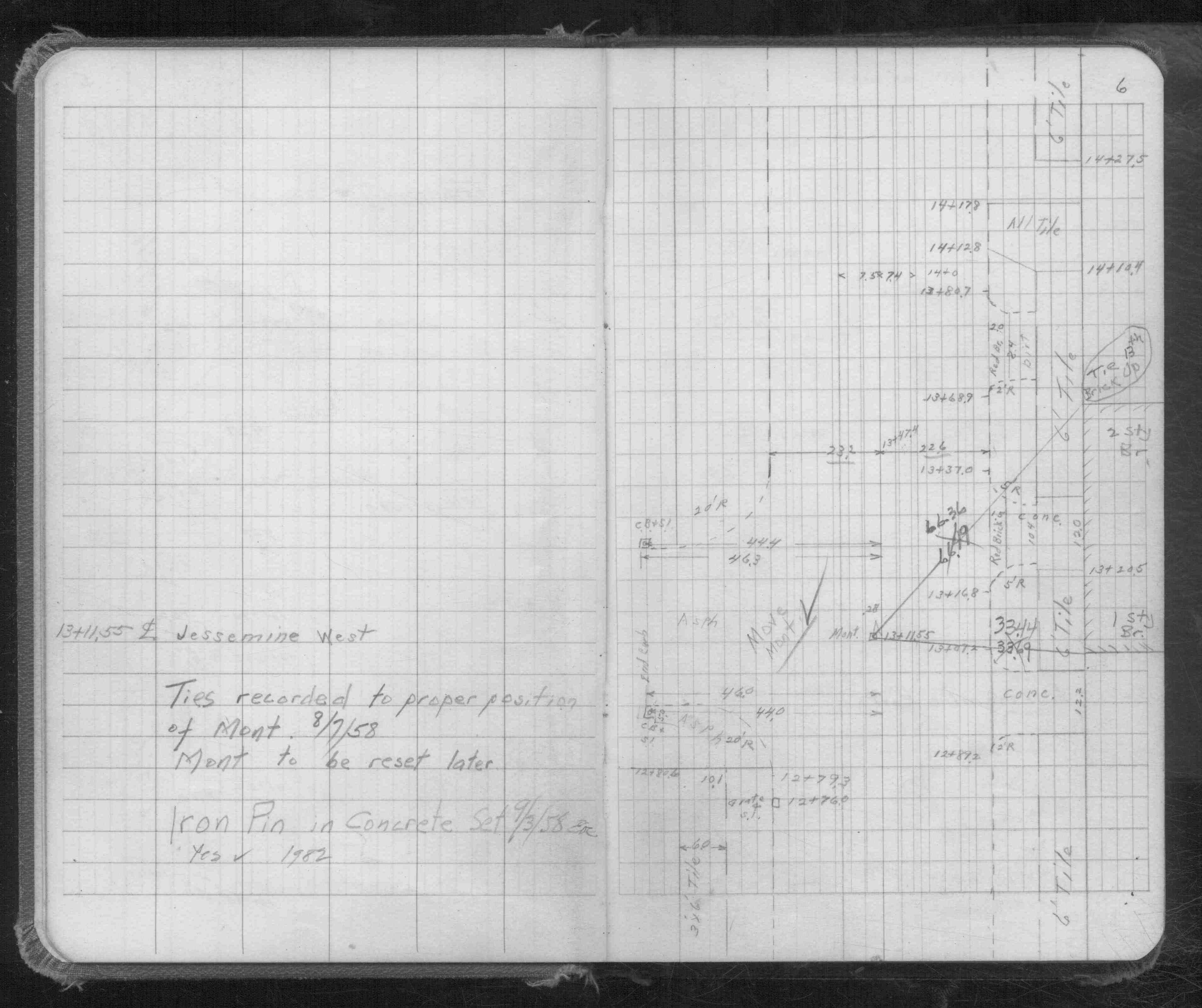
| 9/1/1958 | (Unknown date Sep __, 1958 ) Set Iron Pin in concrete & placed ties. See FB 1481 p.6 |
| 11/30/1889 | Monument set by J H Armstrong |
Above is NOT an all inclusive history of this point. Please review all the links below.
| PLS NOTES | Field | Cross Section | Sewer | J.B. Irvine | Monument | River Survey |
|---|---|---|---|---|---|---|
| FB 1481p.06 |
| FILE | SURVEYOR | LIC. NO. | DATE SIGNED | DATE TIED |
|---|---|---|---|---|
| 5399-1669-A.pdf | Samuel D. Gibson | 44880 | August 17, 2012 | October 20, 2011 |
| 0072N-1669-A.tif | none | none | none | July 14, 1997 |
| FILE | PHOTO DATE | COMMENTS |
|---|---|---|
| 5399-1669-6.jpg | October 19, 2011 | Looking west along Jessamine Ave. |
| 5399-1669-5.jpg | October 19, 2011 | Looking south along Dale St. |
| 5399-1669-4.jpg | October 19, 2011 | Looking east. |
| 5399-1669-3.jpg | October 19, 2011 | Looking north along Dale St. |
| 5399-1669-2.jpg | October 19, 2011 | Close up of monument. |
| 5399-1669-1.jpg | October 19, 2011 | Close up of monument. |