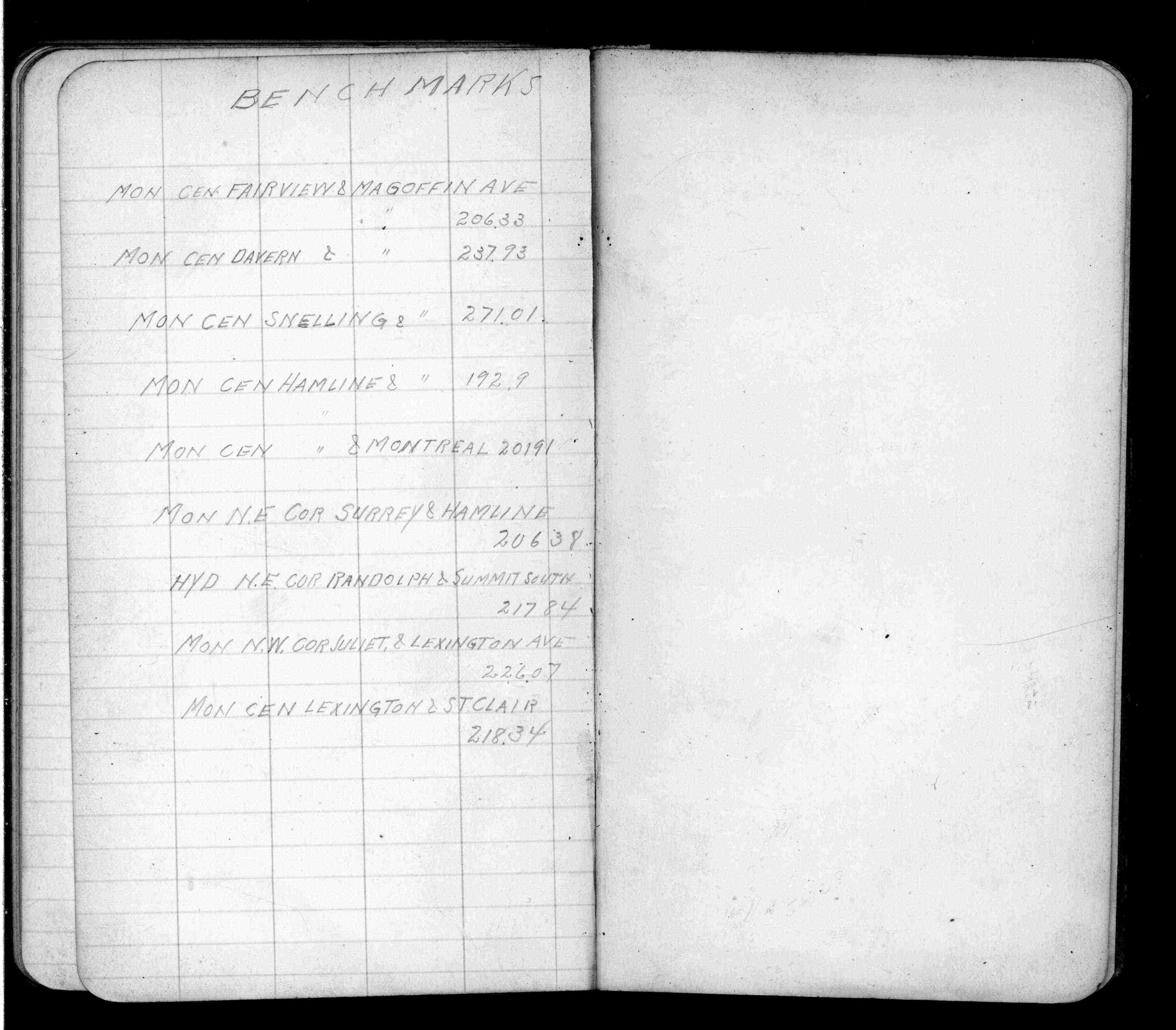
| 1/1/1912 | Recorded elevation of 206.33 on the monument. See FB 675 p.79 |
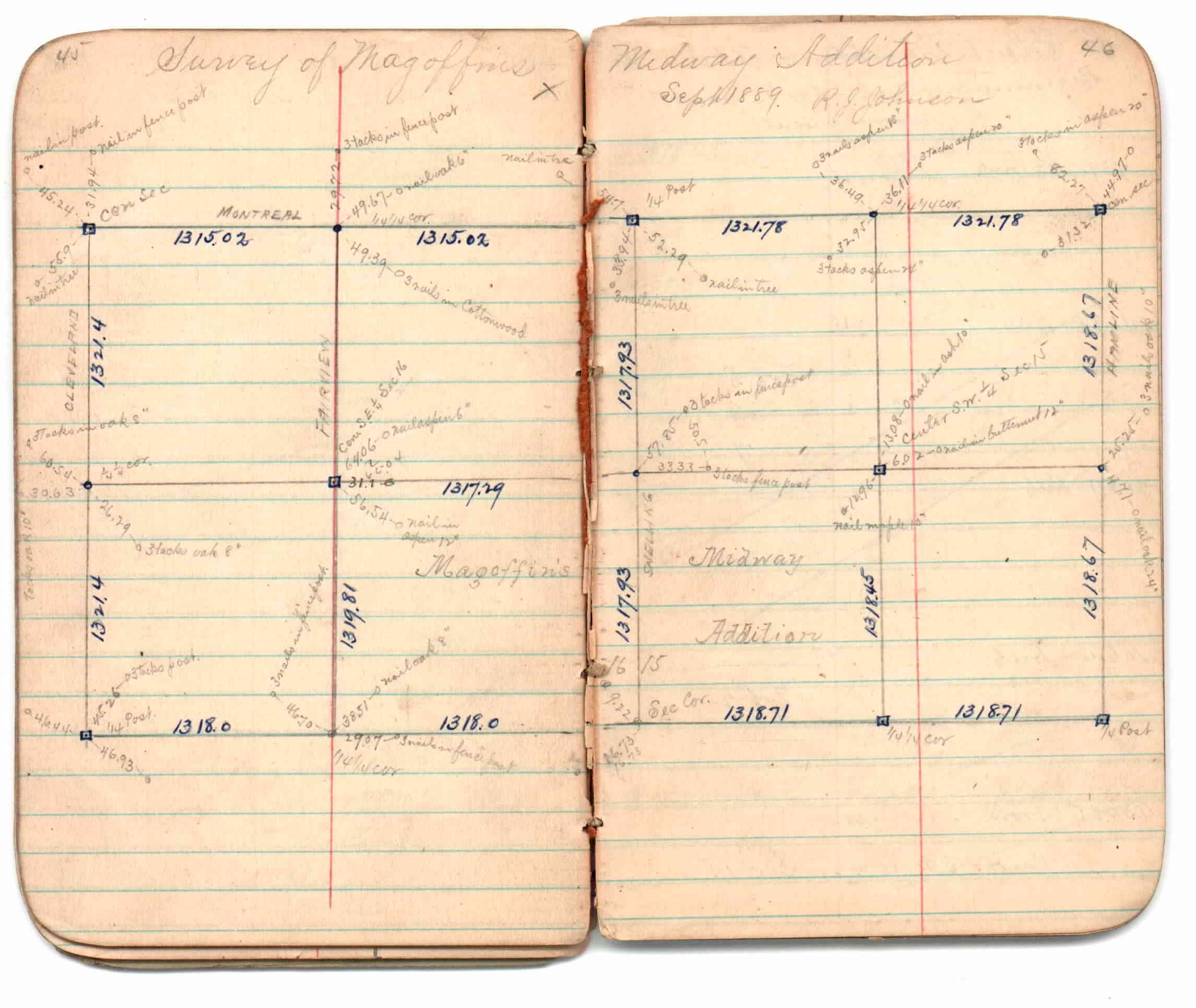
| 9/1/1889 | (Unknown date Sep __, 1889 ) Survey of Magoffins Midway Addition by R J Johnson. See JBI 01 p.45-46 |
| 9/1/1889 | (Unknown date Sep __, 1889 ) Monument set by R J Johnson. See Old Index Book, Entry 1708 |
Above is NOT an all inclusive history of this point. Please review all the links below.
| PLS NOTES | Field | Cross Section | Sewer | J.B. Irvine | Monument | River Survey |
|---|---|---|---|---|---|---|
| FB 0675p.79 | JBI 01 p.45-46 |