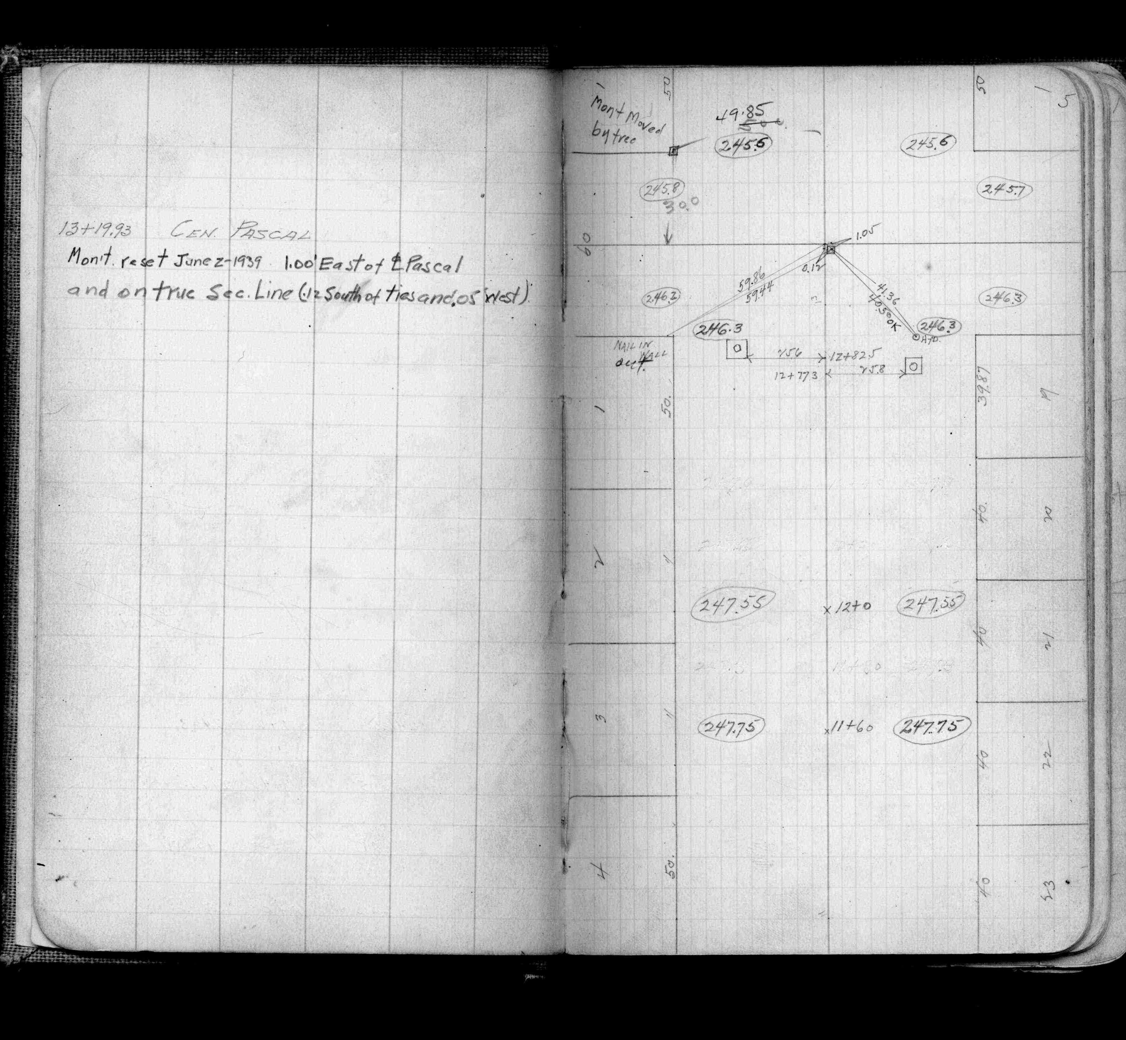
| 6/2/1939 | Monument reset. See FB 921 p.5 |
| 5/19/1899 | See notes before using. |
| 6/1/1894 | (Unknown date Jun __, 1994 ) Monument ok. |
| 3/1/1891 | (Unknown date Mar __, 1891 ) Placed ties. See FB 345 p.15 |
| 8/30/1889 | Monument set by Chas A Hunt after grading |
| 1/1/1800 | (Unknown date ___ __, ____ ) Same as old index #2264. |
Above is NOT an all inclusive history of this point. Please review all the links below.
| PLS NOTES | Field | Cross Section | Sewer | J.B. Irvine | Monument | River Survey |
|---|---|---|---|---|---|---|
| FB 0345p.15 | CS 1308p.04 | |||||
| FB 0921p.05 |