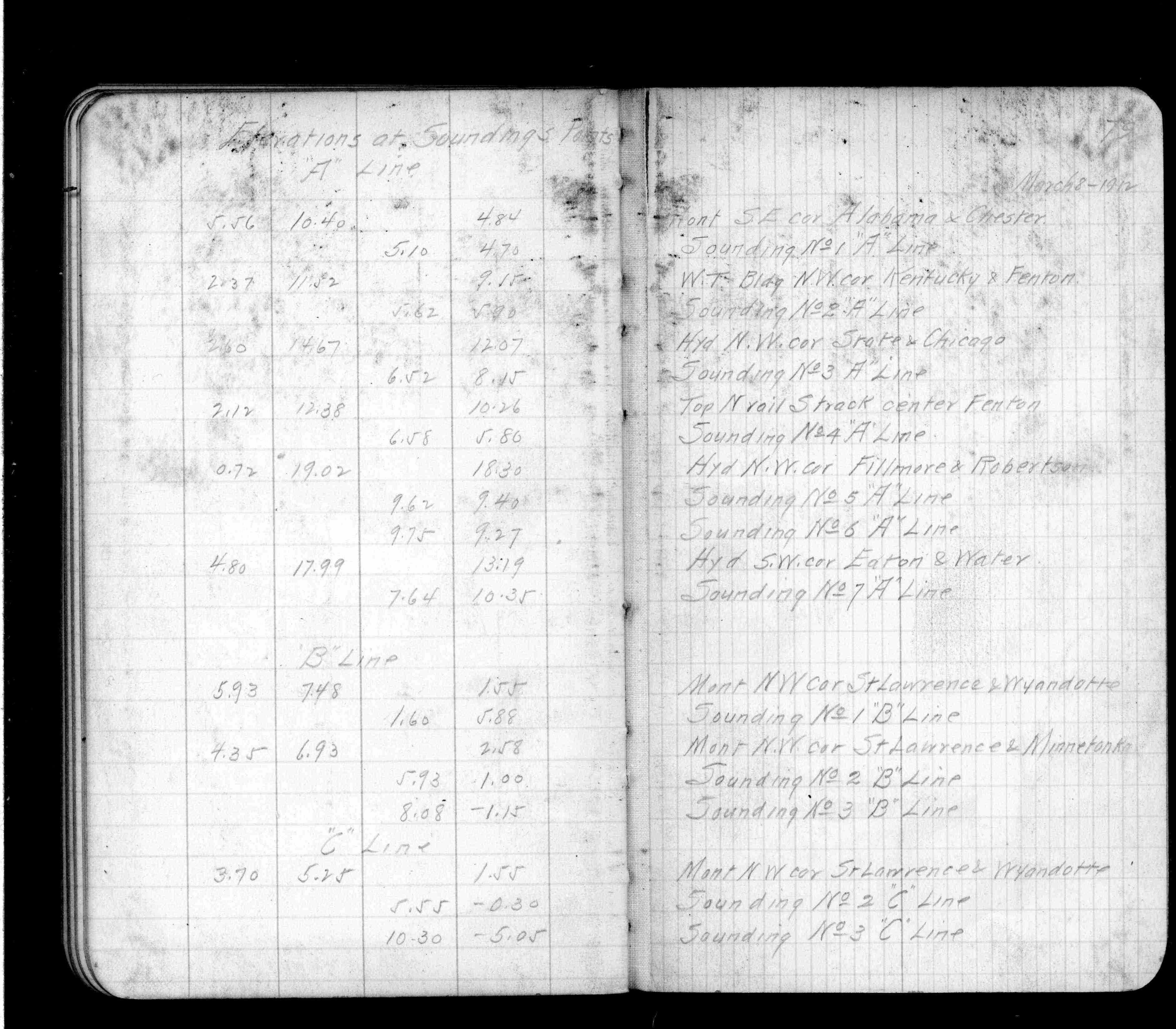
| 3/8/1912 | Elev 4.84 ft. Described as SE Cor, most likely the SW cor. See FB 694 p.79 |
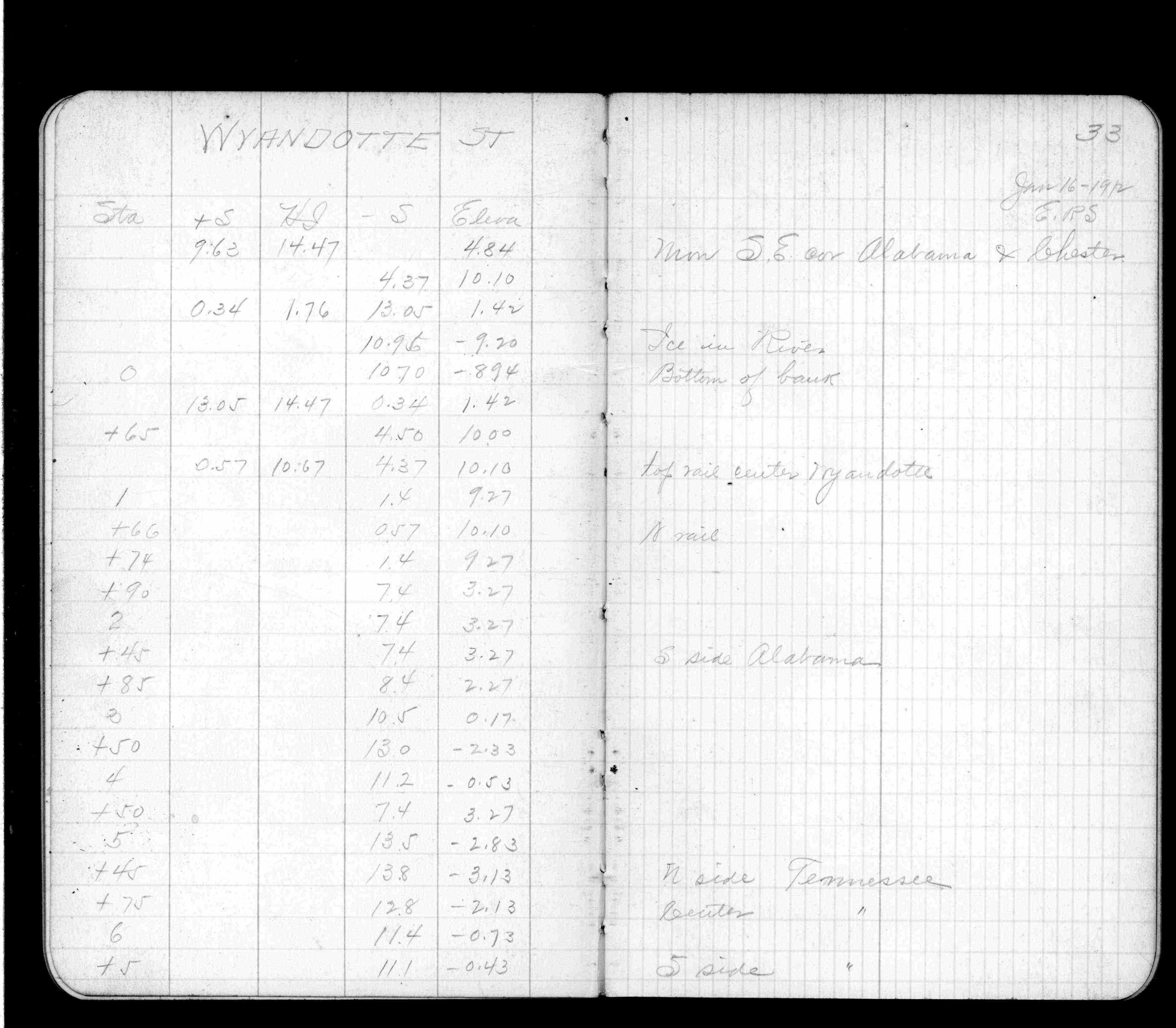
| 1/16/1912 | Elev 4.84 ft. Described as SE Cor, most likely the SW cor. See FB 694 p.33 |
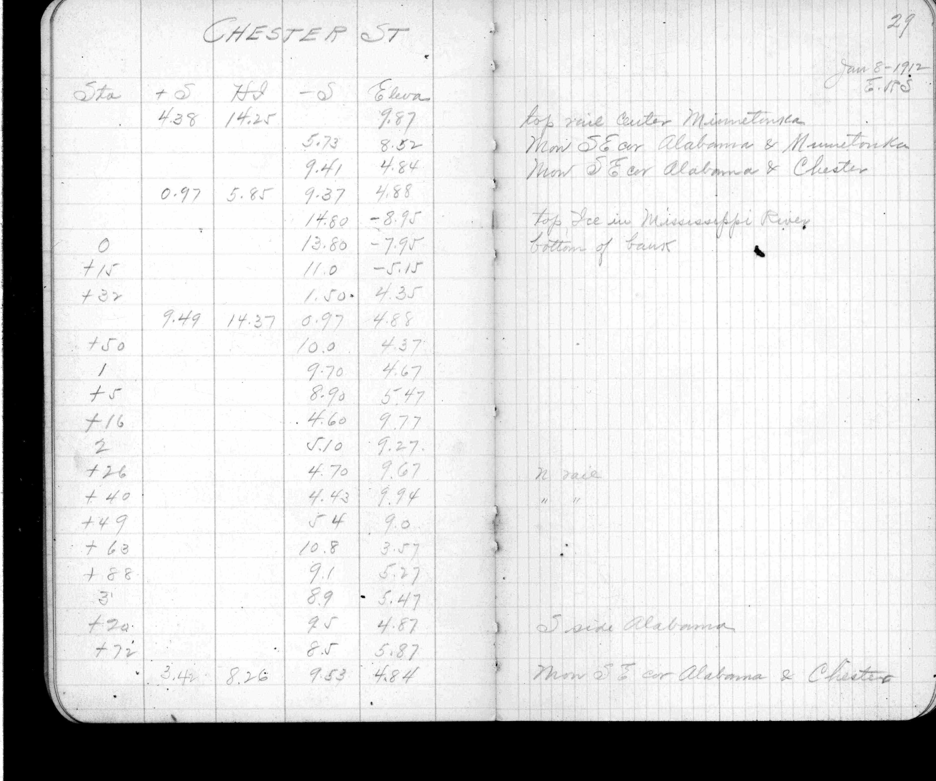
| 1/8/1912 | Elev 4.84 ft. Described as SE Cor, most likely the SW cor. See FB 694 p.29 |
| 10/20/1890 | Monument set by J H Armstrong |
Above is NOT an all inclusive history of this point. Please review all the links below.
| PLS NOTES | Field | Cross Section | Sewer | J.B. Irvine | Monument | River Survey |
|---|---|---|---|---|---|---|
| FB 0694p. 29 ,33 ,79 |