| NAD83 COORDINATES (1986 adj.): |
|---|
| X= 553729.49 Y= 159489.96 Z= 910.1 3/15/2010 RTK-VRS |
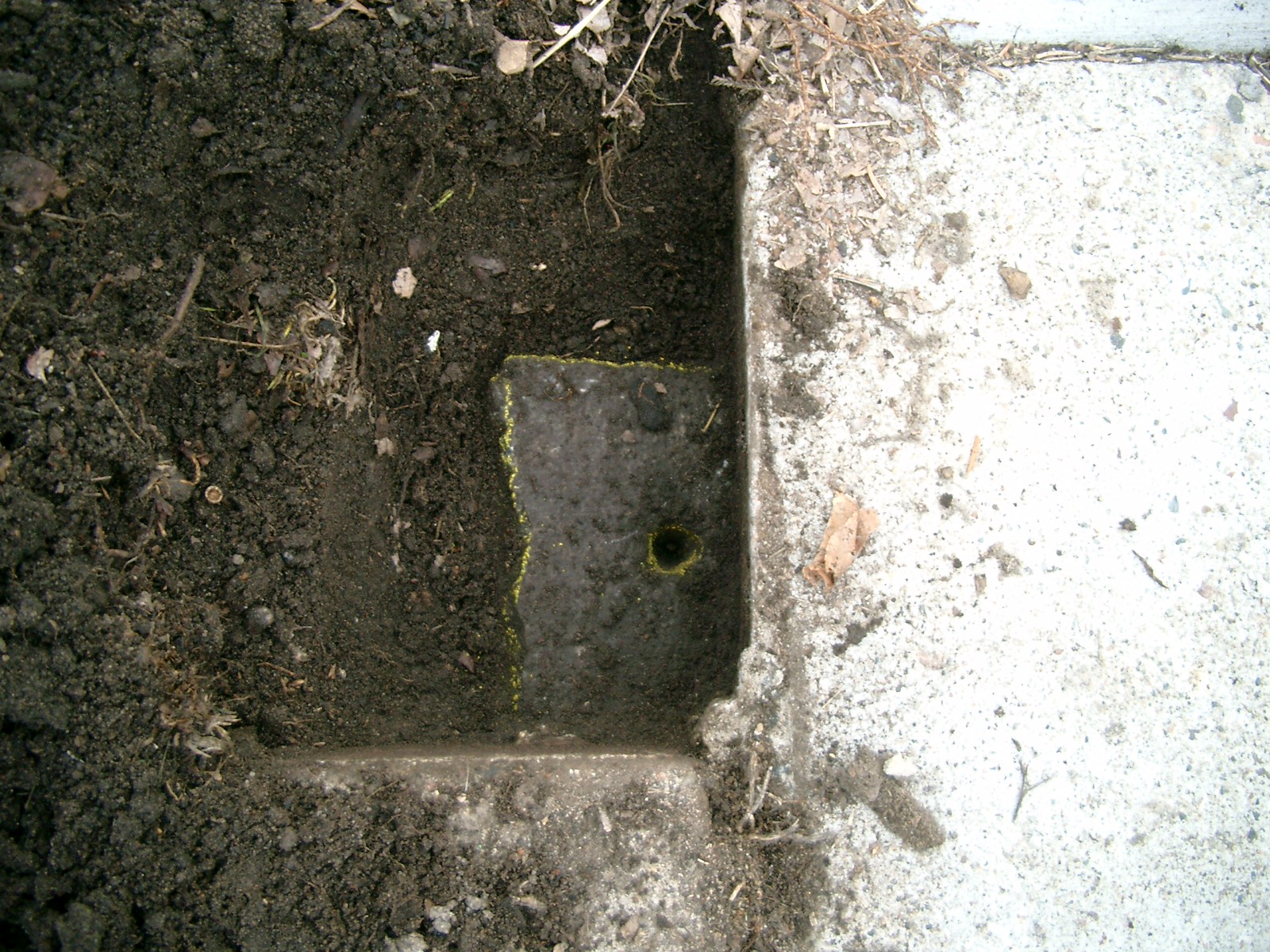
| 3/15/2010 | Found a GM 0.35 ft below the sidewalk. Position established by RTK-VRS, placed ties and photos taken. |
| 2/1/1890 | (Unknown date Feb __, 1890 ) Monument set by Chas A Hunt after grading. See CS 607 p.3,17 |
Above is NOT an all inclusive history of this point. Please review all the links below.
| PLS NOTES | Field | Cross Section | Sewer | J.B. Irvine | Monument | River Survey |
|---|---|---|---|---|---|---|
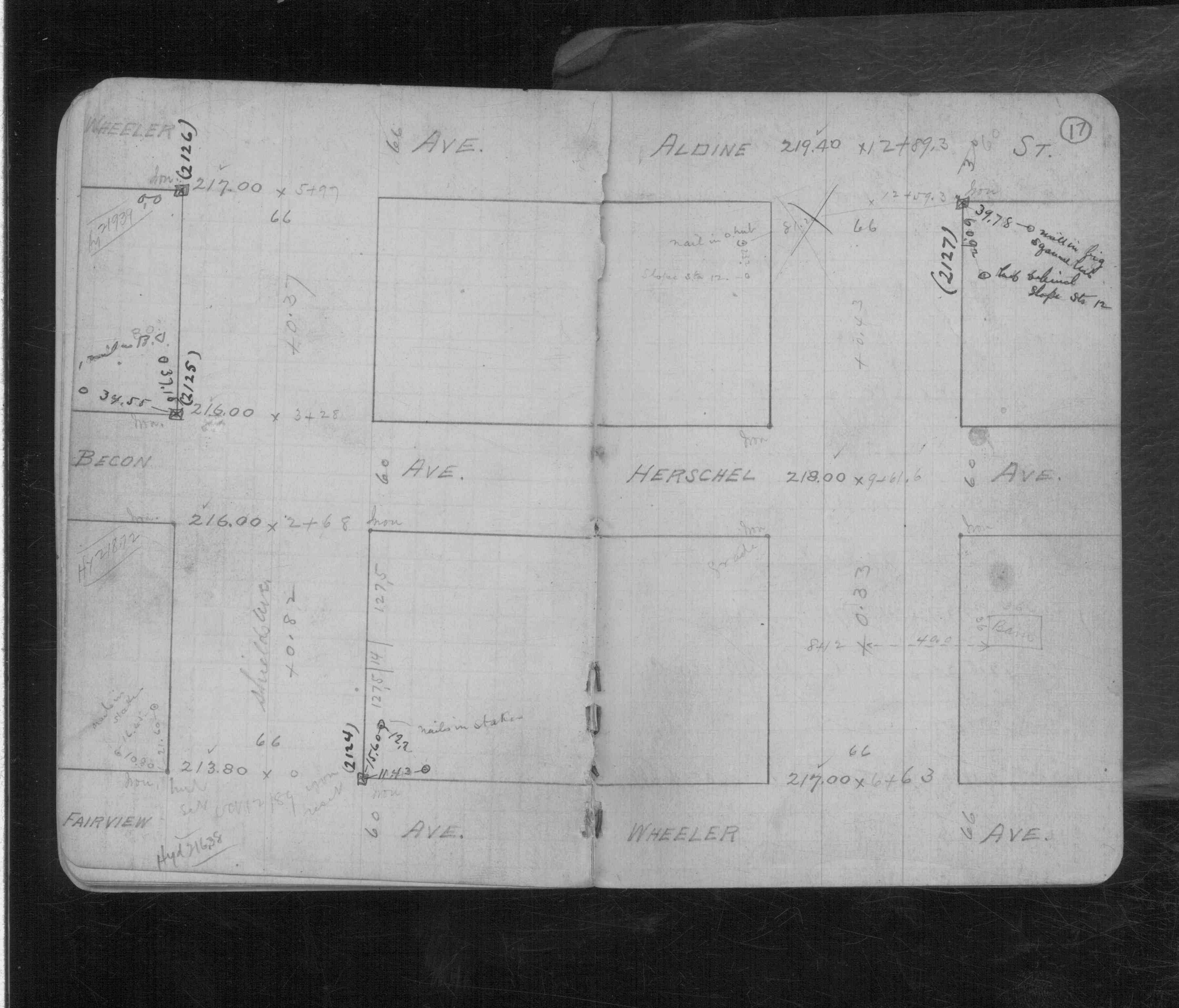
| CS 0607p.17 |
| FILE | SURVEYOR | LIC. NO. | DATE SIGNED | DATE TIED |
|---|---|---|---|---|
| 5764-2125-A.pdf | Samuel D. Gibson | 44880 | May 13, 2010 | March 15, 2010 |
| FILE | PHOTO DATE | COMMENTS |
|---|---|---|
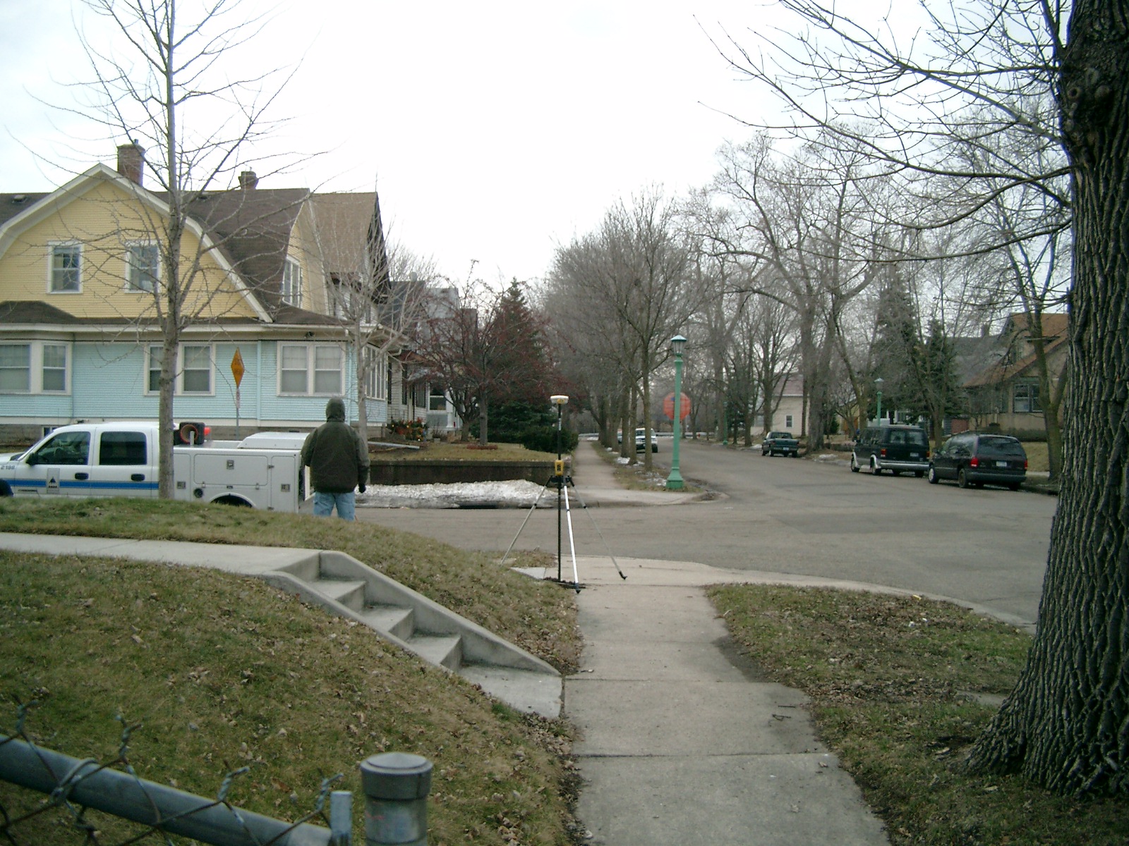
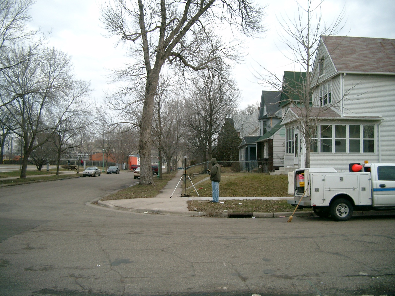
| 5764-2125-5.jpg | March 15, 2010 | Looking West along the North side of Shields Ave. |
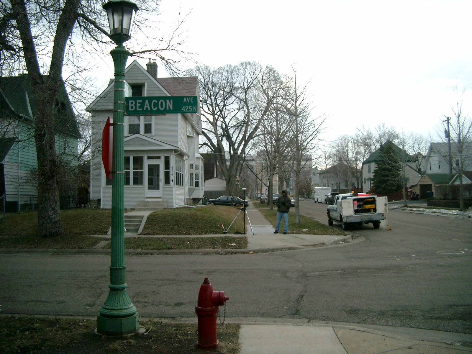
| 5764-2125-4.jpg | March 15, 2010 | Looking South along the East side of Beacon Ave. |
| 5764-2125-3.jpg | March 15, 2010 | Looking East along the North side of Shields Ave. |
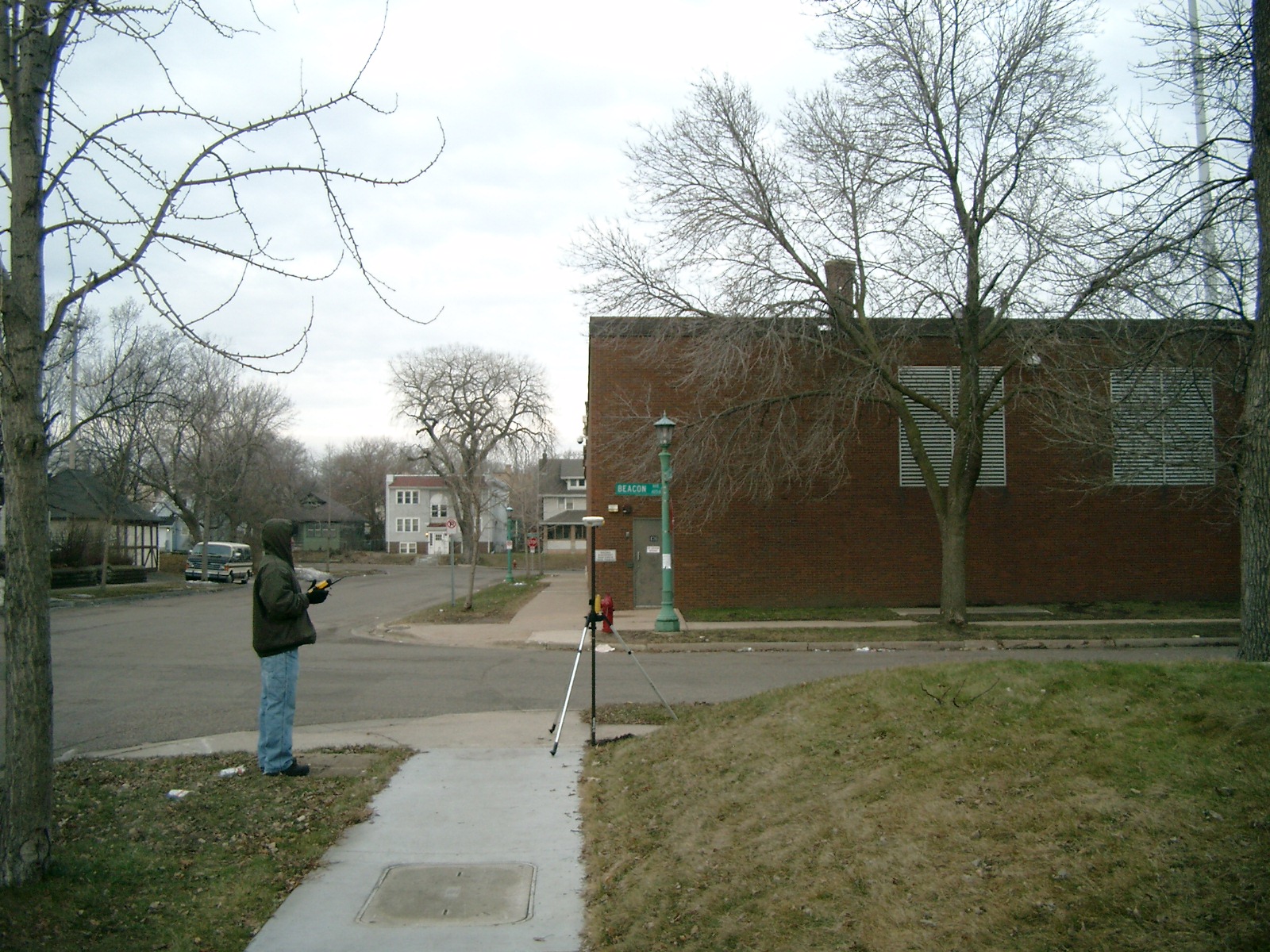
| 5764-2125-2.jpg | March 15, 2010 | Looking North along the East side of Beacon Ave. |
| 5764-2125-1.jpg | March 15, 2010 | Cloes-up of the GM. |