STATION: 6031 Blk Cor SE Fairview Ave (66' ROW) & Niles Ave (vac)
OLD INDEX NUMBER(s): 2480
MAP: D10 SE 1/4 Sec 09 T28N R23W
GPS STATION:
DATE COMMENTS:
4/12/1912
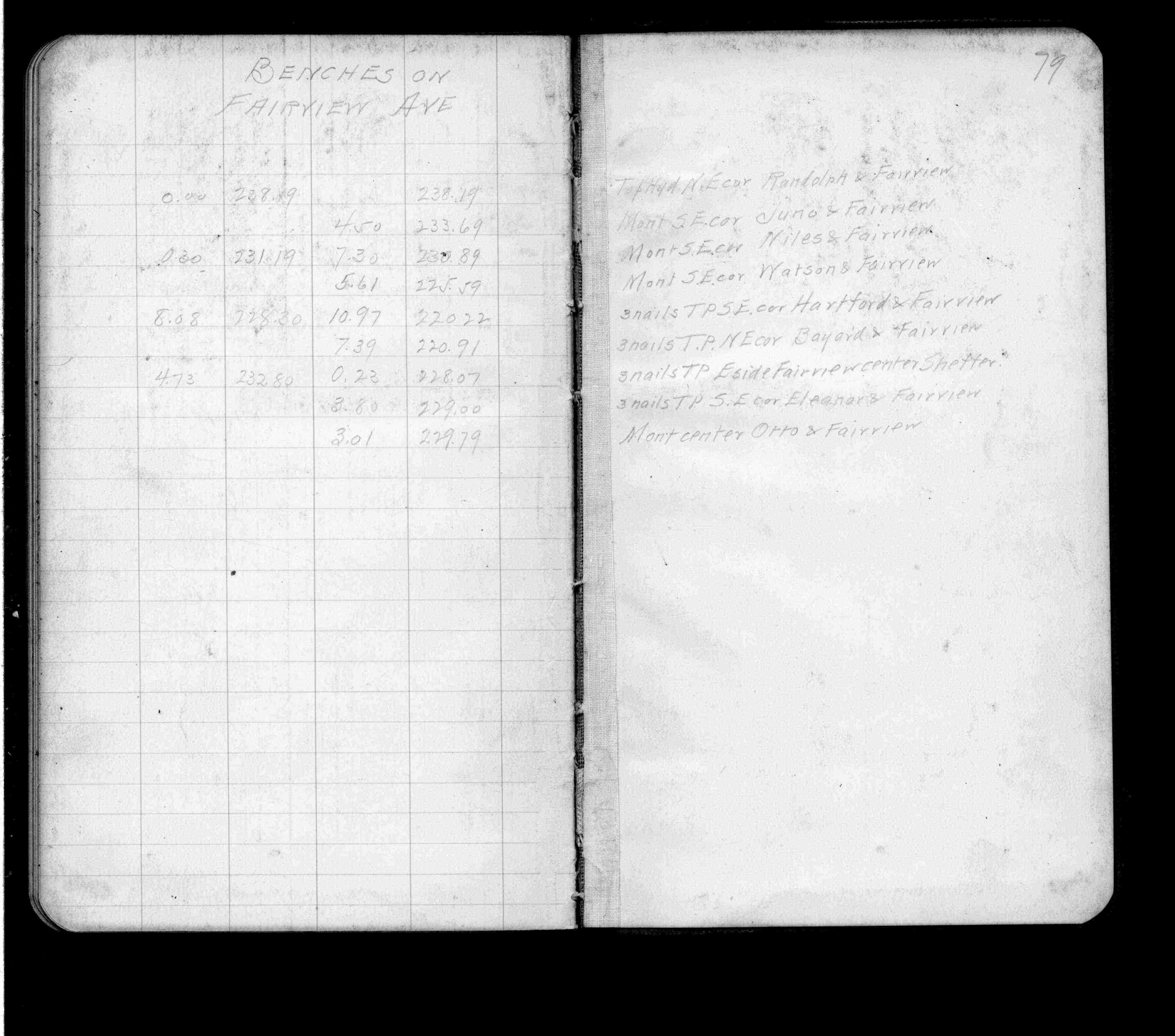
Elev 230.89 ft. See FB 697 p.79
12/21/1891
Monument set by J B Irvine
Above is NOT an all inclusive history of this point. Please review all the links below.
BOOKS
PLS NOTES
Field
Cross Section
Sewer
J.B. Irvine
Monument
River Survey
FB 0697p.79
Revised: April 12, 1912 Updated HTML File: March 02, 2015